
That camera will be right in the action pretty soon.
3 Likes
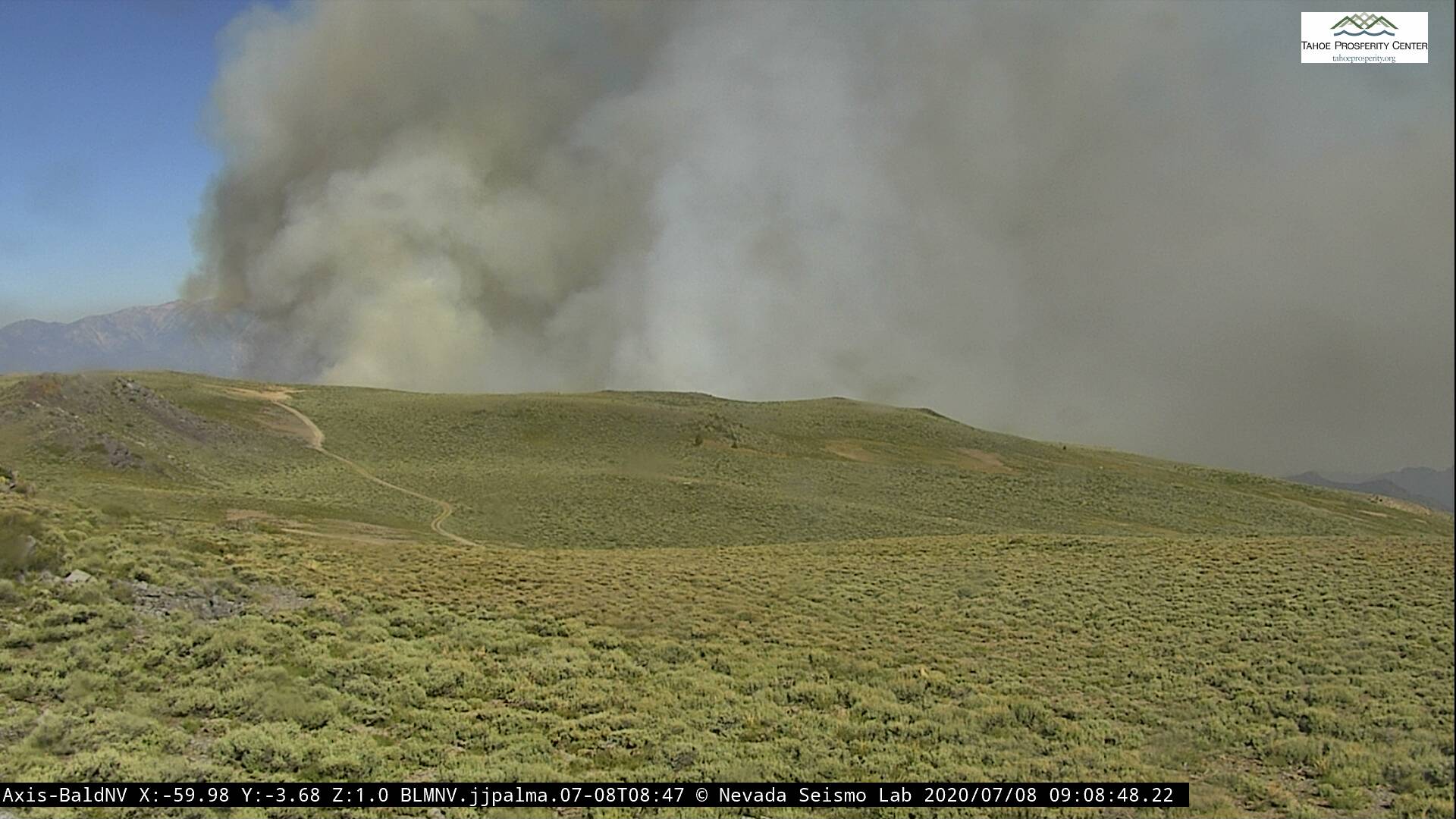
I was watching the progression of drift smoke, looks lime the camera will be affected
Looks like T910 and T914 working this out of MCC.
4 Likes
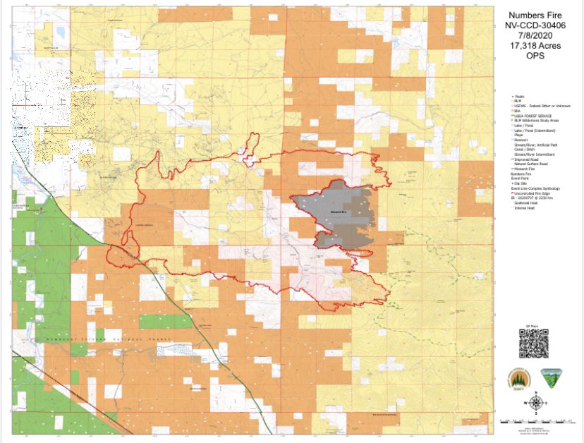
Morning update 20,500 acres 5% contained.
1 Like
Westerly wind gusts of 35 mph this afternoon will be interesting for fire behavior.
1 Like
FISH SPRINGS (FISN2) Severity:41
| TIME | RH | WIND | TEMP | FUEL |
|---|---|---|---|---|
| 11:53AM | 15% | NNW7G10mph | 79 | |
| 10:53AM | 19% | NW5G8mph | 75 | |
| 09:53AM | 20% | NW6G8mph | 72 | |
| 08:53AM | 22% | NNW3G6mph | 69 |
T914 & T910 just launched from MCC heading east. Guessing heading to this fire
910 is for certain. 914 is heading East to somewhere else.
914 is north/northeast of Las Vegas. Looks like there’s some activity up there on the FlightRadar with other aircraft.
T914 went to a fire north of Lake Mead.
It just blew up… rewind for the 15 minute view. Hope it’s a firing operation.
http://www.alertwildfire.org/tahoe/?camera=Axis-BaldNV
http://www.alertwildfire.org/tahoe/?camera=Axis-RidgeTahoe
2 Likes
Tanker 911 assigned from San Bernardino.
I haven’t looked at the radar to see where it’s at yet.
Passing over pine flat reservoir,delilah, and fence meadow lookout now(Fresno county).
1 Like
The fire looks quiet right now.
1 Like
Update 8:30 am 07/10/2020 The Numbers Fire is estimated to be 18,299 acres and 30% contained per Inciweb.
Structures Lost/Damage:
- 3 structures have been lost
- 37 outbuildings
All evacuations are lifted with the exception of Pinenut 2 Road East of Out Our Way.
Minimal active fire showing on the Alert cams.
5 Likes
Thanks for the update muni_captain