6,000 Acres now, its moving east in the Pine nuts
1 Like
Any update on this thing? Radio traffic is basically all law.

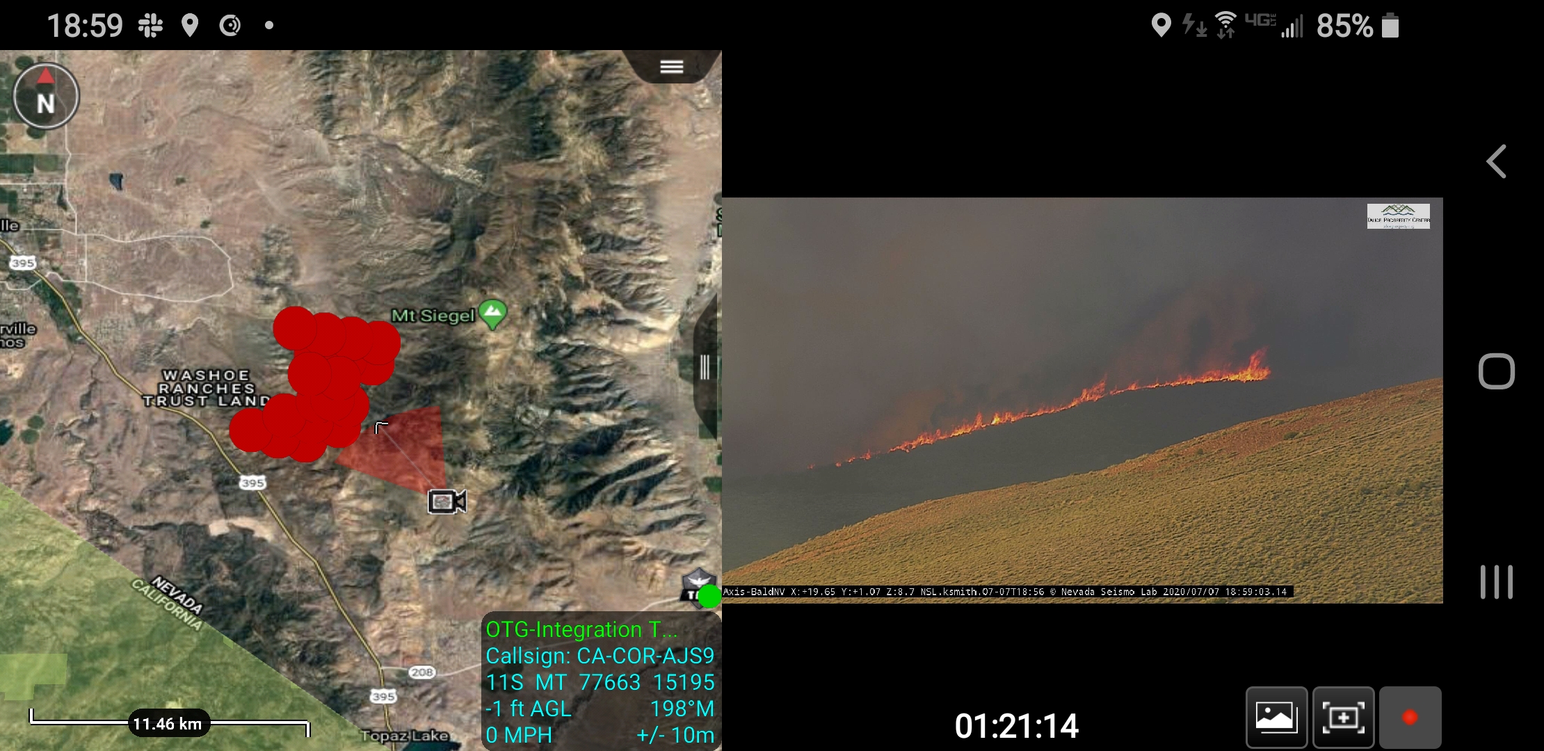
Bald mtn on the Nevada cams is pretty impressive
3 Likes
KRNV is now reporting the fire is 7,500 acres. One house and 10 outbuildings have burned. An additional evac site has been set up at the Holiday Inn Express in Minden, according to the station.
I was hoping to see a map with fire perimeters and direction of spread. Could someone help me out with this?
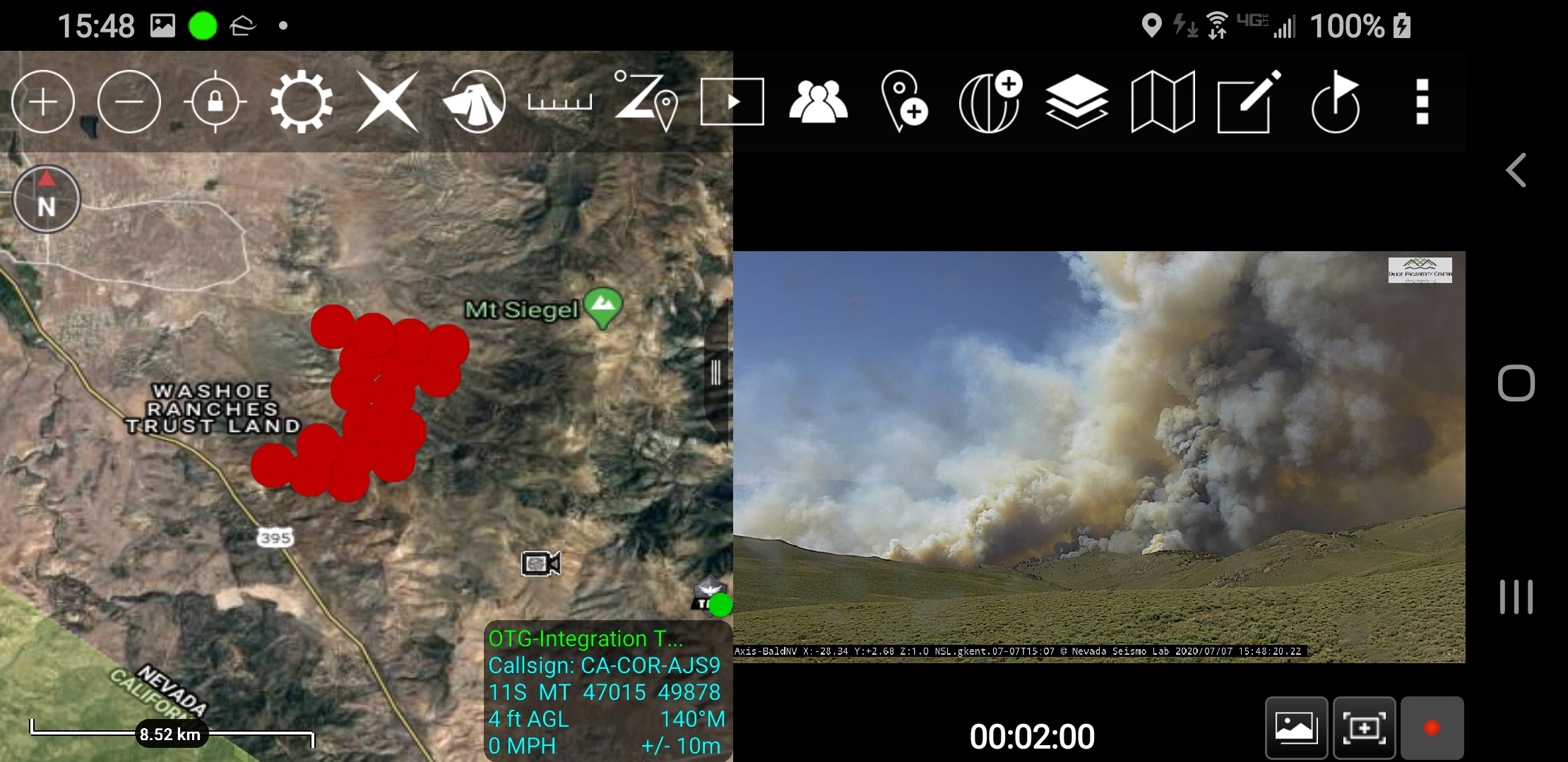
Try this site https://napsg.maps.arcgis.com/apps/webappviewer/index.html?id=6dc469279760492d802c7ba6db45ff0e
2 Likes
Won’t show you direction of spread, but a goo starting off point.
https://napsg.maps.arcgis.com/apps/webappviewer/index.html?id=6dc469279760492d802c7ba6db45ff0e
Click on the hashtag and you may get more real time info from other social media sites
1 Like
10,000 plus acres and going Nuclear at the moment.
What app or site is this aj?
ATAK read through this thread. Then get back to me and we can get you going.
2 Likes
I downloaded ATAK. Definitely need a manual or video on how to use it.
1 Like
GBCC is mobilzing T-2 Team 4 (Roide) to Numbers.
Numbers now at 18K. https://www.ktvn.com/
About 1530-1600, top of column was visible from Placerville.
4 Likes