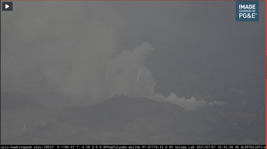
New fire on the Hawkins Peak Cam?
3 Likes
This is in NV. East of Lake Topaz…
1 Like
Yep… my buffoonery - I should know better
Wait… cross puts in CA…
3 Likes
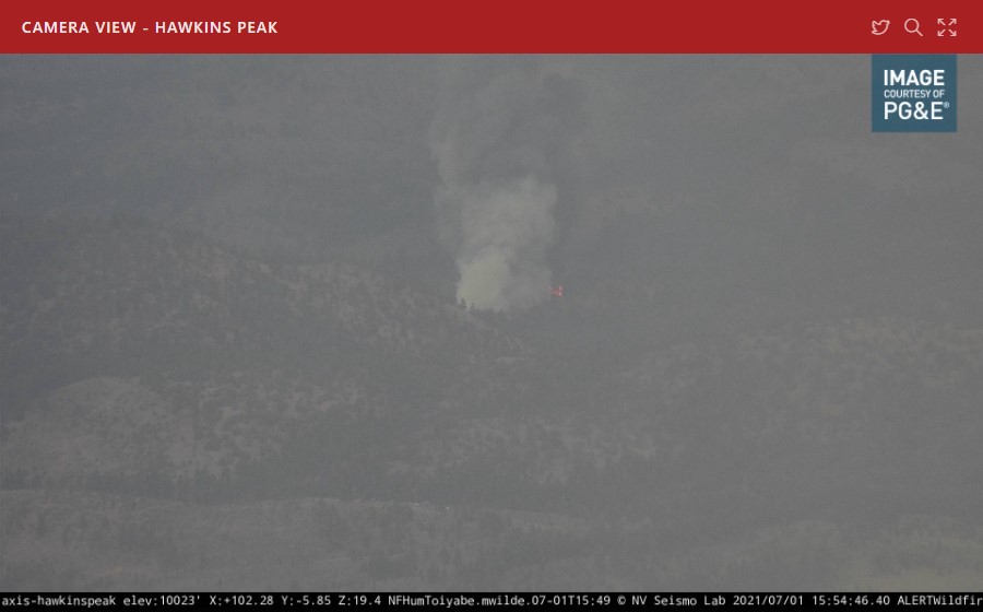
HTF Markleeville area
1 Like
4 Likes
One of the…it’s in California, but a NV incident fires?
5 Likes
Quite the fire activity on the Hawkins one hour loop. They were looking at it for a long time.
3 Likes
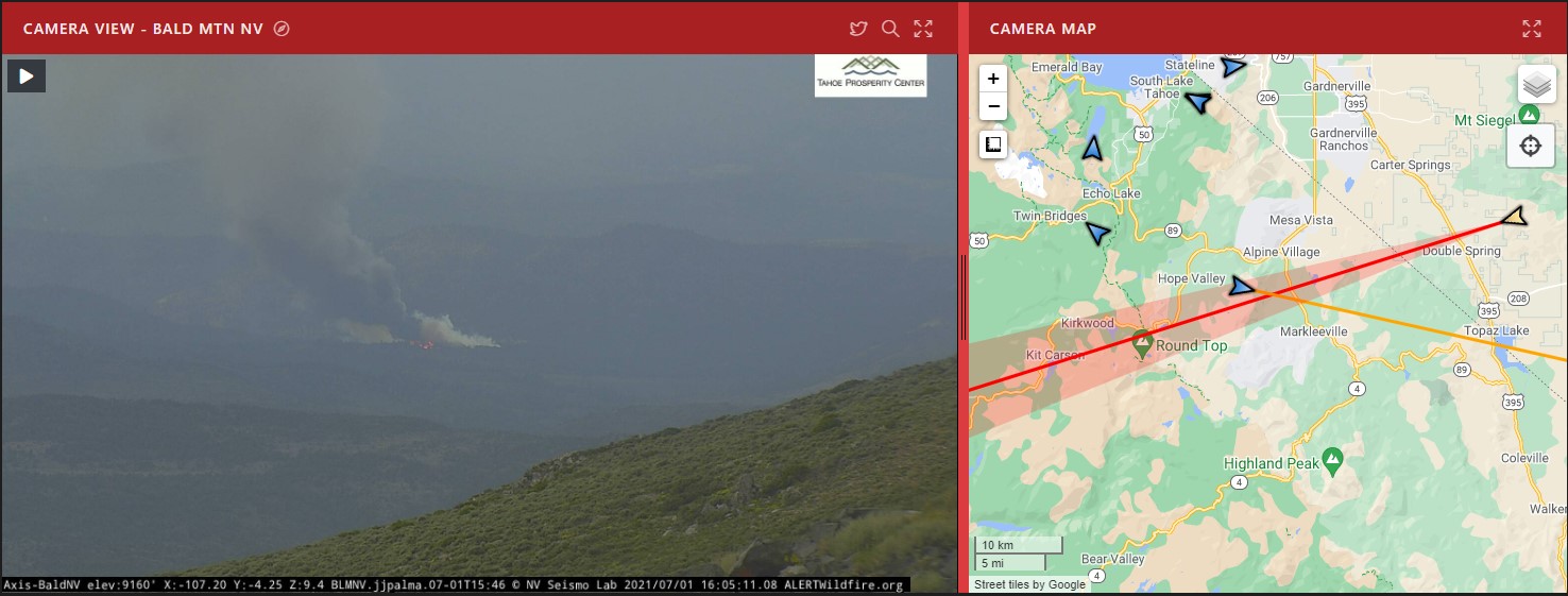
Time lapse on the Bald Mtn shows the smoke pop up at 14:55. Cam zooms in at 15:17
2 Likes
I believe the name is East Fork Incident.
3 Likes
CHP has it in the area of Diamond Valley Rd & Mudd Lake Rd
2 Likes
AA coming on scene with a SEAT in tow.
1 Like
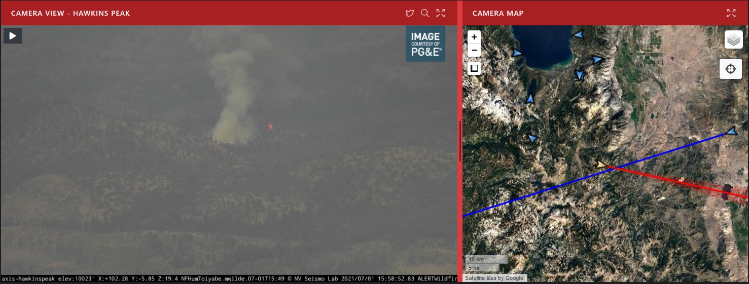
Looking at the cameras…I think there might be two fires. THe Hawkins peak cam is not aimed at where the aircraft are working the fire coming off of the other cam.
1 Like
Definitely possible.
Also, the cameras are often a bit off with their shaded “angle of view” projections on the map.
Sketchy wind shift @ 16:20.
Map Link: ArcGIS Web Application
SCANNER: Calaveras and Alpine Counties Fire, Cal Fire and USFS Calaveras and Alpine Counties Fire, Cal Fire and USFS Live Audio Feed
1 Like
The camera targets are off a bit but both are looking at the same fire east of Indian creek reservoir.
2 Likes
5:36pm 7/1/2021 #EastForkFire is currently burning in Cottonwood Canyon on the California side of the Carson Ranger District (approximately 15 miles east of Woodfords, CA). The estimated size is 15-20 acres, multiple air and ground resources are on scene and responding.
[Humboldt Toiyabe NF]
1 Like
That’s a prescribed burn that’s been going for a while.
2 Likes