Thanks. As I said, we have both. At 1:00 a.m., it was hard to say for sure when I heard secondhand the Guard had been deployed. (I actually was helping friends in the evacuation area yesterday p.m.) Big network, large regions…
We have a lot of Forestry resources here as well, but some have been deployed out of the area (Bear Fire, into Idaho), which is part of the problem. I understand some recalls have been made. In case nobody else mentioned it here, Nevada Governor Lombardo issued a State of Emergency declaration shortly after the Zephyrs picked up again today.
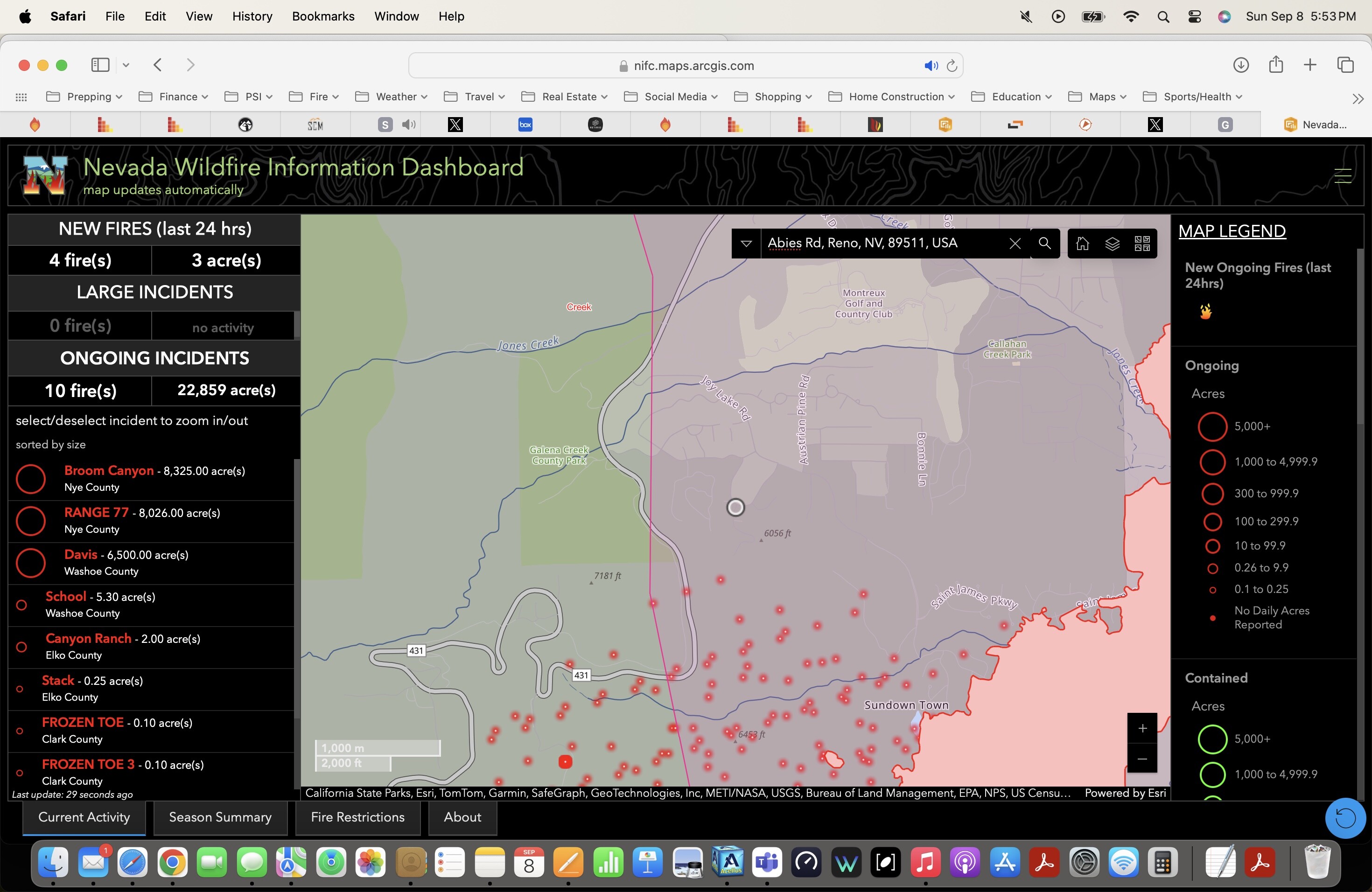
@Smokeyff Does not look to be at Abies Rd yet but the satellite maybe a bit behind and/or inaccurate. I typed Abies rd into the dashboard here ArcGIS Dashboards. !
Keep in mind there is much and many ways to source info. Modis and Viiris do detect heat, but the data has to be interpreted… IE what you are interpreting as fire location and spots, is most likely inaccurate. The satellites detect the heat in the column as well.
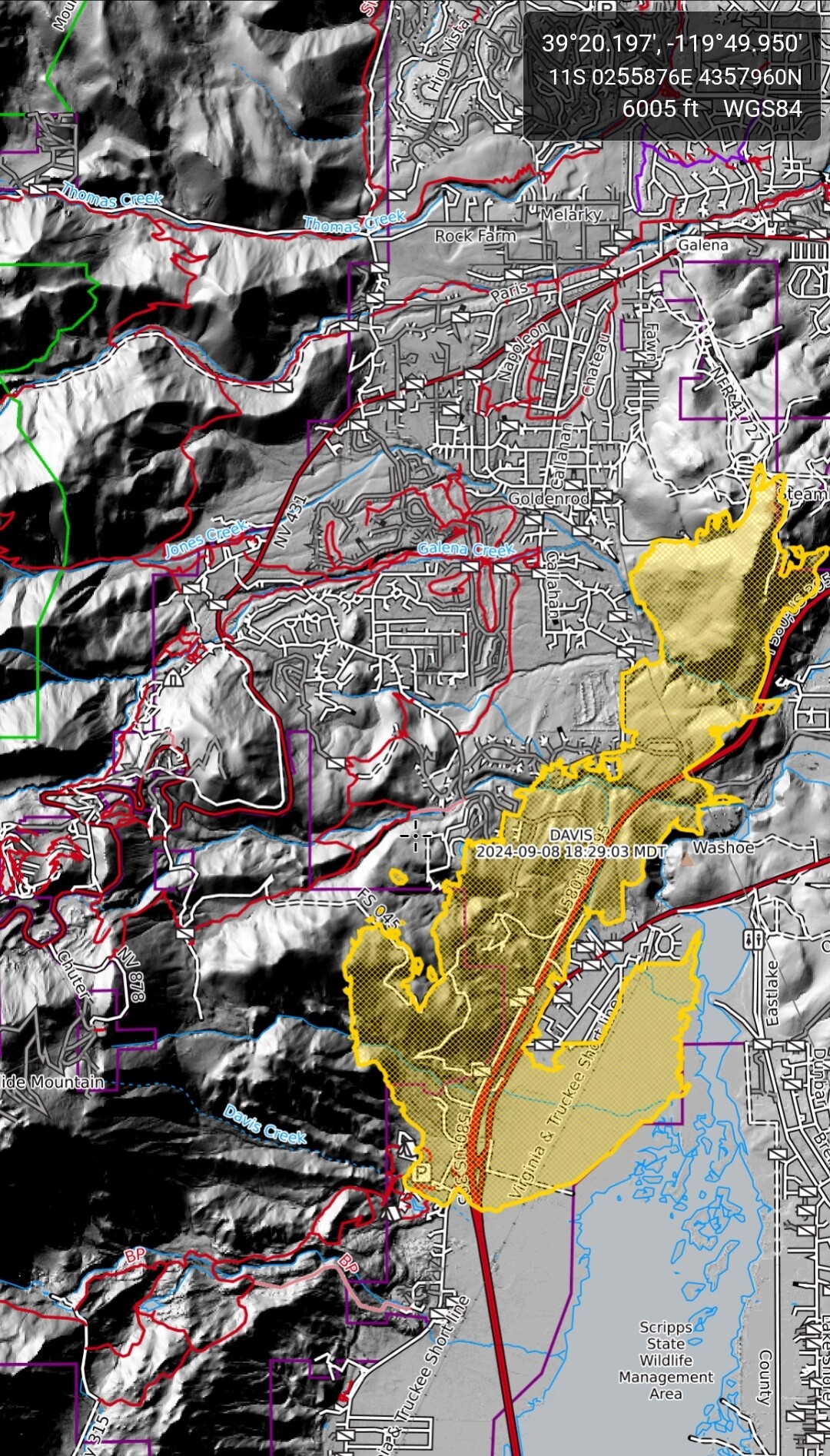
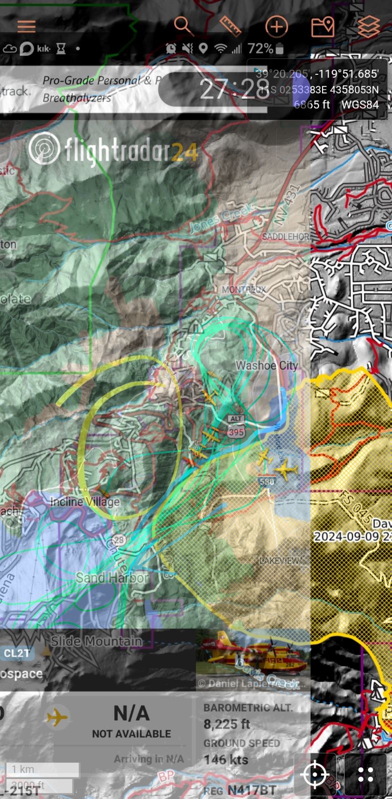
For example a more definitive interpretation is the map I am going to attach here, this is the infrared fire perimeter which is very defined and near absolute. No the timestamp is 35 minutes ago… 1829 MDT
My interpretation of the data given would be that the fire is actually 1.67 MI east of sky tavern… But that is just my interpretation
@modcamo Agree, the NOAA HMS, VIRIS, GOES, etc is only a rough estimate and not pinpoint inaccurate. An aerial mapping from a ship like QRF Copter 76 or FIRIS is better but can still be off as well.
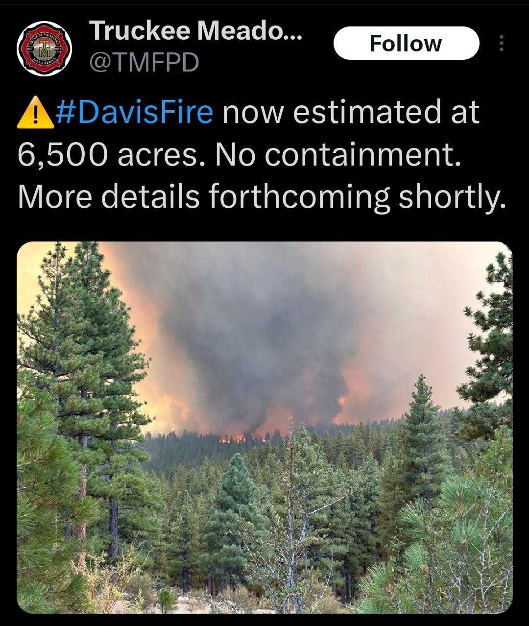
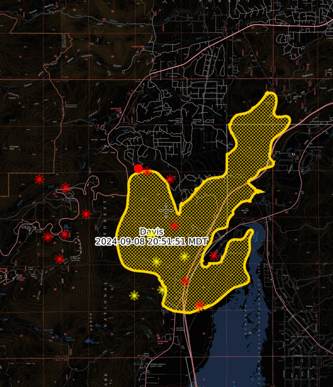
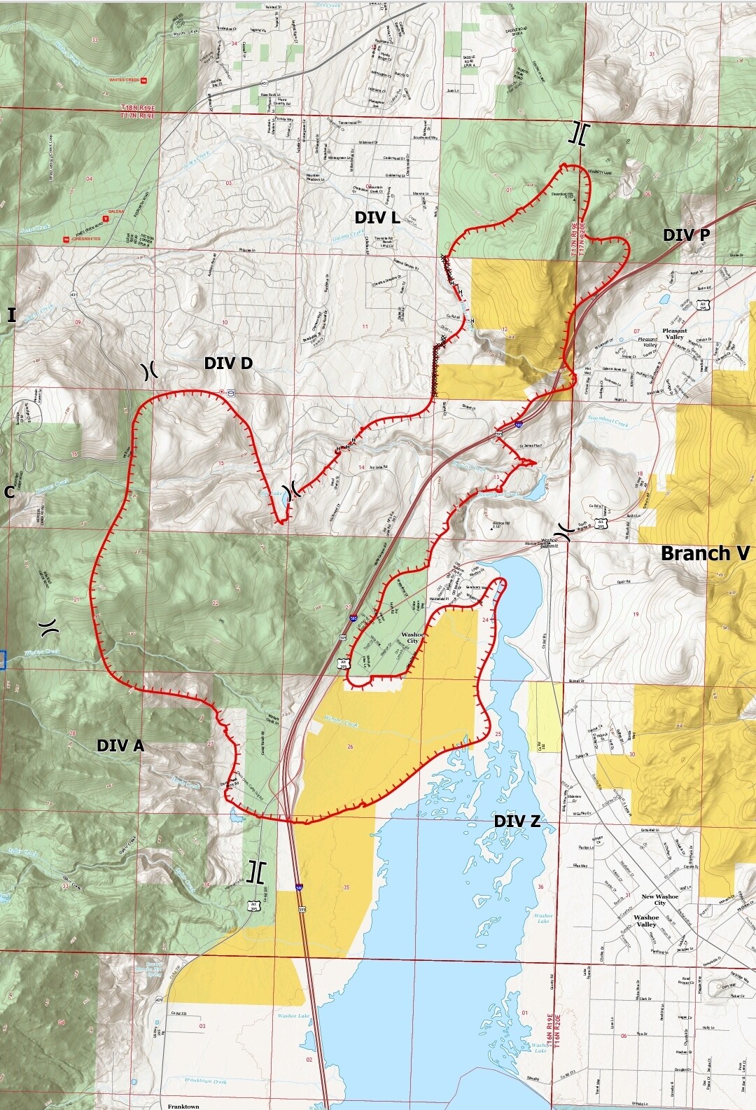
This is the latest perimeter from the CalTopo app with MODIS & VIIRS layers (red dots). I believe this is the 6,500 acre perimeter around 21:00 MST. A night flying chinook is flying as I type.
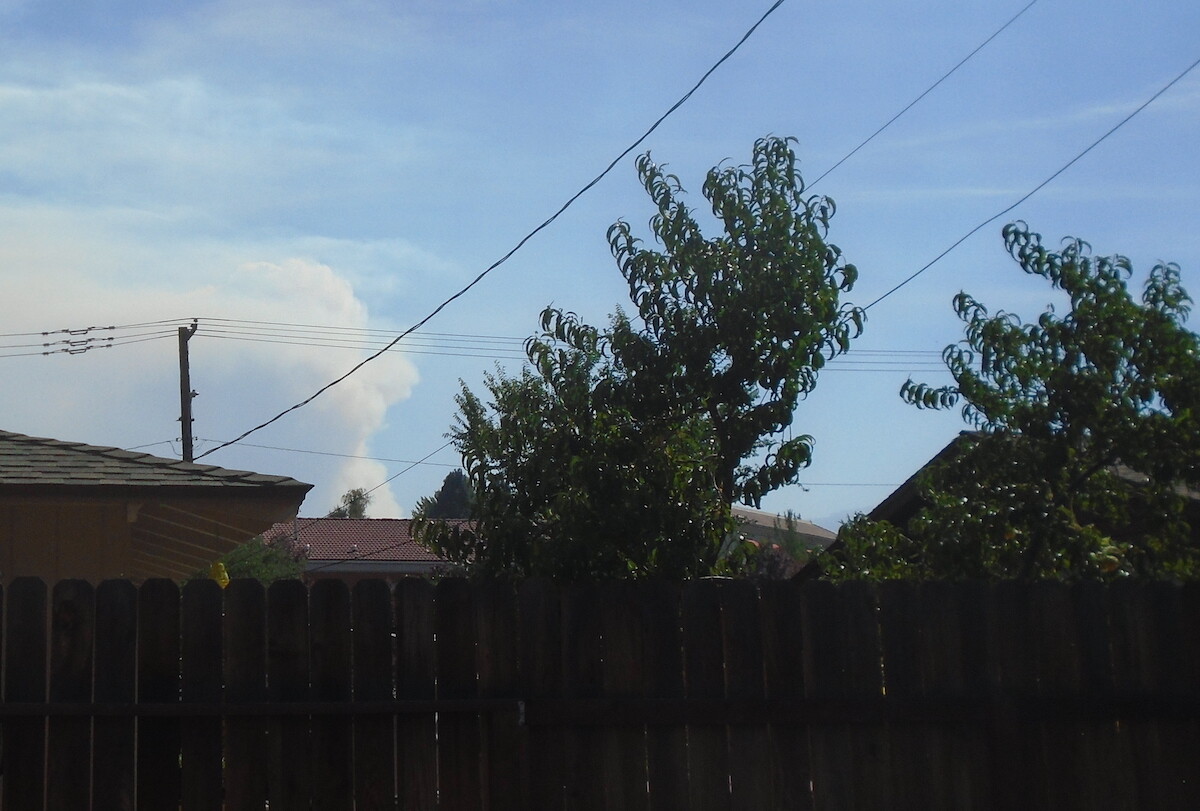
South end of Midtown Reno. Day three she perked up again, as expected, about 3 p.m. – burning uphill mostly into the Mount Rose Wilderness area. Bad news is the fire is leaving grassland and encroaching into heavier timber. Nothing left to do down there (for me), best Renoites can do is stay away from the gawking zone and let the crews work, and pray the winds die down. At least one more Red Flag Day.
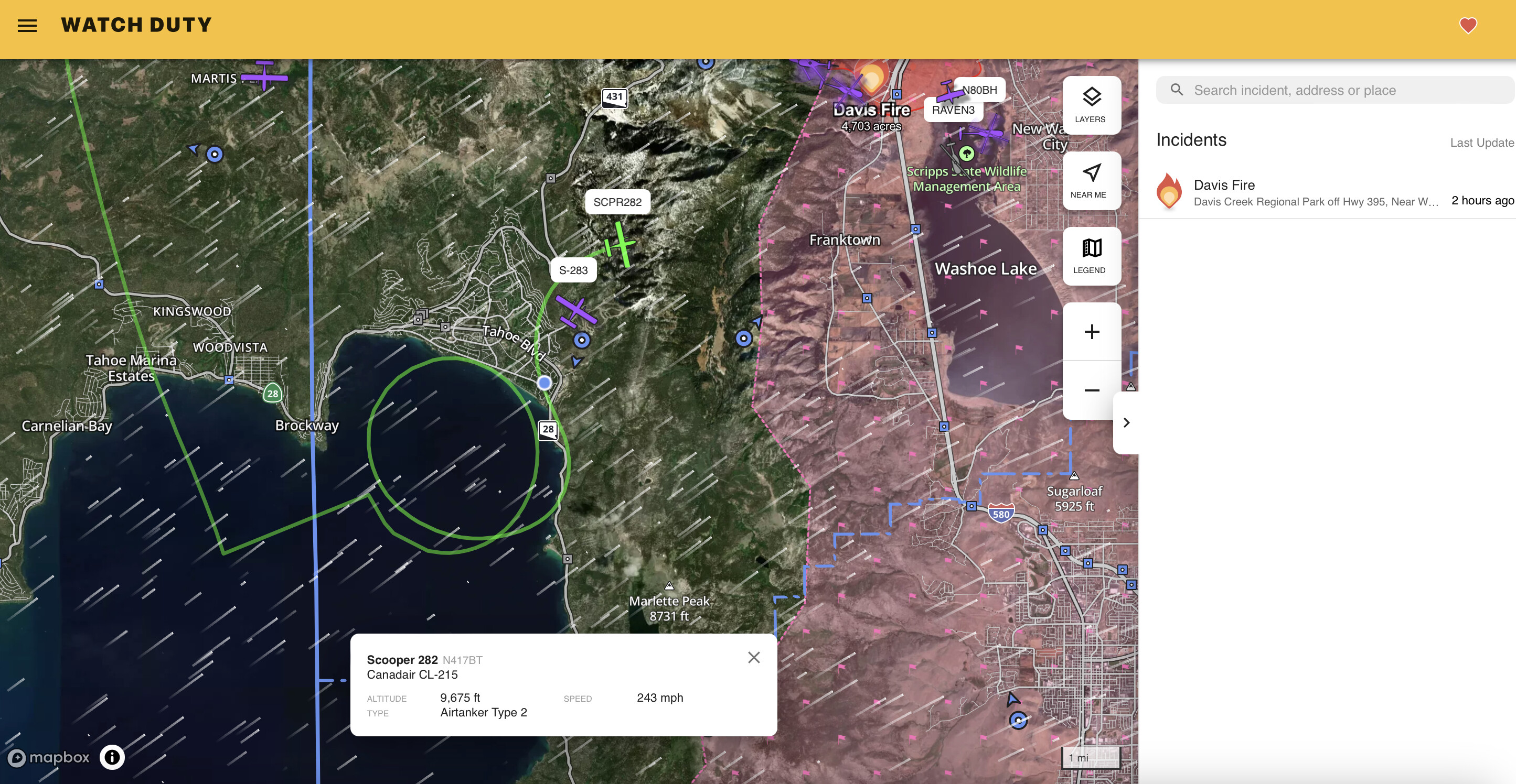
Fun graphic mashup… I’m out of the area but the strategy looks plain as day, shoulder around the improvements to the south using the scoopers and pin it down in browns creek. Overlayed scoopers flight path with current perimeter.