Watched the column collapse on the camera was pretty impressive.
https://www.alertwildfire.org/region/oregon/?camera=Axis-BosleyButte
This camera looked like it had a good view of the fire ,while going through the loop the camera seem to go in circles. I would guess to say that maybe tomorrow the camera will have a good view.
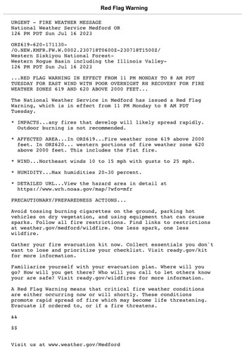
NEWS RELEASE: Flat Fire Update-July 16, 2023
Current estimated size for the Flat Fire, which is located in Oak Flat, which is two miles SW of Agness is 2000-3000 acres.
Due to high winds and steep terrain, the fire grew rapidly since reported at around 6:00 p.m. yesterday. Numerous ground resources and a robust air response engaged the fire, but despite these efforts, fire behavior was extreme with ¼ mile spotting and fire spread on both sides of the Illinois River.
Last night we worked on the east flank with a CFPA dozer, engines and a handcrew to protect the community of Oak Flat. The Incident Commander (IC) and engines were engaged on the fire throughout the night.
Additional resources will be arriving this morning and throughout the day. A Type III IC will be taking the fire this morning and NW Team 6 is enroute to the fire with an inbrief scheduled for 4:00 p.m. today.
Extensive air resources will be utilized throughout the day, as well as an aggressive response from ground resources. The Rogue River-Siskiyou National Forest is committed to protecting the communities of Oak Flat and Agness and will continue to work to keep the fire as small as possible. Weather conditions and terrain are not favorable and rapid growth is expected over the next few days.
Weather conditions are expected to be similar today with winds picking up in the afternoon and early evening. As always, we ask the public to exercise caution and follow all fire restrictions in place.
NW Team 6 mobilized
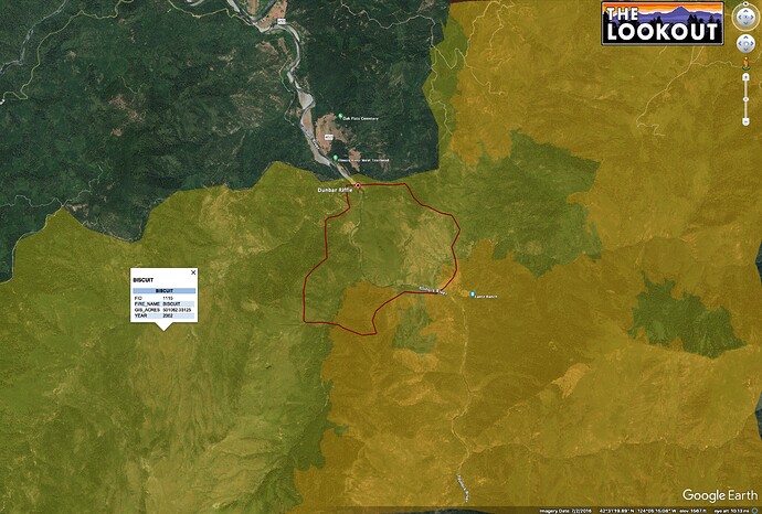
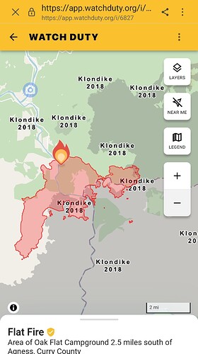
Latest NIFC perimeter in red.
Orange is 2018 Klondike, yellow is 2002 Biscuit.
Not many roads visible to the south of the fire.
Oh I hate to be the one to ask… truly asking for a friend (who is moving cows to stage suppression equipment in their pasture)… but any source I might find for the comms? I searched and haven’t found much. I know it’s early on and the team is just getting there… just can’t seem to find the Rogue/Siskiyou forest info.
Sorry to be the first one asking for the year!
no scanner feeds due to various reasons from what I can tell. The team are Watch Duty is just digging around for info and we have a couple of people that work OR just not that area so much. Looks like it could be an interesting afternoon though.
Thank you. I figured it would be hard area to hear much anyway. Sounds like beyond a tough area to work in.
I believe this camera shows it. The 3 hours time lapse shows nice column growth.
https://www.alertwildfire.org/region/oregon/?camera=Axis-BosleyButte
It’s burning in a fire scar and even with that it’s really progressing at a pretty good rate.
Seems like the worst possible place for a fire in Oregon. 1 million acre box potentially?
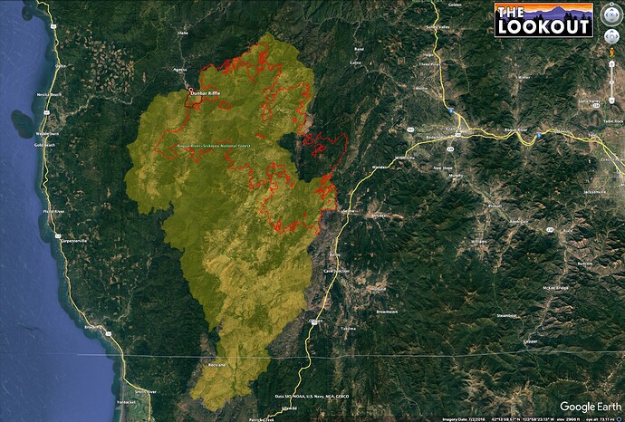
Dunno about a million acres. Biscuit burned 500,000. Shown here in yellow.
This fire is on the northern tip of Biscuit.
2018 Klondike tells a story about potential fire behavior inside the Biscuit footprint.
Klondike (red outline) started on same day as this fire and burned 175k acres, almost all in the Biscuit footprint. It wasn’t declared contained until November.
As you get farther west, the fog influence starts to become more important. Not any sort of expert on this, just remember stories about how it helped to define the western edge of Biscuit in 2002.
The fire is 7,800 acres and did exhibit extreme fire behavior today. I would venture to say that this thing hits 20,000 acres in the next couple days based on the growth In the first 24hrs.
Doesn’t the fact that the Klondike fire burned so well in he Biscuit fire footprint and this fire is burning so hot disprove the USFS theory that frequent fires in our National Forests will reduce fire severity ? Fire without followup treatment only increases available fuels.
To be fair, Klondike happened 16 years after Biscuit in productive westside forest lands. It’s important to parse out what is an appropriate amount of time for a second burn. 16 years between fires seems like too long in just about any western forest type that isn’t high-elevation.
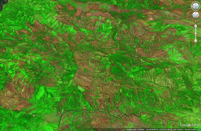
And you’ve got to ask what the outcome was. ‘Burned so well’ is pretty subjective. The Klondike burned 175,000 acres in 4 months, but that doesn’t mean it didn’t do any good work. The image below is Klondike in 2019. Red is higher severity. A lot of the north slopes underburned. According to the BAER team, about 75% of the landscape basically got a big fuels treatment. Given the USFS’ inability to manage fuels at scale, it’s hard to say if the fire was the worst thing that could have happened to the landscape. If we’d kept fire off it for another decade, we might have roasted a much higher proportion.
Thanks Pyrogeo as always!
There are an awful lot of things that effect the degree to which an old fire helps tame a new fire.
When the BAER team assess the Flat fire it will be interesting to put it’s burn severity map over the top of the Klondike’s severity map.
I wonder if anyone has any lidar data from after the Klondike.
The Sentinel radar satellite data would also be a good data layer.
That is the kind of study that will help better understand and plan the use of “fires of opportunity.”
Like the YNP-Pika is being used in Yosemite today.
from IR flight last night at 10pm 5477 acres

