120 acre fire west of grants pass, looking at the photos that have been posted this thing has potential.
Flat Fire - Watch Duty
ALERTCalifornia - High Divide 1 camera
Put up a big pyrocumulus cloud a little while ago, which has now dwindled. Lots of heat on IR via GOES, though.
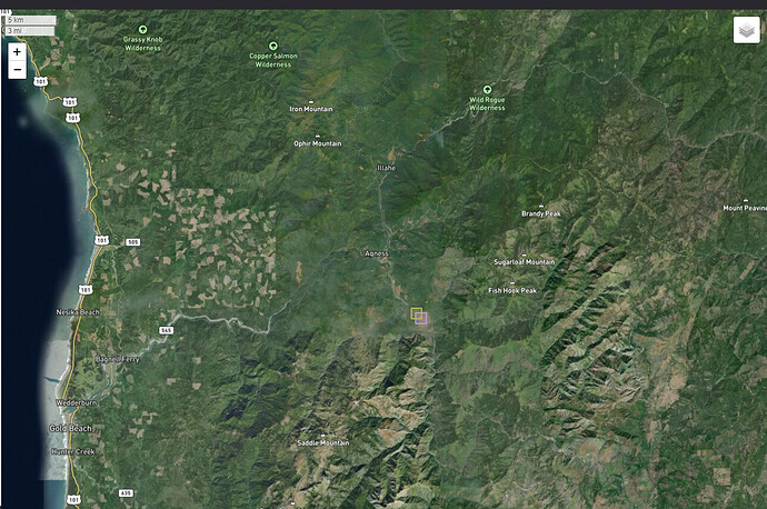
Fire is near Agness, Oregon, about 33 miles east of Gold Beach. Near the confluence of the Rogue and Illinois rivers. Evacuations in progress.
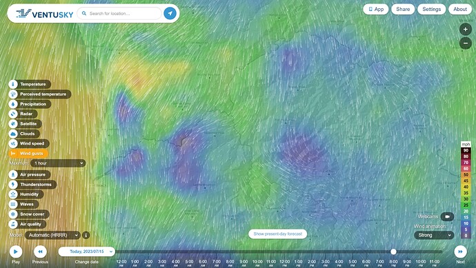
Pretty stiff 25+ mph northerly winds coming down off Soldier Camp Mountain. Forecast to moderate down overnight and through the morning, then pick up to 20-25 tomorrow night.
2003 Biscuit Fire territory.
Topography is gonna a big factor along with the winds on this fire.
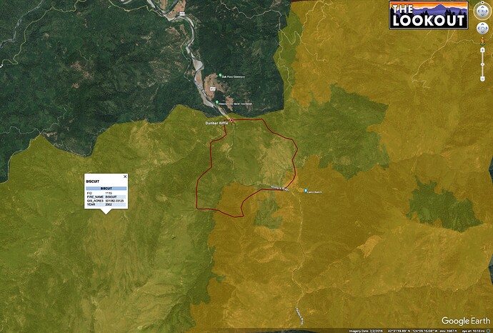
WatchDuty is showing it around Dunbar Riffle.
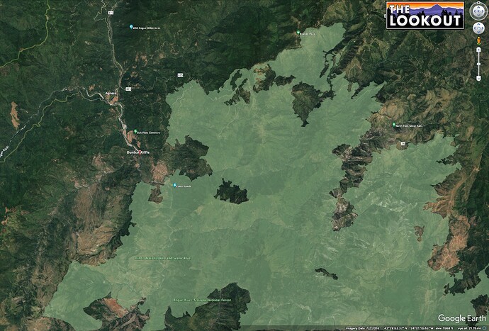
The light green area on the first map is 175k acre 2018 Klondike Fire.
Interestingly, Klondike started on this exact date - 7/15/2018.
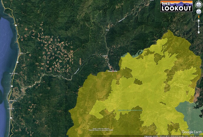
Second map shows 2002 Biscuit (yellow) and Klondike (lighter yellow/light green outside Biscuit).
It is very steep country and largely inaccessible.
I spend a lot of time on the Biscuit. Kind of had to wait for the fire to come out of that steep country.
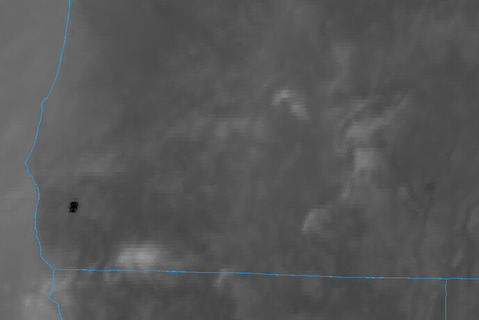
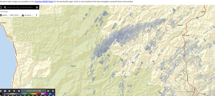
The arc of grey is the smoke plume from NexRad radar.
Got to sleep in a driftwood hut at Gold Beach mapping for one of the 4 IMTs managing Biscuit in 2002.
On the coast, it was foggy and we froze our asses off. It was hard to believe there was a 250,000 acre fire gobbling just inland of the fog line.
The internet barely existed then, there were really long travel times for FOBS, and coordinating mapping between the 4 teams and area command team was a Type I cluster. Not that it made much difference. The fire pretty much did what it wanted. One lesson I learned then, which has been repeated on fires like 2018 and 2020 Mendocino Complexes and 2021 Dixie is that if your fire has more than one IMT assigned, it is surely going to burn until the fall rains, and lots of feelings are going to get hurt.
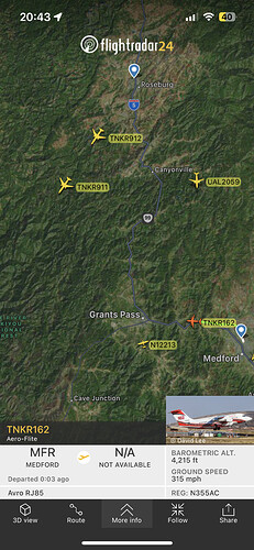
Didn’t know that VLATs fly in pairs like super scoopers.

I think they are going to have to for this fire.
Bet they could get a handle on it if they had all 4 MD-10’s dropping on it like SEAT’s or scoopers. That would be neat to see.
The two squares south and a bit east of Agness – close to Dunbar Riffle are the Hawkeye program hits for this fire.
Watched the column collapse on the camera was pretty impressive.
https://www.alertwildfire.org/region/oregon/?camera=Axis-BosleyButte
This camera looked like it had a good view of the fire ,while going through the loop the camera seem to go in circles. I would guess to say that maybe tomorrow the camera will have a good view.
NEWS RELEASE: Flat Fire Update-July 16, 2023
Current estimated size for the Flat Fire, which is located in Oak Flat, which is two miles SW of Agness is 2000-3000 acres.
Due to high winds and steep terrain, the fire grew rapidly since reported at around 6:00 p.m. yesterday. Numerous ground resources and a robust air response engaged the fire, but despite these efforts, fire behavior was extreme with ¼ mile spotting and fire spread on both sides of the Illinois River.
Last night we worked on the east flank with a CFPA dozer, engines and a handcrew to protect the community of Oak Flat. The Incident Commander (IC) and engines were engaged on the fire throughout the night.
Additional resources will be arriving this morning and throughout the day. A Type III IC will be taking the fire this morning and NW Team 6 is enroute to the fire with an inbrief scheduled for 4:00 p.m. today.
Extensive air resources will be utilized throughout the day, as well as an aggressive response from ground resources. The Rogue River-Siskiyou National Forest is committed to protecting the communities of Oak Flat and Agness and will continue to work to keep the fire as small as possible. Weather conditions and terrain are not favorable and rapid growth is expected over the next few days.
Weather conditions are expected to be similar today with winds picking up in the afternoon and early evening. As always, we ask the public to exercise caution and follow all fire restrictions in place.
NW Team 6 mobilized
Latest NIFC perimeter in red.
Orange is 2018 Klondike, yellow is 2002 Biscuit.
Not many roads visible to the south of the fire.
Oh I hate to be the one to ask… truly asking for a friend (who is moving cows to stage suppression equipment in their pasture)… but any source I might find for the comms? I searched and haven’t found much. I know it’s early on and the team is just getting there… just can’t seem to find the Rogue/Siskiyou forest info.
Sorry to be the first one asking for the year!
