
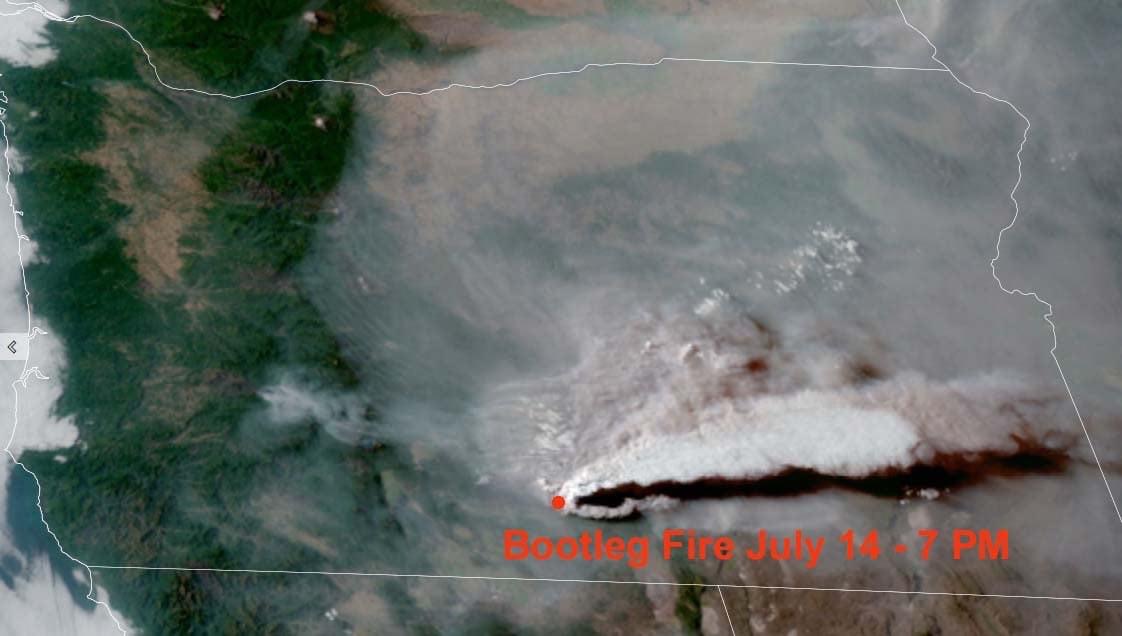
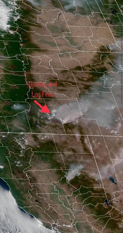
Looks like the Bootleg is making an evening run… these pictures are from near Lakeview on 7/12 at 1930. ~37 miles away. Look behind the evening smoke for tonight’s column…
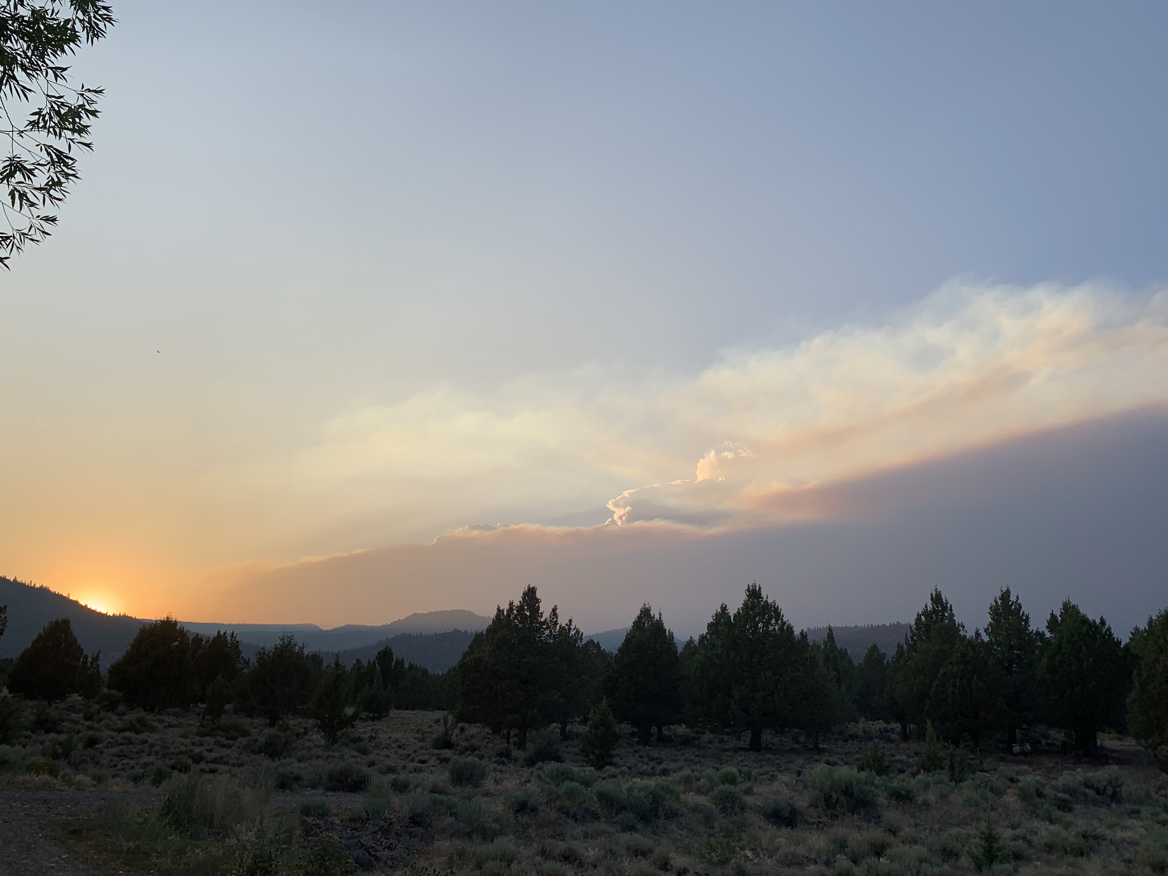
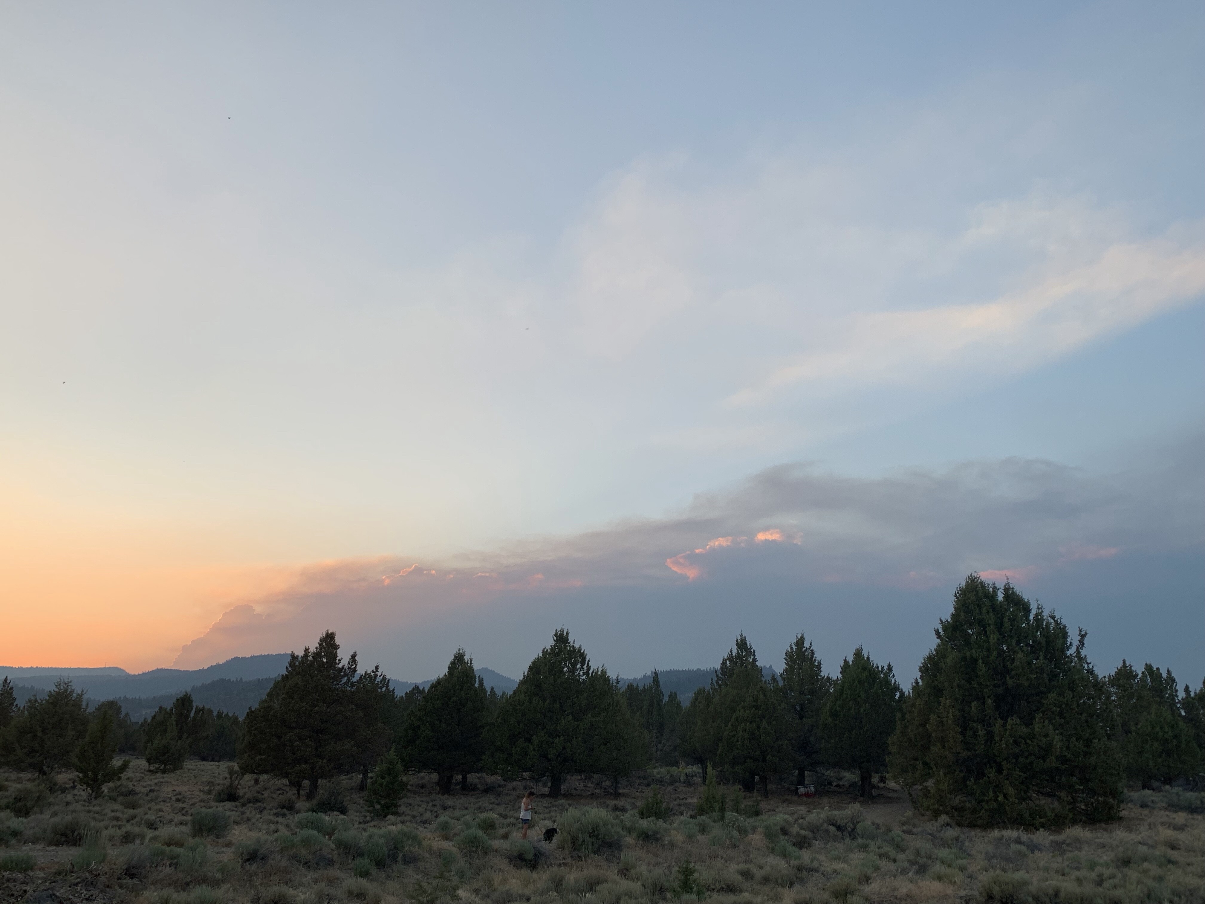
1 Like
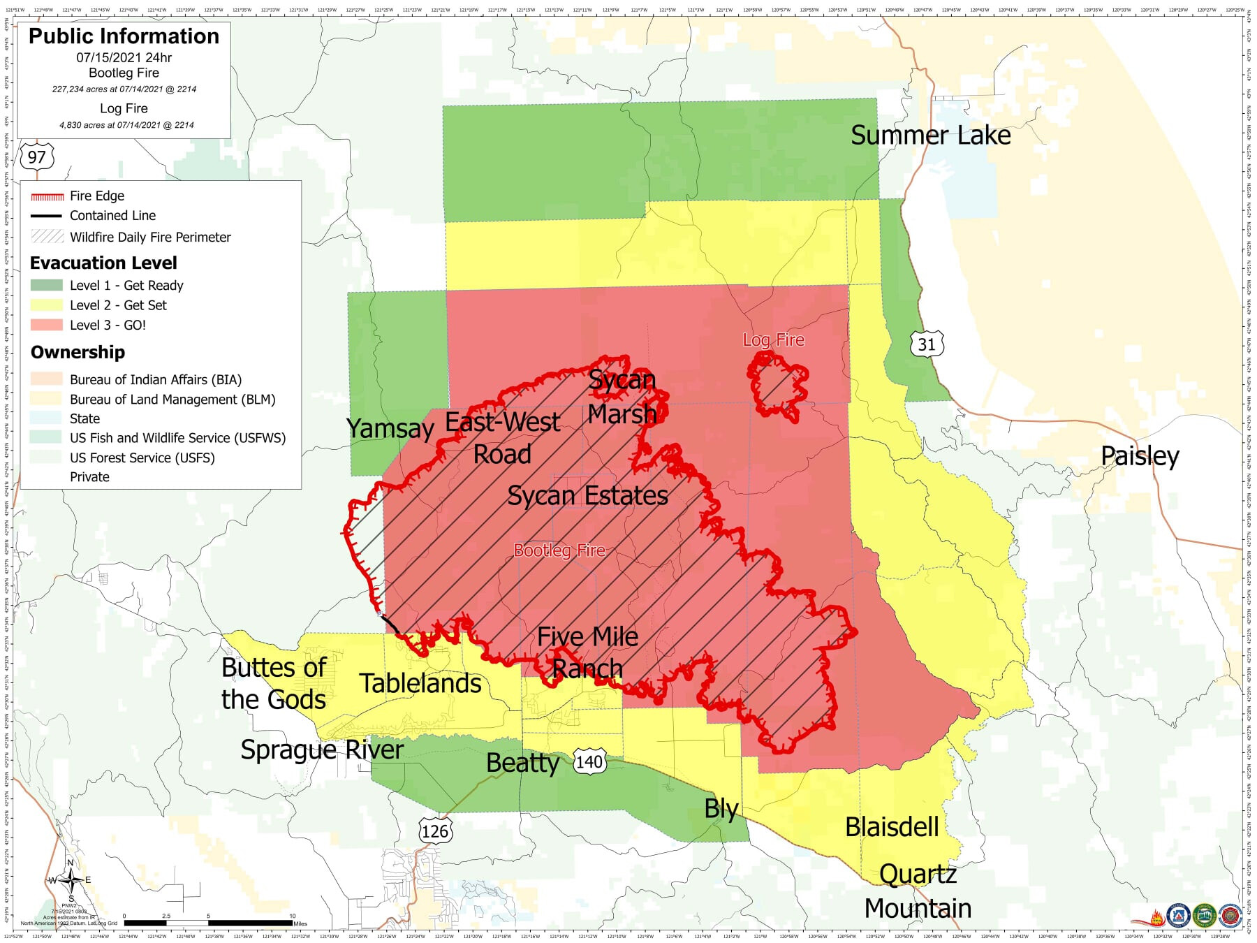
The Lake County Sheriff’s Office is issuing level 1, 2 and 3 evacuation notices.
Level 3 (Go Now):
South of the Sycan River, south of Forest Roads 3239 and 28, and the Gearhart Wilderness west of Forest Road 3372 in Lake County.
Level 2 (Get Set):
Sycan Marsh area, Chocktoot Creek Drainage area, west of Forest Road 28 and east of Forest Road 3372, north of Forest Road 34, and through the area that includes Corral Creek Campground and Mitchell Monument.
Level 1 (Be Ready):
From the northeast at the Lake County line, through the Yamsay Mountain Recreation Area, extending east to the south of Thompson Reservoir to Winter Rim Recreation Area, then south near the Forest Boundary, then following Chewaucan Road south to Forest Road 34.
2 Likes
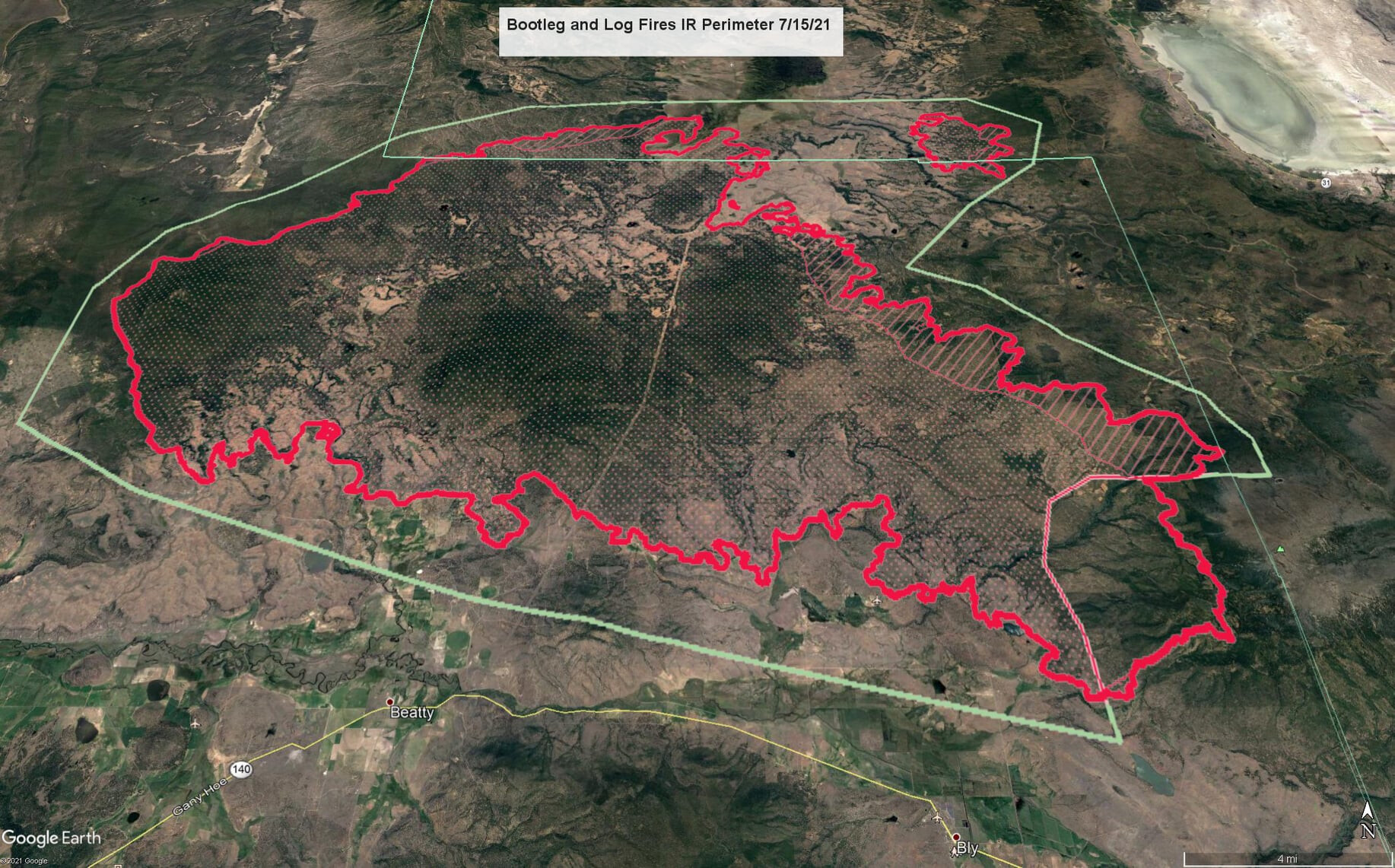
201,700 acres per the IR. The column was visible from Eagle Lake near Susanville, CA yesterday at sunset.
4 Likes
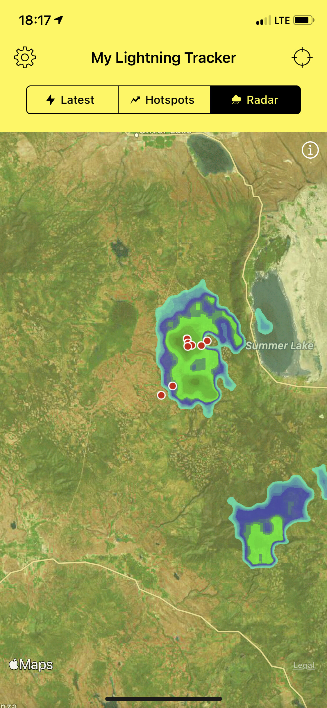
Looks like either a spot or new incident approximately 15 miles NE of the main fire. Approx 120 acres as of 2100 last night.
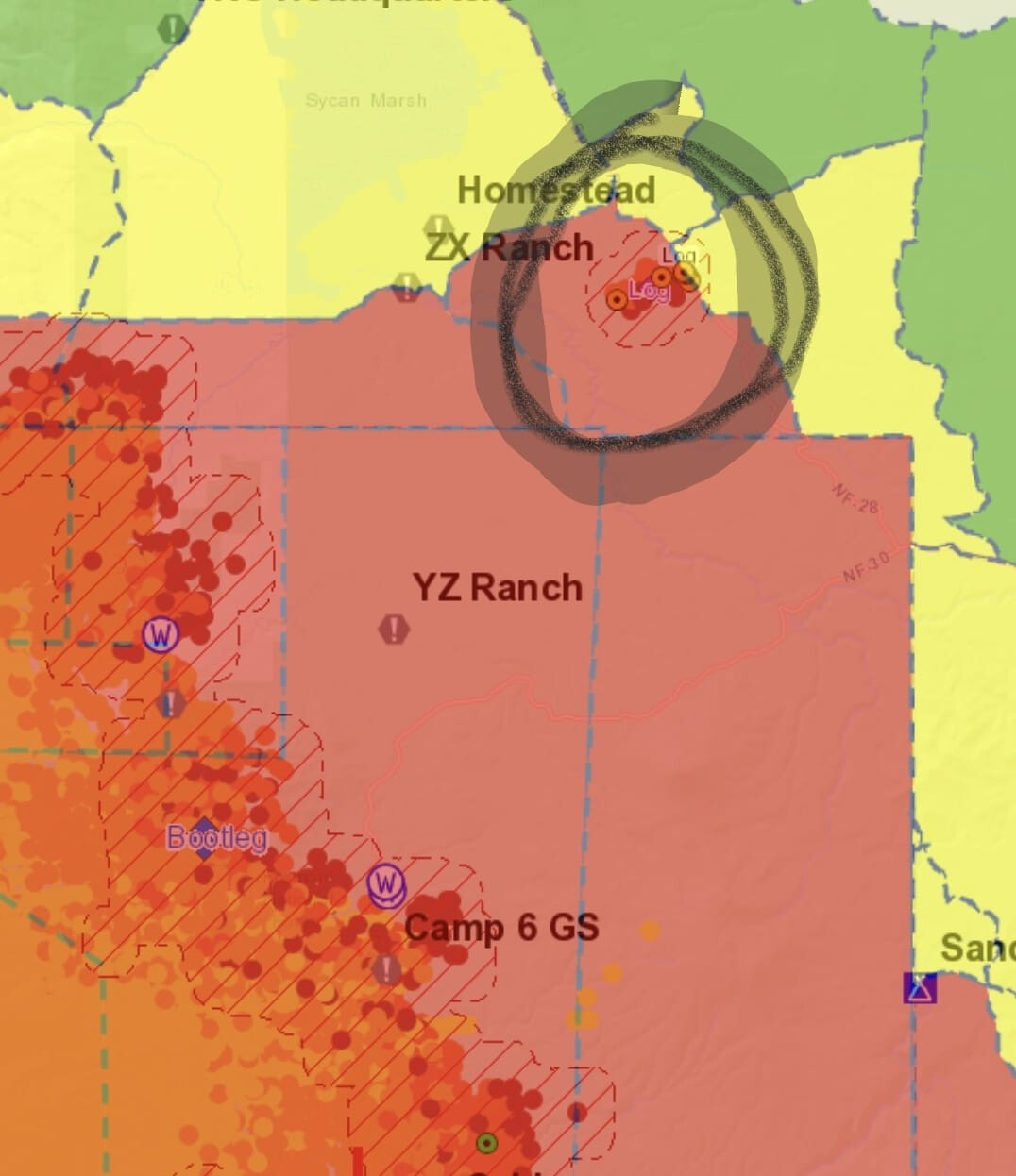
4 Likes
That fire north of bootleg is the log fire. Estimated at 2800 acres. Post to follow
2 Likes
Cool view from my brother’s jet today at approx 1600hrs looking from over the Crater Lake area.

9 Likes
Don’t see that everyday
2 Likes
RED FLAG WARNING NOW IN EFFECT UNTIL 10 PM PDT THIS EVENING FOR HAINES 6 WITH EXISTING FIRE FOR FIRE WEATHER ZONE 624…
-
Impacts: An observed pyrocumulonimbus is ongoing with radar
depicting broad rotation in the smoke column along the fire line.
The very dry and unstable conditions will continue to support
extreme fire behavior for a couple more hours with locally-
generated erratic and gusty winds. Spotting could be
problematic. -
Affected area: The bootleg fire in Oregon Fire Zone 624.
-
Wind: West 10 to 15 mph with gusts up to 25 mph.
-
Humidity: As low as 10 percent.
#BootlegFire
2 Likes
CalOES Type 1 STEN 1840A en route from the LA Basin at 0600 today. OES 341, 343, 378, 395 and 416 with ARC BC105 as leader.
1 Like
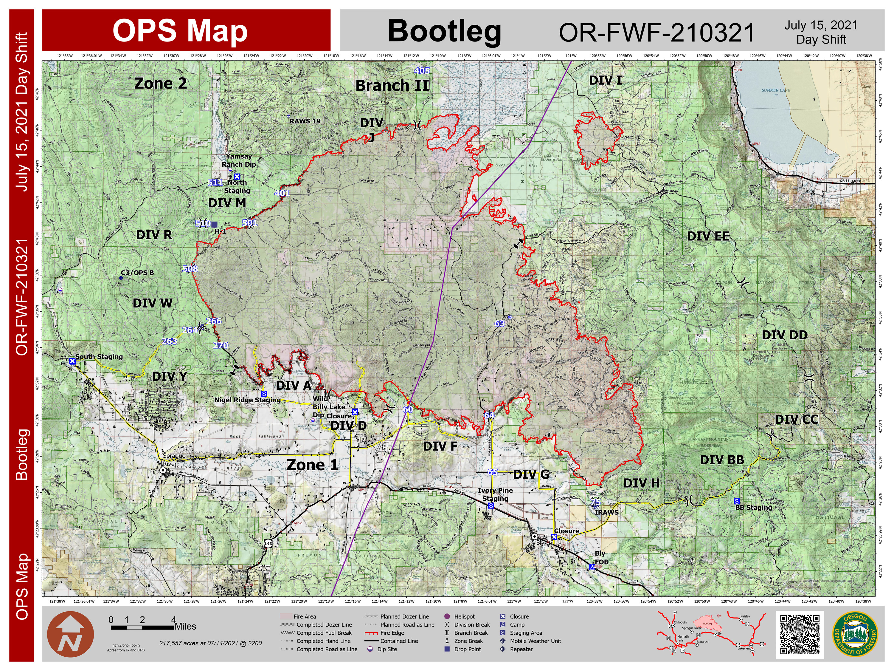
The Bootleg Fire made another big run yesterday being fed by gusty winds and very low humidity and an extremely receptive fuel source. Based on the latest Infrared flight mapping as of this morning the Bootleg Fire is estimated at 232,763 acres with only 5% containment listed. The fire grew another 11,253 acres in the last 24 hours.
2 Likes
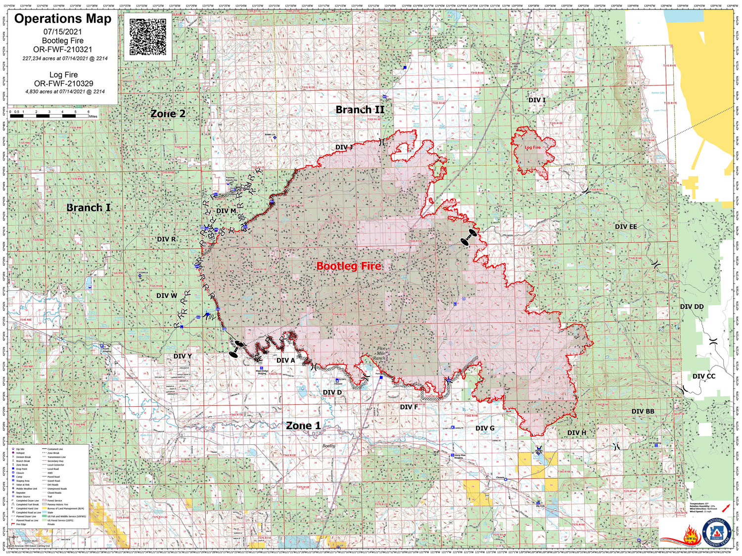
The 3 Washington TFs assigned to Grandview are being reassigned to Bootleg and enroute.
2 Likes
Anyone have contact with the GIS on this team? I am trying to support an OES Strike Team with ATAK data packages and notice some of the maps are not exported as georeferenced pdfs. Any lead would be great. You can PM me.
2 Likes
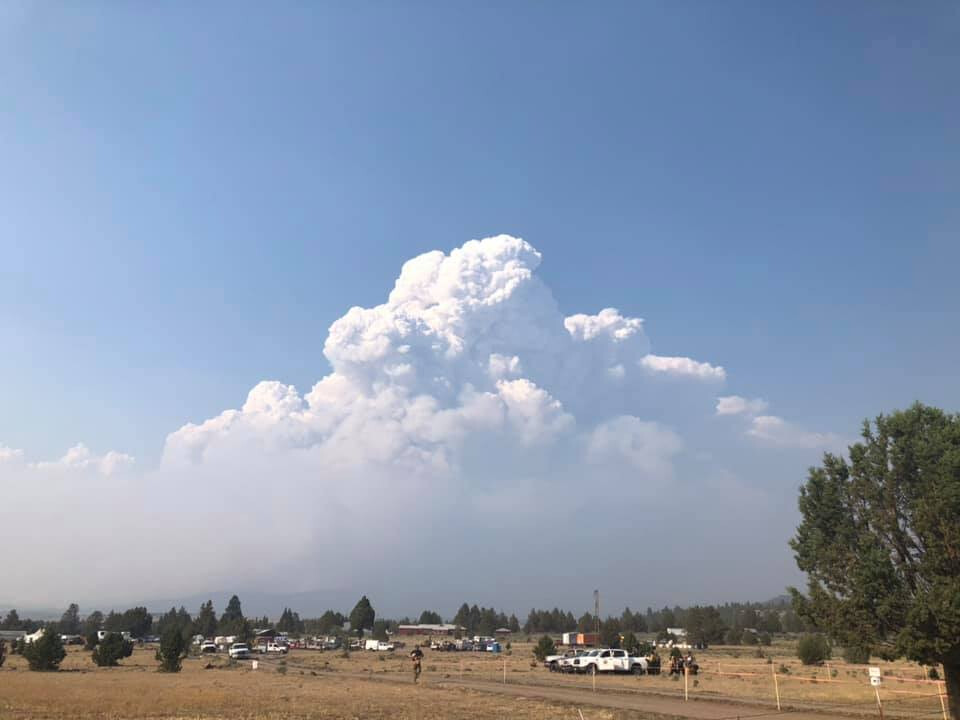
The Bootleg and Log fires are seeing an increase in fire behavior this afternoon as winds increase. Visible satellite as well as radar are picking up on pyrocumulus clouds developing. The fire temperature from GOES-West satellite also depicts the increase in activity and fire behavior. This is indicative of the orange glow on the active flanks of the fire in tgrr red third image. The north and northeast flanks appears to be the most active. The team currently assigned to the fire indicates there is potential for the Bootleg and Log fires to merge today. Fire crews have pulled back from the main fire but continue to scout new containment line opportunities to the north and east. Image 4 shows estimated cloud tops of the pyrocumulus clouds at around 22-29k feet.
5 Likes
New evacuation orders for Lake county.
LAKE COUNTY EVACUATION UPDATES
Lakeview, OR – Lake County Emergency Manager Evacuation Updates. Due to increased fire activity on the Log Fire, which is NE of the Bootleg Fire, evacuation zones near Summer Lake are increasing. Also, due to increased fire activity on Bootleg Fire, evacuation zones near the Gearhart Wilderness and the town of Paisley are also increasing. See the link below for an interactive fire map.
Effective Immediately:
Level 3 (Go Now)
• County line on Hwy 140 east to Quartz Mt, following the FS RD 3660 to Corral Crk, north to FS Rd 34, to Deadhorse and Campbell Lakes, Bald Butte to the north of Winter Rim, to Picture Rock Pass, east over Hager Mt, county line at Coffee Pot Spring.
Level 2 (Get Set)
• From county line near Mitchell Monument south to Hwy 140, running along Hwy 140 east to Quartz Mountain and northeast to Dairy Creek CG, then north to Government Harvey Junction, north on FS 29 Rd to Hwy 31 again encompassing the west shore of Summer Lake and stopping 2 miles short of ODFW headquarters on Hwy 31, then west across Thompson Reservoir to the County line.
Level 1 (Be Ready)
• West of Hwy 140.
Level 1 – Be Ready Residents should be aware of the danger that exists in their area, monitor emergency services websites and local media outlets for information.
This is the time for preparation and precautionary movement of persons with special needs, mobile property, and (under certain circumstances) pets and livestock.
If conditions worsen, emergency services personnel will make every attempt to contact you. You may be contacted via the emergency notifications system.
Evacuation shelters are located at the following locations: Klamath County Fairgrounds, La Pine Middle School, and a shelter will be available later tonight at the Daly Middle School Auditorium (220 South H ST)
Area residents and Forest visitors are asked to avoid the fire area and related roads while suppression activities continue. Anyone driving in the area should watch for increased traffic and vehicles associated with wildland firefighting.
https://kcgis.maps.arcgis.com/apps/webappviewer/index.html?id=4bfb02b41eb7473ca95b04c3cbd1da21
2 Likes