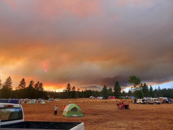
Was 1300 acres this morning but well past that with the incoming frontal winds and may be heading east up grave creek drainage now.
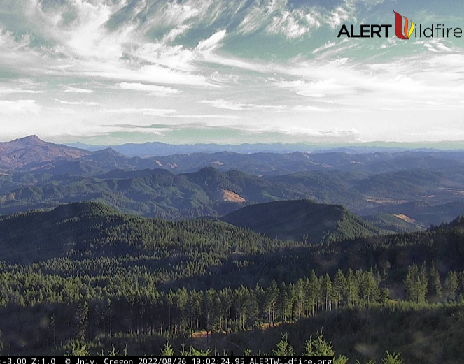
https://www.alertwildfire.org/region/northcoast/?camera=Axis-HarnessMtn
Was 1300 acres this morning but well past that with the incoming frontal winds and may be heading east up grave creek drainage now.
https://www.alertwildfire.org/region/northcoast/?camera=Axis-HarnessMtn
Should be OR-MEE-Rum Creek is correct. Fire is being managed by PNW IMT 13. Fire is making a significant run tonight.
Local govt strike teams en route for structure protection.
Level 3 evacuations in Galice area.
From emergency management-
Level 3 - GO NOW evacuation from South and West of the Rogue River and North of Bear Camp Road; includes Rand, Galice, and Galice Creek Road.
Leave without delay. It is unsafe to stay and threatens the safety of you, your family, and emergency responders. Your life could be in great danger. Emergency services personnel may not be available to help you if you choose to stay.
This may be the only alert you receive. Find resources at wildfire.oregon.gov.
Level 2 - BE SET to evacuate from North of Galice Road and the Rogue River, South of Lower Grave Creek Road, East of the Rogue River and Taylor Creek, West of Hog Creek Road.
Conflagration declared-
Office of State Fire Marshal (OSFM) is mobilizing four task forces and an Incident Management Team to the Rum Creek Fire. Our resources will be there to protect life and structures. We will be in unified command with ODF and the federal resources in place. The fire is currently 4,700 acres in size. The Josephine County Sheriff’s Office has issued Level 3, Level 2, and Level 1 evacuation orders for homes near the fire.
OSFM team starting to arrive.
Fire looks like it’s now established across the river.
New Level 2 - BE SET to evacuate from North of Onion Mountain Road, Shan Creek Road and Briggs Valley Road. South of Galice Access Road and Galice Road. East of Taylor Camp Road and Hansen Creek Road. West of Buckhorn Mountain, Little Picket P Line.
New Level 1 - BE READY notice for: North of Shan Creek. South of Buckhorn Mountain. East of Burned Timber Creek. West of the Rogue River and Griffin Park area.
New evacs on the fire -
Wildfire alert from Josephine County Sheriff. Level 3 - GO NOW evacuation from North of Indian Mary Park and Stratton Creek Road. South of Belknap Gulch and Stratton Creek. East of the Rogue River. West of Hog Creek Road and Hog Creek.
Is there an online scanner for this fire or a location for the IAP? Nothing showing in ftp site.
Fire is making a good push today. Hearing acreage may be close to 7k.
2 additional task forces from OSFM are en route.
Also additional evacuations in place.
Wildfire alert from Josephine County Sheriff. Level 1 - BE READY notice for: North of Lower Grave Creek Road. South of Douglas County line. East of Bunker Creek. West of Sugarloaf.
Another round of evacuations. Looks like the fire is pushing south east.
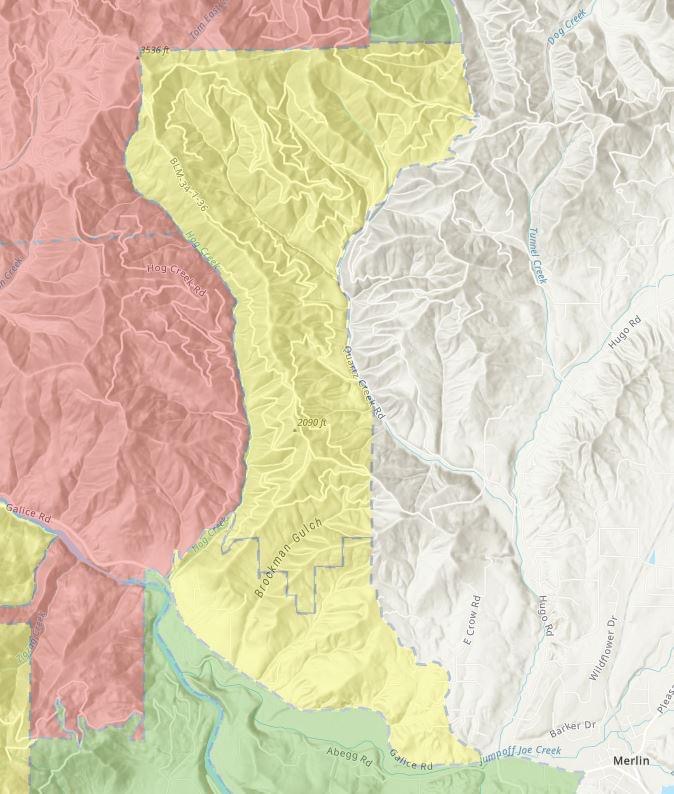
Rum Creek wildfire emergency alert from Josephine County Sheriff. Level 2 - BE SET to evacuate from North of Robertson Bridge Road and Riverbanks Road. South of Tom East Creek, includes Brockman and Avery Gulch area. East of Hog Creek. West of Crow Road and Quartz Creek Road…
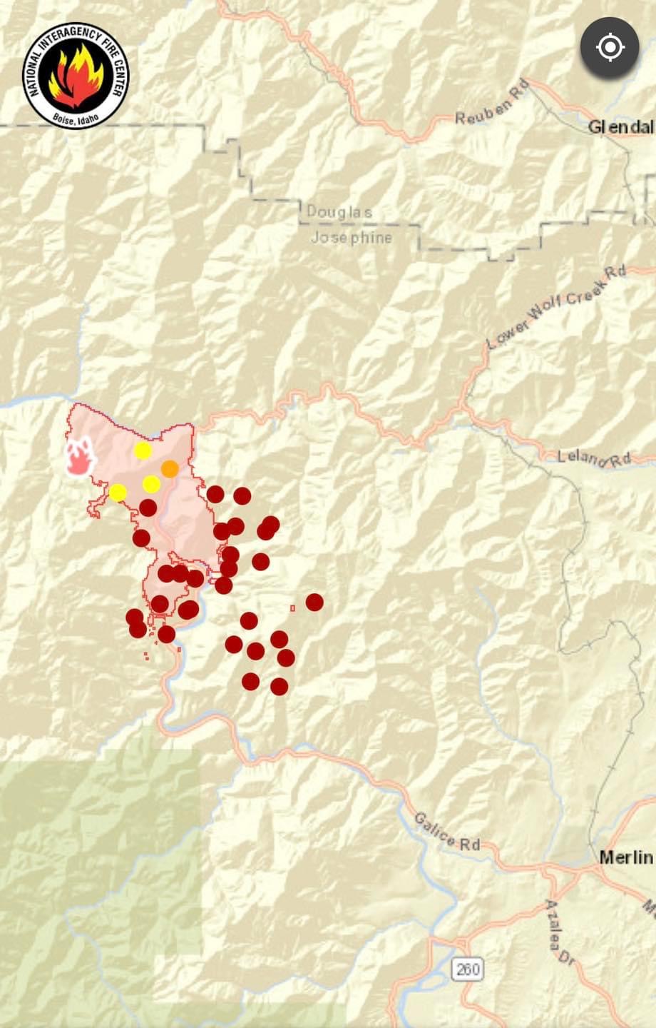
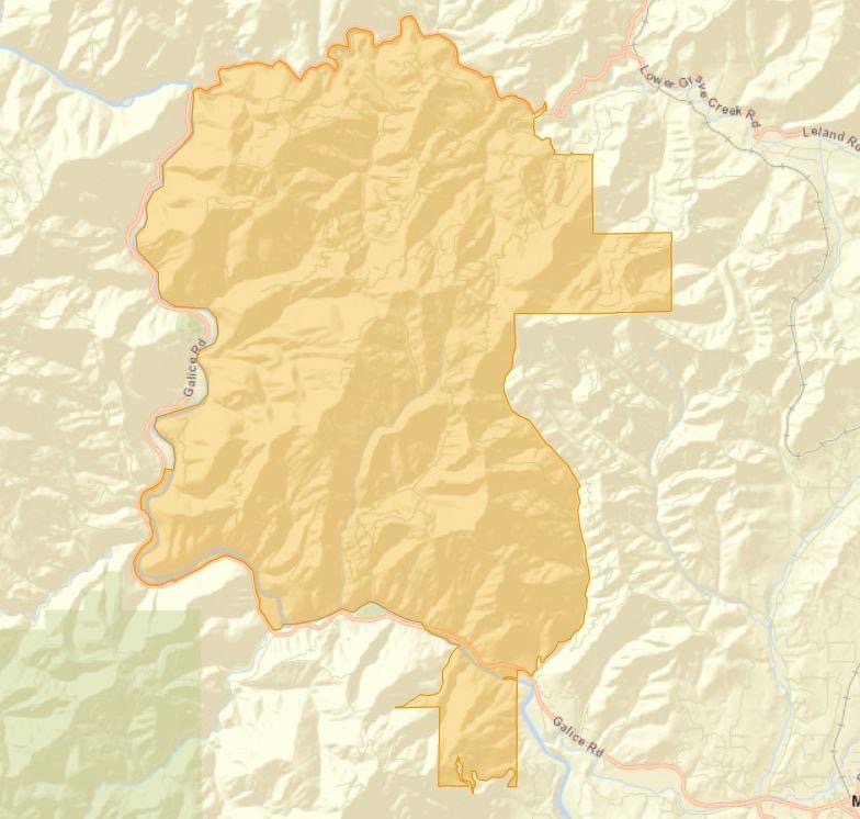
The 2018 Taylor Creek Burn (blue) may help hold up southward progression of the Rum Creek Fire.
Satellite heat mapping in this view may be inacccurate. We should have detailed maps on The Lookout Livestream on YouTube tomorrow morning at 7am.
Nice work on this!
Fire reported at 8408 acres this morning.
Haven’t seen an IR this morning. Return of triple digit heat tomorrow through mid week with mid teen RH.
We looked at the Rum Creek Fire this morning on the Lookout. We show the firelines from 2018 Taylor Creek Fire, and look at options for controlling this fire. https://youtu.be/Pg6li54cDqM?t=613
Additional evacuations have been ordered. Fire stood up again this afternoon.
Wildfire emergency alert from Josephine County Sheriff. Level 2 - BE SET to evacuate from North of Lower River Road, Robertson Bridge Road. South of Galice Road. East of West Pickett Road, Panther Gulch. West of Azalea Drive.
And Wildfire alert from Josephine County Sheriff. Level 1 - BE READY notice for: North of Galice Road, Merlin Road. South of Copper Queen Road and 2000 block of Dog Creek Road. East of Crow Road, Quartz Creek Road and Tunnel Ridge. West of I-5.
The evacuations are getting closer to population centers.
Anyone know if they activated EMAC for this? Cal-OES putting together multiple strike teams for Oregon?
Ive heard of at least one Type 6 Cal OES strike team being deployed.
Looks like CA-XSA is sending T3 OES out tomorrow…