
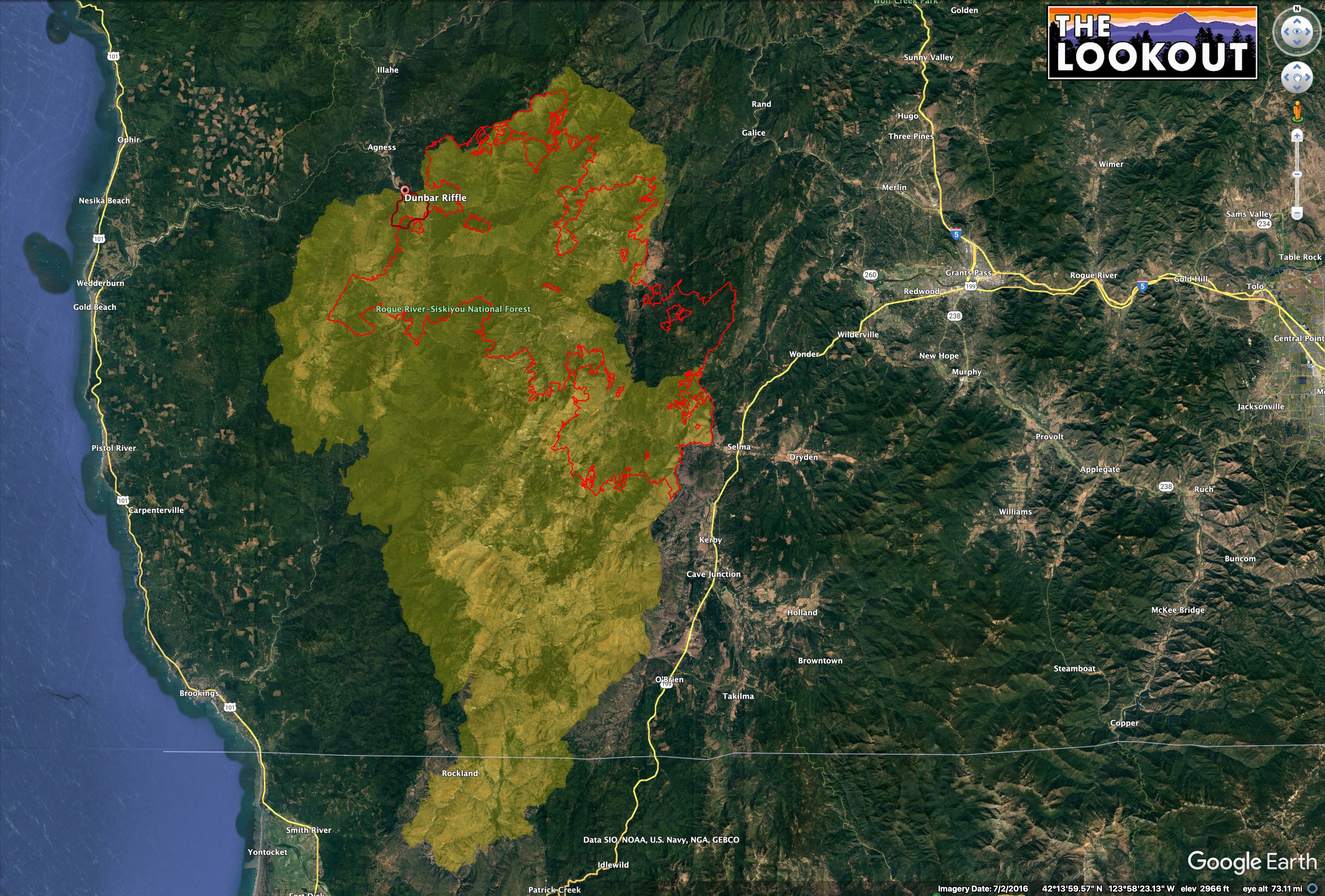
Dunno about a million acres. Biscuit burned 500,000. Shown here in yellow.
This fire is on the northern tip of Biscuit.
2018 Klondike tells a story about potential fire behavior inside the Biscuit footprint.
Klondike (red outline) started on same day as this fire and burned 175k acres, almost all in the Biscuit footprint. It wasn’t declared contained until November.
As you get farther west, the fog influence starts to become more important. Not any sort of expert on this, just remember stories about how it helped to define the western edge of Biscuit in 2002.
8 Likes
The fire is 7,800 acres and did exhibit extreme fire behavior today. I would venture to say that this thing hits 20,000 acres in the next couple days based on the growth In the first 24hrs.
2 Likes

Doesn’t the fact that the Klondike fire burned so well in he Biscuit fire footprint and this fire is burning so hot disprove the USFS theory that frequent fires in our National Forests will reduce fire severity ? Fire without followup treatment only increases available fuels.
3 Likes
To be fair, Klondike happened 16 years after Biscuit in productive westside forest lands. It’s important to parse out what is an appropriate amount of time for a second burn. 16 years between fires seems like too long in just about any western forest type that isn’t high-elevation.
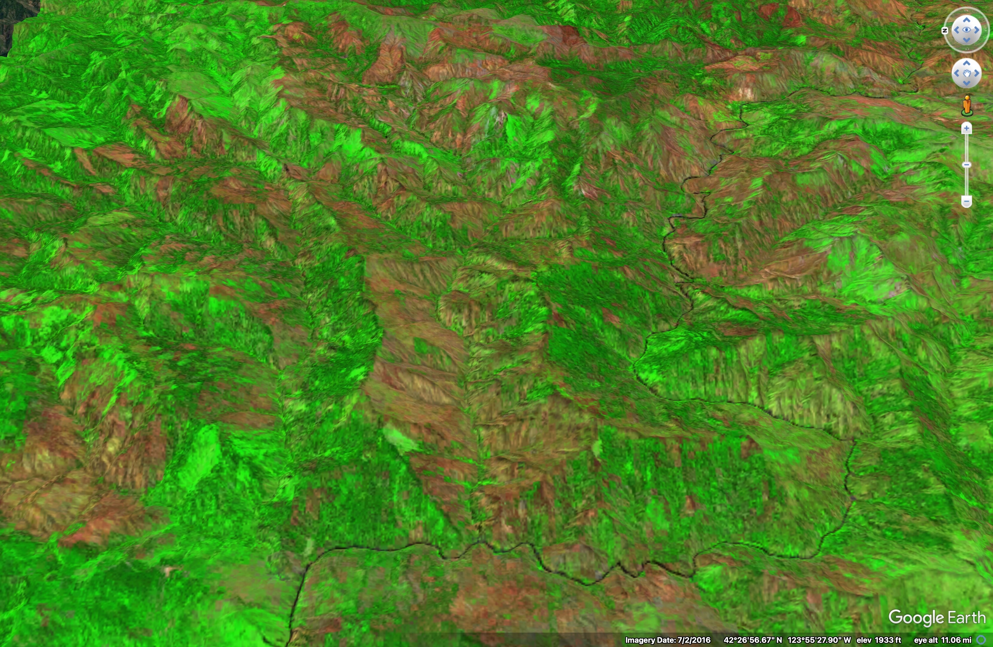
And you’ve got to ask what the outcome was. ‘Burned so well’ is pretty subjective. The Klondike burned 175,000 acres in 4 months, but that doesn’t mean it didn’t do any good work. The image below is Klondike in 2019. Red is higher severity. A lot of the north slopes underburned. According to the BAER team, about 75% of the landscape basically got a big fuels treatment. Given the USFS’ inability to manage fuels at scale, it’s hard to say if the fire was the worst thing that could have happened to the landscape. If we’d kept fire off it for another decade, we might have roasted a much higher proportion.
10 Likes
Thanks Pyrogeo as always!
There are an awful lot of things that effect the degree to which an old fire helps tame a new fire.
When the BAER team assess the Flat fire it will be interesting to put it’s burn severity map over the top of the Klondike’s severity map.
I wonder if anyone has any lidar data from after the Klondike.
The Sentinel radar satellite data would also be a good data layer.
That is the kind of study that will help better understand and plan the use of “fires of opportunity.”
Like the YNP-Pika is being used in Yosemite today.
4 Likes
from IR flight last night at 10pm 5477 acres

4 Likes
That spotting to the south concerns me a little…
3 Likes
The fire will be on the northern extent of a mid level
moisture plume so there could be enough to drive pyrocu development today
3 Likes
Looks like an earlier inversion lift. To get back on topic and provide some local intel - any clear air for aircraft to operate is probably not desirable. This area benefits from marine layer push and coastal inversions. With the indices sitting at near-record levels for the coast, any clear air will have this fire running. Stay safe all.
For the mods, this is OR-RSF-000209
4 Likes
Wondering when large resource orders will go through for this fire
2 Likes
I was a FELB on the Biscuit; my local fallers GPS the trees we dropped (mostly virgin timber).
Pres. Bush approved the harvesting . Sierra club and other far lefters put a stop to the harvesting
Sticks still on the ground to be burned up in the Flat fire
4 Likes
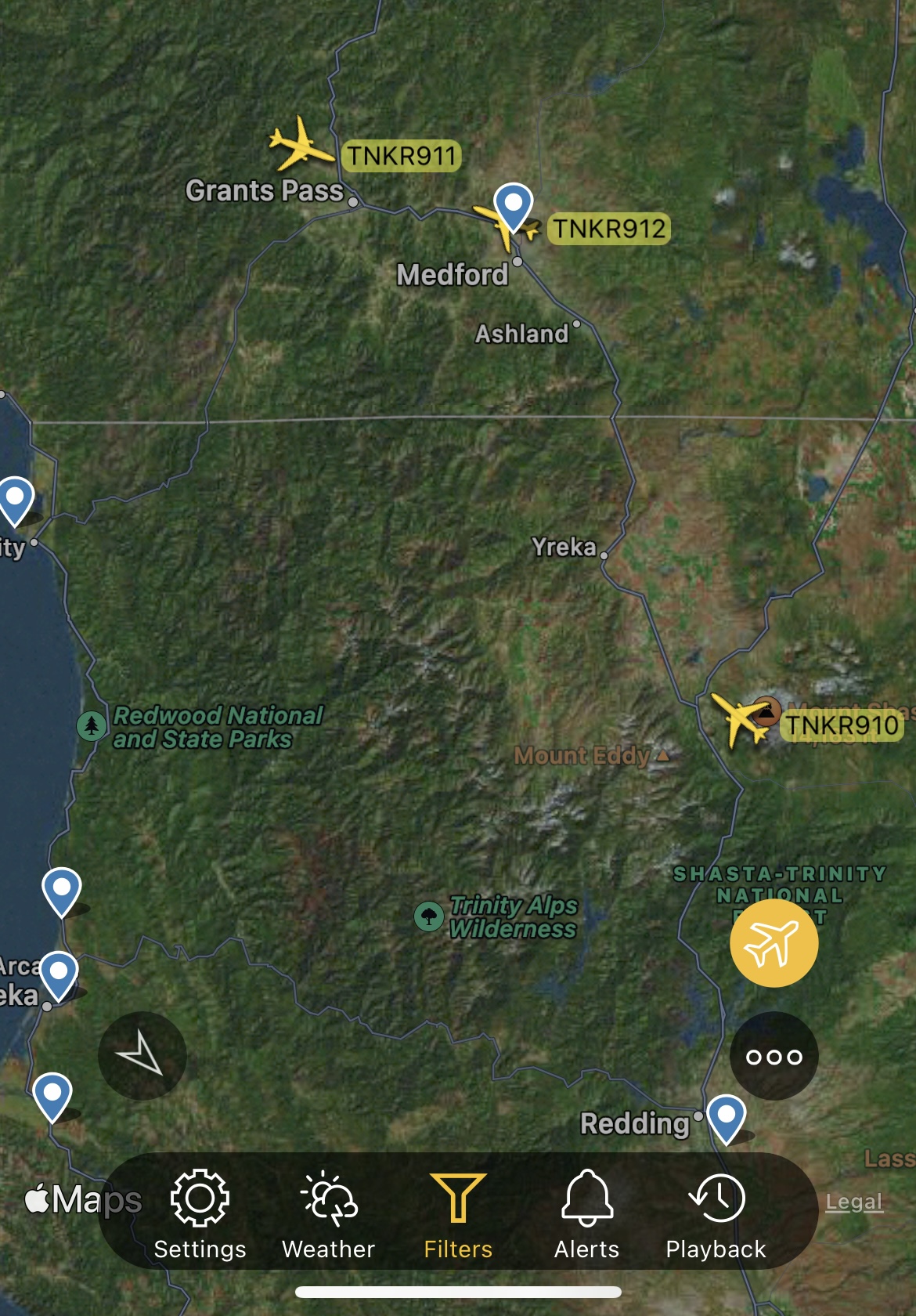
Tnkr’s 911 & 912 @ Medford
4 Likes
912 over the fire 
3 Likes
Does anyone have an update on acreage and fire activity and potential spread and direction of this fire?
2 Likes
3 Likes
Quite the air show being put together there.
4 Likes
Zoom Earth - Flat Fire Overlays: Flat Fire, Curry County, Oregon, United States | Zoom Earth
3 Likes