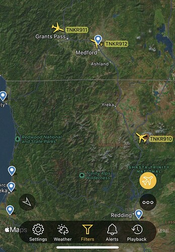
912 over the fire 
Does anyone have an update on acreage and fire activity and potential spread and direction of this fire?
Quite the air show being put together there.
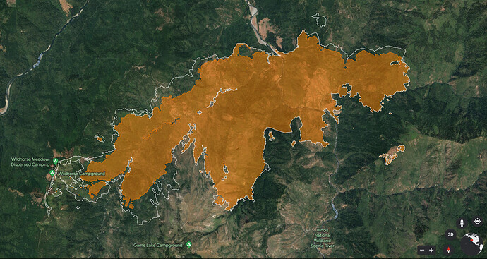
Zoom Earth - Flat Fire Overlays: Flat Fire, Curry County, Oregon, United States | Zoom Earth
- My son (Fire hog) was working there in 2002 with the USFS. He was a Fuels and Fire BC before the Biscuit Fire. He was assigned afterwards to work on the FS salvage logging plan, which was taken to court by the Sierra Club and other groups. They said USFS needed to look at saving all the habitat and let the forest recover on it’s own. Well over the years wildfires have really been tough battles in the Biscuit Burn.
I’m guessing the Flat Fire may clean it all up. Abundant heavy dead fuel loading, fire behavior, access issues, low resource values at risk under the current weather the Flat Fire may burn throughout this summer. 
- How many IC Teams will rotate through the Flat Fire? I’m thinking 8 or 10 by mid October! .
Growing up in Southern Oregon and seeing most of nor cal and SO on the ground; there’s years of fire scars for a reason. West of I5 is a different place. It’s an odd year when there isn’t something going in the kalmiopsis or the red buttes. Terrain, access and the amount of growth per year allows for it to burn year after year. As stated above the areas you can treat get protested and the majority of it has no access. Spending many rolls burning night after night, you get a fall like wind event and there’s no way to catch up. It might look ok on a topo but there are some places you just can’t get to for IA.
Anyone gonna post a iap from today?
20230718_.pdf (2.2 MB)
8,204 acres
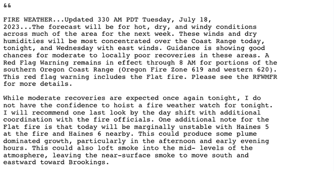
High Haines index plus continued drying and above average temperatures could lead to plume dominated fire behavior with spotting.
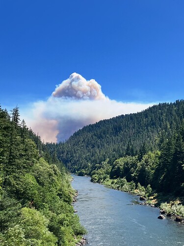
This picture was taken yesterday 7/17 in the afternoon looking downstream on the Rogue River.
Image Credit: Dana Leavitt, Public Information Officer #FlatFireOregon2023
Acres: 8,204
Total personnel: 378
Crews: 13
Helicopters: 7
Engines: 16
Bull dozers: 2
Water Tenders: 2
https://twitter.com/RRSNF/status/1681292284493697026?t=bC89ayV12qL1lgybUGhYrA&s=19
Acres: 12,756
Total personnel: 516
Crews: 17
Helicopters: 7
Engines: 10
Bull dozers: 4
Water Tenders: 2
Masticators: 6
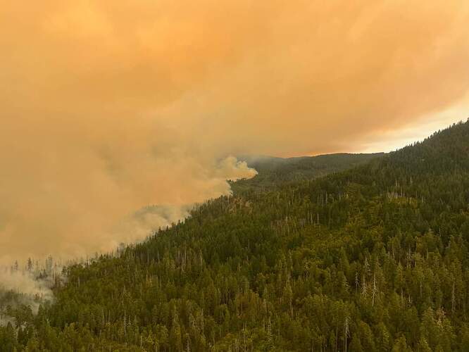
This is the western flank of the fire from the air looking southeast
Image Credit: Dan Martin, Lead Operations Chief #FlatFireOregon2023
Red Flag Warning, Haines of 6 for the fire area today.
Mods - would it be possible to correct the agency ID, it should be OR-RSF-Flat, there is no RSM.
15,217 acres from last night’s flight, 2316 PDT. Google Earth map shows growth since flight prior
Copying/pasting text from the IR log:
Most of the growth was call around the west head and along most of the north side. There looks to be a pretty major burnout along Wildhorse Lookout Road for about a 2 mile stretch. There was also a push to the south in the west towards Game Lake Peak. There is a new well-established spot in the NE above Nancy Creek. There is intense heat along the burnouts in the west, scattered along the leading edge of growth in the north and SW, and in the new spot in the NE. Most of the rest of the fire is covered in scattered heat with some cool spots developing interior.
From NWCC:
Overnight, three small, targeted burnout operations were completed in the
northwest flank. Masticators are working around the fire to reduce vegetation, assisting
firefighter operations, and about 30% of the west flank has been completed. Firefighters are
about halfway through securing control lines in the northern section of the fire.
Working on the Flat Fire there are many personnel from different businesses and agencies,
including local firefighters who live in surrounding communities like Gold Beach, Brookings,
and Agness.There has been minimal spread to the north with the most active part of the fire being the
west flank. Today, the fire will continue to be most active in the west.
Today’s activities: Firefighters and South Coast Lumber will continue working together to
improve an existing shaded fuel break utilizing Forest Service Road 3318. If conditions permit
firefighters will be conducting small burnout operations on the western flank of the fire to
slow fire spread. Structure protection groups will continue working to prepare buildings.
Weather didn’t permit a mapping flight last night
