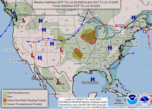
In fact, the storm prediction center has much of the area hashed for isolated dry lightning strikes for today.
In fact, the storm prediction center has much of the area hashed for isolated dry lightning strikes for today.
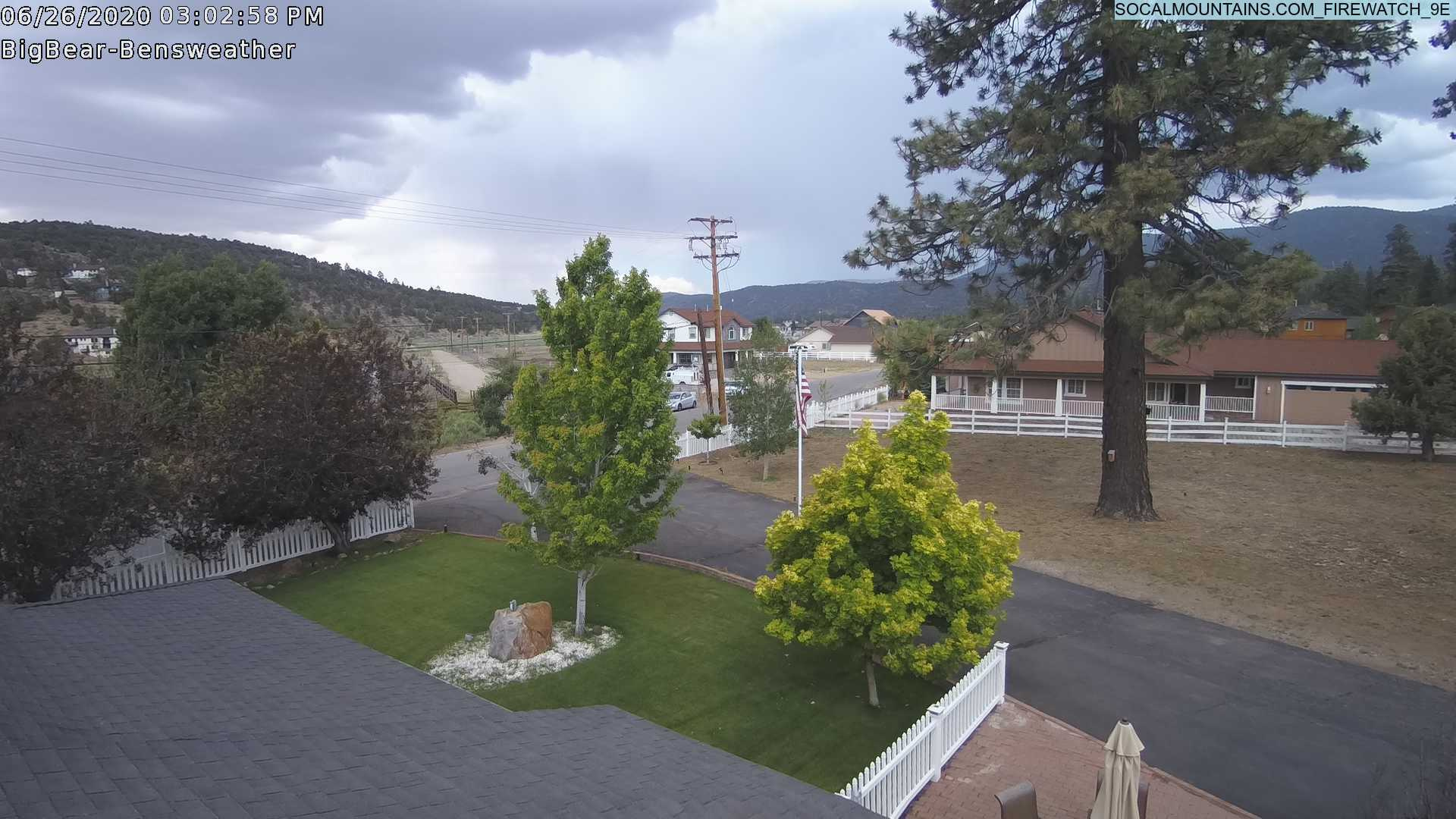
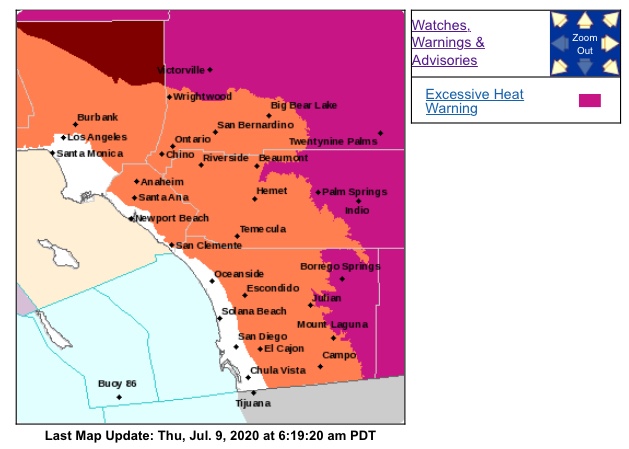
One thing that’s a given it’s Freaking Hot out today…Hydrant your troops!!! Take care of those Handcrews………
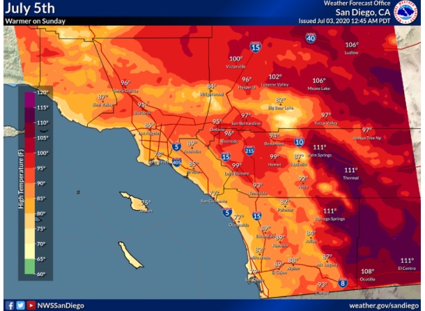
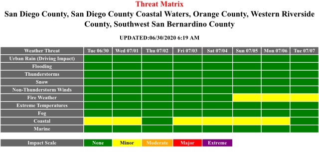
Regional Forecast
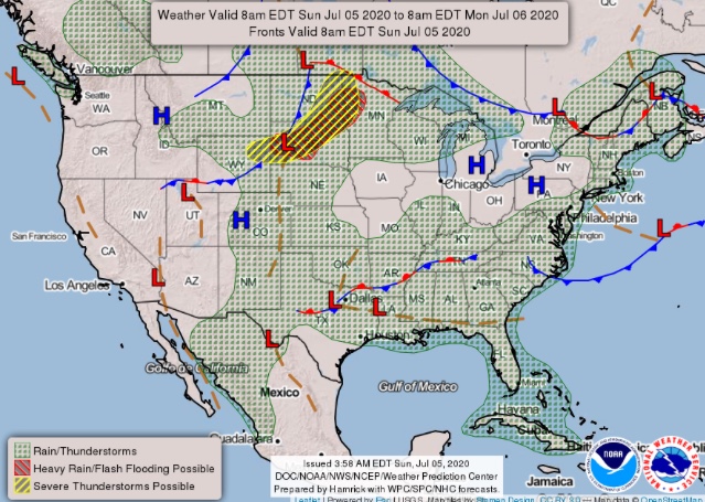
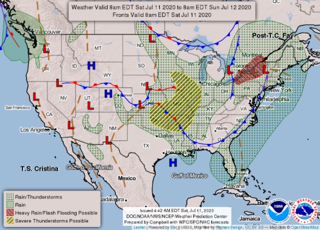
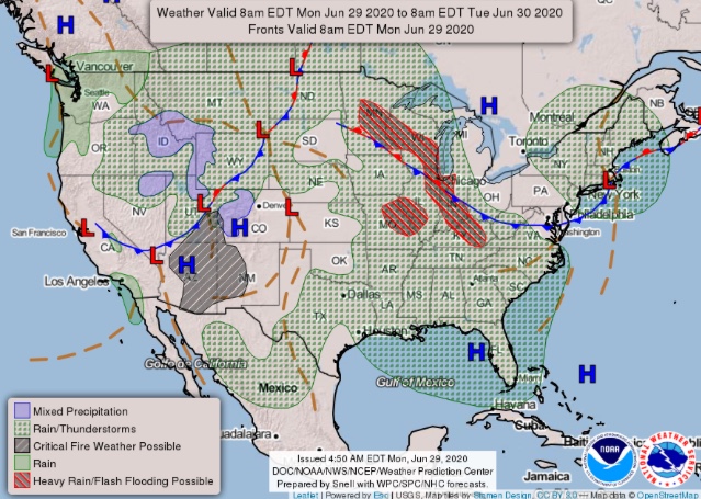
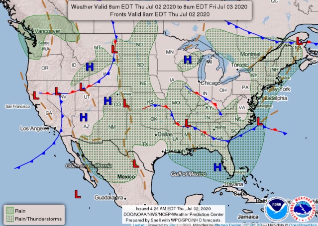
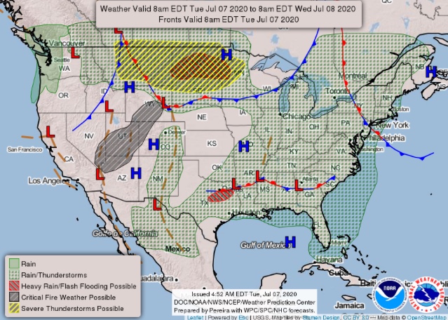
National Forecast Map
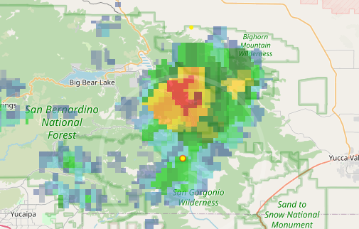
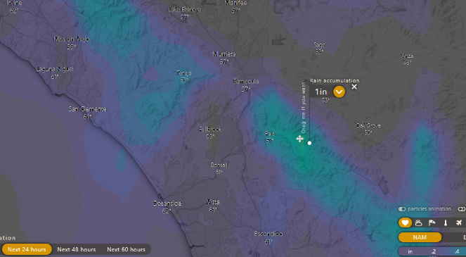
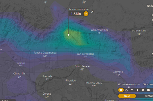
NAM spits out 1 inch of rain at Mt Palomar and 1.5 inches in the Cajon pass tonight, surely anything close to that would be a record for this time of year.
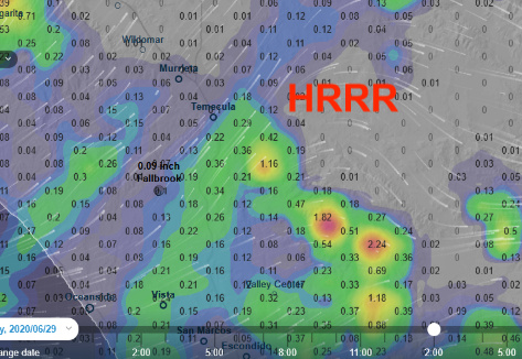
Just checked HRRR which shows this :o
Regional Forecast
The ridge is gradually expected to expand westward and reorient itself into a monsoon pattern. Heights rise across Southern California the first week of July and temperatures could be 5-10 degrees above normal by the 4th. Some monsoon moisture is noted around D8, and as usual it will depend on Gulf Surges, mesoscale complexes, and outflow boundaries that are too small for models to pick up. Regardless, the median first monsoonal thunderstorms looks on track for the middle of July in Southern CA.
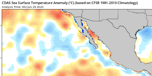
Of note, Gulf Of California and California bight SST are above normal currently.
These models missed it by that much. 0.00 reported on Palomar Mountain
Regional Forecast
Forecast Outlook
https://www.wrh.noaa.gov/total_forecast/getprod.php?new&prod=XXXAFDSGX&wfo=sgx
Yikes…
Upper level ridge is oriented over Southern CA with lower heights into the San Joaquin Valley, this will set up the possibility of weak sundowner winds each night through Santa Barbara county, Ventura County, and the I-5 corridor through the end of the weak. The biggest threat is the continued intense drying that the pattern has been promoting, with live fuel moisture in the interior dropping rapidly. A very anomalous ridge is indicated by both reliable models but the placement varies. Overall temperatures in SO will be 4-8 degrees above normal with upper level flow turning SE on Thursday advecting monsoonal moisture. Seeing as though there is likely going to be a tropical cyclone embedded in the monsoon trough (although well offshore) would not be surprised to see some high based thunderstorms starting next weekend.
Regional Forecast
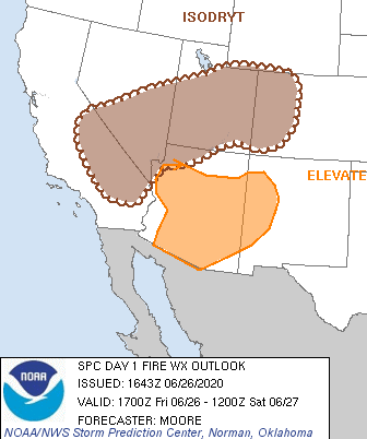
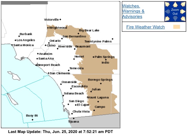
Fire Weather Forecast
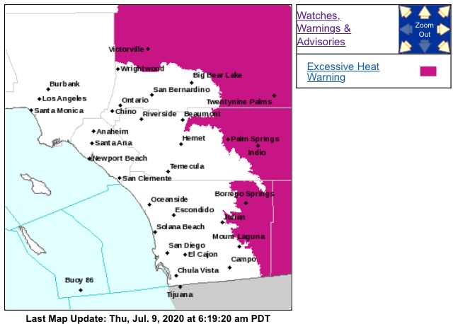
Wx Advisories
https://www.weather.gov/wwamap/wwatxtget.php?cwa=sgx&wwa=all
Trough moving into Northern CA bringing 3-8 degrees of cooling today and tomorrow. Weak sundowner winds promote overnight drying in the interior of Santa Barbara county, with RH in the 10-35% range. Onshore winds 20-30 mph on the desert slopes will lead to critical fire weather today and tomorrow.
Monsoon flow starts on Thursday with remnants of a thunderstorm complex and gulf surge moving into the eastern deserts. The moisture is elevated and by this weekend elevated thunderstorms could occur in the mountains. The ridge is building overhead again this weekend which is a limiting factor when it comes to convection. Hottest day between Sunday-Tuesday depending on where the ridge sets up.
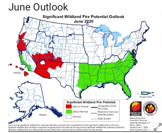
The pattern continues to promote above average drying through out South Ops.
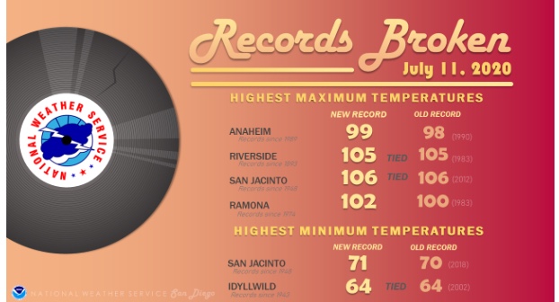
Well, that just looks hideous.
Keep hydrated my friends.
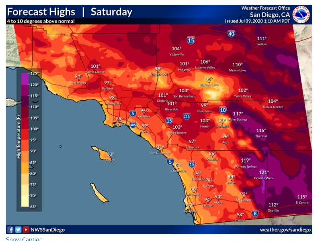
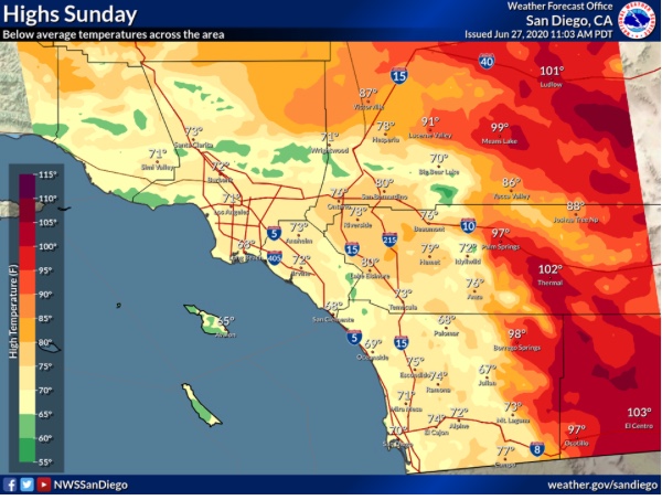
Some of the ensembles are showing hottest temperatures reaching 128 degrees in the deserts on Sunday. The operational models are about 5-6 degrees cooler.
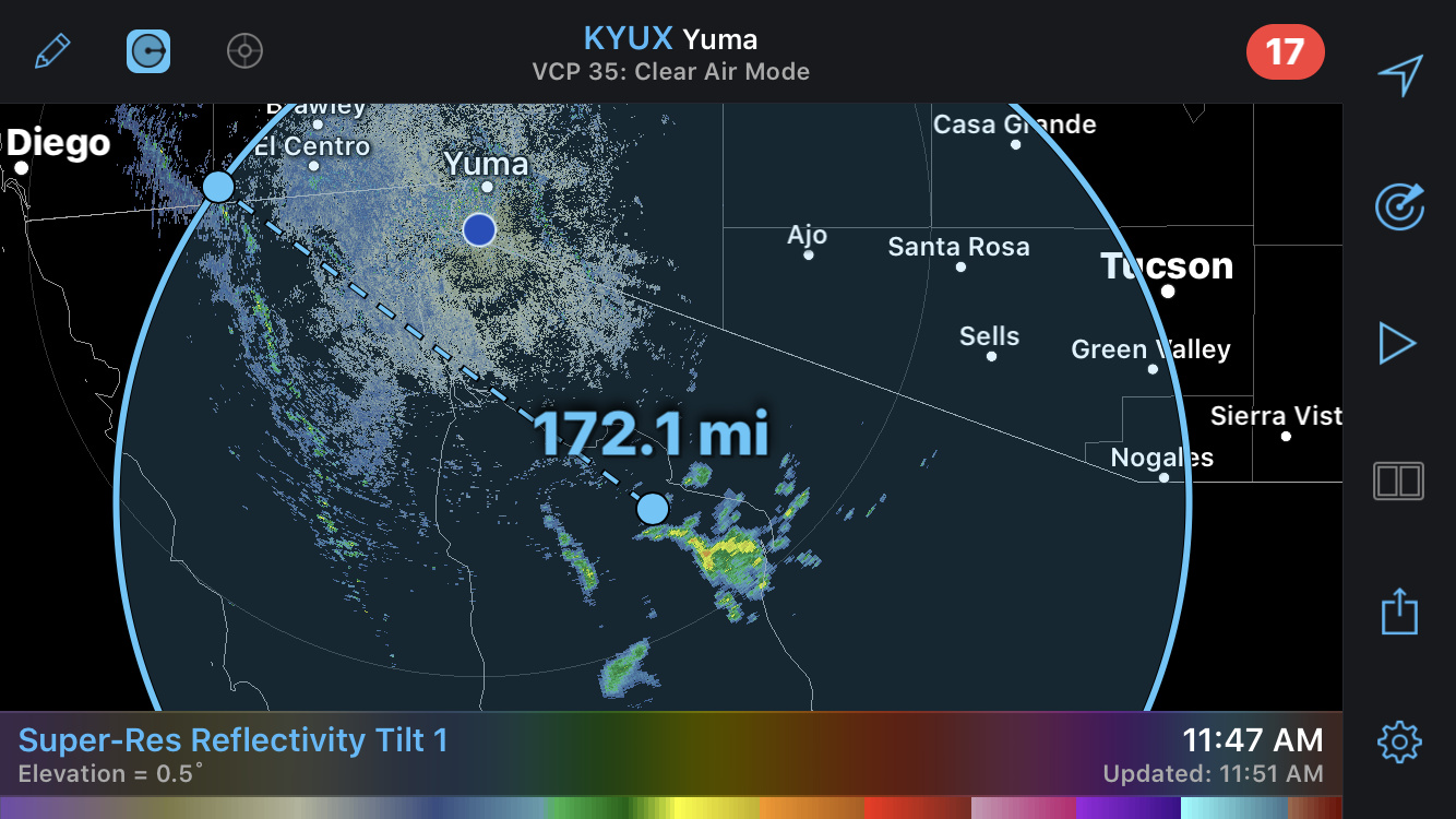
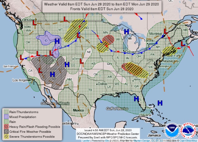
The monsoon trough is about 180 miles SE of CA, some elevated dry convection is occurring along it. Worth watching as it moves in.