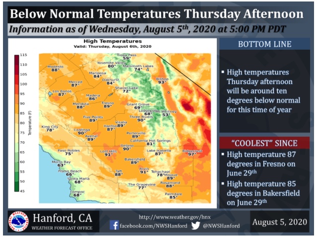
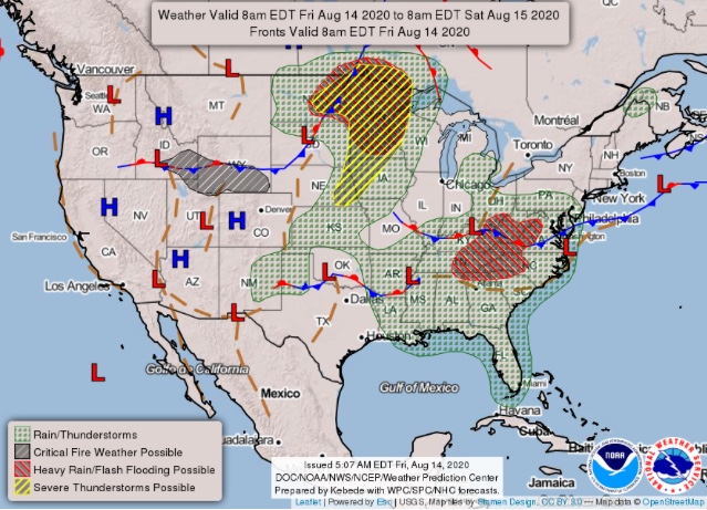
Slight chance of thunderstorms in the mountains today. We are not seeing a lot of vertical growth due to the high pressure being directly overhead. Intense drying continue through Monday. On Tuesday a cut off low undercuts the ridge and moves offshore of Pt Conception. The flow turns out of the south by Thursday. Onshore flow occurs with cooling 6-12 degrees. We will have to watch to see if the upper level low has enough dynamics to produce thunderstorms. The low retrogrades SW out of the area Saturday and the ridge rebuilds with above average temperatures continuing. Saturday-Monday of next week. The ridge will be in a more favorable position for the monsoon to enter the area.
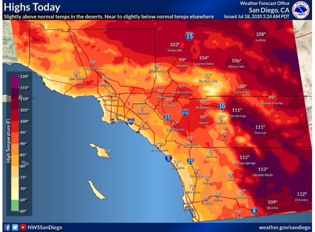
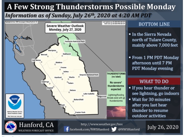
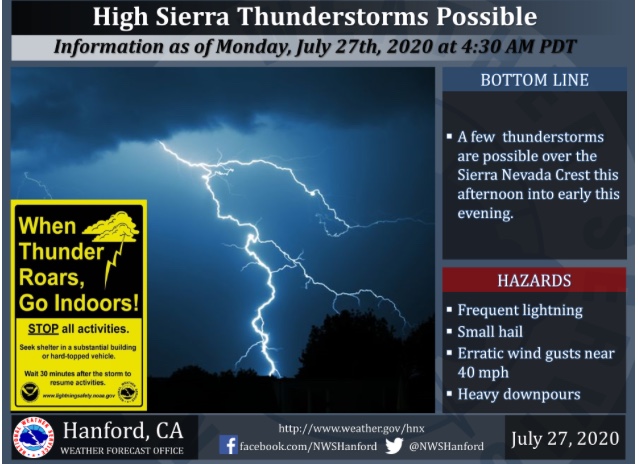
Weak trough to the west of CA continues to retrograde west, it will likely produce some thunderstorms across the Sierra today with the possibility of severe thunderstorms due to a deformation zone over the area. Heights continue to rise across Southern CA and will be seasonably warm with 2-7 degrees above average inland. Winds will increase this afternoon on desert slopes leading to critical fire weather conditions with Temps in the 90’s RH 10-18% and SW winds 15-25 MPH gusting to 35 MPH. A repeat is likely the next few days.
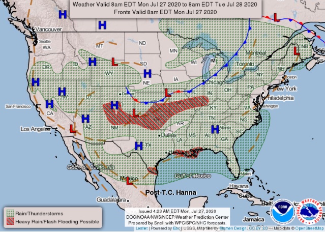
The monsoon continues to fester SE in Mexico and the timing of any monsoonal flow into Southern CA will depend on what happens with the trough to the West. The GFS ejects the trough to the N setting up SE flow across Southern CA on D6 while the ECMWF cuts the trough off into a cut off low and has more of a S-SSW flow across the region by D8.
Cooling is expected either way Tuesday-Friday and I would heavily favor the models to change again since the monsoon is so wishy-washy and hard for them to forecast.
5 Likes
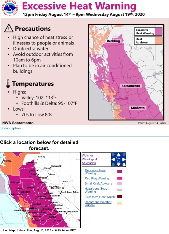
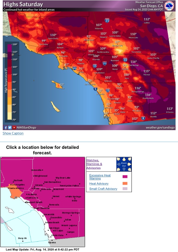
Regional Forecast
Forecast Discussion
https://www.wrh.noaa.gov/total_forecast/getprod.php?new&prod=XXXAFDSGX&wfo=sgx
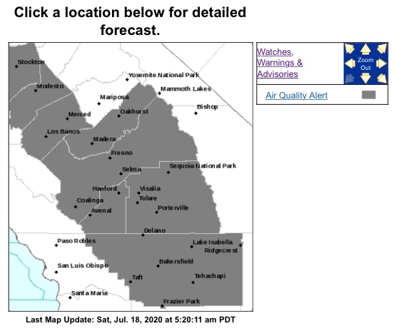
Central Valley Forecast
1 Like
No, I have no idea where the monsoon is.
2020 in a nutshell. With the heat later this week I expect dead fuel moisture to break records for lowest recorded moisture content, in a couple south ops zones. The optimism of the remants of Hanna bringing us moisture has evaporated into pretty much nothing.
5 Likes
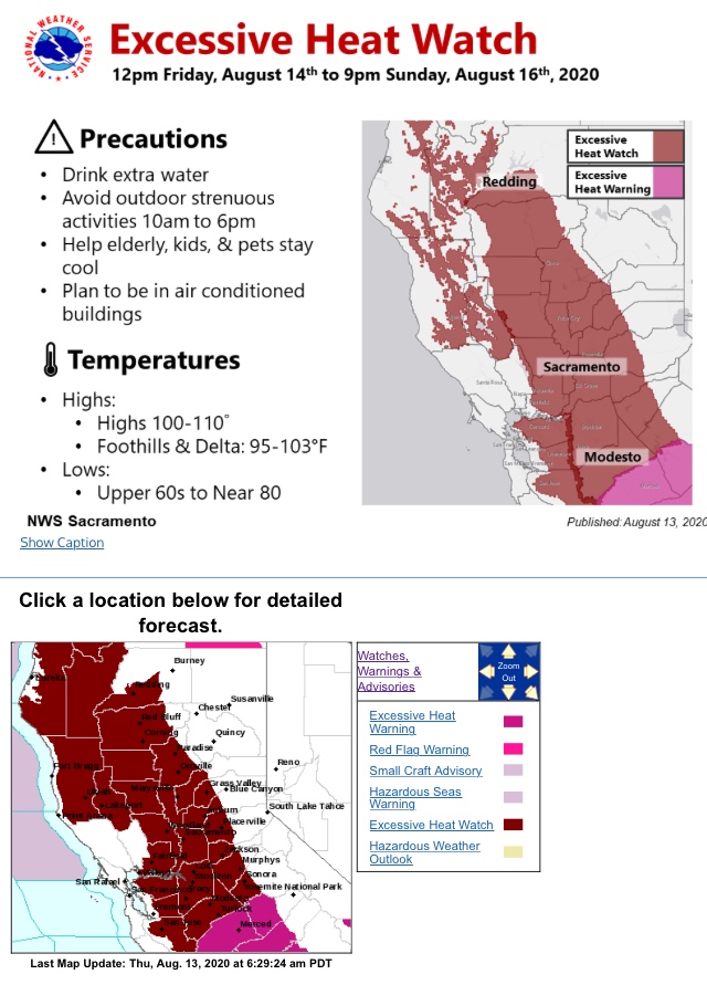
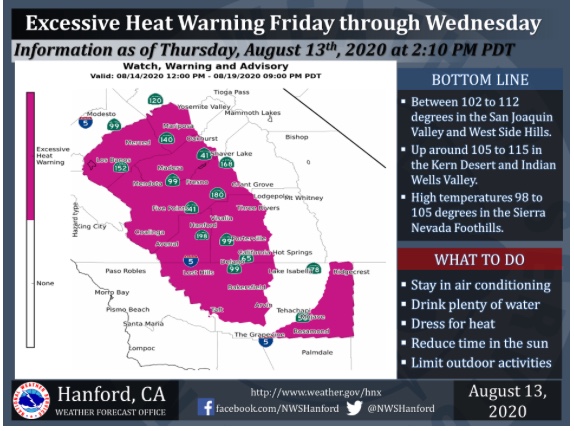
Regional Forecast
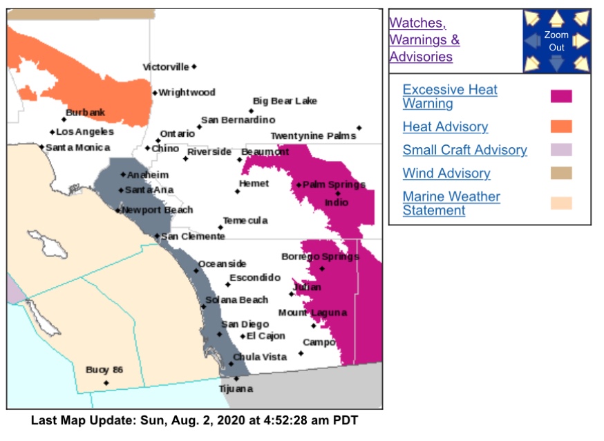
SoCal Watches & Warnings
https://www.weather.gov/wwamap/wwatxtget.php?cwa=sgx&wwa=all
Central Valley Forecast
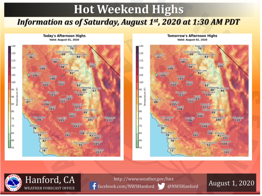
Valley Watches and Warnings
https://www.weather.gov/wwamap/wwatxtget.php?cwa=hnx&wwa=all
2 Likes
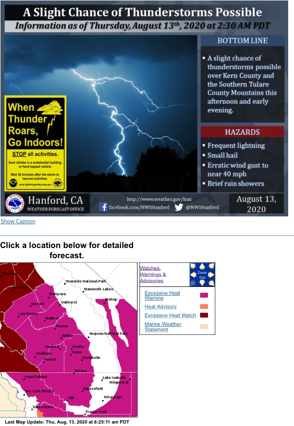
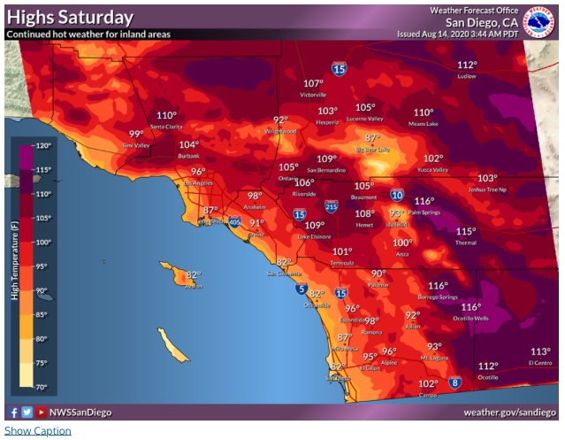
Regional Forecast
Forecast Discussion
https://www.weather.gov/wwamap/wwatxtget.php?cwa=sgx&wwa=all
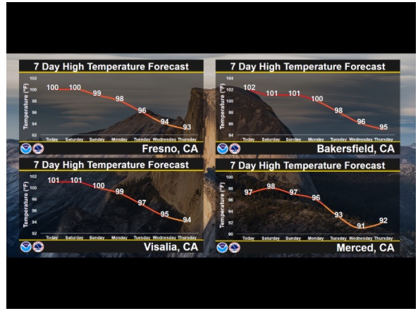
Central Valley
Forecast Outlook
https://www.weather.gov/wwamap/wwatxtget.php?cwa=hnx&wwa=all
1 Like
Feels like a crisp fall morning… the pattern of sinking air over the Great Basin looks to continue as troughing is anomalous in the Pacific NW. Might be a slight window of monsoon 10 days out but with the general pattern once we are almost into September it could already be too late to see any impact from monsoonal moisture.
1 Like
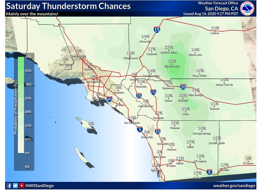
Regional Forecast
Forecast Discussion
https://www.weather.gov/wwamap/wwatxtget.php?cwa=sgx&wwa=all
Central Valley
Forecast Discussion
https://www.weather.gov/wwamap/wwatxtget.php?cwa=hnx&wwa=all
1 Like
Thunderstorms over the mountains today. Ultimately it depends on how much clearing of the mid level clouds occur, but parameters look good for some isolated strong convection. A few dry lightning strikes are not out of the question. Expect more plume dominated fire behavior, with the potential for more robust pyrocumulus clouds due to increased moisture & instability.
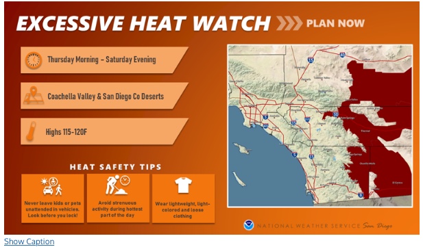
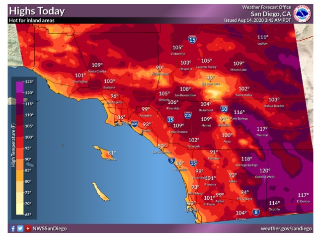
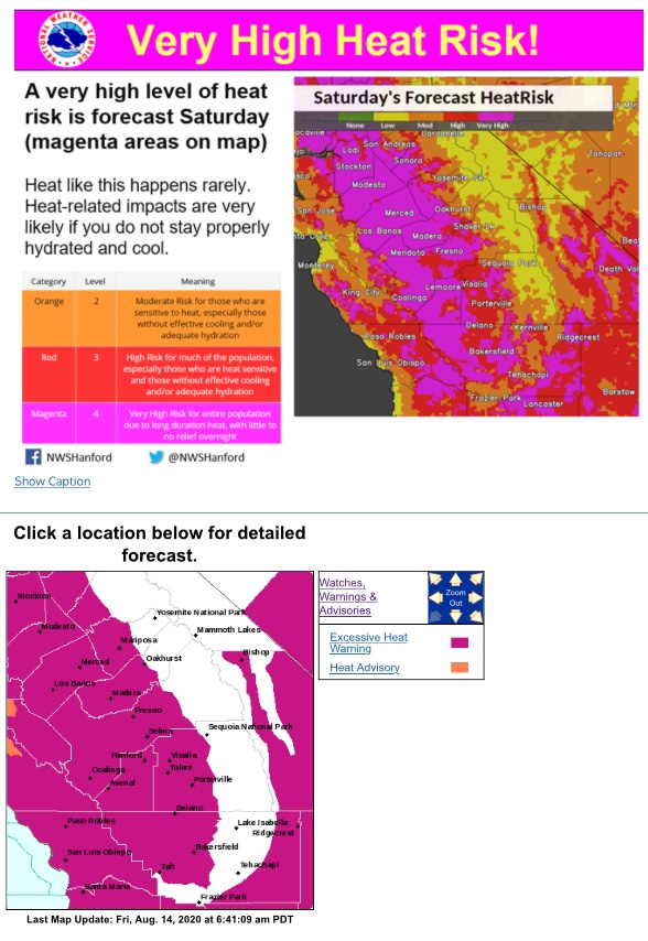
Ridiculous heat wave. Its the duration not the max temperatures. It looks like the heatwave will peak on 8/18. The MJO is favorable for monsoonal moisture advecting into the region but most of it appears to be high based. The ridge expands over us early next week which may squash convection. Continued drying of fuels. ERC’s will continue to flirt around maximum recorded values. The marine layer looks like it will be shallow through the end of the month, as the monsoon trough moves just SW of the area keeping mid level moisture streaming in and disrupting any inversion.
Watching the 6-9 day period for possibly more tropical cyclone remnants.
7 Likes
Regional Forecast
Forecast Discussion
https://www.weather.gov/wwamap/wwatxtget.php?cwa=sgx&wwa=all
Central Valley
2 Likes
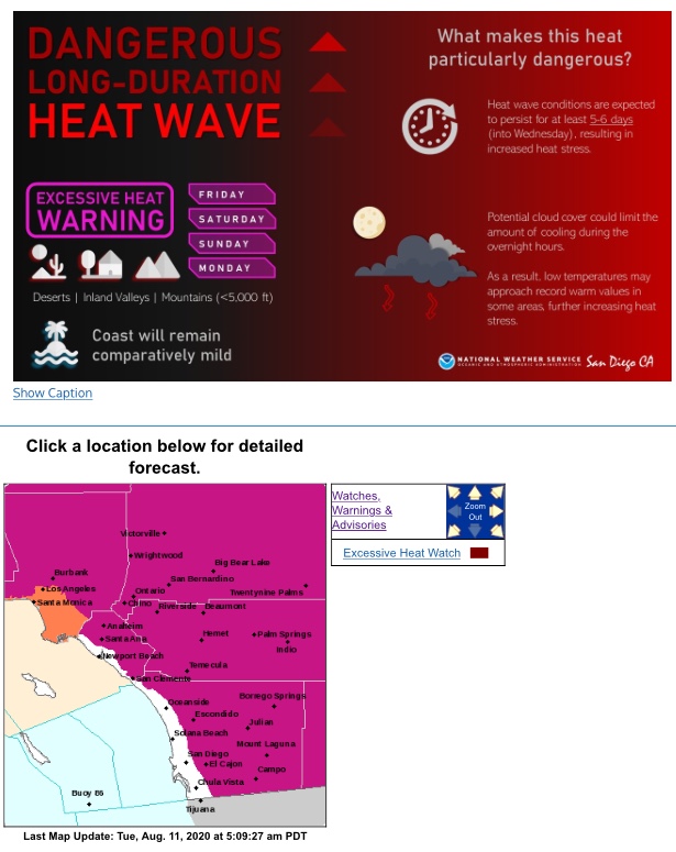
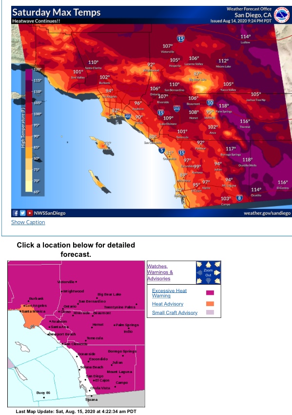
This heat is going nowhere soon!!! It could very well last until September starts…
https://www.cpc.ncep.noaa.gov/products/predictions/814day/
From Daniel Swain at @Weather_West (A great follow for weather!!!)
Widespread & long-duration California heatwave kicks into high gear today. Many consecutive days of intense heat likely. Record daytime & overnight temperatures possible; poor overnight temperature recoveries likely in unusually humid airmass. Heat may continue for 10+ days.#CAwx pic.twitter.com/We4IknGEvH
— Daniel Swain (@Weather_West) August 14, 2020.
8 Likes
Regional Forecast
Watches & Warnings
https://www.weather.gov/wwamap/wwatxtget.php?cwa=sgx&wwa=all
Central Valley
Forecast Discussion
https://www.weather.gov/wwamap/wwatxtget.php?cwa=hnx&wwa=all
1 Like
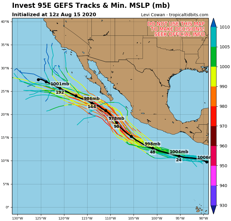
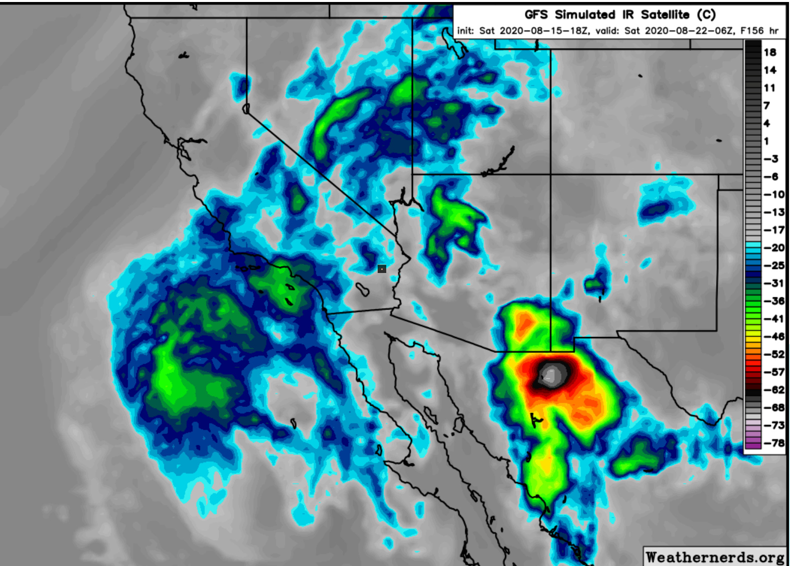
95E is forecasted to achieve at least category 2 hurricane status. If the storm strengthens more than guidance and it remains on the right side of the forecast envelope it could bring us significant rainfall next week. The belligerent heat wave and monsoon trough has allowed sea surface temperatures to rise significantly and we are not at the peak. Some areas near the coast are almost 80 degrees. This will help slow the rate of decay of the 95E’s remnants. Stay tuned as the storm develops.
4 Likes
Last week the GFS showed the low coming onshore near SLU, all the recent runs have kept it off shore. Not sure the water will be warm enough, deep enough to enhance convection. I also wonder with the high breaking down if there will be some shear that will keep it from remaining formed.
The low is the fly in the ointment, a wobble of 100 miles, could be the difference between some rain, and just clouds…
1 Like
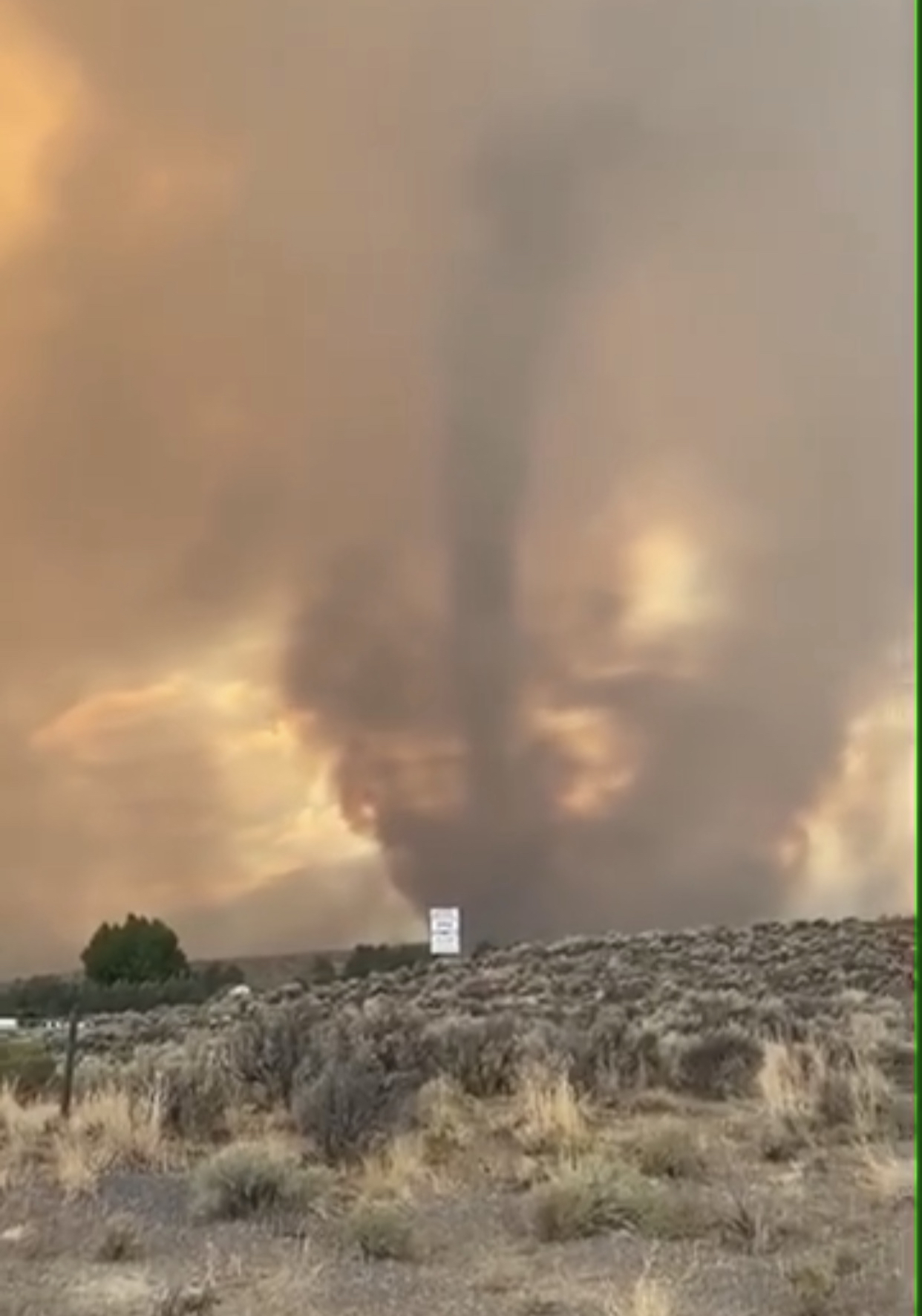
Where is this taken from?
Loyalton fire
1 Like
Thanks 29! Wow, great shot…
2 Likes