Additional batch of elevated convection. Will have to see if there is any enhancement as the sun goes down.
Additional batch of elevated convection. Will have to see if there is any enhancement as the sun goes down.
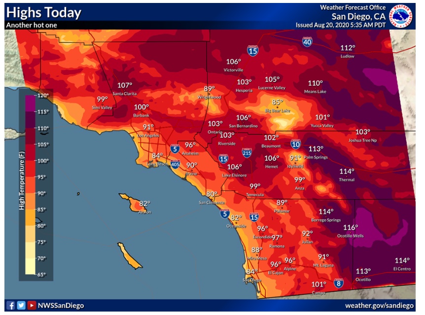
Regional Forecast

Watches & Warnings
https://www.weather.gov/wwamap/wwatxtget.php?cwa=sgx&wwa=all
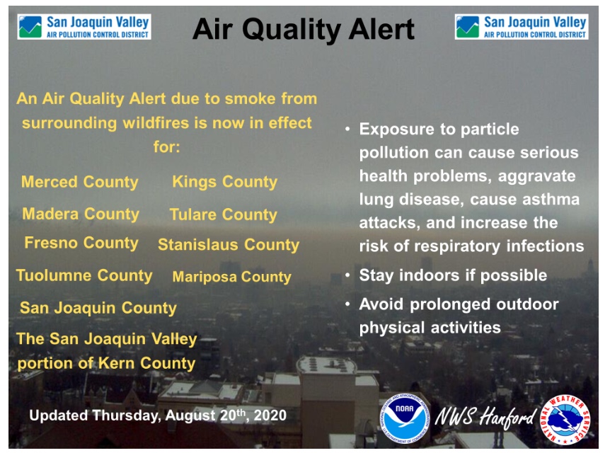
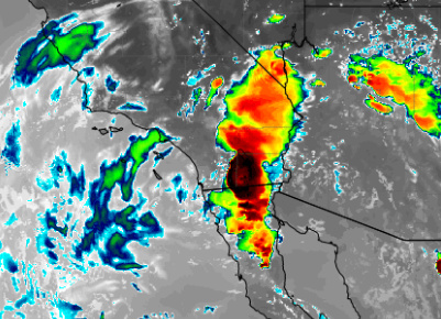
Central Valley


Official NHC forecast is for Genevieve to become a category 4 hurricane with 145 MPH winds.
There is nothing stopping the storm from achieving category 5 status besides time and its own structure.
We will have to continue to monitor the track as it evolves and catches up with actual intensity.
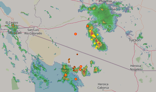
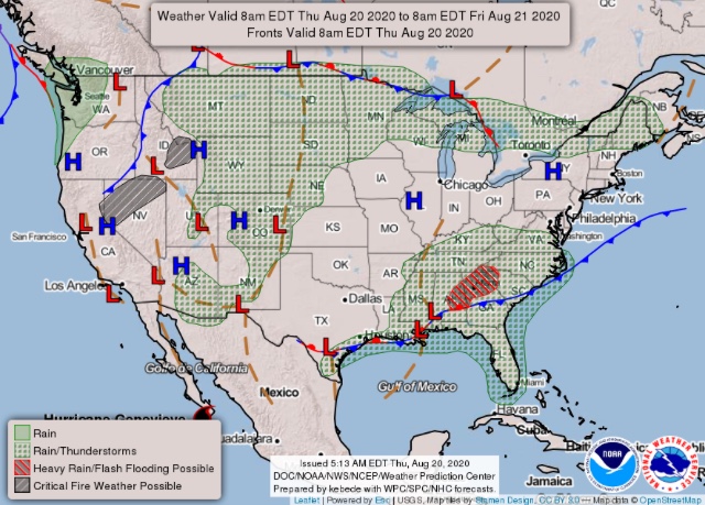
Outflow winds from a thunderstorm complex in AZ are expected to arrive into the deserts over the next few hours.
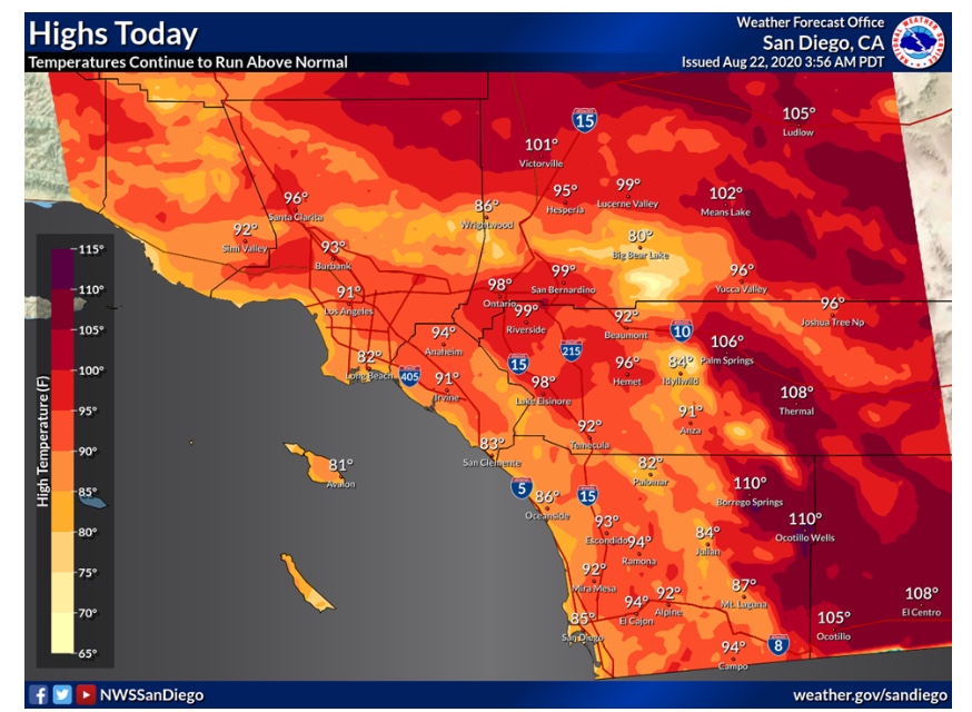
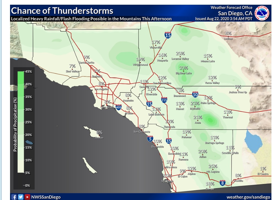
Alright, here we go. The ridge has peaked today and so will the heat. Many records are likely to fall. Convective models are showing widespread thunderstorm development especially in the Inland Empire. These storms will be moving quickly and there is a dry layer in the low levels of the atmosphere. This is a recipe for a major dry lightning outbreak. The Elsinore convergence zone could produce a tornado today. Any fires that start today in the area of thunderstorm outflows will exhibit extreme fire behavior.
Check out the spread between surface temperature and dew points:
In fact, the storm prediction center has much of Southern California under a marginal risk for severe thunderstorms.

Regional Forecast
Forecast Discussion
https://www.weather.gov/wwamap/wwatxtget.php?cwa=sgx&wwa=all
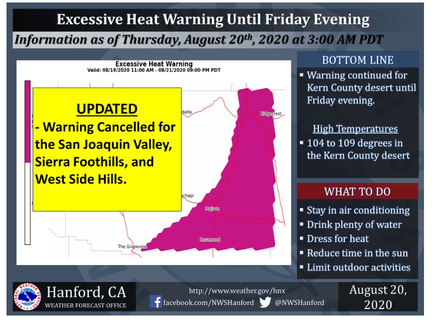
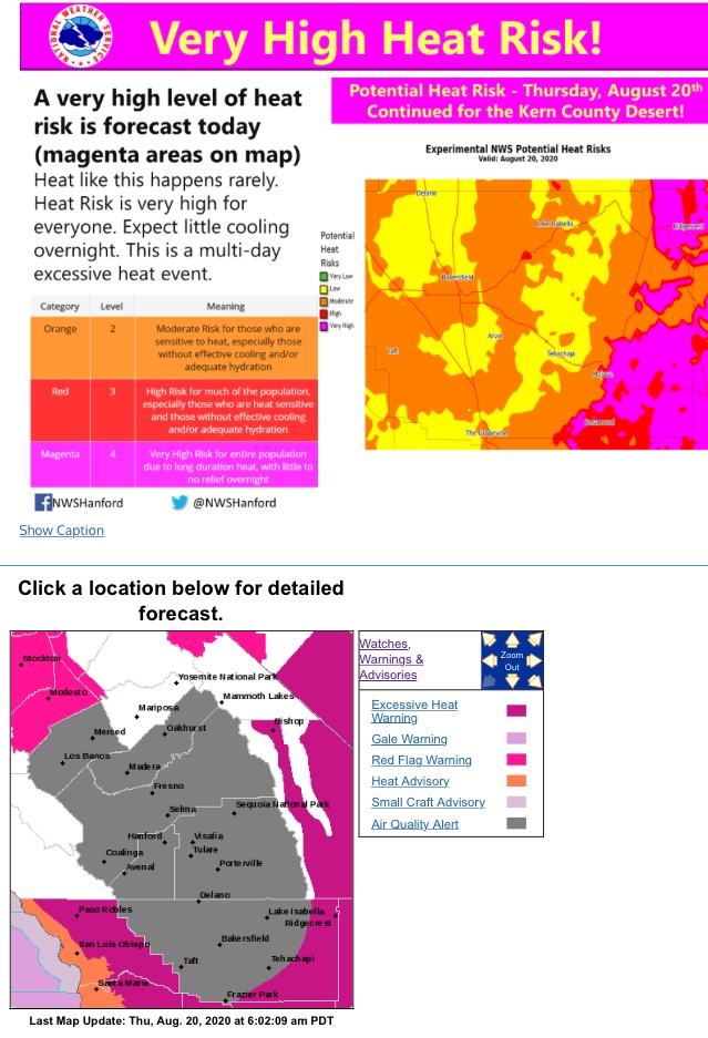
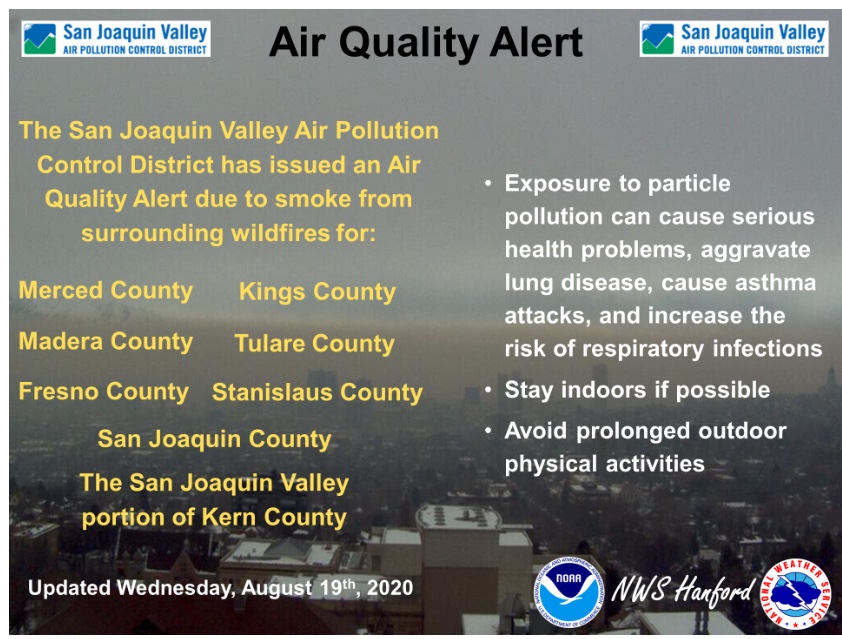
Central Valley
Forecast Discussion
https://www.weather.gov/wwamap/wwatxtget.php?cwa=hnx&wwa=all
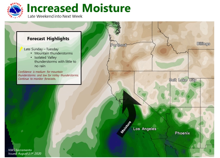
Got this from the Weather West weather blog regarding possible lightning Sun-Mon time frame…
" Weather West Mod AR (Scorchyvale) • 43 minutes ago
Yep. There’s little chance this event will bring any beneficial rain at this point, so our best bet is that it misses entirely. I’d give it 50/50 odds right now, which is unfortunately pretty high for these sorts of events."
OK here’s some real wonky stuff…
https://www.nnvl.noaa.gov/view/globaldata.html#SSTA
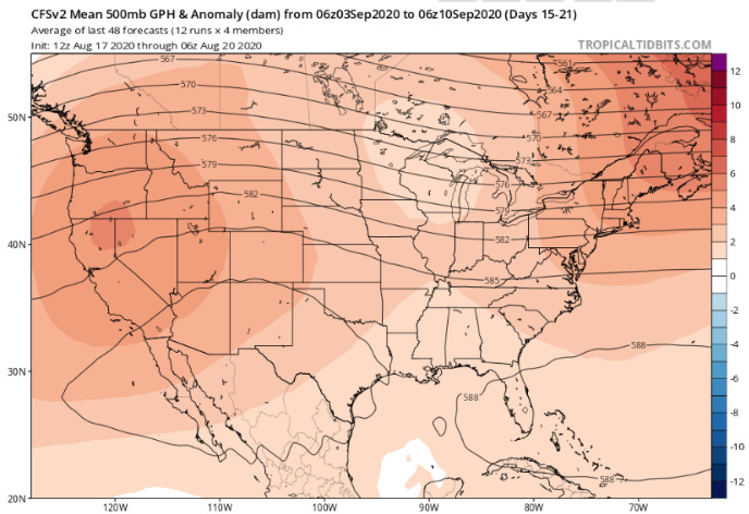
Whenever the NE Pacific gets a warm blob we tend to get a lot of “ridiculously resilient” high pressure systems. This lead(possibly or at least contributed) to the drought of 2014-2017 and the near abandonment of summertime wetsuits in NorCal.
More wonky?
https://www.integratedecosystemassessment.noaa.gov/regions/california-current/cc-projects-blobtracker
and of course just some good reading.
https://www.climate.gov/news-features/department/enso-blog
Will need to monitor the potential for dry lightning tomorrow from the remnants of Genevieve
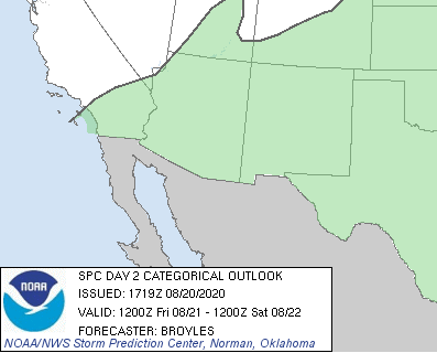
SPC has some of Southern CA under general risk of convection. NAM shows some thunderstorms.
Forecast discussion:
Regional Forecast
Forecast Discussion
https://www.weather.gov/wwamap/wwatxtget.php?cwa=sgx&wwa=all
Central Valley
Forecast Discussion
https://www.weather.gov/wwamap/wwatxtget.php?cwa=hnx&wwa=all
Predictive Services has added a “High Risk” day for Sunday in SoCal for expected “Abundant Lightning”.
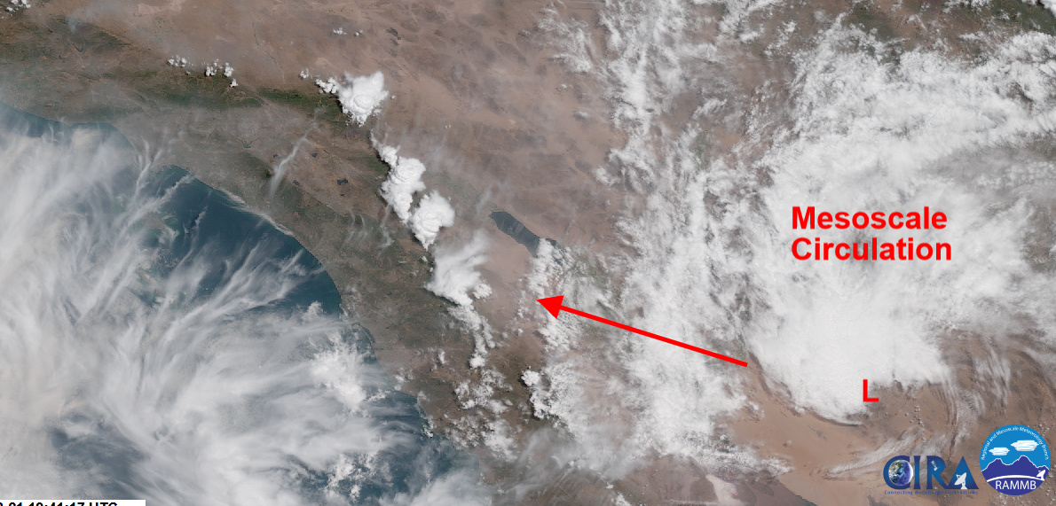
MCS is headed into the area today, with over 1,000 j/kg of CAPE… strong thunderstorms possible.
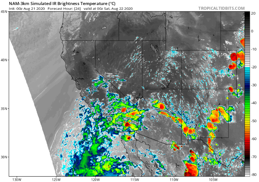
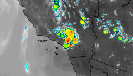
Today’s large thunderstorm complex simulated by NAM developing by 4 pm:
This MSC crushed us pretty good in metro PHX last night.
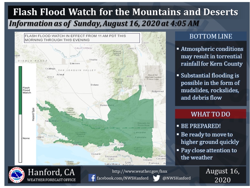
Flash Flood Watch issued for Saturday afternoon thru the night. May have an huge impact the Lake Fire and other Southern Cal incidents:
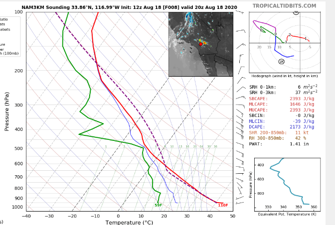
Perhaps a mix of dry and wet thunderstorms tomorrow based on the sounding. Slight inverted v profile. Sinking air at the low levels, but high PWV’s should cause heavier cells to get precipitation to the surface. The deep layer of instability should cause a lot of lightning. Will have to see if there is more drying at the low levels than depicted on the model.
NWS San Diego touched on the possibility of trophosperic folding, which can push dry air into the column from the upper levels
Looks like at least two or three starts in the San Diego inland areas. I see some rain clouds too on the cams. Does anyone have a good lightning tracker website they use?