.25 in my gauge in Twain Harte this morning. Didn’t rain long but hard. Drip line under the trees are wet.
2 Likes
This was just brought to my attention. 1st I’ve heard of this possibility. Any weather experts care to weigh in on what could be our offshore event of the season ??
4 Likes
NWS Forecast:
https://forecast.weather.gov/product.php?site=HNX&issuedby=HNX&product=AFD&format=CI&version=1&glossary=1
3 Likes
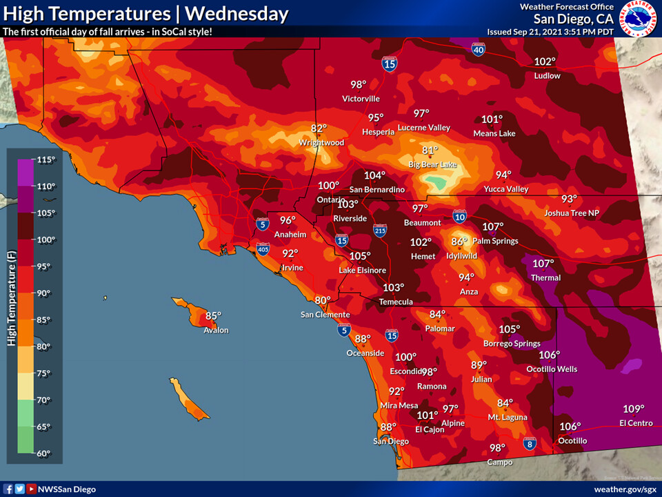
Very hot for the first day of fall tomorrow as heights and thicknesses peak. Temperatures will be well above normal.
On Thursday a cut off low parks itself off of the coast of Southern California and the associated dynamics could produce thunderstorms. Due to the hot and dry airmass at the surface isolated dry lightning strikes could occur at least Thursday and Friday before the atmosphere moistens.
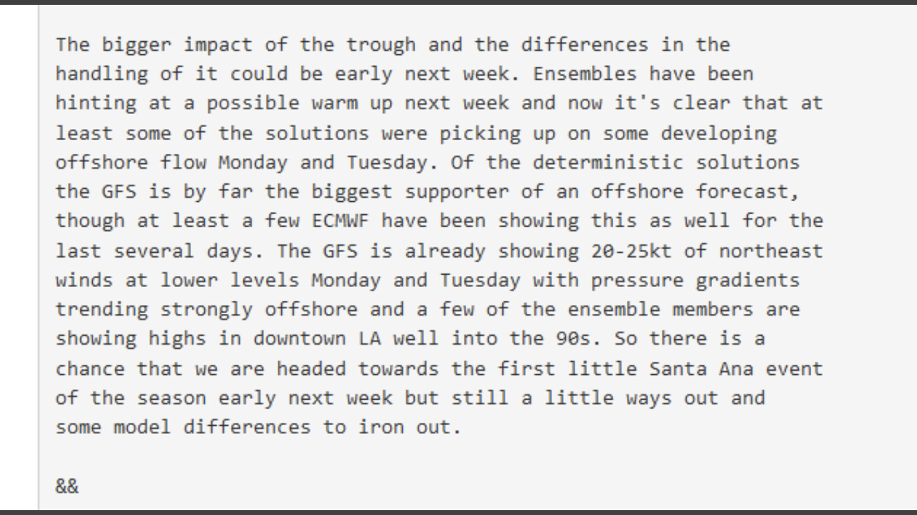
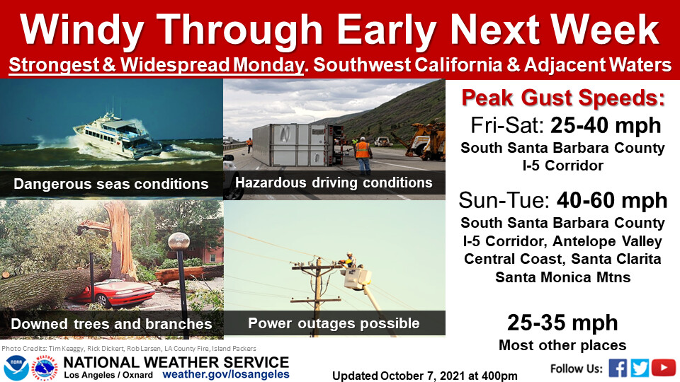
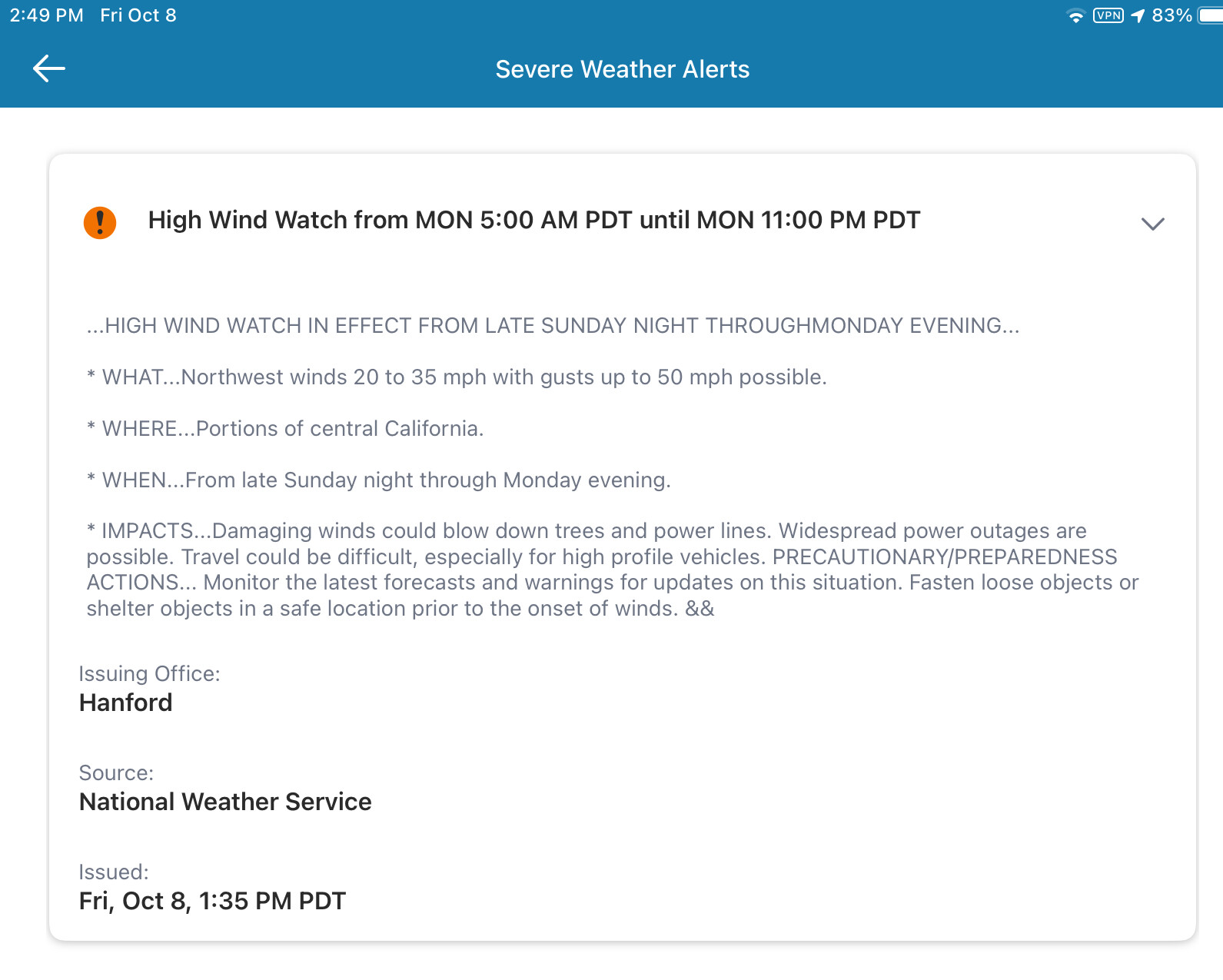
Forecast models are showing an active jet stream over the Pacific NW next week, and the associated troughing features during this time of the year are typically translated too far west in the mid-long term forecast window… so we will need to watch the possibility of inside slider activity for Santa Ana winds… as these troughs look unseasonably potent.
10 Likes
The first Santa Ana wind event of the season should begin starting this evening. The NAM peaks LAX-DAG gradients at -3.7 and LAX-BFL gradients at -3.1. Assuming the NAM overdoes gradients by half a millibar, we are track for a weak and brief Santa Ana wind event to kick off the offshore flow season. The most significant impact will be the downsloping flow that dries and heats the vegetation out, the compressional flow will cause temperatures to rise significantly and impact fuel moistures significantly. The upper support is okay but brief, and advisory level winds could be reached in Ventura county for a short period tomorrow.
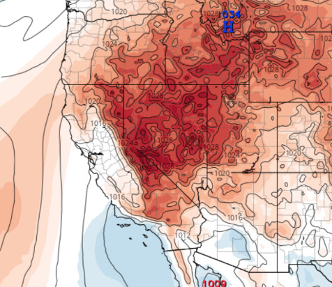
NAM 32 KM 18Z MSLP Norm Anomaly.
The next 3 or 4 days or so will have weak offshore gradients in the morning followed by weak onshore flow in the afternoon. Now is the perfect time to finish brush clearance, prune lower branches, clear leaves from gutters, and remove russian thistle (tumbleweeds) as we head into the offshore wind season.
12 Likes
20 Likes
Well… Tumble… they are invasive and non-native!!! The icon of the West!
5 Likes
Forecast models bring a shortwave into Southern California Monday-Tuesday. Deeper marine layer and some light precip possible. This shortwave opens up the door for deeper troughing along the West coast. The western extent of the trough will depend on how fast the shortwave moves east. The NAM seems to think that it will be faster and the weakness in the ridging will allow the big Pacific NW trough to dig further east at the end of next week, whereas the GFS and ECMWF want to bring the trough west enough to bring potential precipitation the end of next week.
If the trough adjusts a bit further east the big thing to watch for will be some major sundowner winds.
The key will be as stated before how the cut off shortwave moves and where the trough is able to sharpen… the big picture here is that plenty of cold air has pooled up over Northern Canada and the Gulf of Alaska and this will likely manifest as offshore winds for us at the middle of the month as the longwave trough axis moves into the Great Basin.
15 Likes
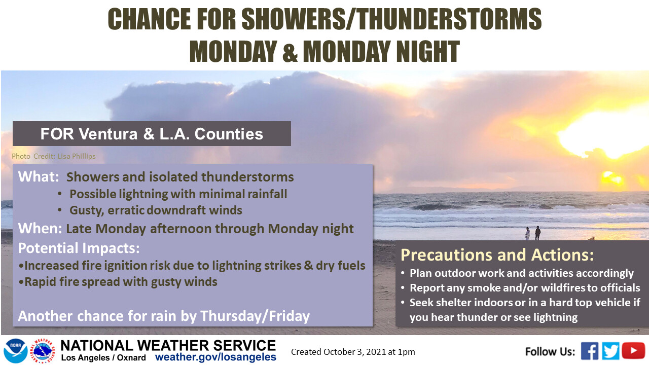
On the northern section of the moisture shield with the associated shortwave tomorrow there will be a chance of dry lightning strikes, further south (RRU and south) less risk.
Update…
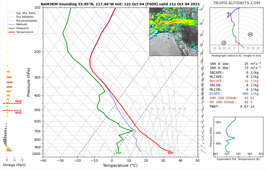
Here is a good example of the initial onset of convection later today into tonight. This is a classic inverted V/sub cloud dry layer on the sounding. There will likely be a threat of dry lightning strikes for at least the first few hours as surface temperatures and humidity are low before PWV’s moisten up later tonight.
5 Likes
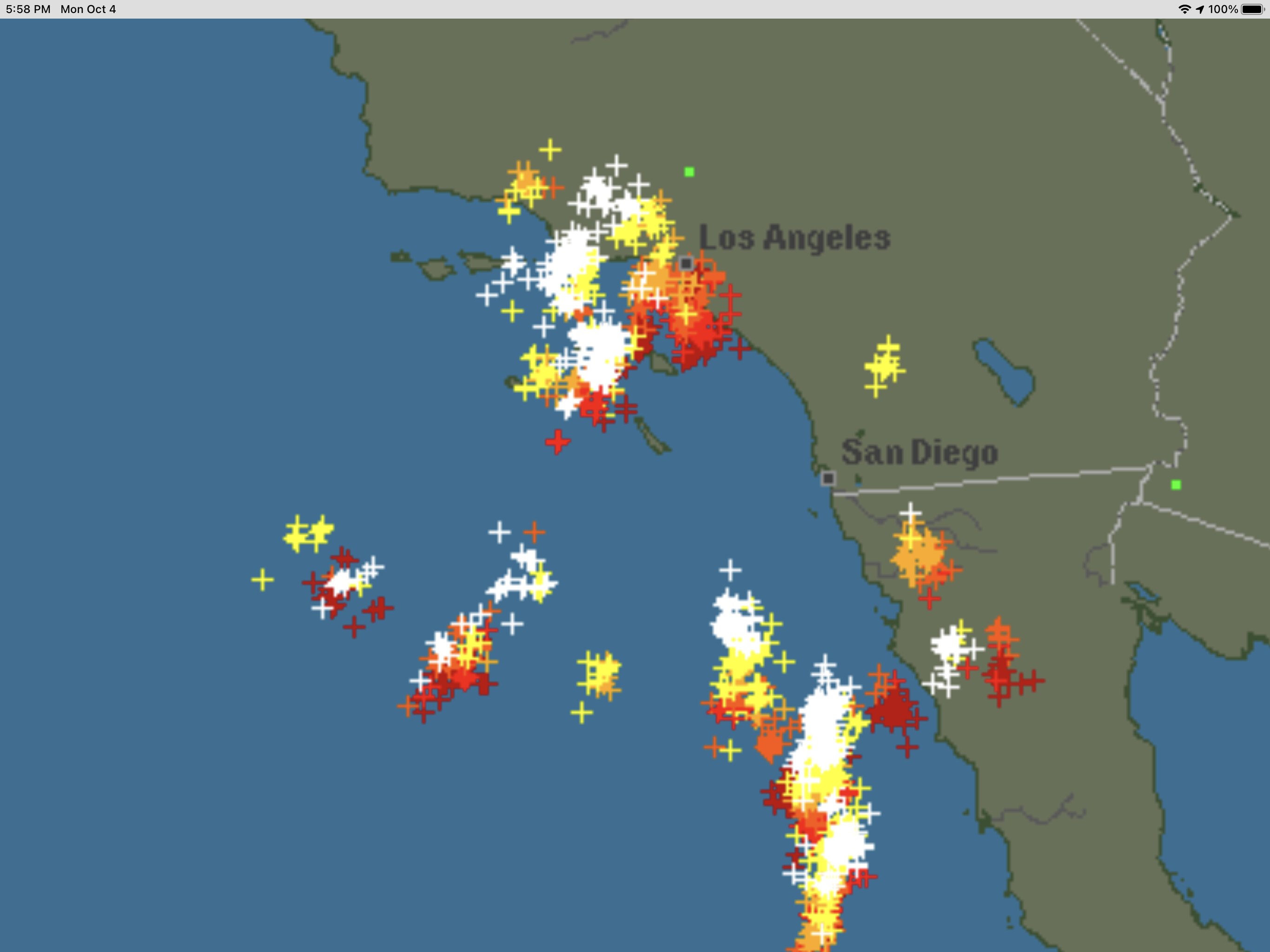
Blitzortung or the more detailed map
1 Like
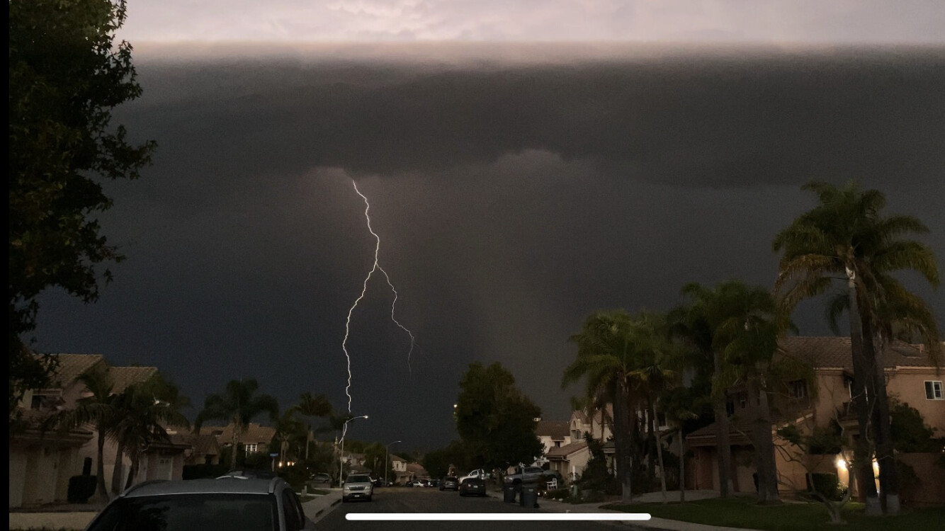
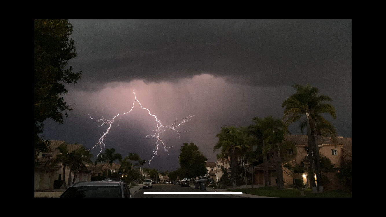
Heavy rain and very frequently lightning in southern Riverside county.
3 Likes
Can you ship that weather minus the lightning to Kern and Tulare. Sounds like they could use a break. Thanks!!!
7 Likes
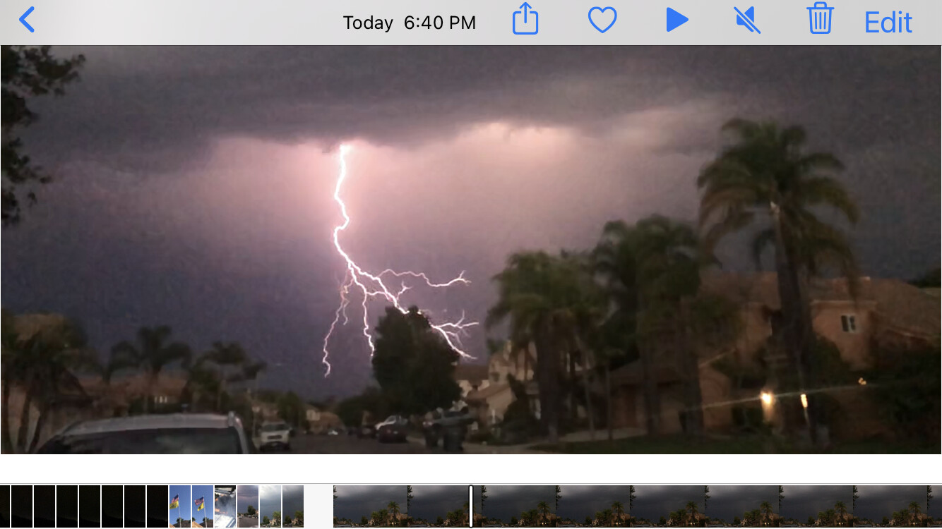
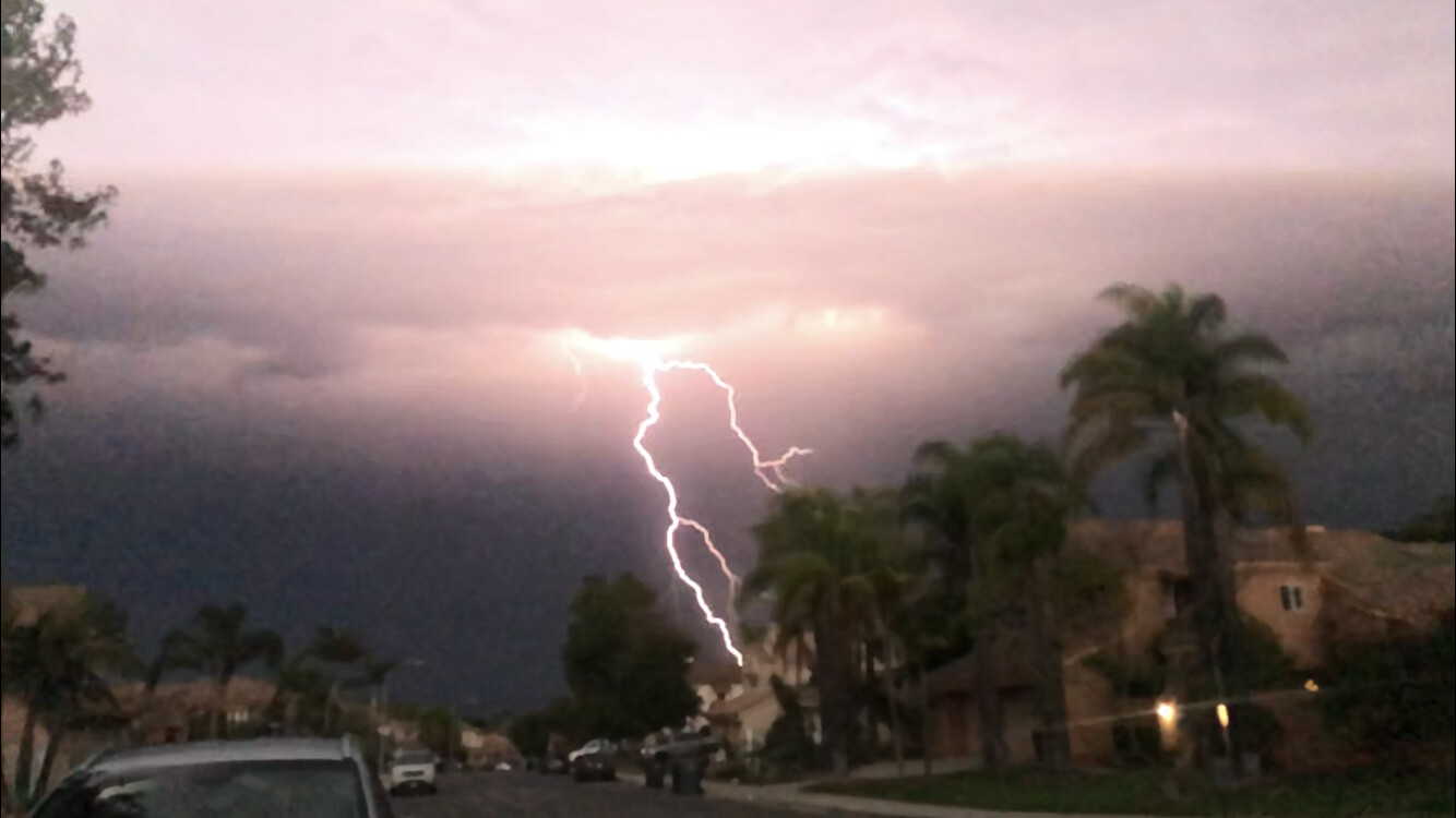
Lightning and rain in Santa Barbara county now.
4 Likes
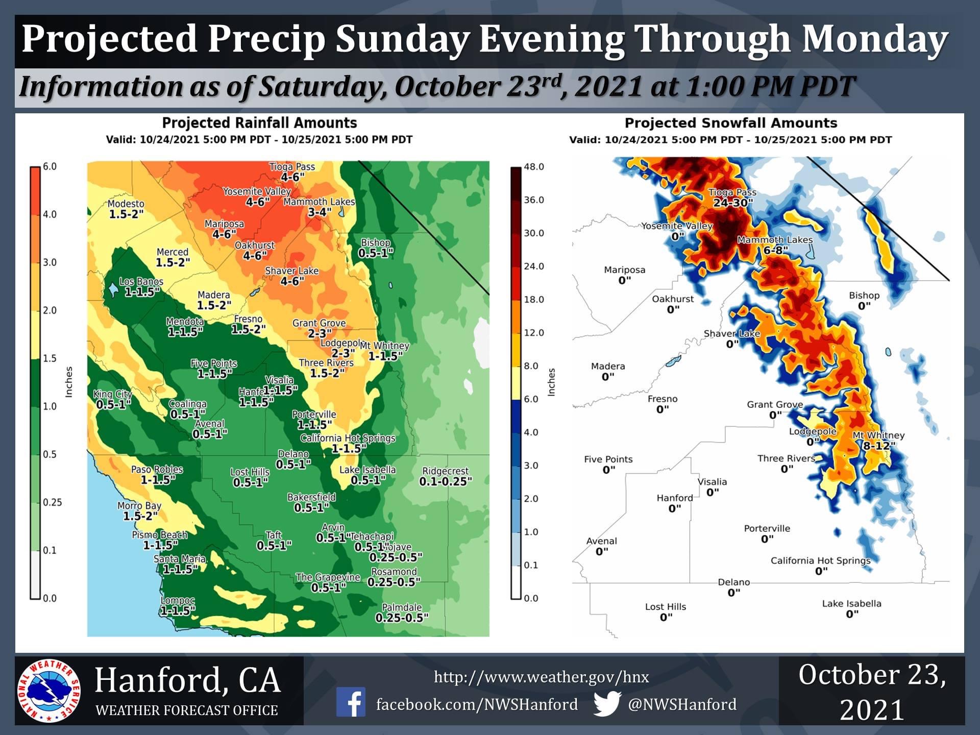
Flash Flood Watch for most burn areas in the Southern Sierra from Sunday night and Monday due to very elevation snow and intense rain possible.
https://forecast.weather.gov/wwamap/wwatxtget.php?cwa=hnx&wwa=flash%20flood%20watch
5 Likes
Forecast models indicate no rainfall for the next 10 days and a broad offshore flow signal during can be seen through the forecast window.
12 Likes