This is the live fuel moisture posted by LACounty FD 4 days ago.
stuff is still burning. prepare well and stay safe out there…
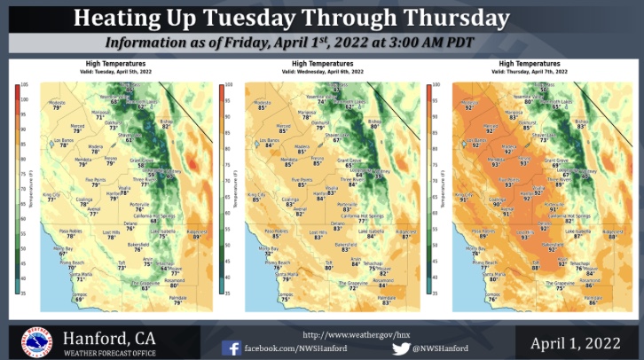
This mornings ECMWF forecast run would bring a strong heatwave for this time of the year middle of the next week through the next weekend. The ECMWF shows a vigorous upper level low sharpening into the midwest as strong surface high pressure settles into the Great Basin.
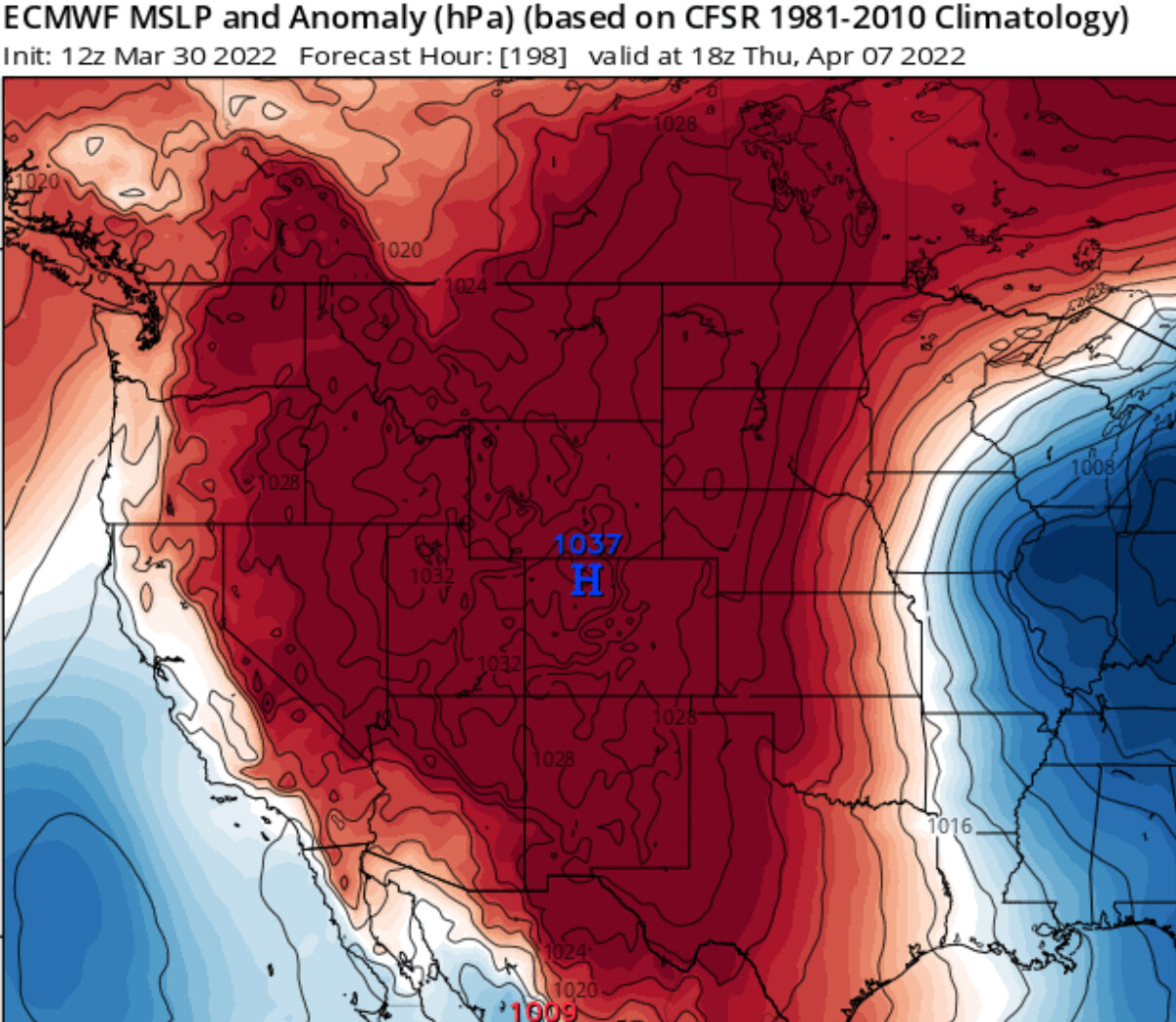
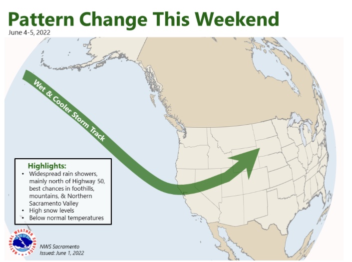
In addition, a strong upper level blocking pattern develops over the Pacific NW.
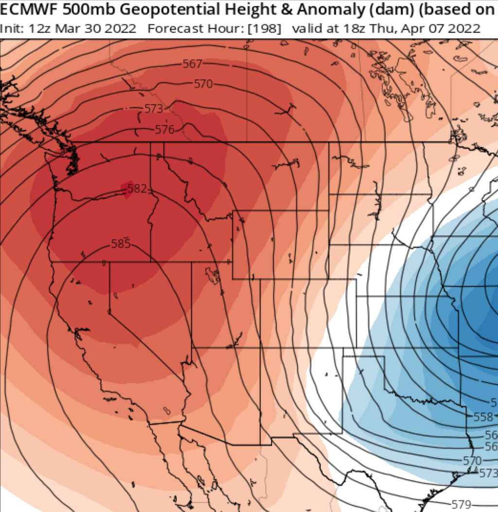
The combination of these two factors lends potential for a heatwave… widespread 6-12 degrees above normal the first day peaking at 10-20 degrees above normal at the hottest part of the heatwave. The strength of offshore winds depends on many factors, however this could be an untimely moderate offshore wind event.
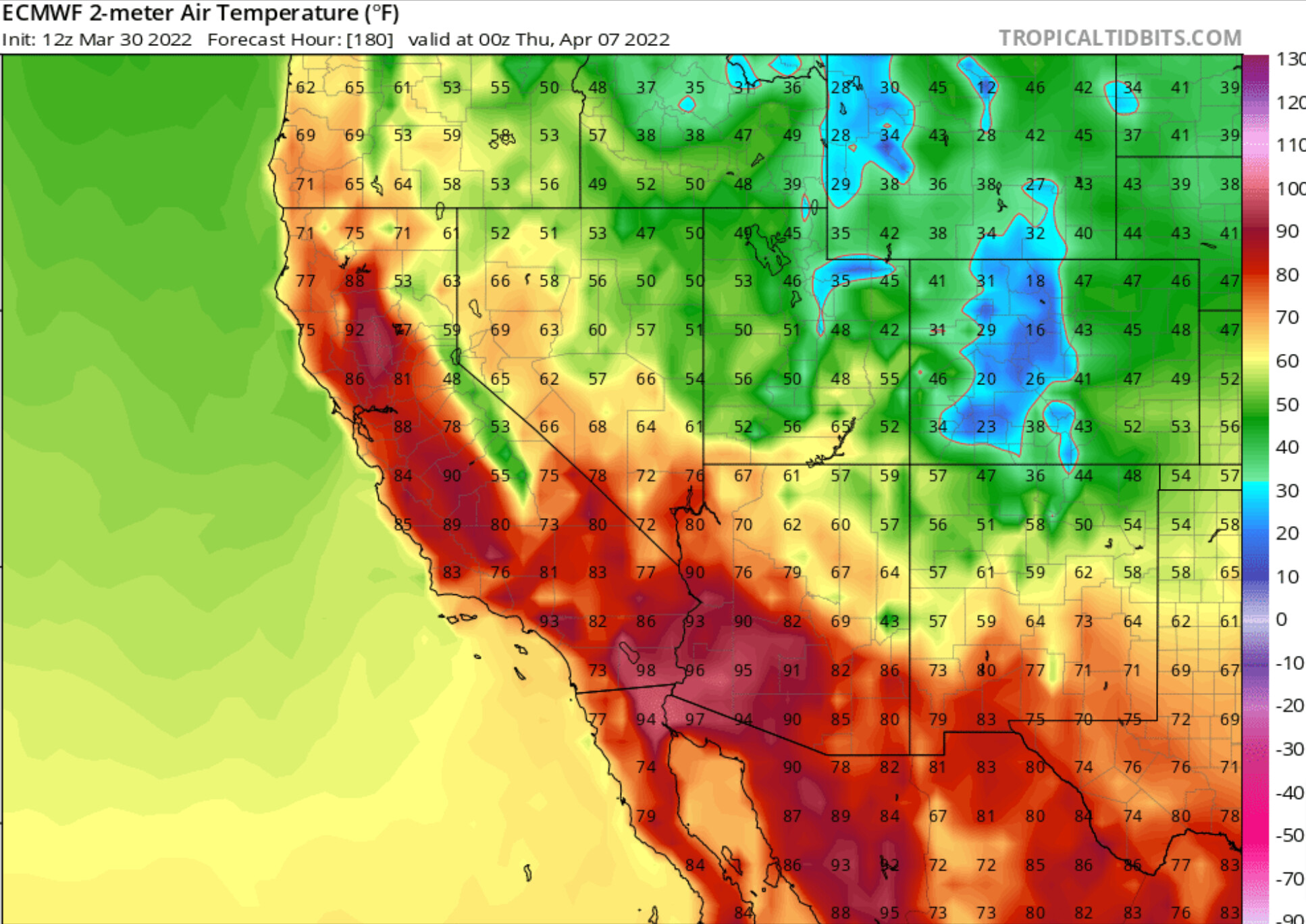
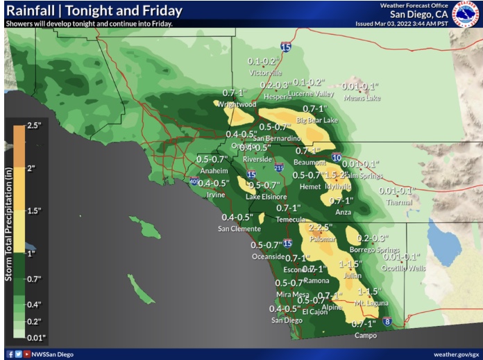
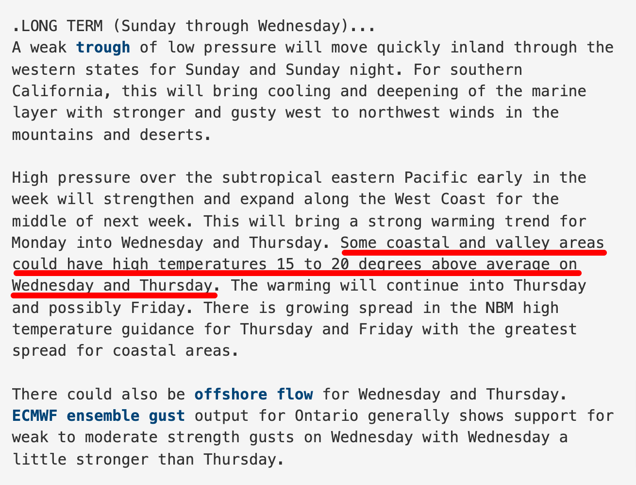
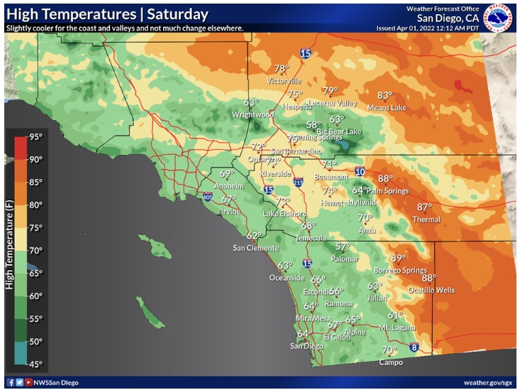
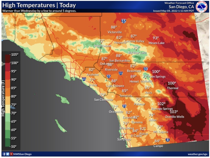
From San Diego NWS’s AFD this morning…
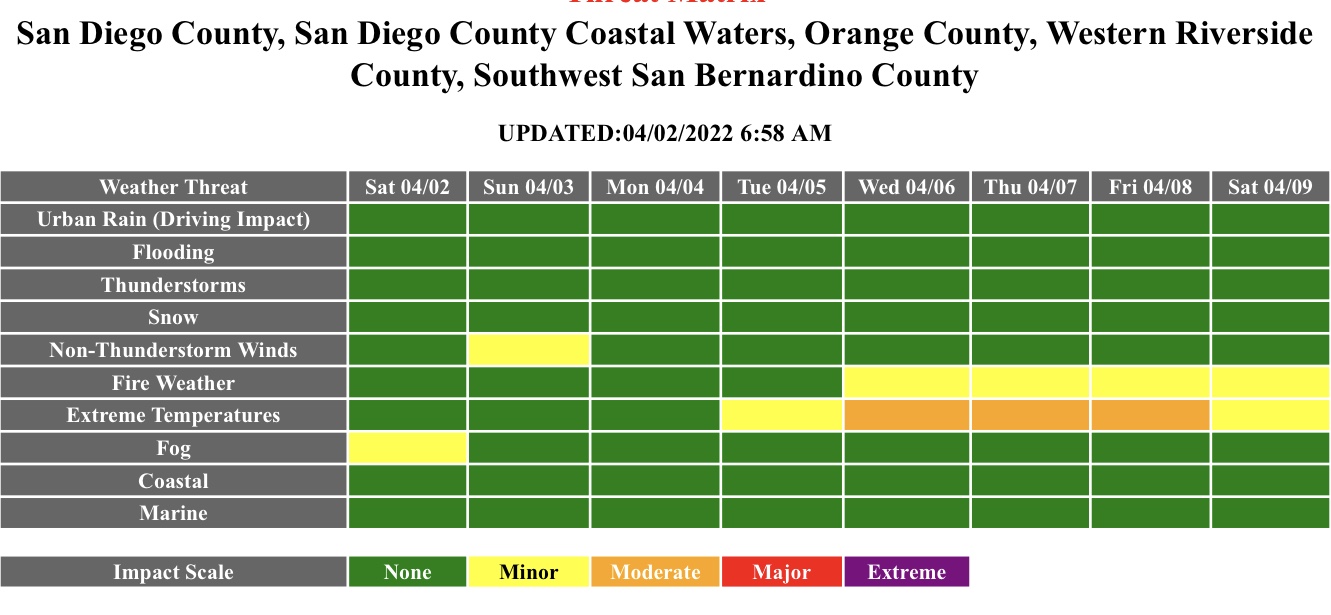
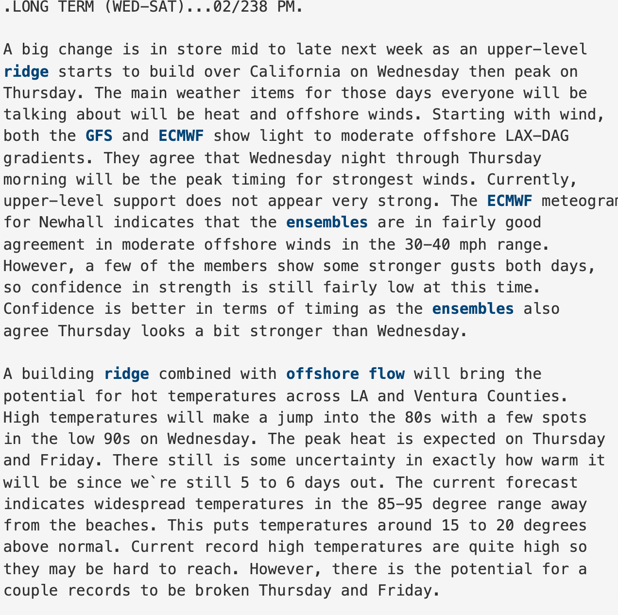
There is also the possibility of a period of offshore flow around Wednesday or Thursday. There is quite a lot of spread in the lower level flow for the middle of next week, anywhere from weakly onshore to strongly offshore. The most likely scenario is for weakly onshore to weakly offshore, though ensemble output from the ECMWF for Ontario does show a few members with strong offshore flow on Wednesday and another few on Thursday, 3 of 50 members on Wednesday and 2 of 50 on Thursday.
Overtime: the unbelievable weather events occurring across the US are going to continue and worsen.

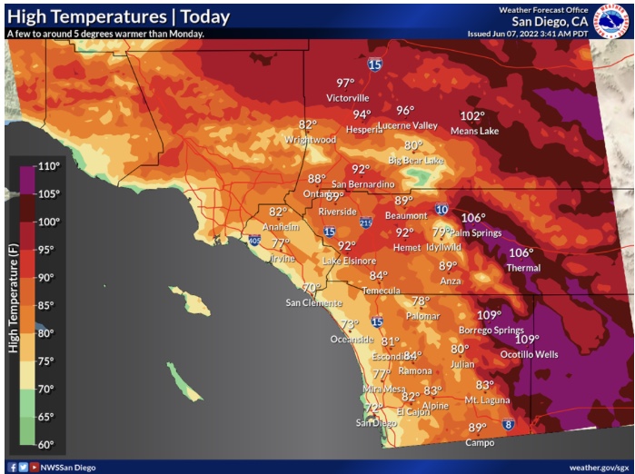
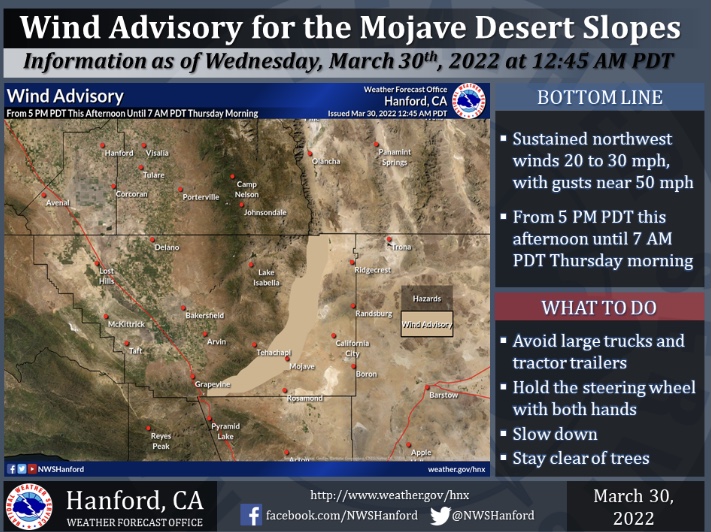
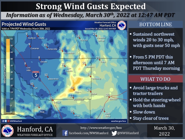
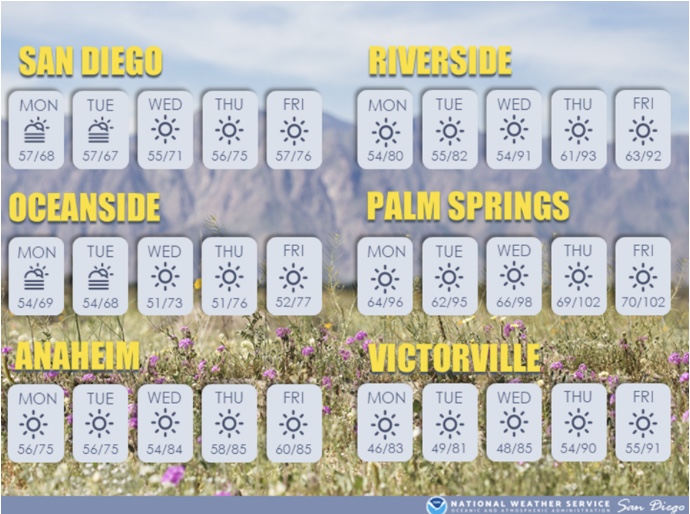
New wind advisory to go along with our heat advisory! Gonna dry everything out pretty quick with RH in the 8-15% range, gusts to 50 and temps 95-100. Sounds like the same pattern of the fire siege in May of 2014 when we had the Poinsettia Fire in Carlsbad then the Coco’s went off in San Marcos the same day.
take notice that with continued weather of high heat and no moisture these figures are going to drop quickly. also these are more inland…so look for more inland moistures to be lower. I believe June moistures will be a lot lower. just a heads up…be safe but have always a heads up altitude.
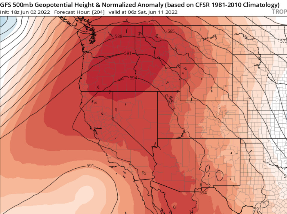
I am watching the models reach agreement on the sypnotic set up for a heat wave June 7th- June 14th. Forecast models build a strong ridge over California, peaking on June 11th. Heights reach about 597 DM and 850 MB temperatures reach much above normal. California’s breadbasket and the deserts are likely going to bake.
The high pressure is such that there may be a strong thermal gradient towards the deserts, and onshore winds will likely promote critical to locally extremely critical fire weather conditions on desert slopes in the afternoons.
This heat wave would dry out fuels, and fuels at all elevations would become receptive to fire thereafter.
A transition period is occurring, as models show and struggle with surface cold fronts moving into the Great Basin towards mid month. The dubious handling of these features murkies the even more extended forecast… but a general transition towards a monsoonal pattern should be occurring by the end of the month.
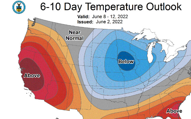
The climate prediction center has near 100% chance of above normal temperatures for South Ops in both the 6-10 and 8-14 day outlook.