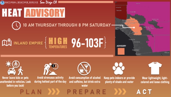
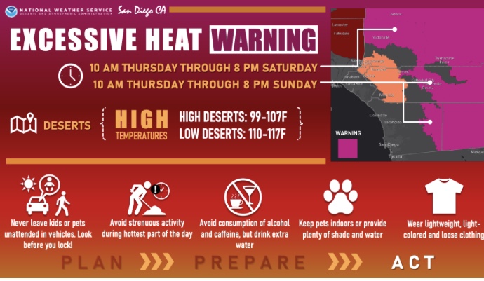
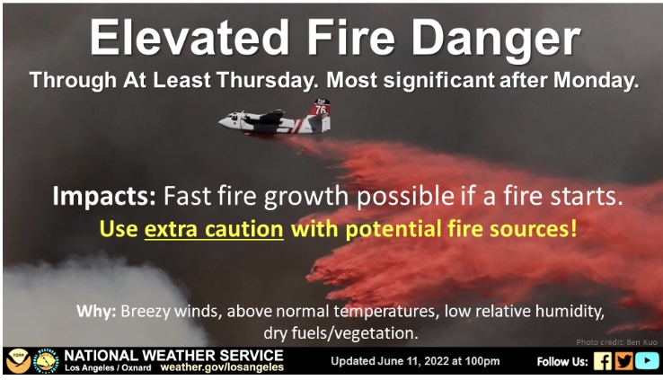
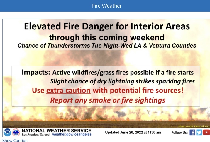
A follow up to my previous post. Critical to extremely critical fire weather on the desert slopes as the ridge breaks down. This is not reflected in the storm prediction center outlook, so be on guard.
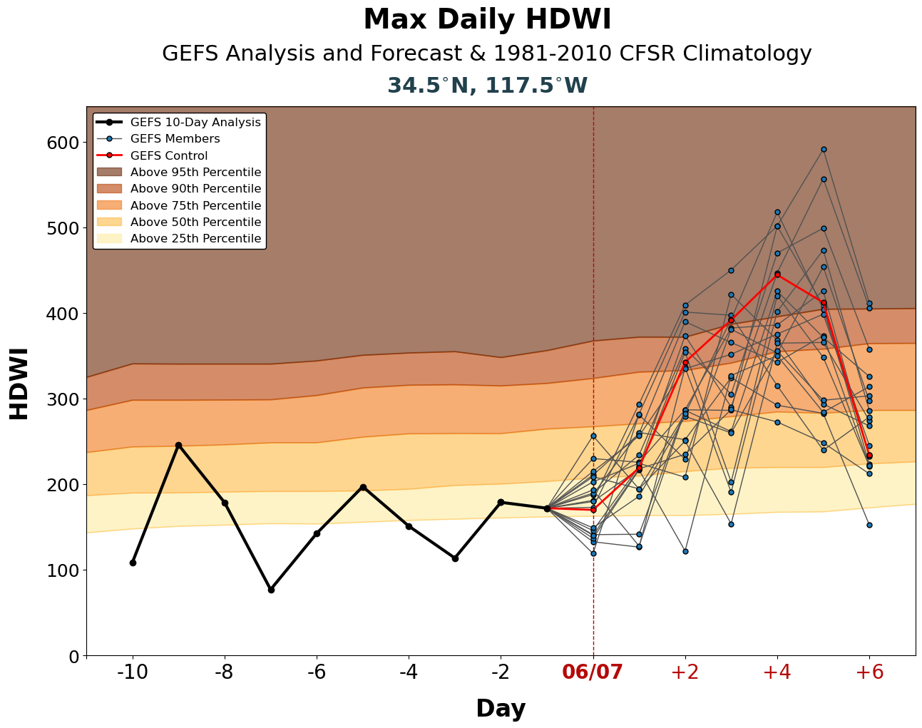
Here is the GFS ensemble hot-dry-windy index deviation chart for the desert slopes. The control member is above the 95th percentile:
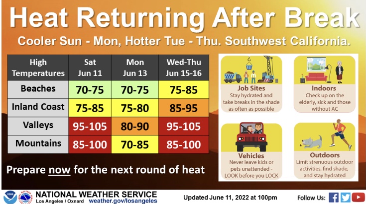
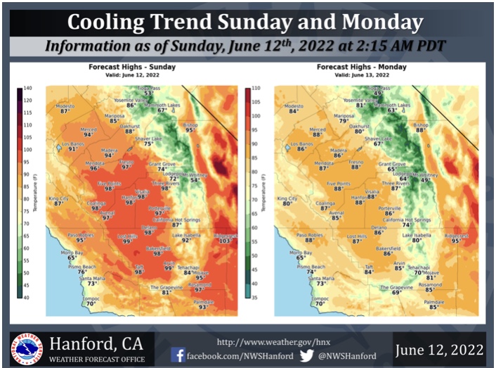
Saturday and Sunday are the most critical fire weather days. I am also watching the potential moderate sundowner wind event for early in the week, Monday-Wednesday. There may be really good upper level support and a strong thermal gradient as a trough sharpens into the central valley. Stay tuned for that bit as high resolution models help the data points.
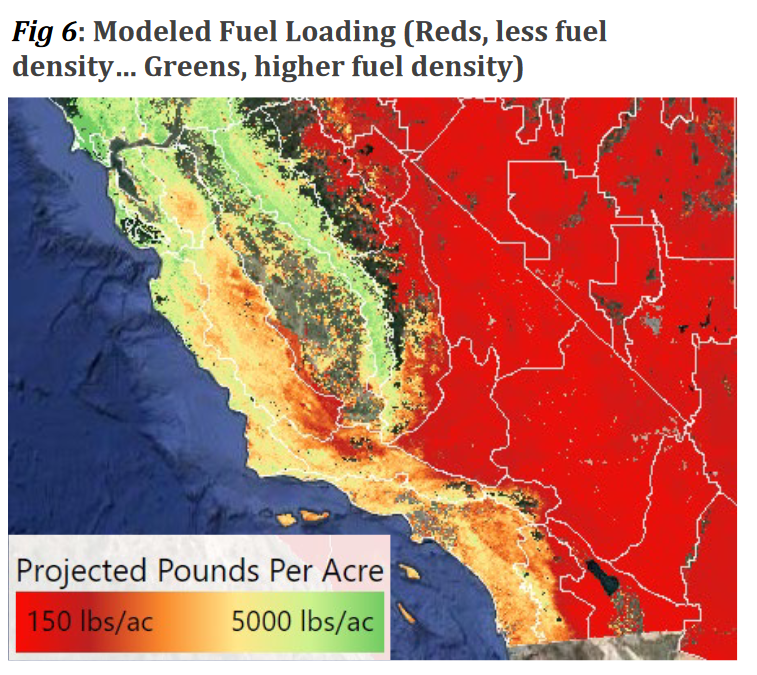
I found this interesting image from the South Ops outlook; it shows the amount of fuel per acre
Interesting image to look at, because much of Southern CA has had pretty slow fire seasons the last few years. The website with high resolution data is FuelCast. A good resource for judging how bad a previous scar may be, but only in the grass and brush type fuels.
9 Likes
Since I’ve always seen fuels measured in tons per acre, I’m assuming by using pounds per acre, it’s to emphasize a lack of fuels? Or is it a typo, or something else. It’s weird since the highest mark on the graph is 5000 lbs and there can be more than that in a single tree! Maybe Im just reading it wrong.
Is this just for grass and brush loading? This map would be seriously under estimating loading if it left timber out the way timber has burned in recent years.
3 Likes
Yea just for grass and brush. Timber on the map
Is excluded
2 Likes
A closed upper level low is cutting off from the main jet stream off of the coast of Oregon. This low will quickly drop south through Wednesday and cut off the coast of CA.
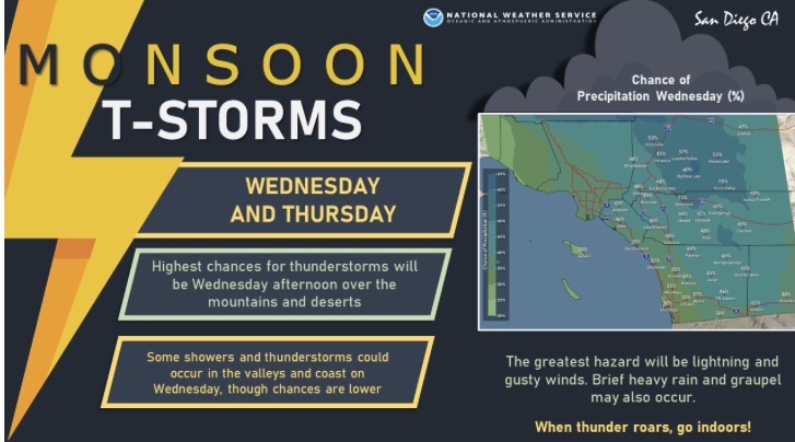
Monsoonal moisture will work it’s way into Southern CA Tuesday night. On the leading edge of the deep moisture, there will likely be an inverted V profile for possible dry lightning strikes. As the moisture plume deepens the threat will diminish by Wednesday afternoon except perhaps far Northern LA County.
PWV may actually approach the upper bound of recorded data for this date in the CA bight, so there may be heavy precipitation with any thunderstorms that do form.
9 Likes
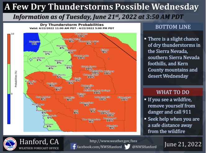
Thunderstorms are possible midweek across the Southern Sierra and Kern Desert.
4 Likes
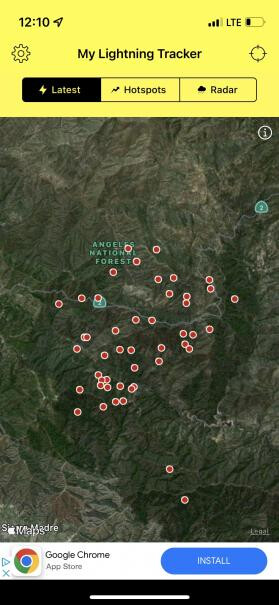
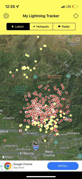
Heavy lighting on the ANF
1 Like
Any new starts or wet system.
1 Like
everything ive seen is that its dry but then I am not 100% very well could be wet
1 Like
For reference there is over 800 strikes in some areas that it is striking I am seeing rain predicted after sun up but low chances of 11 and 10% for now but for the total area I am not sure
2 Likes
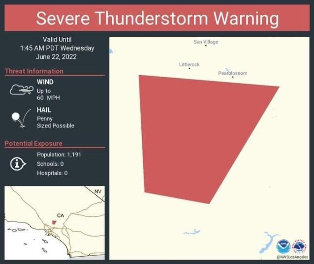
Also per national weather service los angels some wet storms are possible with rain being generally under a quarter inch total with wind gusts up to 60 mph
3 Likes