2022 Weather
San Diego County Observations:
https://sdgeweather.com/
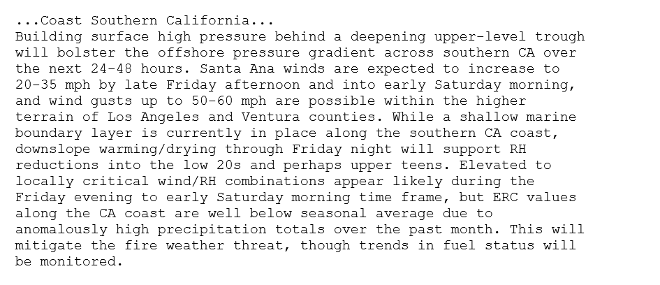
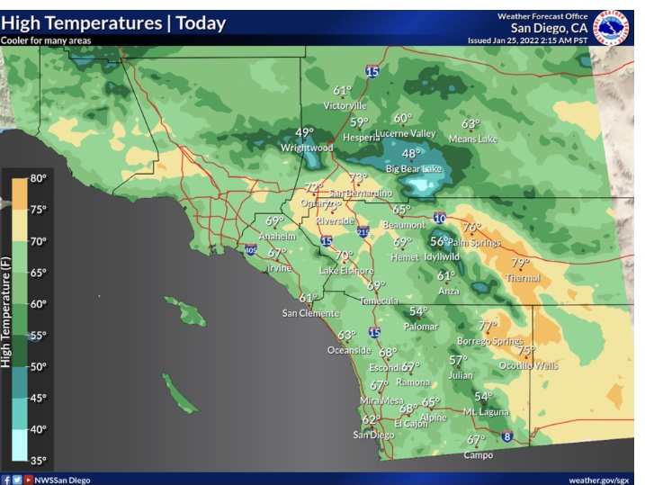
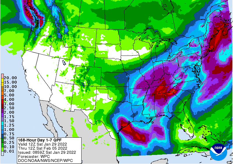
Forecast models indicate no widespread heavy precipitation during the next 10 days across Southern Operations area… Surface high pressure over the Great Basin will lead to much higher than normal temperatures as we are in the typical January heat wave.
Varying degrees of offshore winds will continue to promote drying of fuels.
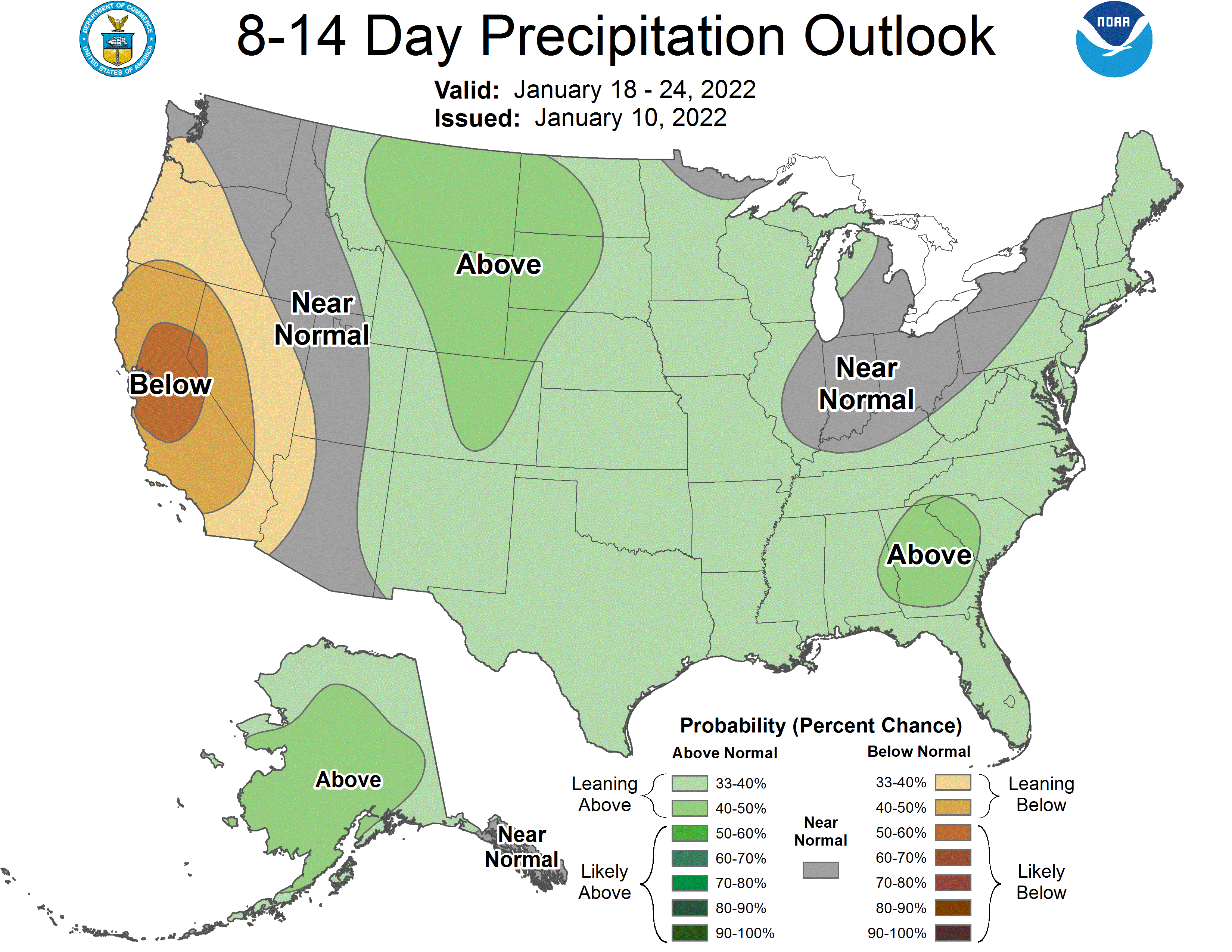
The climate prediction center indicates above normal temperatures & drier than normal weather during the next 8-14 days.
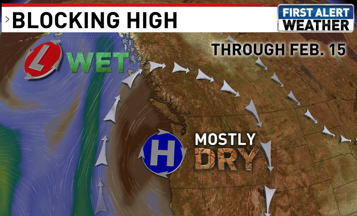
The Rex Block across the Northern Pacific will likely continue until the end of the month… afterwards it could be eroded from troughing to the west and east. Depending on which side wins out, very cold temperatures could occur to start February.
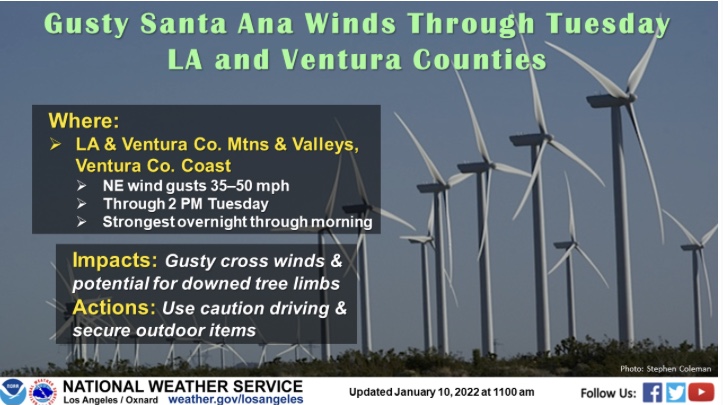
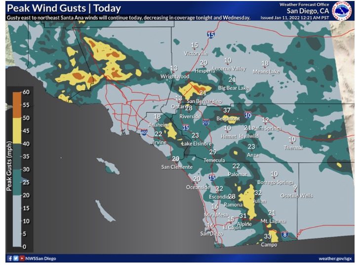
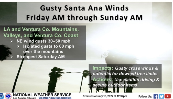
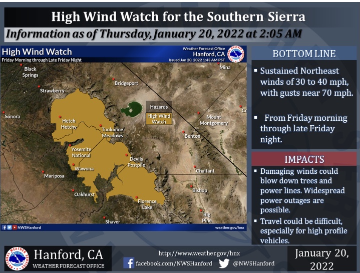
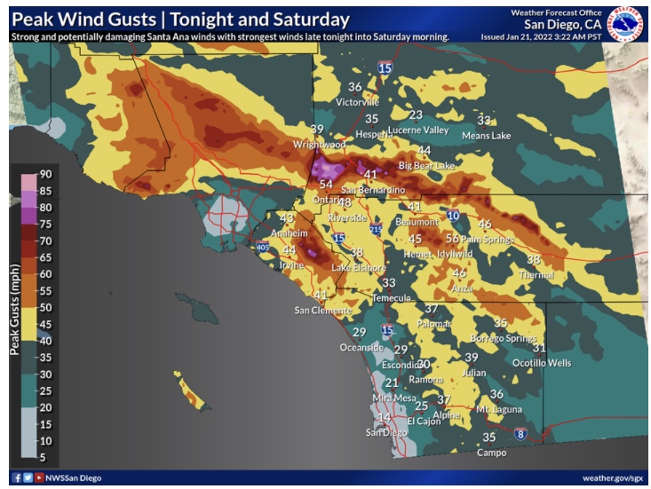
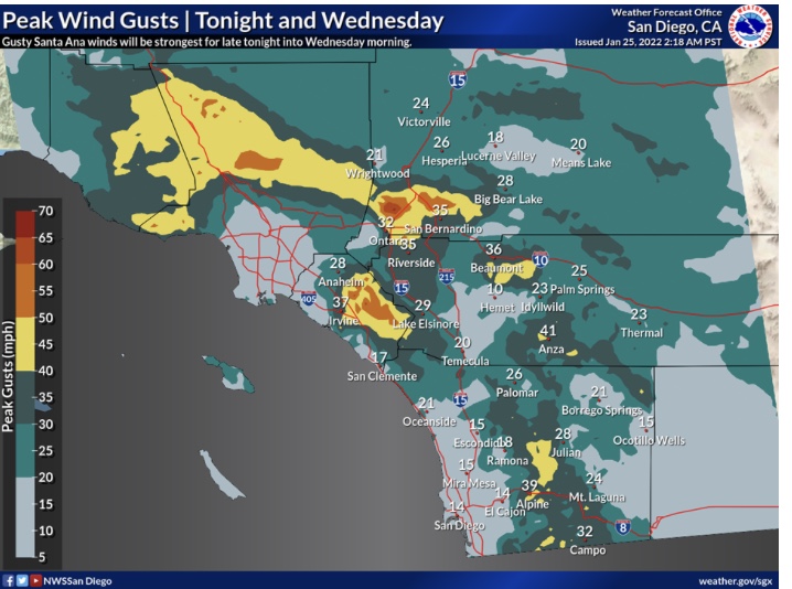
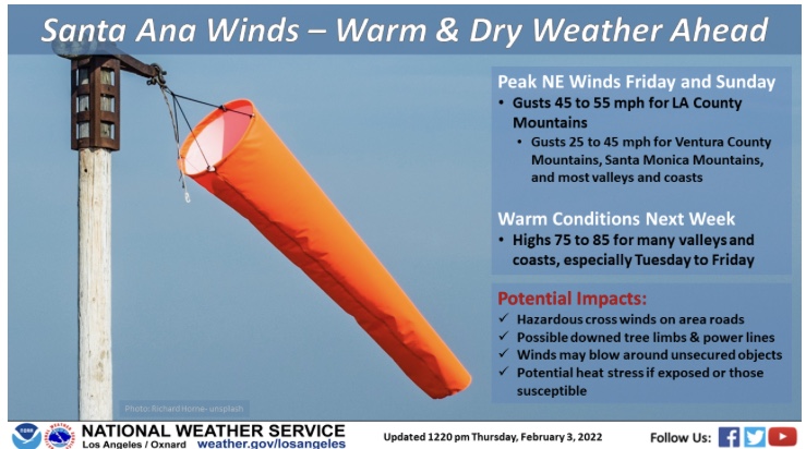
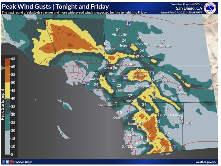
A Santa Ana wind event is set to begin tonight. Winds will be moderate offshore through Friday.
On Friday night a closed low drops out of the Great Basin. This low pressure is very cold and has excellent upper level support to work winds down to the surface. Mountain wave activity is likely to develop which would drive chaotic winds into the valleys.
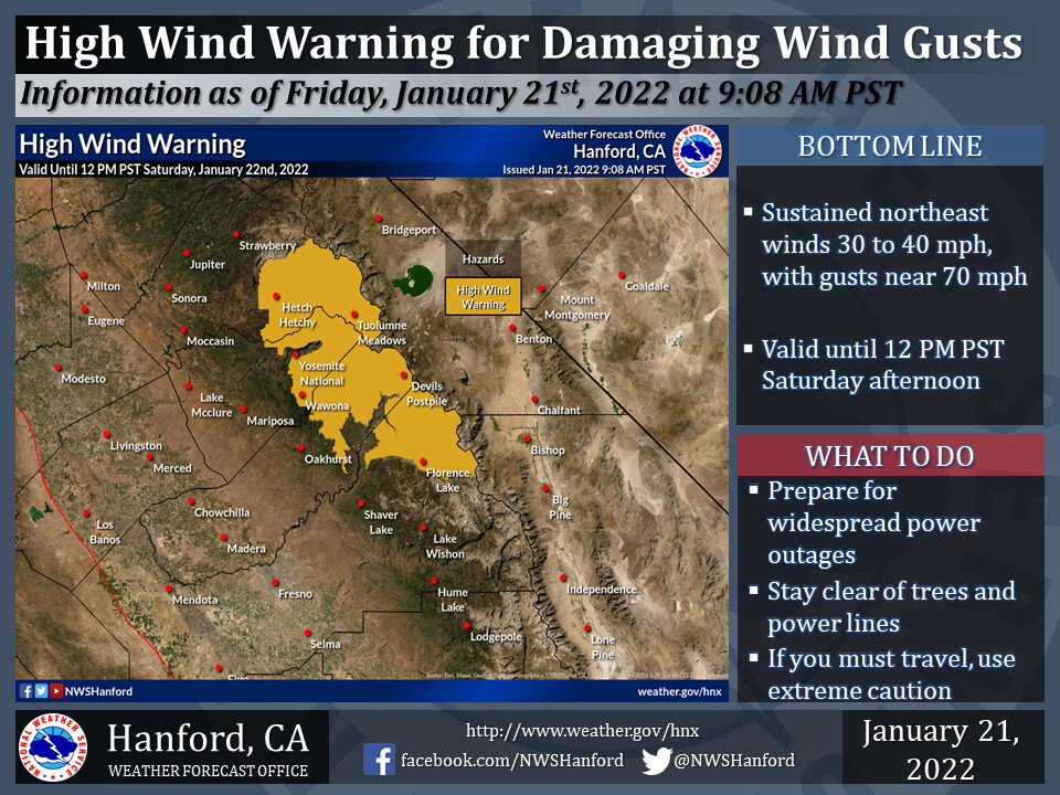
High wind warnings are likely to be posted very soon.
Forecast models do not show precipitation for the rest of January.
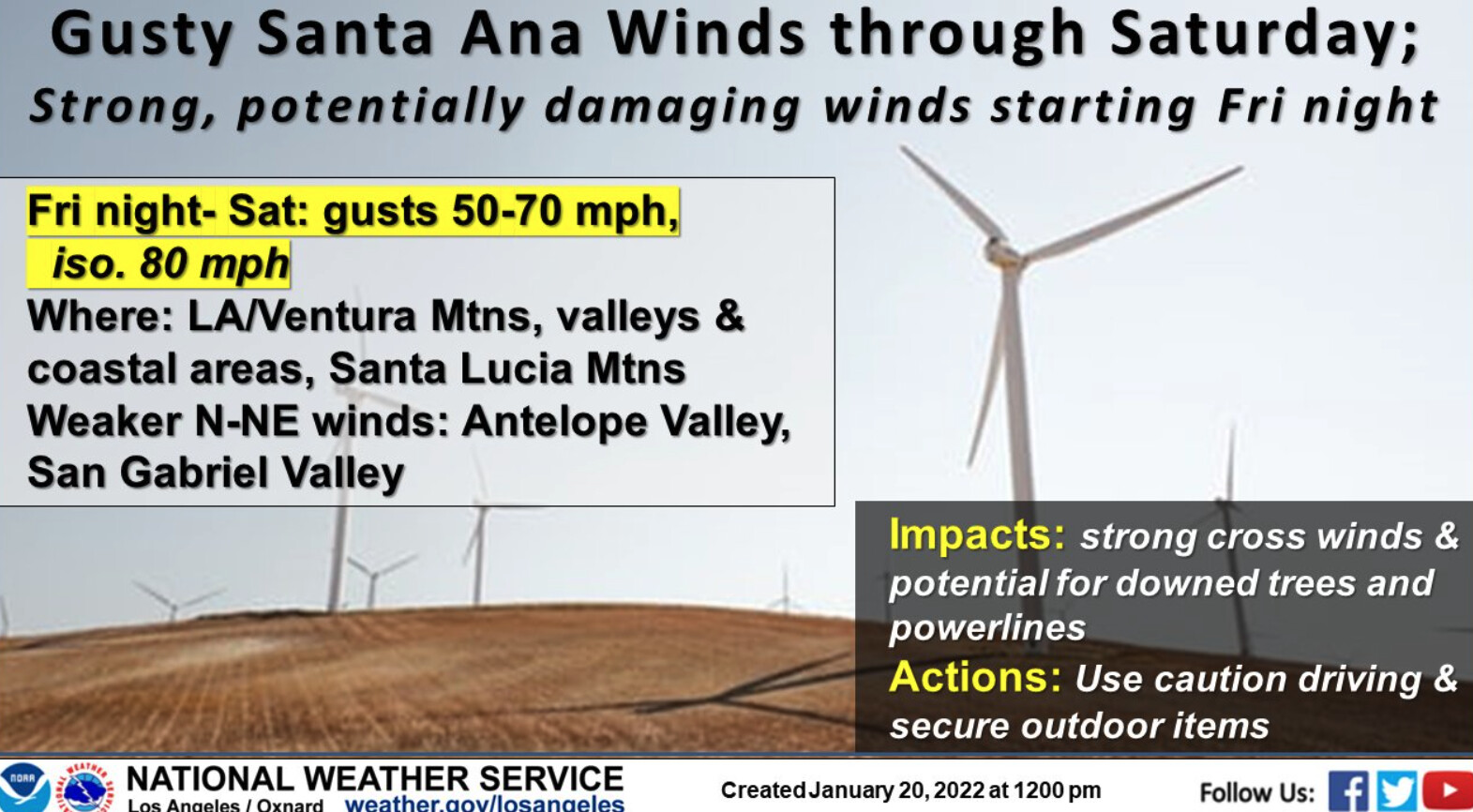
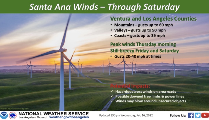
NWS LA: 131 PM A stronger event is expected later Friday into Saturday which for many parts of LA/Ventura Counties will **likely be the strongest Santa Ana weve seen in quite some time.** An upper low currently over southern British Columbia will drop south through the Great Basin Friday and bottom out over the lower Colorado River Valley early Saturday. This is a classic Santa Ana upper air pattern with good cold advection and strong wind support aloft (60kt between 850 and 900 mb). Although forecast gradients are only in the -6 to -7 range the very favorable conditions aloft should help produce gusts over 60 mph in the LA Mountains (including the Santa Monicas), as well as higher portions of the LA/Ventura valleys. And because of the great support aloft well also see gusty winds in areas that typically don`t get Santa Anas such as the San Gabriel Valley, eastern San Fernando Valley, and even down through Long Beach and other pars of the LA Basin. This one is unusual too with the timing as winds will be strengthening through the day Friday before peaking Friday night into early Saturday. Expecting to see isolated gusts to 80mph in the western San Gabriels with this event and gusts in the 60s across the other typically favored areas such as the Santa Monica and Santa Susanna Mountains and the hills around the northern and western San Fernando Valleys.
The top of mammoth mountain had sustained winds over 100 mph and gusts up to 120 mph.
https://www.wrh.noaa.gov/mesowest/timeseries.php?sid=MTH03&num=72&banner=gmap&raw=0&w=325
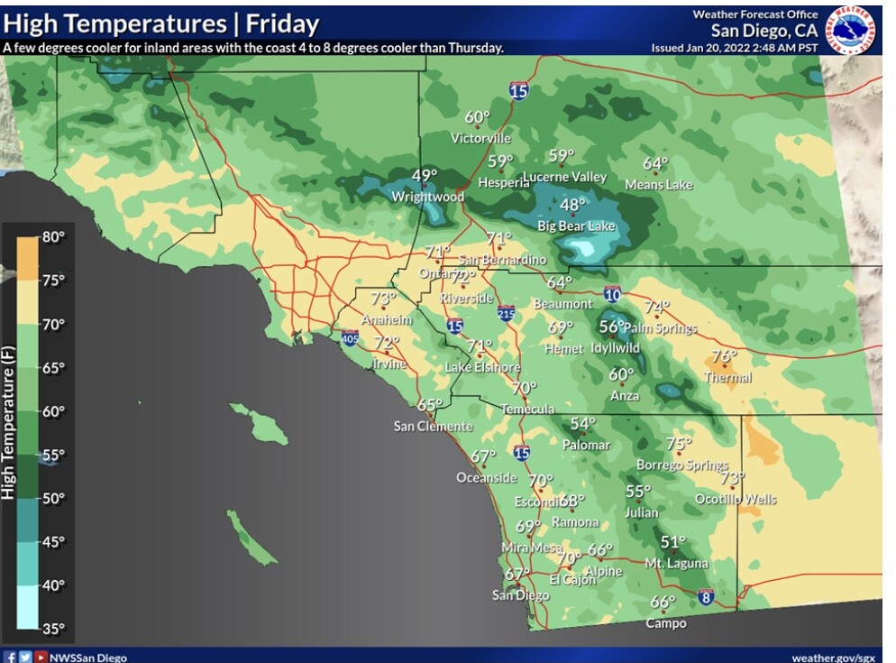
NWS: LA Thursday: The NAM forecast a 9 mb offshore push from the east which is likely 2 mb too strong. Not much in the way of a push from the north so the winds will be more easterly than usual. More importantly there will be a large amount of cold air advection and this will drive a moderate Santa Ana event that will start in the mtns early this evening and then spread to the coasts by midnight. Wind advisories are posted from early this evening through Friday afternoon for all of VTA/LA counties except for the Antelope Vly and the San Gabriel Vly. The winds will likely only affect the Malibu area of the LA county coast. The axis of strongest winds will run from the Santa Clarita Vly almost due west through the eastern VTA vlys and the the VTA coast. The one oddity will the the max temps. Due to the much stronger than normal cold air advection There will be 4 to 8 degrees of cooling for much of LA and VTA counties despite a good deal of compressional warming.
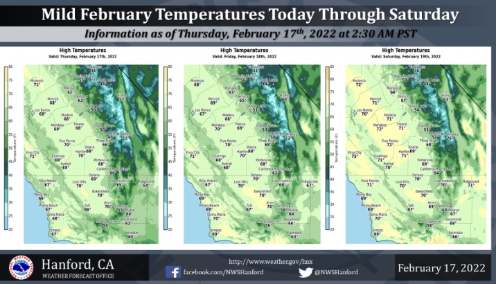
Mostly dry through Feb. 15th.
General Briefing-20220205_1326.pdf (1.0 MB)
And I was having such a great weekend.
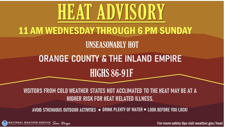
Be safe and hydrate.
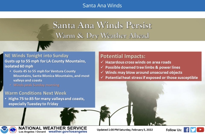
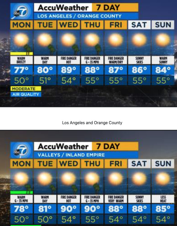
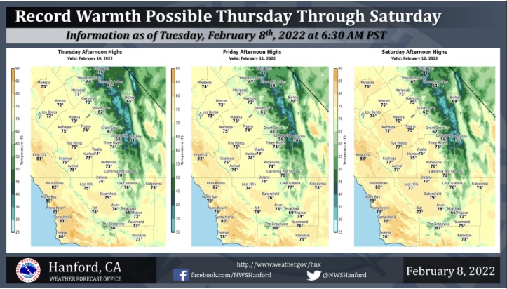
NWS LA Monday: Near record high temperatures are forecast for at least Wednesday when deterministic NAM-WRF 950 mb temperatures climb to near 22 degrees Celsius across the coastal and valley areas with surface pressure gradient tightening to around -7 mb between KLAX and KDAG and -4 mb between KSBA and KBFL. NAEFS and EPS ensemble standardized temperature anomalies exceed the 99th percentile on Wednesday.
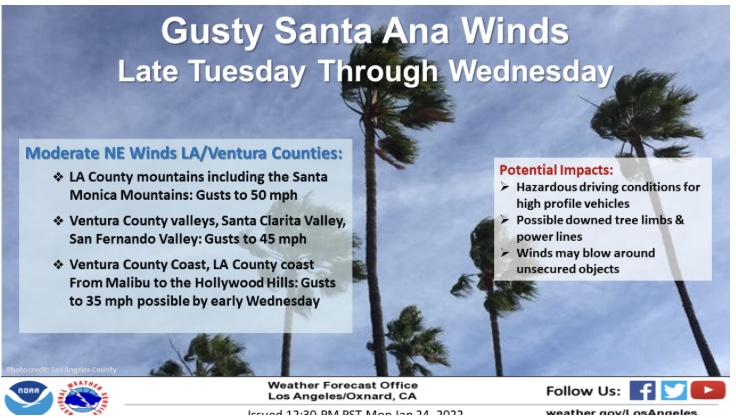
Wind EPS ensembles and deterministic GFS and NAM-WRF solutions are starting to strengthen winds for another offshore flow event for Tuesday night and Wednesday, possibly increasing to damaging levels between Wednesday night and Thursday.
This reminds me of 2017 during the Thomas Fire the Santa Santa Ana wind blew nearly the entire month of December. Good thing we got some rain this year.
Good afternoon,
Surface high pressure building into the Great Basin tonight should tighten gradients at the same time anomalous high pressure builds overhead. This will lead to moderate offshore flow, with very warm surface temperatures for this time of year. A compounding effect occurs in fuels, as the sun angle is directed on SW slopes plus the drying Santa Ana winds and high temperatures could make bulky fuels receptive in the afternoon tomorrow on aforementioned SW slopes.
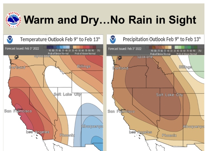
Forecast models are not yet in agreement on a big trough that drops out of Canada next Monday… I am leaning towards an inside track that would continue the dry weather through mid month. We are now over half way through winter, and the fall precipitation in South Ops has been pretty much neutralized due to almost no rain in the last 40 days. The CFS monthly climate model shows grim conditions for the next few months, which could mean below average precipitation the rest of the way.
In South ops it is more important to have a wet spring than a wet fall, because the marine layer influence on fuels will be much less as fuels dry out heading into the dry season.