
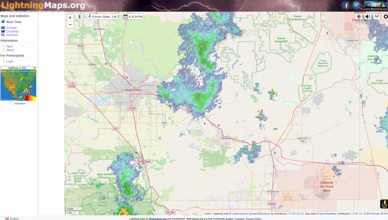
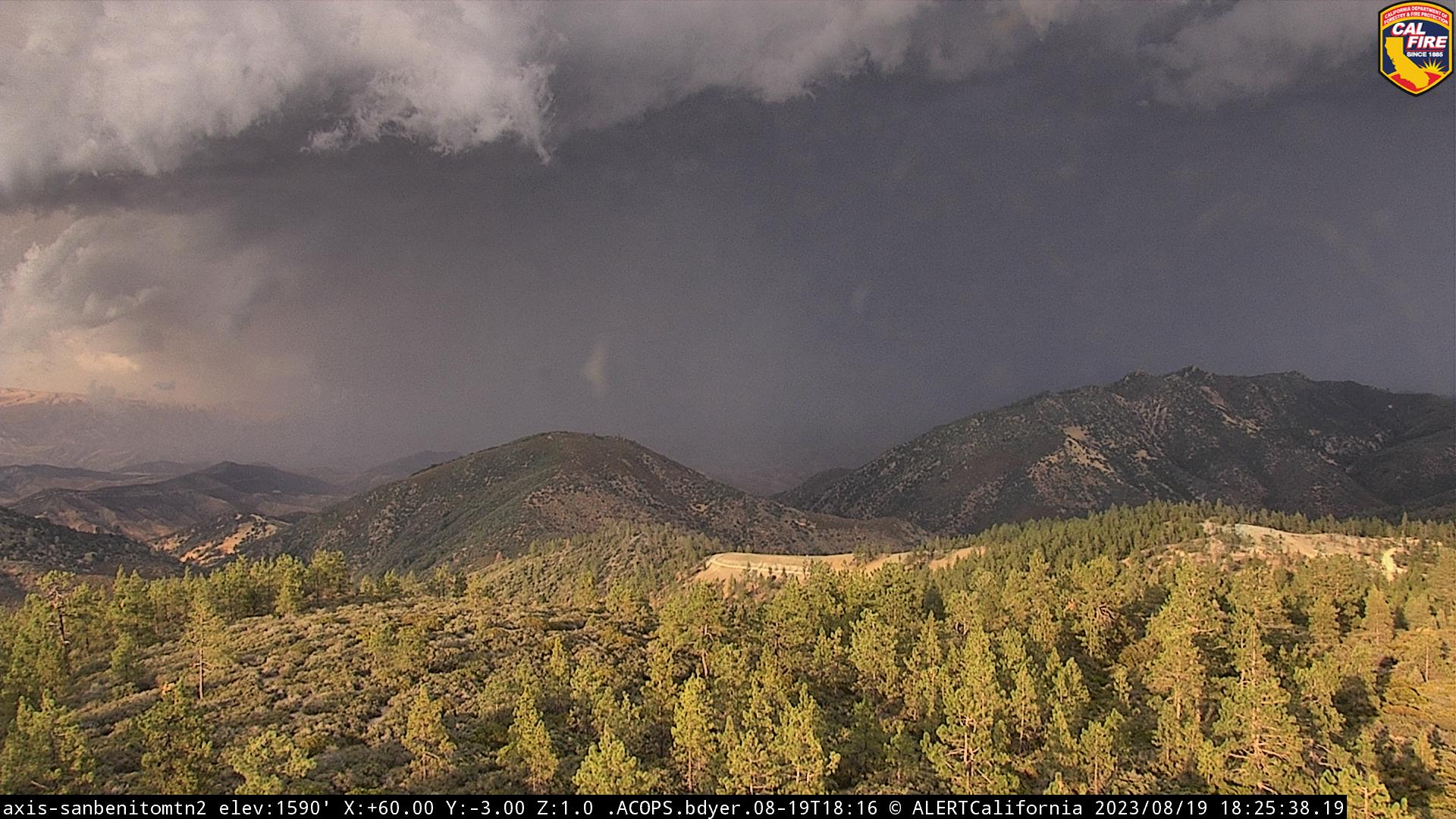
6:30 pm PT Wed Aug 16 lightning detections sporadic, but fairly steady between Bakersfield and Tehachapi. Not a lot of precip to go with it so far.
4 Likes
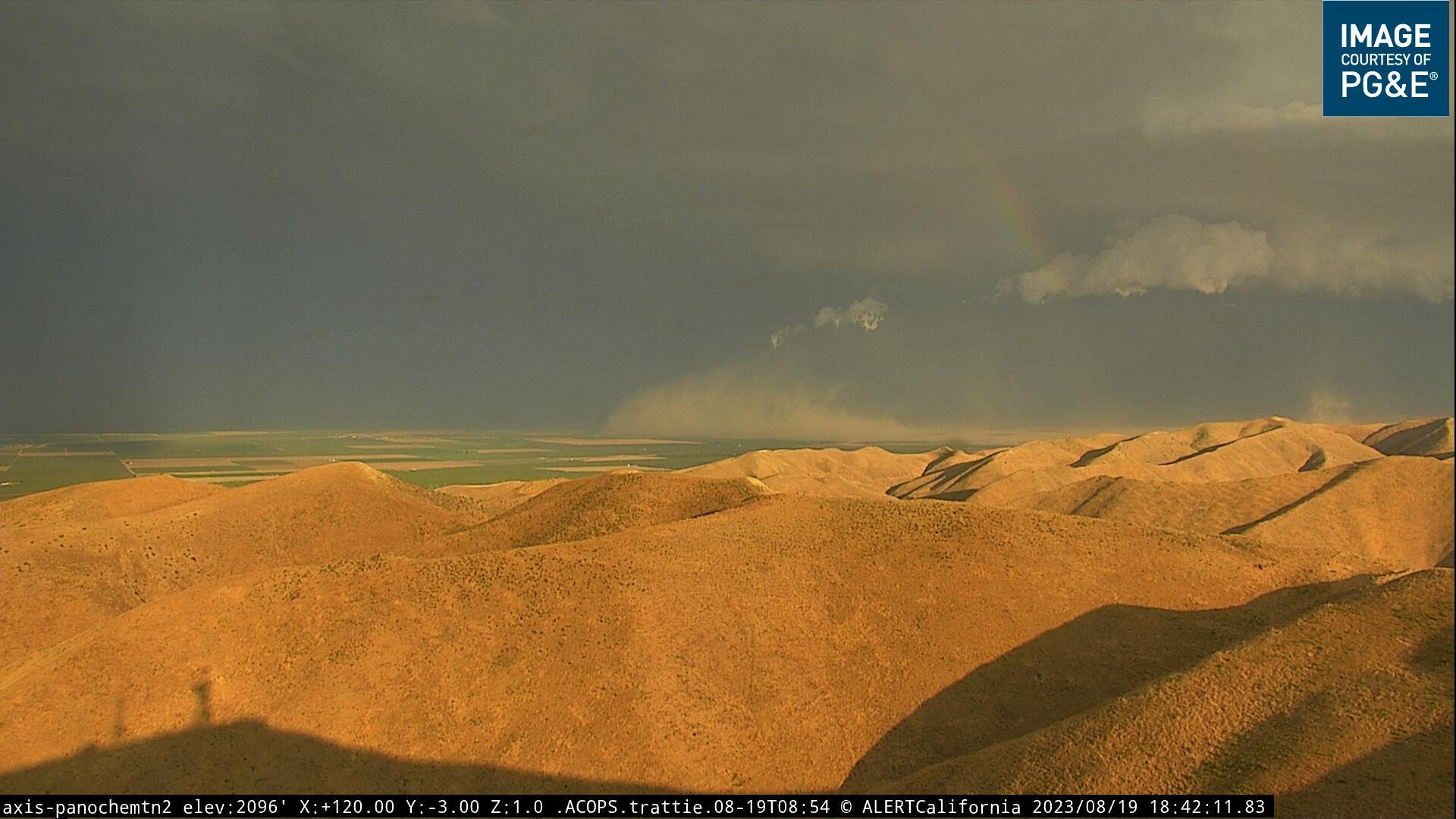
Downpour of rain in Tehachapi for roughly 20min. Shows more rain coming in. Lightning and thunder as well.
4 Likes
The cells have been on the move. Sounds like the pilots are getting tossed around a bit.
5 Likes
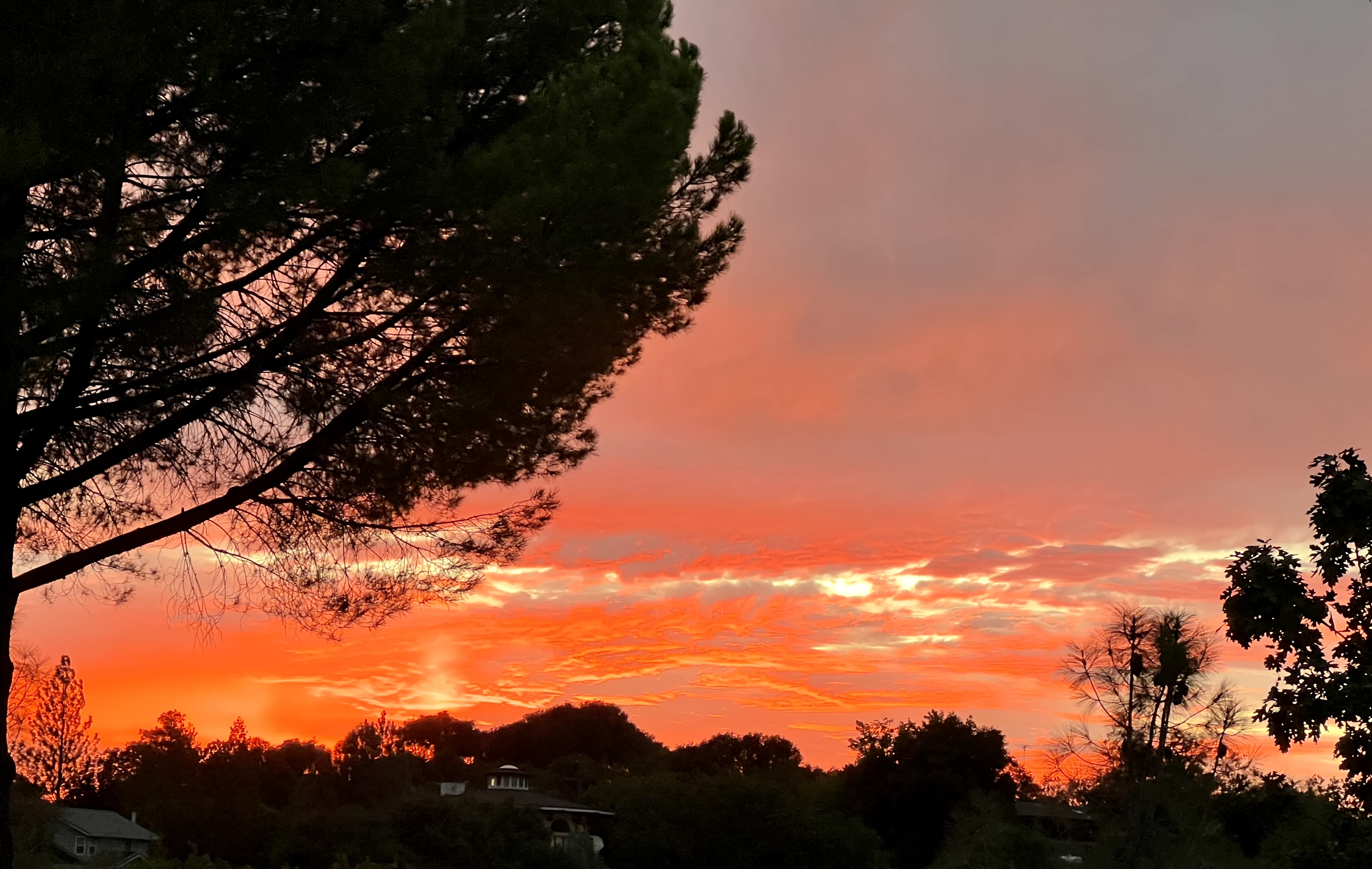
Late afternoon thunderstorms make for great looking sunsets. From my house in Sonora looking NW. No rain or lightning local but plenty of wind. Went from 102 to 88 at the house.
9 Likes
Hilary has developed an inner core this evening and is in the process of rapid intensification. The SHIPS-RI index that expresses the probability of rapid intensification is near 100%. The maximum intensity of the storm is important, because it will take longer to ‘spin down’ the lower the pressure becomes.
As the storm approaches Baja, it is going to evolve into a very volatile situation for the desert mountains and valleys, especially the Coachella and Imperial valleys. As the hurricane pushes it’s right front quadrant into the very warm waters of the Gulf of California, the hurricane will be up against air flowing from a different direction from the cut off low pressure system off of the West coast. This could set up a ‘deformation zone’ (info) that leads to tremendous rainfall amounts.
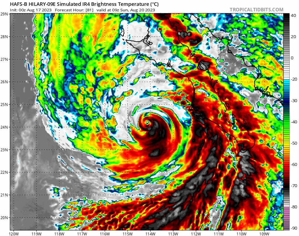
The probability of the storm impacting Southern California is increasing, and will likely climb to certainty if the storm rapidly intensifies into a major hurricane.
Satellite data: 1 minute floater (refresh anytime for present image)
15 Likes
Flood Watch just issued for an extremely large area of SoCal due to approaching Hilary…in effect Saturday morning-Monday evening
5 Likes
As for now we will leave existing discussion of Hilary in place, but let’s carry event specific discussion here
Hillary Discussion
4 Likes

It was…Wasco.
4 Likes
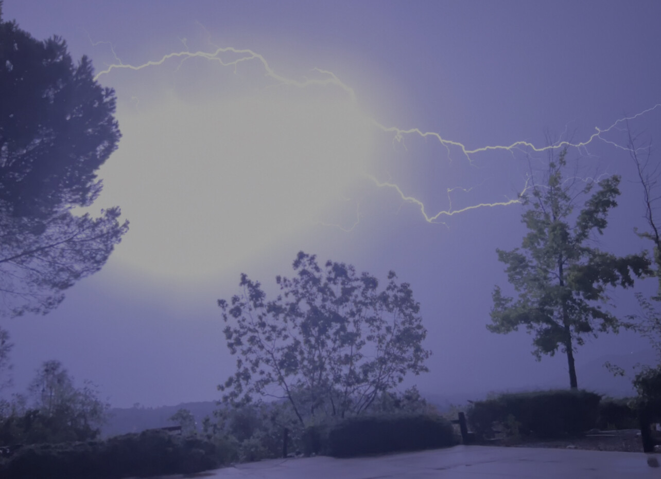
Rain and lightning in Mariposa
4 Likes
Same for Twain Harte
4 Likes
Lightning in the Central Sierra is worrisome. Obviously Fresno and Tulare have had their fill of fires the last few years. But in the mid range altitudes of MMU and TCU between 1500 and 5000 feet initial attack and larger fires have been relatively low compared to past years. There are thousands of acres of dead stands of timber due to bark beetle. Fortunately, due to lack of fires, there has been a lot of logging and burning, lessening risk. But a hold over fire, in the right spot could be catastrophic once the weather warms up and drys out.
5 Likes
I’m not sure a fire will hold over my family said atleast half an inch in mmu
3 Likes
TCU got slammed pretty hard with lightning. We did get a couple small fires in Murphys, Angles Camp and Sonora. We did get wetting rain with the lightning.

8 Likes
This morning I had .25 inches in the rain gauge Sonora area. To my surprise under the drip line of my trees and some brush it was dry. I don’t think it will stay dry long with the incoming weather. Not raining at the moment but sprinkles now and then. Heading to Reno see what happens there in the next day or two.
7 Likes
While we are not completely done with Hilary yet I wanted to offer some philosophical thoughts on the current weather set up. Also wanted to point out how good the GFS did with Hilary, so as much deserved flack it gets like an American made vehicle it did good this time.
We should watch a developing tropical cyclone in the Gulf of Mexico for some additional moisture intrusion as it moves west. It could bring a few showers and thunderstorms towards the end of the week.
The pattern should really dry out and ridging should build in with SW flow aloft, and it will surprise many how fast South Ops dries out. Computer models show potential for a major heatwave at the end of the month into early September, if the philosophy of future Hurricane Franklin approaching the eastern seaboard comes into play. It seems as if the story is just going to write itself, so we should expect more amplified weather events. The biggest problem with summer rain in South Ops is it takes a long time for dormant vegetation to respond to significant rain, so you could probably throw 20 inches of rain at it but the fuels are adjusted to remain dormant until the winter, and a couple of heatwaves later it’s ready to go again.

14 Likes
Yep kudos to the GFS. I think the first time I saw it show the Hilary SoCal solution was around 330 hours out. Atlantic basin tropical activity is not my area of expertise but given the hot tub of water in the Gulf of Mexico and Atlantic its not hard to imagine tropical activity getting busy on the correct side of the country (:
6 Likes