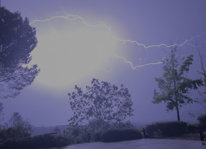
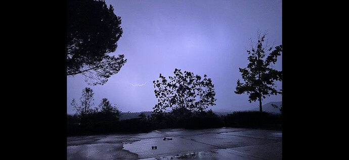
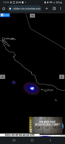
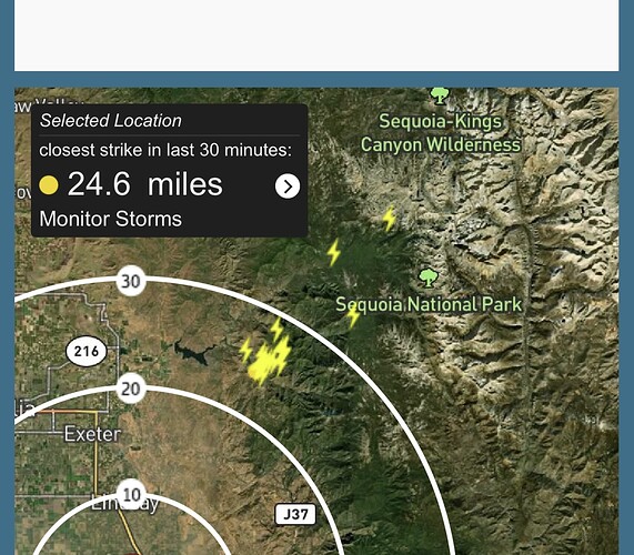
TCU got slammed pretty hard with lightning. We did get a couple small fires in Murphys, Angles Camp and Sonora. We did get wetting rain with the lightning.
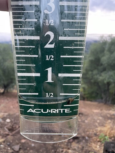
This morning I had .25 inches in the rain gauge Sonora area. To my surprise under the drip line of my trees and some brush it was dry. I don’t think it will stay dry long with the incoming weather. Not raining at the moment but sprinkles now and then. Heading to Reno see what happens there in the next day or two.
While we are not completely done with Hilary yet I wanted to offer some philosophical thoughts on the current weather set up. Also wanted to point out how good the GFS did with Hilary, so as much deserved flack it gets like an American made vehicle it did good this time.
We should watch a developing tropical cyclone in the Gulf of Mexico for some additional moisture intrusion as it moves west. It could bring a few showers and thunderstorms towards the end of the week.
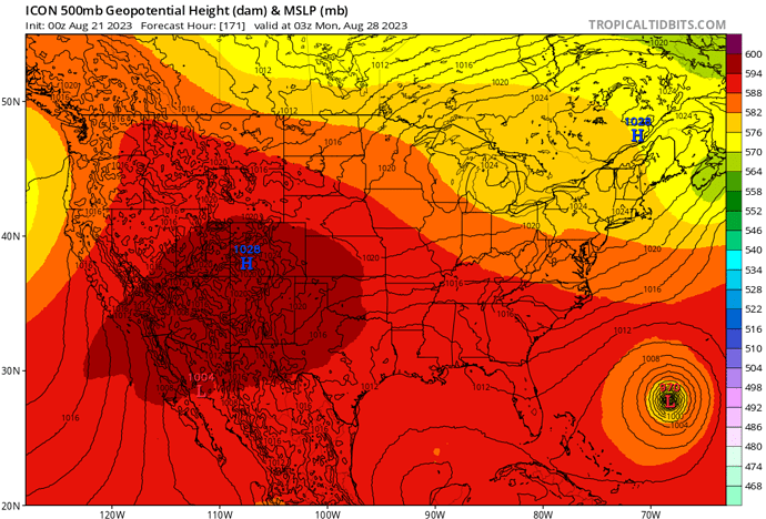
The pattern should really dry out and ridging should build in with SW flow aloft, and it will surprise many how fast South Ops dries out. Computer models show potential for a major heatwave at the end of the month into early September, if the philosophy of future Hurricane Franklin approaching the eastern seaboard comes into play. It seems as if the story is just going to write itself, so we should expect more amplified weather events. The biggest problem with summer rain in South Ops is it takes a long time for dormant vegetation to respond to significant rain, so you could probably throw 20 inches of rain at it but the fuels are adjusted to remain dormant until the winter, and a couple of heatwaves later it’s ready to go again.
Yep kudos to the GFS. I think the first time I saw it show the Hilary SoCal solution was around 330 hours out. Atlantic basin tropical activity is not my area of expertise but given the hot tub of water in the Gulf of Mexico and Atlantic its not hard to imagine tropical activity getting busy on the correct side of the country (:
Hilary Rainfall Totals
https://forecast.weather.gov/product.php?site=SGX&issuedby=SGX&product=RRM&format=CI&version=1&glossary=0
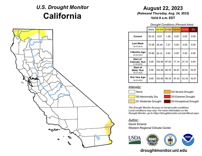
Current update:
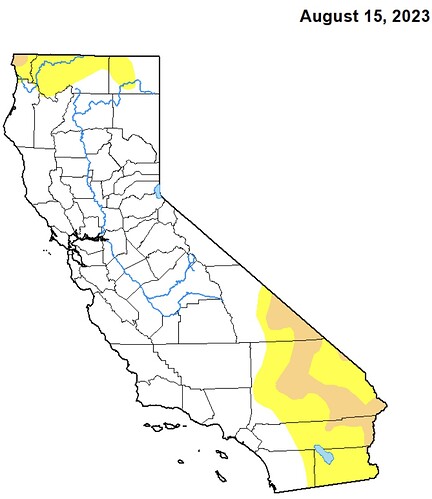
A week ago:
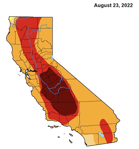
One year ago:
Mother Nature helped put a nice bandaid on the water situation this year.
We can think of the current weather patterns as “compression” of seasons. For example, we had a very late start to the monsoon and it was almost non existent when it did manifest. That was, until tropical storm Hilary moved into the area. We can think of this as the monsoon trough reaching its peak. The manifestation of a compressed and intense monsoon season was essentially in a single event.
Going forward, we can expect the “second summer” in September to be very intense. This is the time period where the subtropical ridge hands off to the North Pacific high pressure system. I would expect that after our cool down and cooler but dry weather we experience a major heatwave in mid September. A compressed version of what September typically brings, which is peak heat west of the mountains.
We can probably expect this for Santa Ana wind season as well. Less events, but more intensity.
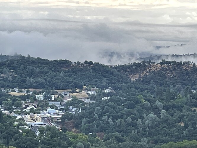
At the house in Sonora we received almost a half inch of rain. 59 out when I took the pic. Here’s a look out towards Sonora this morning. More rain tomorrow is in the forecast.
sure felt like a pretty good rain for the first of September. glad I put away some things that were outside yesterday… lol
Fire Weather Watch for Dry Lightning issued by NWS Monterey:
https://forecast.weather.gov/wwamap/wwatxtget.php?cwa=MTR&wwa=fire%20weather%20watch
Upgraded to a Red flag warning.
https://forecast.weather.gov/showsigwx.php?warnzone=CAZ518&warncounty=CAC053&firewxzone=CAZ518&local_place1=5%20Miles%20S%20Priest%20Valley%20CA&product1=Red+Flag+Warning&lat=36.1088&lon=-120.7076
https://x.com/scweatherforce/status/1706329080629690855?s=46&t=sXjhUhVRpGnaHbLlV81GFA
Check it out before they flag it as offensive for whatever reason.(the ones I shared for the previous Hurricane were removed by admin) I figure the more weather outlooks by different folks the better firefighters can expect for the future.
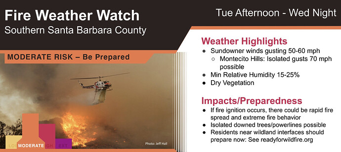
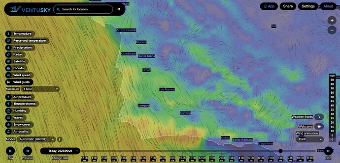
NWS LA: A Fire Weather Watch is in effect for southern Santa Barbara County Tuesday afternoon through Wednesday night. There is the potential for critical fire weather conditions due to gusty sundowner winds, low humidity, and dry vegetation.
Live Cams: Santa Barbara County Fire webcams
Now that’s a nice photo 
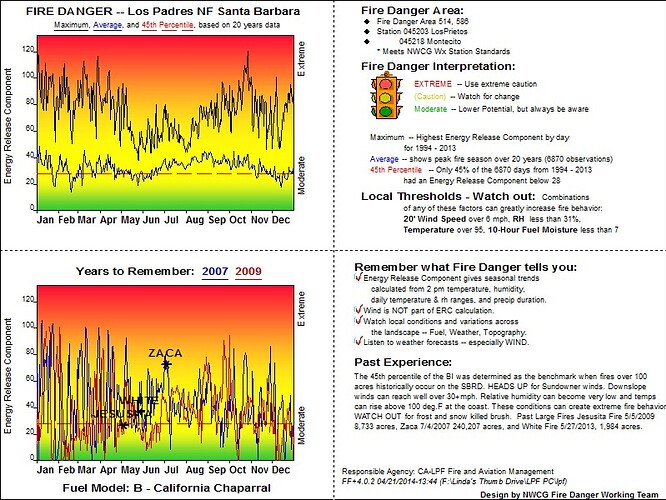
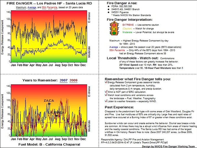
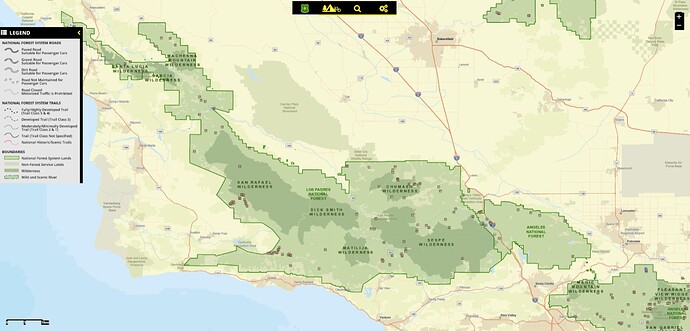
LPCC Santa Barbara and Santa Lucia Ranger ERC cards. October Sundowners. San Rafael, San Gabriel and Santa Ynez Mountain chapparal, Oak scrub, Manzanita and some Douglas Fir.
On the bright side, Cachuma is nearly full to the brim (looking better than last fall’s camping trip)…those SuperScoopers could have easy laps. Vandenberg Hotshots can count on at least 8-12 T1 hand crew from SLU Toro, Camarillo and scratch mobs plus County to roll on an incident that goes full offense.
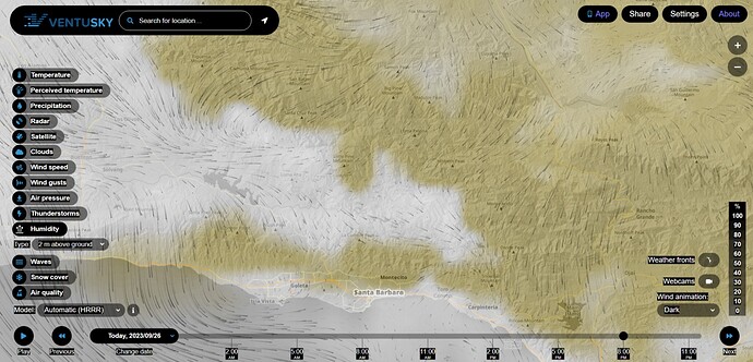
Down to 10% rH in the Fire Watch, from Santa Cruz Peak to west of Ojai by 8pm tonight. (I don’t really want to go out on a limb, but is there a drying band on the windy shores of a distant atmospheric river?)
45-60mph gusts from Montana de Oro State Park and northerly downdrafts.
Good shore break and northward flowing swell on point if you surf.
