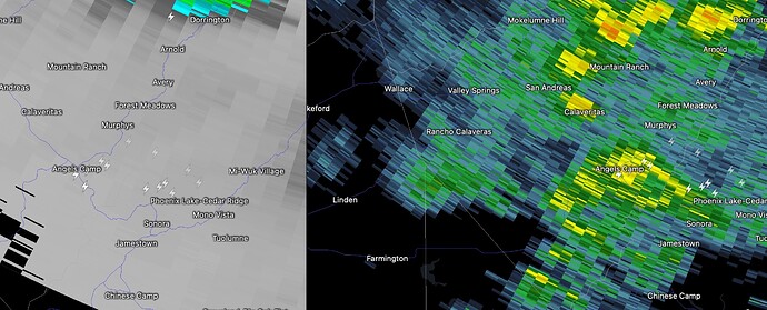
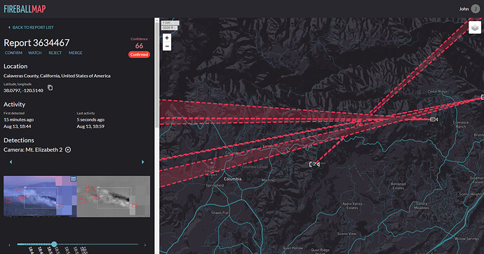
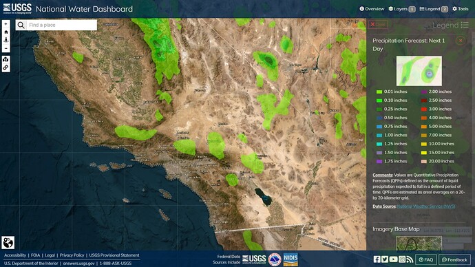
Lightning popping off just north of Sonora.
Radar precip looks pretty light.
Y’all getting any rain?
Yes there is precep with these strikes.
Barely any rain in Sonora…
Well if he is saying 75% chance 7 days out I would like him to purchase me some lotto tickets.
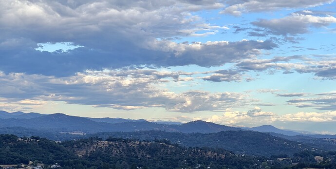
in the far distance. Both the STF and Cal Fire running strikes in LRA and SRA. Very little rain Sonora area.
Just a small amount of moisture here in Sonora…nothing wetting ir substanstanial below the drip line…just enough to mess up your windshield and make it smell nice in these parts!!
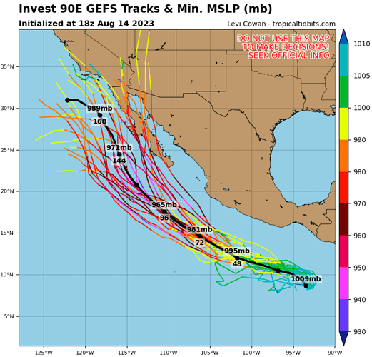
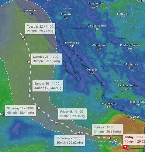
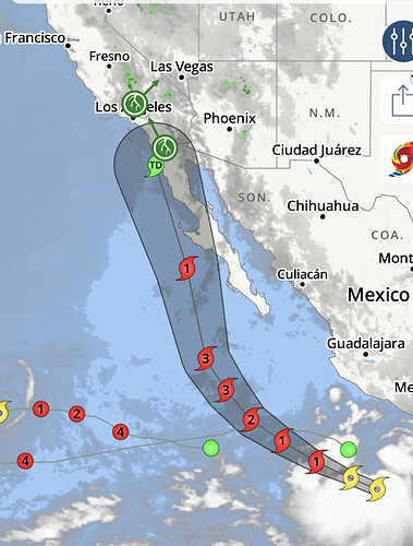
90E Is now designated and here is the first ensemble spaghetti plot for the system.
This will change in time because the storm does not have a clearly defined center yet.
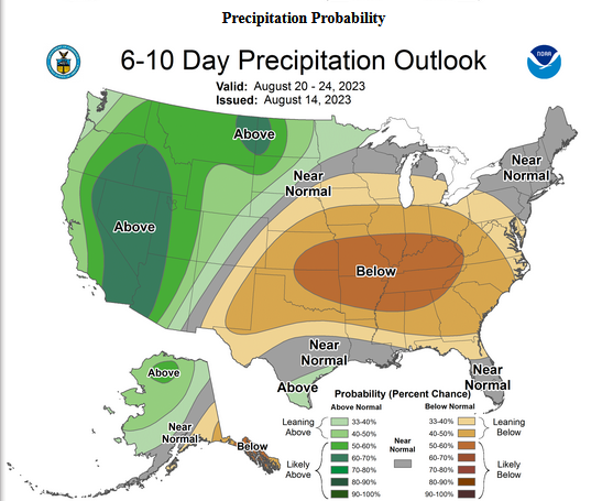
Someone is latching on to some precip incoming early next week!
90E is on the verge of tropical depression status. When upgraded to tropical storm status it will become Hilary.
90E is a gigantic storm as far as diameter goes. The wave axis extends over 1,000 miles across the ocean, and this will prevent the storm from strengthening rapidly because it will take a long time to completely spin the cyclone into a circular shape. You could easily fit Hurricane Fernanda, Tropical Storm Dora, and Tropical Storm Greg into the footprint of this storm.
The general forecast philosophy is that 90E will develop an inner core at some point in the next 3 days, and begin to strengthen. The rate that this occurs will depend on the storms own structure, and early runs of the hurricane models show a decent chance of category 4 status at maximum intensity.
The amount that this storm strengthens will also dictate where it goes, because stronger storms tend to move further north, but in the case of this storm… the stronger it is further north could push it to the west due to its anticyclone enhancing high pressure to the east. The other factor is the interaction with a cut off low pressure system currently off of our coast. Cut off lows are a nightmare to forecast.
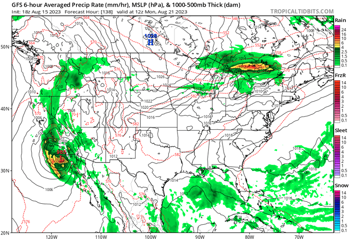
At this point in time, the primary threat will be a downsloping wind event caused by the pressure gradient… with precipitation in the deserts, as the forecast models currently have the storm moving west of Baja and south of the bight. Could we see a direct landfalling tropical cyclone? It’s a very very small possibility. It is far too early to pinpoint impacts to Southern California, as the forecast track will continue to evolve.
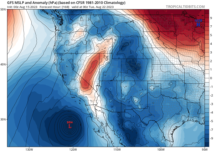
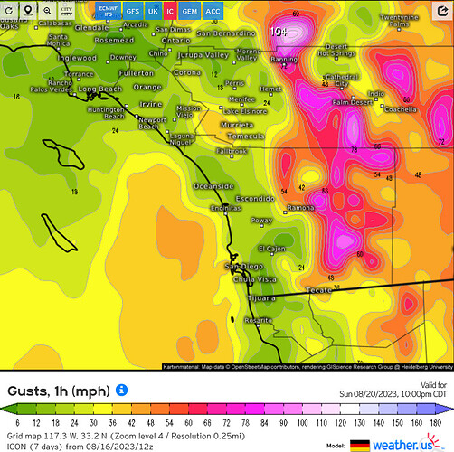
Santa Ana wind event scenario on tonight’s 00z GFS run
There is a dry layer of air near the surface this morning in South Ops, if thunderstorms can establish themselves today there could be dry lightning strikes, especially north and west of Riverside county.
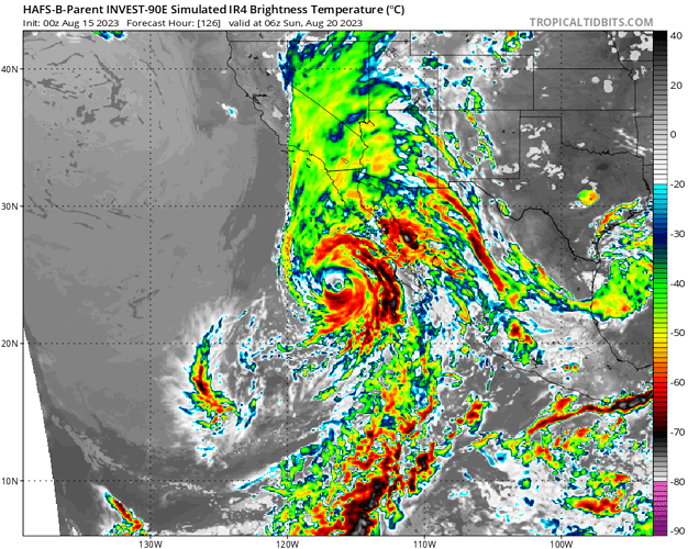
The hurricane models are beginning to support a potential landfall.
Irregardless of landfall, the effects will likely be severe.
It will likely depend on how much the storm is able to strengthen and if it is able to “phase” meaning combine with the upper level low. This will become evident very soon.
The official NHC forecast.
The NHC peaks the storm at 125 MPH in about 3 days. This peak could be conservative and the NHC tends to be conservative on tropical cyclone intensity. The key here is how much the minimum central pressure drops to, because as the storm combines with the upper level low it will likely become a subtropical cyclone. We should not focus on the core of the storms winds, but the track it takes because the downsloping effect off of the Southern CA mountains will likely produce much stronger winds than the core of the storm.
The average general consensus between all of the models is peak intensity near 960 MB, but the storm could strengthen more than that.

