
Rain in meadow lakes now. Here comes the lightning.

2 Likes

Upgraded to a Red flag warning.
https://forecast.weather.gov/showsigwx.php?warnzone=CAZ518&warncounty=CAC053&firewxzone=CAZ518&local_place1=5%20Miles%20S%20Priest%20Valley%20CA&product1=Red+Flag+Warning&lat=36.1088&lon=-120.7076
5 Likes
3 Likes
2 Likes
https://x.com/scweatherforce/status/1706329080629690855?s=46&t=sXjhUhVRpGnaHbLlV81GFA
Check it out before they flag it as offensive for whatever reason.(the ones I shared for the previous Hurricane were removed by admin) I figure the more weather outlooks by different folks the better firefighters can expect for the future.
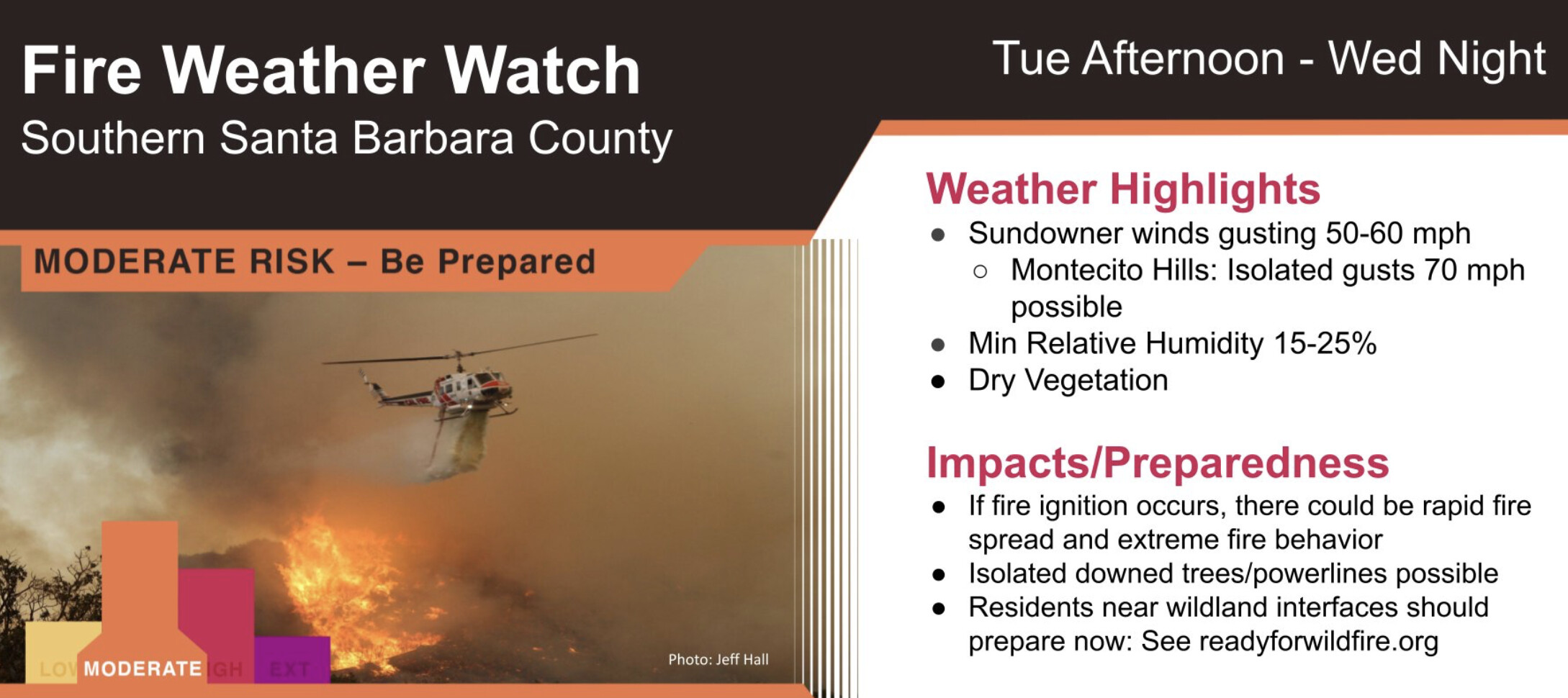
NWS LA: A Fire Weather Watch is in effect for southern Santa Barbara County Tuesday afternoon through Wednesday night. There is the potential for critical fire weather conditions due to gusty sundowner winds, low humidity, and dry vegetation.
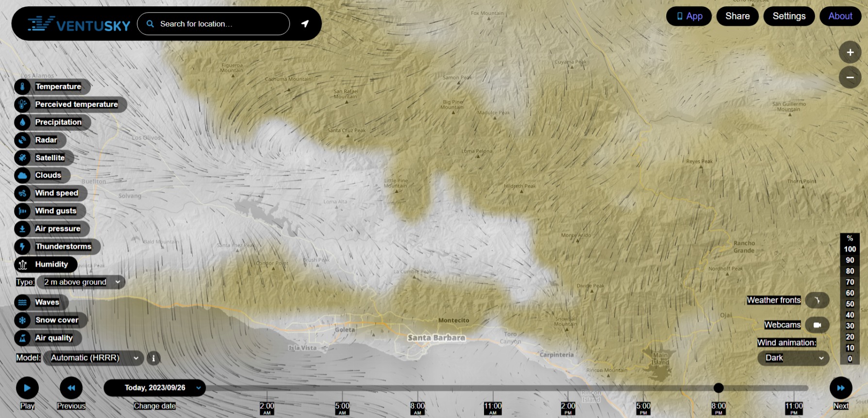
Live Cams: Santa Barbara County Fire webcams
6 Likes
Now that’s a nice photo 
6 Likes
LPCC Santa Barbara and Santa Lucia Ranger ERC cards. October Sundowners. San Rafael, San Gabriel and Santa Ynez Mountain chapparal, Oak scrub, Manzanita and some Douglas Fir.


On the bright side, Cachuma is nearly full to the brim (looking better than last fall’s camping trip)…those SuperScoopers could have easy laps. Vandenberg Hotshots can count on at least 8-12 T1 hand crew from SLU Toro, Camarillo and scratch mobs plus County to roll on an incident that goes full offense.
Down to 10% rH in the Fire Watch, from Santa Cruz Peak to west of Ojai by 8pm tonight. (I don’t really want to go out on a limb, but is there a drying band on the windy shores of a distant atmospheric river?)
45-60mph gusts from Montana de Oro State Park and northerly downdrafts.

Good shore break and northward flowing swell on point if you surf.
6 Likes
NWS LA: 3:30pm
Gusty northerly winds are expected across the mountains of
Santa Barbara county as well as the South Coast tonight through
Thursday morning. The strongest winds, gusts 30 to 50 mph with
possible gusts to 60 mph, are expected tonight through Wednesday
morning. These winds will combine with relative humidity in the
15 to 25 percent range this evening and again Wednesday evening
to bring critical fire weather conditions to these areas. The
confidence for widespread critical fire weather conditions is
high for tonight and Wednesday morning and a RED FLAG WARNING
is in effect. For Wednesday afternoon through Thursday morning,
confidence in widespread critical fire weather is not as high
and a FIRE WEATHER WATCH is in effect. These conditions could
lead to rapid fire spread, especially in the coastal foothills.
This part of Santa Barbara County is particularly vulnerable to
fires due to dry fuel moisture values at this time of the year.

4 Likes
Incoming - a long way out but it is that time of year.
4 Likes
Seems like that’s the earliest they have been projected in a few years
2 Likes
If your coming down the Grade for SLU, there’s some pretty good spots. I dunno why everyone mobs up at Pismo Pier. Pier Ave at Oceano, is 10 min away, near the airstrip and ORVA, is 8-12ft and practically deserted this morning. Santa Rosa Creek and Moonstone also worth a look. If you make it to SB, there’s Razorblades and El Capitan if you want to avoid the Hollywood at Rincon.
3 Likes
Already removed
1 Like
5 Likes

The Pacific Ocean has some things to say about the low pressure at Gaviota overnight with wind gusts peaking to 35 in the coastal ranges and north of Santa Clarita.

Dawn patrol looking good tomorrow at 6am. Winds should continue backing off through 4pm Thursday.
5 Likes
4 Likes
A little dusting of snow at 8200ft… Move those bucks around today in the High County.
5 Likes
SoCal Rainfall totals
https://forecast.weather.gov/product.php?site=NWS&issuedby=SGX&product=RRM&format=CI&version=1
2 Likes
