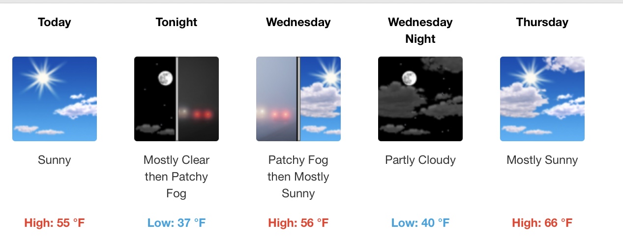
Snow is accumulating around 1500’ near Fontana. More snow this afternoon and evening? Suppressed surface temperatures from the occluded frontal boundary in the Inland Empire is limiting day time heating. The cold core of the upper level low approaches the area this afternoon and evening and any convection could lead to low elevation snow as the air aloft is cold and surface temperatures are suppressed. The HRRR has accumulating snow in the IE starting around 02z (6PM)
5 Likes
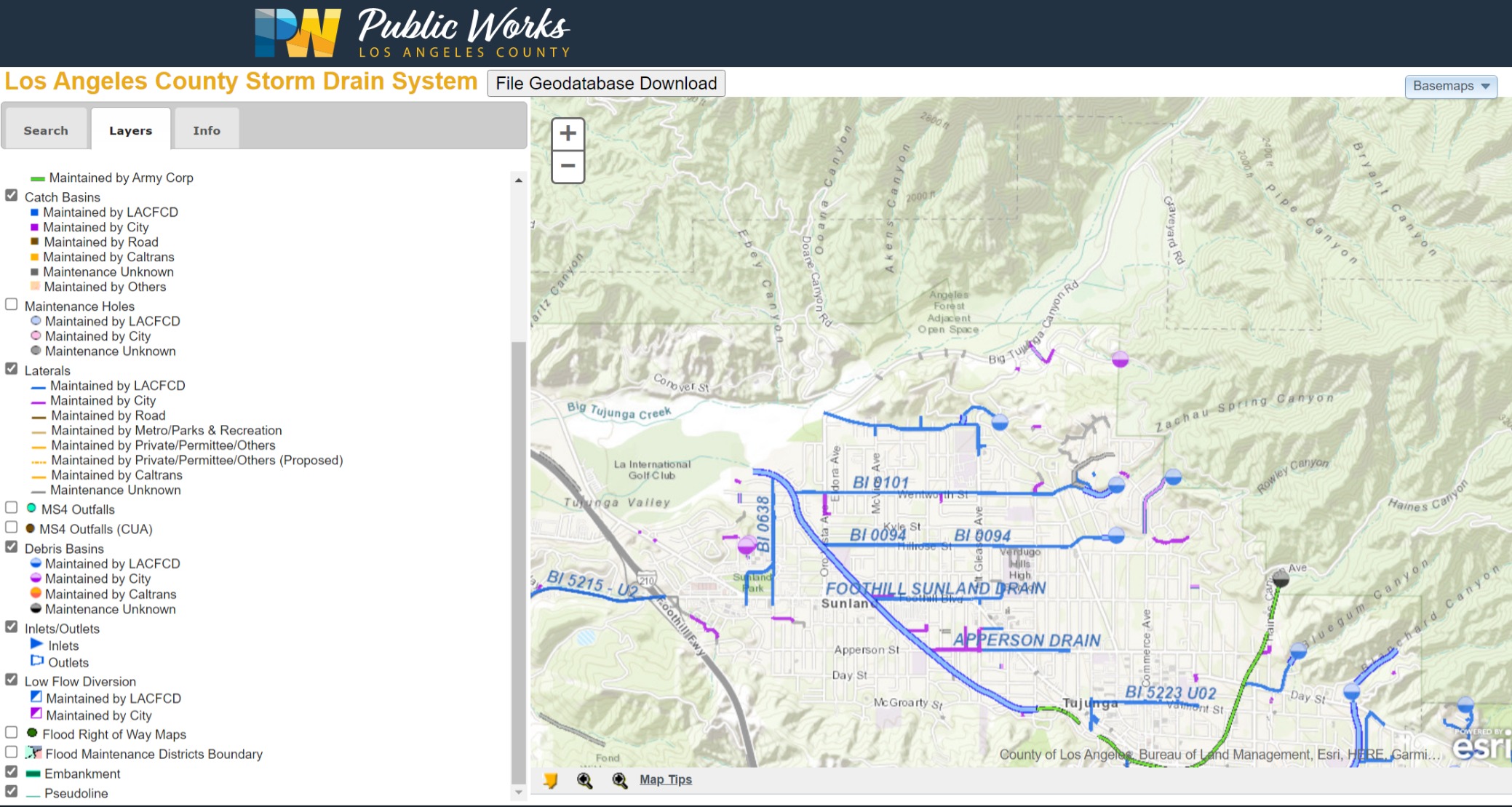
Big Tujunga and Little Tujunga. Stormdrains. Upcanyon provides no opportunity to sequester runoff, despite Big Tujunga Dam reducing outflows. There are basins to tap stormwater into the drainage system, but that’s terrain driven. Zachau Spring, Rowley, Haines, etc. Those could as easily be called ravines, imho, as ‘canyons’.
These stormdrains are rivers in all but name. I mean, look at the chunk of rock the ancient Tujunga River carved out of the San Gabriels and respect the flow. :o|
4 Likes
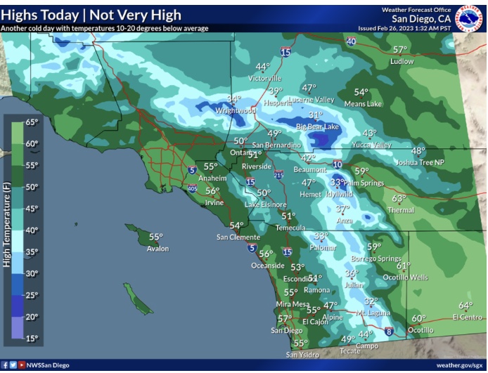
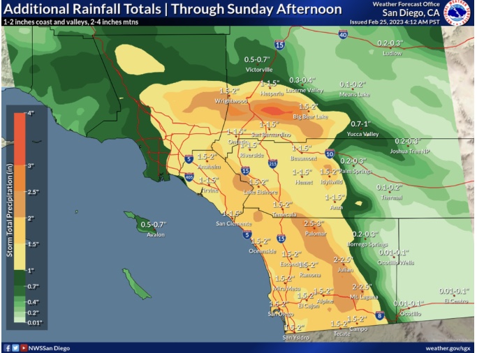
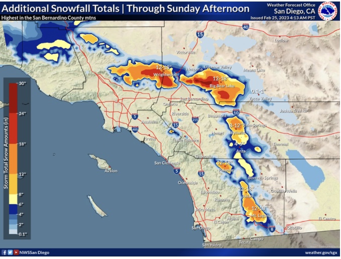
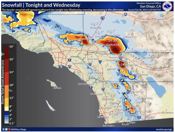
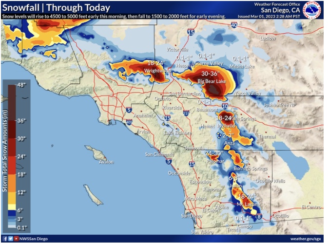
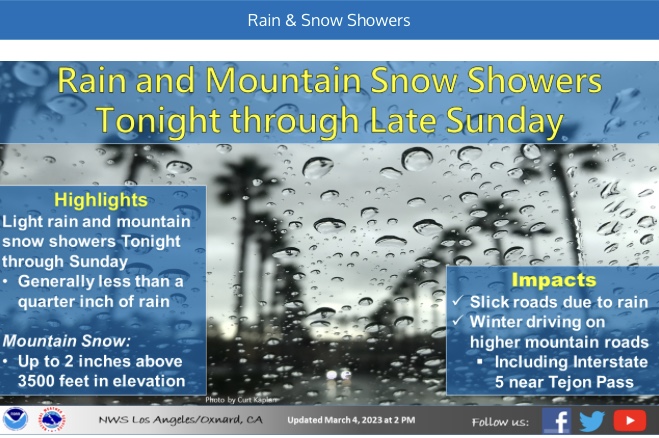
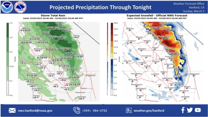
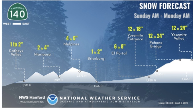
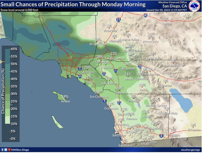
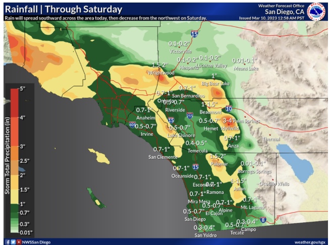
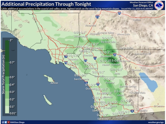
Current Rainfall & Snow Totals
https://forecast.weather.gov/product.php?site=sgx&issuedby=SGX&product=RRM
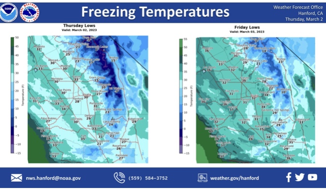
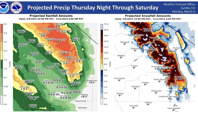
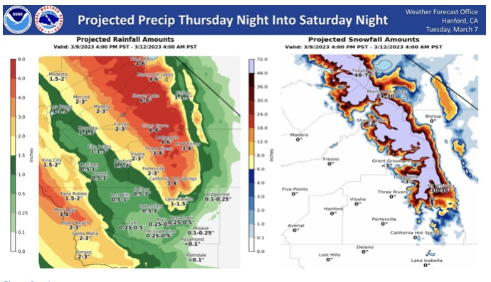
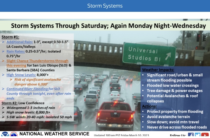
Forecast models have trended the next upper level low further SW over Southern CA, and held onto a little bit colder solution than previously shown.
If this track and upper level heights verify, than the snow level could drop to as low as 750 feet in the interior behind the cold front.
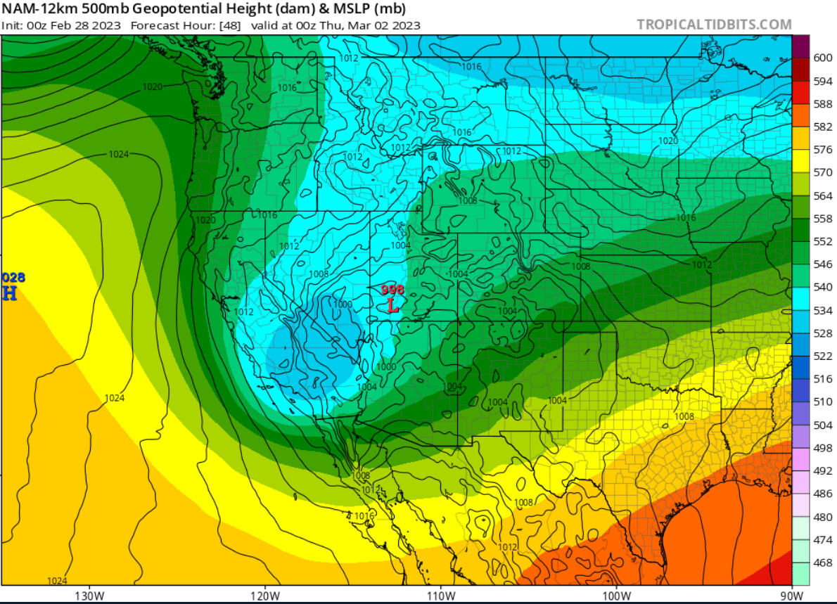
From NWS Hanford AFD
2 Likes
2 Likes
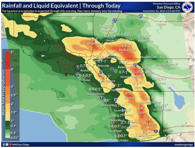
**Latest Rainfall & Snow Report **
https://forecast.weather.gov/product.php?site=sgx&issuedby=SGX&product=RRM
2 Likes
3 Likes
3 Likes
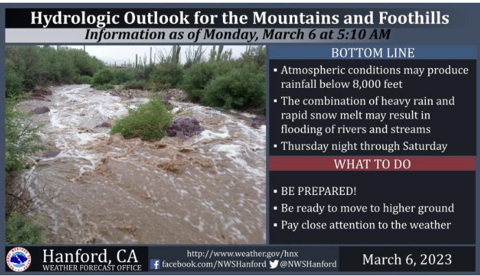
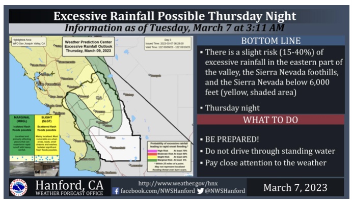
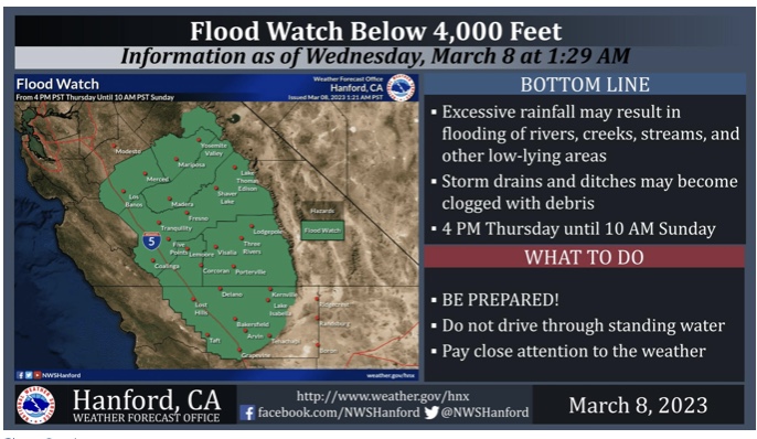
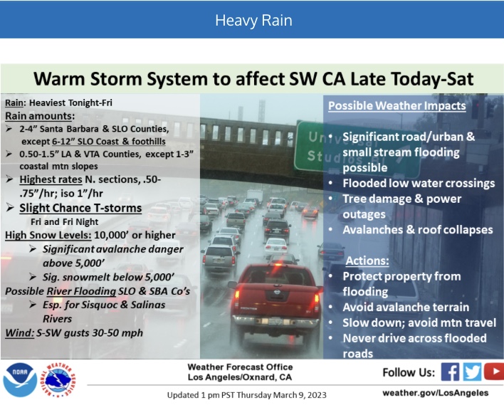
Flood Watch
Flood Watch
National Weather Service Hanford CA
1226 PM PST Tue Mar 7 2023
CAZ300>336-081200-
/O.NEW.KHNX.FA.A.0005.230310T0000Z-230312T1700Z/
/00000.0.ER.000000T0000Z.000000T0000Z.000000T0000Z.OO/
West Side Mountains north of 198-Los Banos - Dos Palos-Merced -
Madera - Mendota-Planada - Le Grand - Snelling-Coalinga - Avenal-
West Side of Fresno and Kings Counties-Caruthers - San Joaquin -
Selma-Fresno-Clovis-West Side Mountains South of 198-Buttonwillow -
Lost Hills - I5-Delano-Wasco-Shafter-Hanford - Corcoran - Lemoore-
Visalia - Porterville - Reedley-Buena Vista-Bakersfield-Southeast
San Joaquin Valley-South End San Joaquin Valley-Mariposa Madera
Foothills-Mariposa-Madera Lower Sierra-Fresno-Tulare Foothills-
Fresno-Tulare Lower Sierra-South End Sierra Foothills-South End of
the Lower Sierra-Yosemite NP outside of the valley-Yosemite Valley-
San Joaquin River Canyon-Upper San Joaquin River-Kaiser to Rodgers
Ridge-Kings Canyon NP-Grant Grove Area-Sequoia NP-South End of the
Upper Sierra-Kern River Valley-Piute Walker Basin-Tehachapi-
Grapevine-Frazier Mountain Communities-
Including the cities of Arvin, Kingsburg, Fish Camp, Cedar Grove,
Atwater, Giant Forest, Wasco, Alpaugh, Bass Lake, Tuolumne Meadows,
Lodgepole, Delano, Taft, Merced, North Fork, Five Points,
Bakersfield, Wawona, Los Banos, Yosemite Valley, Shafter, Sanger,
Visalia, Oakhurst, Lake Thomas Edison, Lake Wishon, Devils Postpile,
Avenal, Coalinga, San Luis Reservoir, Lamont, Hanford, Goshen, Hume
Lake, Richgrove, Camp Nelson, Lake Isabella, Lost Hills, Lemoore,
Lake Mcclure, Kerman, McKittrick, Huntington Lake, Grant Grove,
Corcoran, Mariposa, Madera, Lebec, Porterville, Buttonwillow,
Fresno, Le Grand, Blackwells Corner, Lemoore Station, Tulare,
Johnsondale, Tehachapi, Frazier Park, Kernville, Selma, Millerton
Lake, Coarsegold, Shaver Lake, Grapevine, El Portal, Auberry,
Parlier, Florence Lake, Kettleman City, and Planada
1226 PM PST Tue Mar 7 2023
…FLOOD WATCH IN EFFECT FROM THURSDAY AFTERNOON THROUGH SUNDAY
MORNING FOR ELEVATIONS BELOW 4000 FEET…
-
WHAT…Flooding caused by excessive rainfall is possible.
-
WHERE…A portion of central California, including the following
areas of Kern, Tulare, Kings, Fresno, Madera, Merced, Mariposa
Counties and Yosemite NP. -
WHEN…From Thursday afternoon through Sunday morning.
-
IMPACTS…Excessive runoff may result in flooding of rivers,
creeks, streams, and other low-lying and flood-prone locations.
Creeks and streams may rise out of their banks. Flooding may occur
in poor drainage and urban areas. Area creeks and streams are
running high and could flood with more heavy rain. -
ADDITIONAL DETAILS…
- Excessive Rainfall from heavy precipitation entering the
Central California Interior later on Thursday and into
Friday. - http://www.weather.gov/safety/flood
- Excessive Rainfall from heavy precipitation entering the
PRECAUTIONARY/PREPAREDNESS ACTIONS…
You should monitor later forecasts and be alert for possible Flood
Warnings. Those living in areas prone to flooding should be prepared
to take action should flooding develop.
&&
$$
CM
3 Likes
Been really busy at work
Mariposa County Sheriff’s Issue Evacuation Warning
Local Sheriff’s Offer Warnings and Resources
Madera County Sheriff’s Issues Evacuation Warning
National Weather Service Issues Flood Watch
1 Like

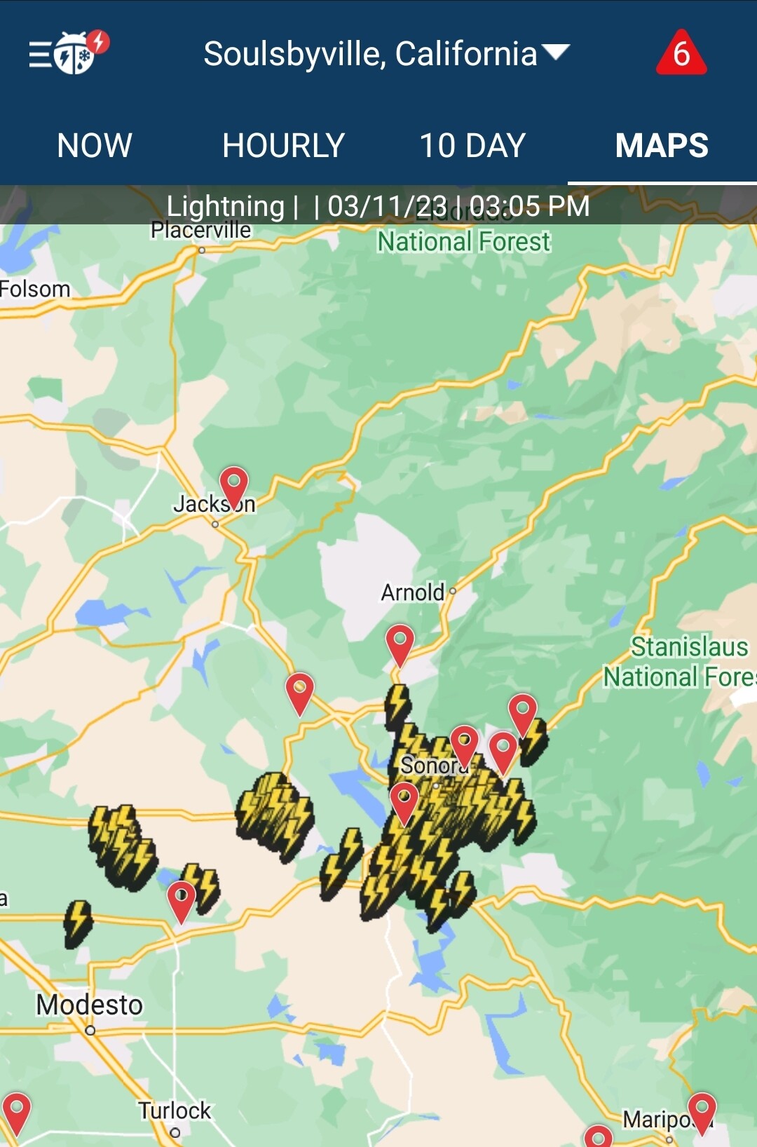
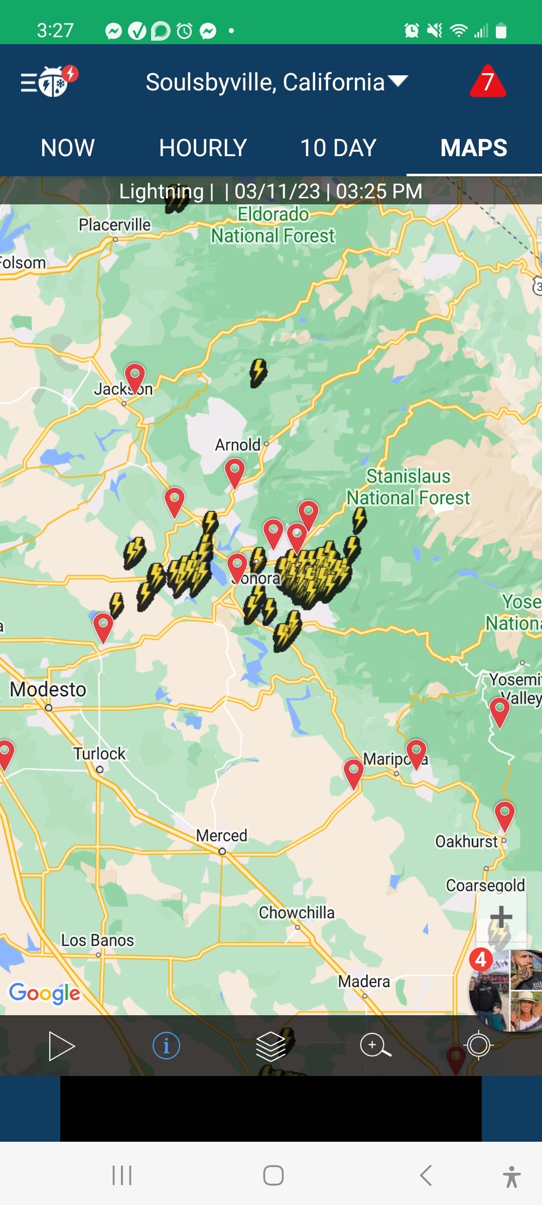
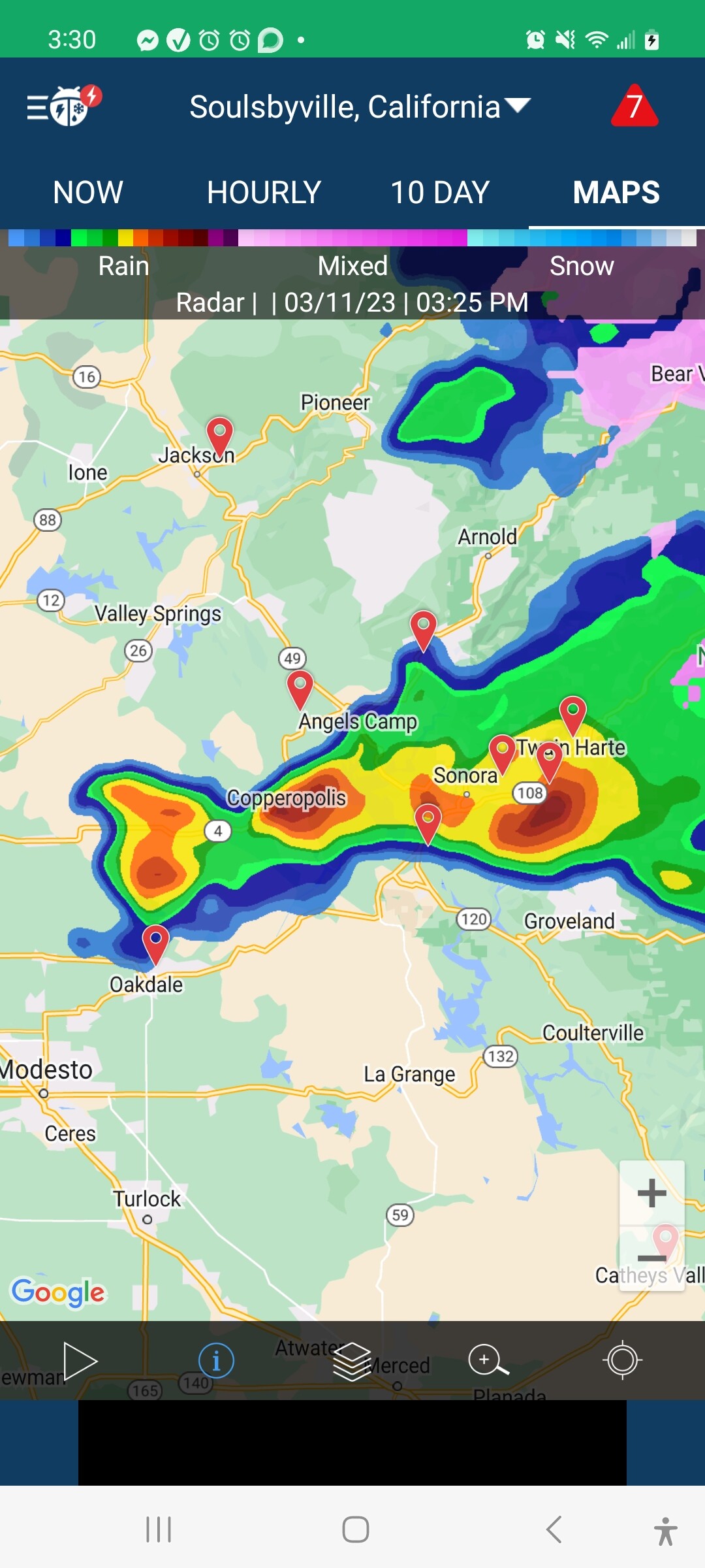
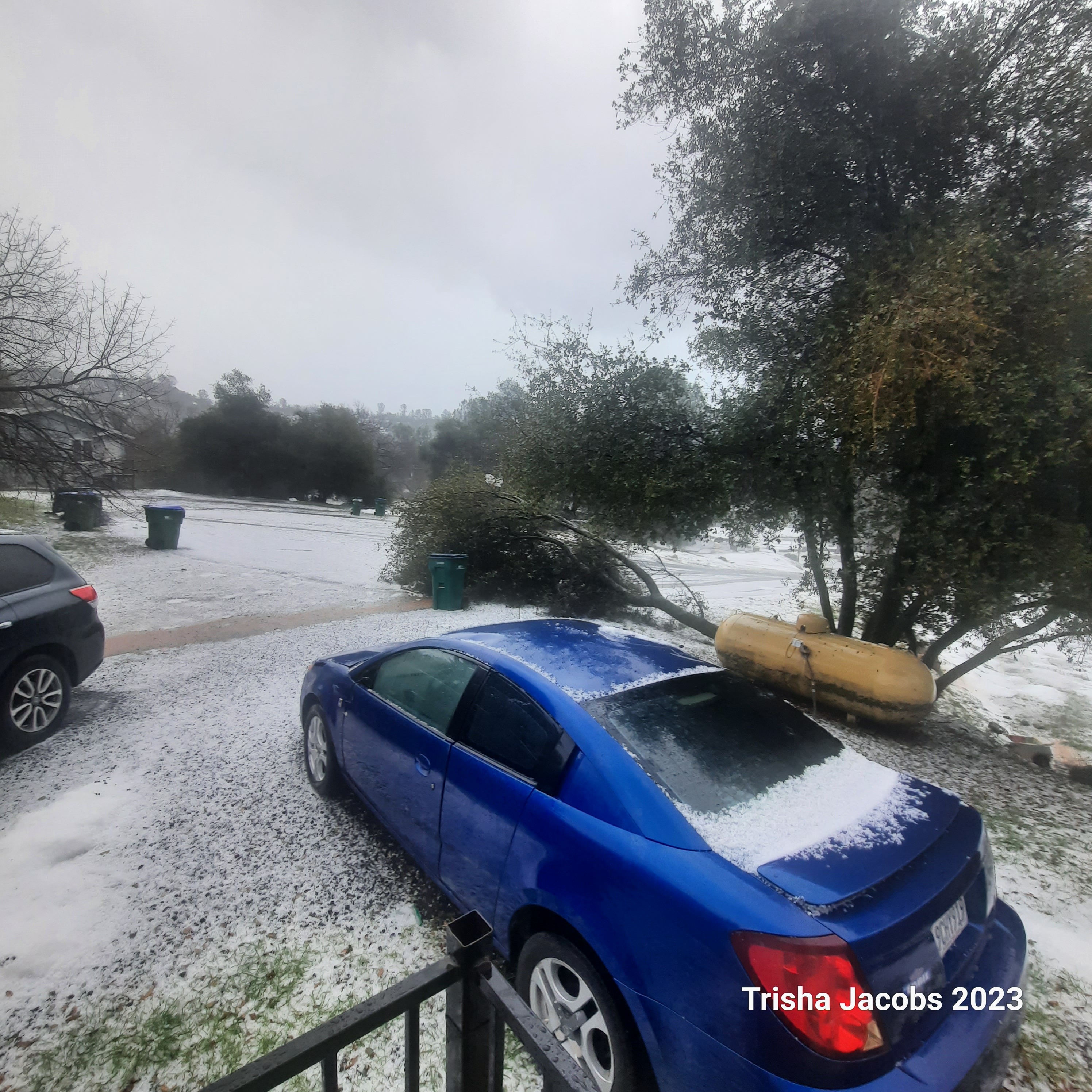
well the warnings were correct… that was the most insane thunderstorms I’ve ever experienced and we’re not done ! the last picture is hail not snow
1 Like
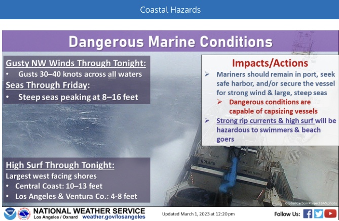
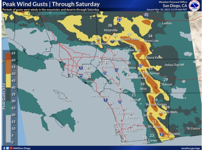
Subtropical like storm set to undergo deepening along the longwave trough axis and make landfall on Monday/Tuesday. Heavy winds and strong atmospheric river conditions likely for South Ops and North Ops. High resolution models may actually point towards a stronger pressure decrease than operational global models. Those frames on the models will be out soon. Moderate risk of wind damage, high risk of flooding
3 Likes
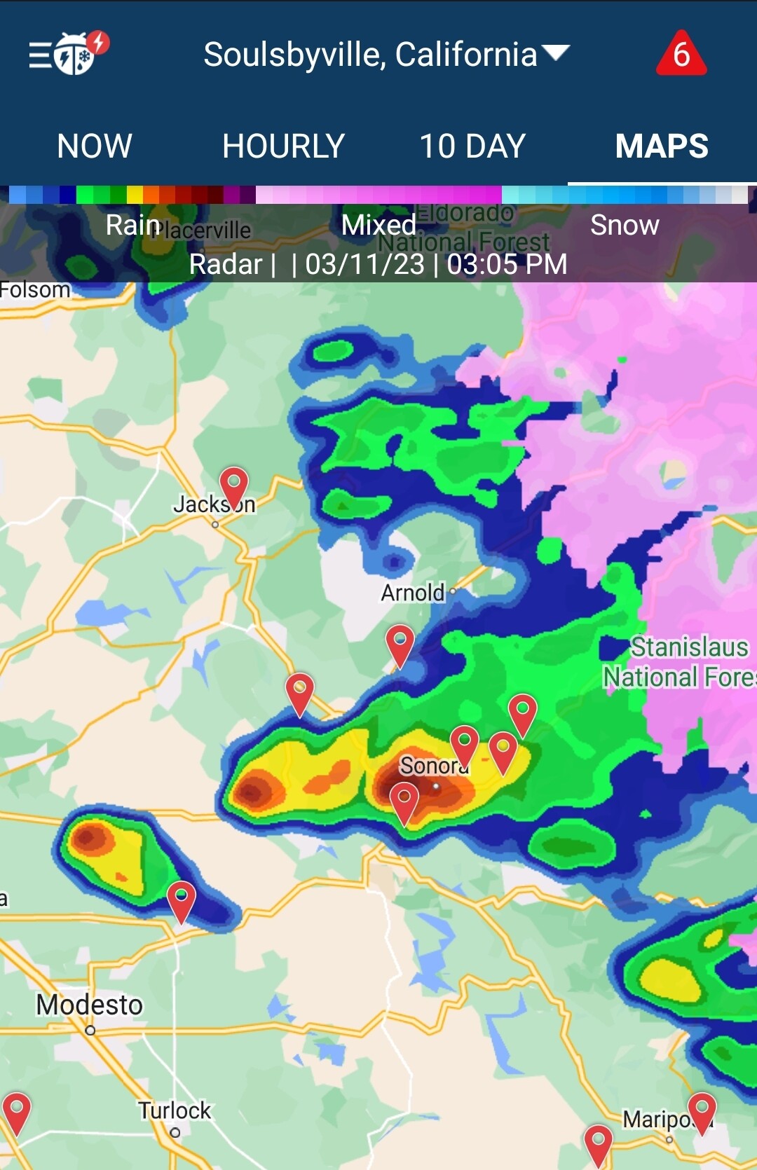
Yup, have not seen this since growing up in Texas. We were under a Tornado warning. 1.5 inches in less than 30min. 1/4 hail had to throw a tarp over my truck. Hail was over an inch deep. Flooding everywhere in Sonora and Jamestown. A lot of road closures due to flooding. Have some great video of lightning and Hail but can’t get it to load up on this site. Power out and trees down everywhere. Working structure in Jamestown when all this was going on. Heard Draper Mine and Via Este were flooding up by you across HWY 108. Sounds like some business has water coming out their front door in Sonora. Rawhide at Tuttletown is a Crapshow. Just Chaos everywhere!
1 Like