South Ops Weather-2023

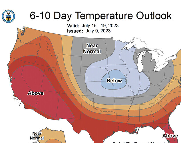
On the GFS, which is not reliable for long term forecasting it is suggested that the heatwave could last in perpetuity. 500mb heights do not change much over the duration of 10 days. I could see this as a feasibility because the high pressure systems are on a predictable amplification cycle, and essentially what happens is that the subtropical high pressure system builds across northern Mexico , then hands off to the North Pacific high, then hands back off to the subtropical high pressure system. This is reflected on EC and GFS ensemble mean. The heatwave would be persistent with temperatures 8-15 degrees above normal, and as sea surface temperatures warm temperatures near the coast will likely bump up. There will be Gulf surges but because the ridge will be overhead convection could be shallow and suppressed. Bottom line is this looks like a very dangerous situation of long duration heat perhaps lasting for 10 days or more.

Any sort of fuel moisture excesses should be wiped out at all elevations.

10 Likes

![Screen Shot 2023-07-09 at 12.47.22 PM|634x500]

8 Likes

Published: Jul 10, 2023 7:23:41 AM MT

7 Likes

Upper level heights are expected to remain around the same for the extended period, which will continue the heat. The high pressure system will begin to drift north east across the 4-corners region and this will begin to set up monsoonal flow over the area by early next week. Higher than normal PWAT values will begin to filter into the area, but because there is a lack of low level moisture established across the desert SW… the risk of thunderstorms will bring a chance of mostly dry thunderstorms to start.

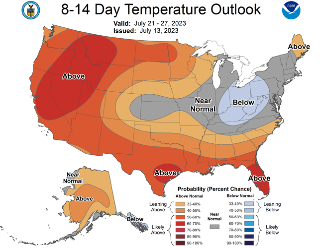
Cooler than average SST lead to gusty onshore winds which will cause fire weather issues across desert slopes. Based on all model data, the heat wave should continue through at least the 22nd and perhaps longer. A marine heat wave could develop due to the strong trade winds aloft, which would bump up SST and overall humidities towards the end of the month.

11 Likes

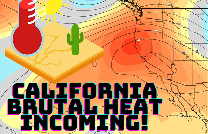
Both the GFS and ECMWF continue to keep upper level heights around 595 DM over Southern operations area for the entire forecast period. Temperatures really don’t fall much from their peaks. We have dealt with heatwaves in the past but the problem at this juncture is if we are going to spend the next 10-14 days with these heights over us, what will the climatological peak heat look like in August? It could be quite intense.

6 Likes

Good daily videos about Ca. weather: https://youtu.be/T-4v4KzkZeg

5 Likes

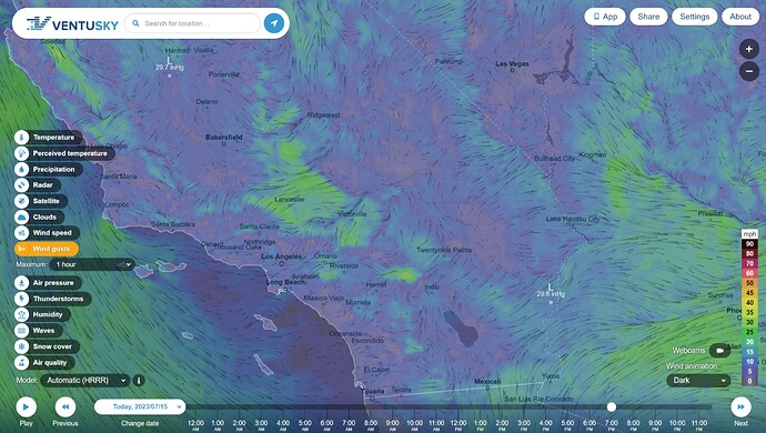
7pm wind forecast for SoCal. Sunset is at 8pm.

Spot rH 30% at Carona, 20% at Hemet and drops to about 10% in the Rabbit complex area.

4 Likes

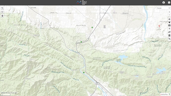
San Bernadino NF has several small starts in the Cajon Pass.

Oak, Oak2, Ramp and whatever “Wf/ar/32” spells with moderate growth potential. No acreage reported.

3 Likes

Your right lot of potential in that area, has lots of fire history. But not the Grapevine that would be the Cajon Pass.

2 Likes

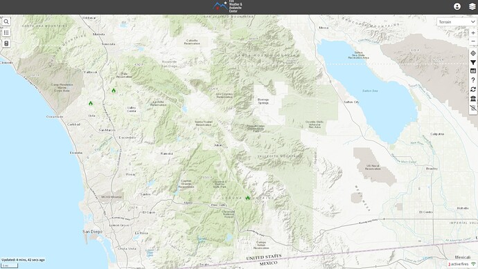
Cleveland NF is also looking at a few starts. One mutual aid, “Fairview” in Vista, and a couple more that haven’t been named, yet.

1 Like

Ah. Thanks.

2 Likes

Fairview is a SDU fire that is FROS at 2 acres. Other fire is in the exact same area as the Canyon fire on Sunday but now called the Couser Fire. It also is FROS at 3-5 acres. Couser Canyon and Lilac

3 Likes

Significant westerlies in the Laguna Mountains to 30mph. Ain’t fit for man nor beast in the desert, right now.

2 Likes

These darker areas are under 18-25mph gusts, 100+ degrees and 10-20% humidity. It’s drying fast.

6 Likes

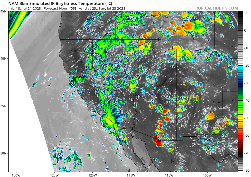
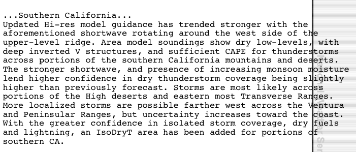
Mesoscale models bring a tropical wave from the east across all of California starting tomorrow morning. The low levels of the atmosphere remain dry. Most of the moisture streaming across will be in the form of mid level clouds but as is always possible there could be lightning associated with these clouds, especially during the nocturnal phase.

The forecast ensembles are keeping the ridge of high pressure centered over the 4 corners region for the next 7 days, with disagreement on where it will pivot at the end of the forecast window. Upper level heights will remain above normal, but the monsoonal trough should be over the area for the extended period. This will continue to increase low level moisture and heat index values, with thunderstorm potential increasing. It will be interesting to watch future Emily in the Atlantic basin, because it will likely greatly influence our weather pattern around August 1st if it is near the United States.

12 Likes

10 Likes

8 Likes

3 Likes

The nonsoon continues. Anomalous high pressure over Northern Mexico continues to shift the flow to the SW and keeps things dry. This is detrimental to most of the western US as it keeps the deeper low level moisture from ever getting established when the monsoonal flow re-develops. The moisture flowing in has a tendency to be in the middle layer of the atmosphere, and we are running out of runway for major monsoonal thunderstorms.

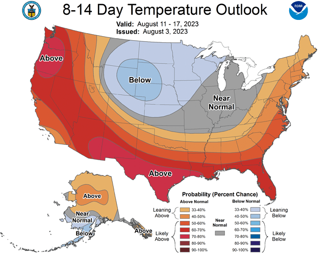
Attention should be placed towards the middle of the month. The GFS, ECMWF, and CMC show a Rex blocking establishing itself off of the coast of Oregon. This could bring an extreme heat wave to the West coast if the atmosphere becomes amplified.

Rex Block Explanation

7 Likes

Live Fuel Moisture, LAcFD:
https://fire.lacounty.gov/fire-weather-danger/

3 Likes