Yes Chief.
9 Likes
San Diego Coast this morning, Sun feels warm, sky is clear, no marine layer in sight. Little bit of dew in the shaded areas. No wind. Yesterday the Marine layer hung around till about noon.
6 Likes
One of the most comfortable mornings in a while here in SD. It was even a little crisp overnight. I am loving this weather although it looks to be short lived.
12 Likes
Looks like Rachel is going to be Marie number two. Gigantic storm with a similar track. There should be a large southerly swell… and now that the coastal trapped kelvin wave is here maybe it will be destructive again. The big difference now is that the great basin and desert SW are cooling off, so there is the offshore gradients daily. So it looks like we are going to roast once again as the atmosphere couples to the surface features out over the ocean. The juxtaposition between the warm conditions over the ocean and the rapidly cooling Great Basin will continue to lend potential for strong offshore wind events should an inside slider track into the Great Basin. Weirdest weather year here ever.
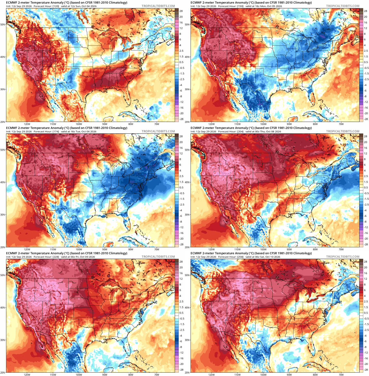
So once again, the southerly swell and downwelling combined with the coastal trapped Kelvin wave from this broad wind field storm will send a large amount of warm water towards Southern California… also patching up Polo’s cold wake.
19 Likes
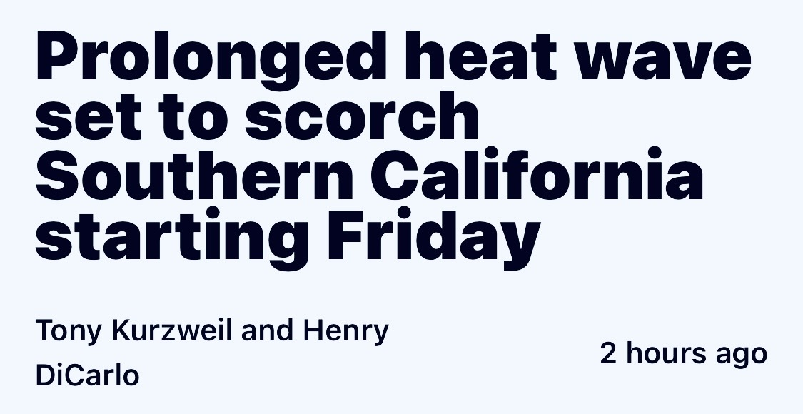
SDG&E is sending out PSPS 24 to 48 hour notifications. Kinda strange since SAWTI isn’t lit up and only shows it being hot.
4 Likes
Second round of SDG&E PSPS notifications. Just pointing out that this is odd since we have had low-moderate Santa Ana events where no notifications were sent. Forecast is 102 ish for the next 3-4 days.
On the bright side this will allow me to extensively test my theories on “Buoyancy of human fat cells in residential swimming pools”.
12 Likes
The sheer scale of the destruction that has been caused by power company equipment under weather duress, and the huge monetary settlements following those disasters, has boosted awareness, preparedness, and foresight.
Nobody wants their power turned off. No utility wants to turn off the power, but if the potential negative consequences of not doing so lifts the potential cost by orders of magnitude, the choice is obvious for the execs and managers who would prefer that their heads not roll.
5 Likes
Agree with you and understand the rationale quite well. SDG&E’s “Cole Grade” weather station is located on my property and have had multiple discussions with their weather team since inception.
This is just odd to me because it is going to be hot and not windy. The fires have started in windy conditions. Some hot and some cold.
2 Likes
SDG&Es website calls for Santa Ana conditions Fri-Sun. Which would constitute a PSPS in some areas. I didn’t get one but VC is more wind prone. You should be good though, I did hundreds of LE38s up there in 2001 
6 Likes
If you check out Michael Snyder, he discusses the models calling for strong east winds starting Friday.
4 Likes
This weather reminds me of the Oakland Hills Fire minus the wind. Warm start for October.
4 Likes
Thanks to both you and RedFive. Much appreciated.
Not sure which scenario I like better. Hot, stale and humid or Hot, windy and dry. LOL
5 Likes
nws is calling for gusts 25 friday 30 saturday for valley center. might not be a hurricane but definetly will get a fire moving
6 Likes
It hit 100 today In Alpine (SD County), East Wind has been Blowing since early this morning 10-15 MPH RH 25
Forecasting wind gust tomorrow to 50 MPH in the Favorite locations.. A couple of SDG&E Raws Stations are on the Bubble.
A crazy weather year for sure.
for PSPS.
11 Likes
It’s becoming more likely that Rachel is going to recurve. All of the ensembles and most of the modeling agrees. What I question is if the modeling captures the updated sea surface temperatures from the heat wave and coastal trapped Kelvin wave forcing the 26° isotherm all the way up to 30N. There will be an incredibly anomalous area of sea surface temperatures that could actually strengthen the storm as it gets closer to Baja. It’s looking very likely that there will be a Santa Ana wind event in synchronization with the storm, with it potentially moving into Arizona. Will update as we get closer.
19 Likes
Any general timetable? I am seeing predictions of Rachel moisture in far SoCal this coming weekend.
3 Likes
Monday.. tonight’s runs are pretty wild. We’re still a little too far out to confidently say. But I really contemplate this hypothetical science of having a 985 mbar surface low from Rachel with surface high pressure building into the great basin. It seems like a crazy situation
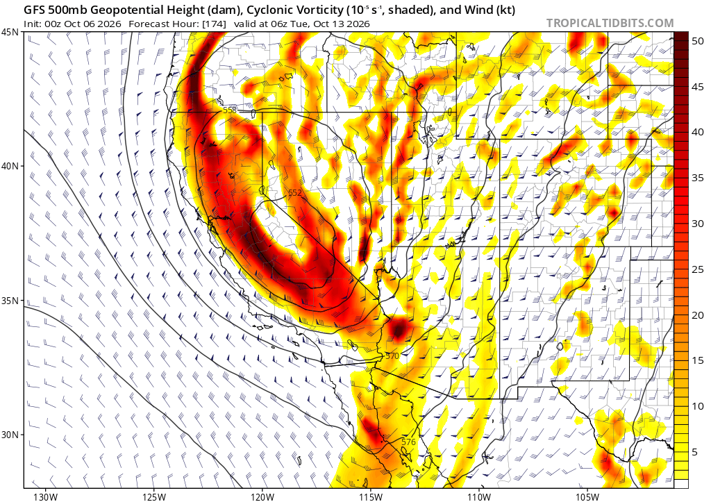
Vorticity off of the charts.
13 Likes
Which means
6 Likes
Too much wind!
7 Likes