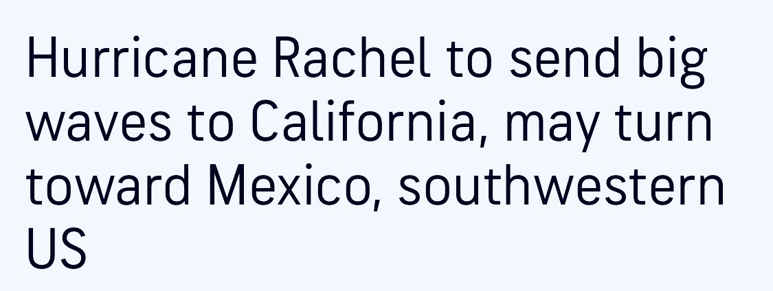
Enjoy your posts but literally none of the solutions show a pattern that would be impactful from a fire weather perspective. All solutions suggest precipitation, cooler temps, higher RH. Yes some winds but no doomsday scenarios and certainly not the mythical Santa Ana/East wind on the back side of Rachel.
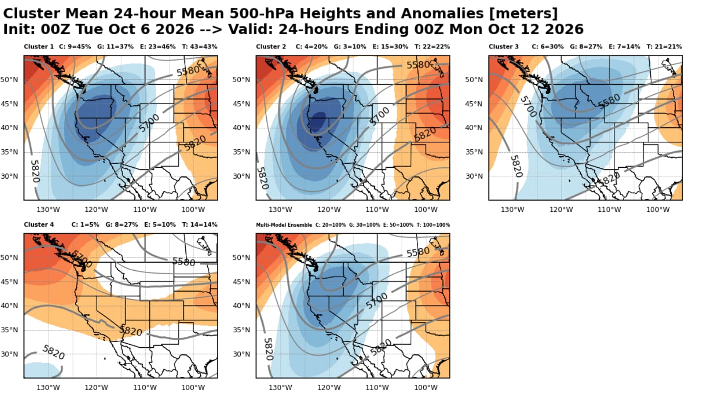
Understandable. I think we should just wait until the high resolution models come into frame. The EC shows a perfect set up for a Santa Ana wind event on the control run with no precipitation. Let’s just all take a moment to appreciate that we’re likely going to have another historic type tropical cyclone event (or sub) and finally a change in the weather.
Well - while it isn’t 100 percent official yet - sure seems like @anvilhead 's prediction from months ago has a pretty good shot at coming true this weekend.
https://www.nhc.noaa.gov/refresh/graphics_ep3+shtml/072043.shtml?cone#contents
Most of the modeling shows us getting rain as of now, but I will still hold out for the exact track and high resolution models. It was pretty obvious this was the route based on the sigil put out in June. I contemplate if Simon can actually continue trending further to the left and impact the Arizona area as well. We will have to watch that. I also contemplate another storm closer to the full moon for the southwest. As far as “doomsday” type scenarios, I can only interpret based on the bigger picture… I’m not posting anything here, but most people have a general idea about what’s going on and can put pieces together in their own mind.
Additionally, I am wondering if the El Niño could have a double maximum based on some of the modeling showing another increase in sea surface temperatures for 2027 in the Nino regions. It’s still too early to use that kind of modeling at all… but if we have to look at the much larger angle of this thing then it would also make sense.
I’ll collect half a W for this.
Correct me if i am wrong , i seem to recall about 10 years or so ago , we were suppsed to have a massive never seen before el nino , and we ended up getting about normal rainfall ? Iirc the scientific community said the water was too warm to do its usual el nino thing
Im genuinelly curious what will happen this winter for so cal , as this has been a rather odd summer
This is what I am also thinking. What if we end up with a very dry year and just run it back for winter of 2027 before having the epic rainfall? Then the double maximum El Niño on the models would make sense. Although all of the climate models are showing above average rainfall this season, we have seen that script before and El Niño does not guarantee above average precipitation.
And that’s the difference between climate and weather. Weather is short, climate is long. They co-exist, neither is wrong.
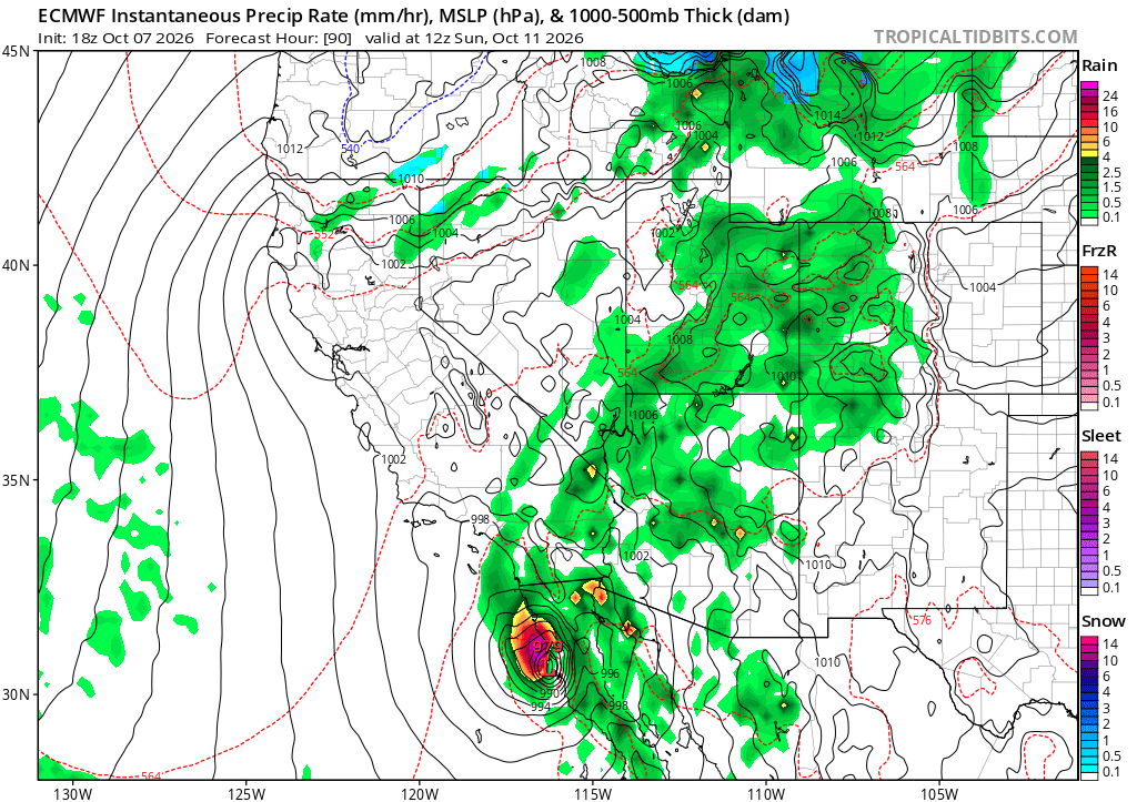
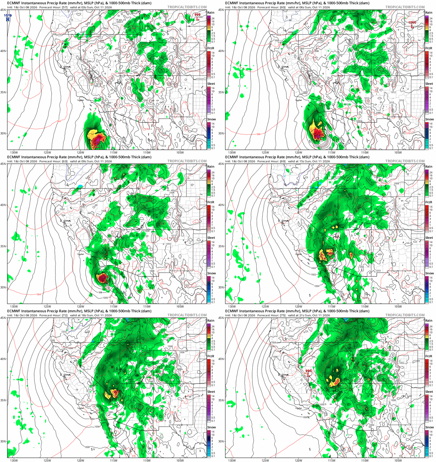
I’m really hoping that the European model pans out. It would be a cool situation. Rachel approaches at 979 MB 70 miles south of San Diego. Fire weather concerns likely due to the strong NW-SE gradient. As the storm moves further inland into the Imperial Valley there would be heavy rain on the desert slopes with light rain west of the mountains.
-Windy
-Fire Wx concerns
-Rain, but not enough to end fire season
-The crazy scenario of having a strong compact surface low pressure east of the mountains
Should be pretty clear what the exact track will be by 12z tomorrow.
This happened in 2022 during the Fairview Fire in Riverside.
Tropical Storm Kay did what you described, except she stayed offshore and really ramped up the winds before the rain came.
Fire ripped out of Hemet/Sage towards Temecula before the rain came and what was a fire fight, turned into flood fight.
All of the local news “Weather Guessers” will be giddy if this materializes. Watch for a run on AquaNet Super hold at Walmart because they will all try to outdo each other with the wind blown shots. Heck…Geraldo Rivera might even show up hoping to rescue a gopher snake from a small puddle. 
It’s truly kind of just a nuanced weather nerd event at this point. We get strong onshore/NW winds every fall. Probably will not be much different than that and the media will hype it up like usual. The only place I do worry about is the flooding in the deserts and the power infrastructure heading out to Vegas. But to me it seems like a lot of intention and manifestation was put into this for it to be a nothingburger, which is why I figured it out as early as June.
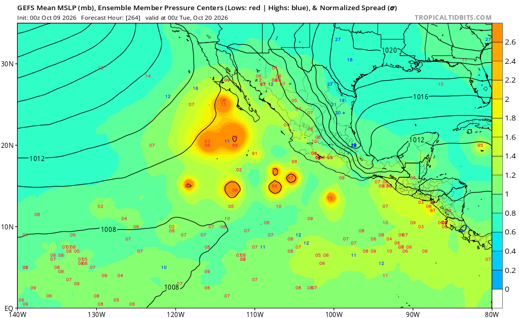
So - when WAS the last time we had a tropical storm watch for San Diego County?
Hilary in 2023
Right now it still looks like a 50/50 split that we get heavy rain or we get nothing from tropical storm Rachael. ABout everey model, including the high resolution models have two tracks.
The first senario is that it makes landfall well into Baja California and gives no rain impacts for any of socal besides the Desert areas.
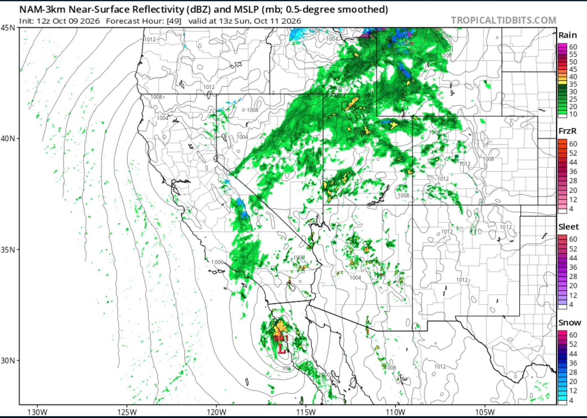
The second senario is that it takes a farther track north and gives us pretty severe impacts, would give us a lot of rain in a short amount of time and some wind. In my opinion, this model the Euro is more close to the 90th percentile, so this is a pretty bold forcast but cool to look at for now.

SoOps weather forcast mentioned a short lived Santa Ana wind even Sat/Sun before TS Rachel makes landfall.
@anvilhead
Keep up your EXCELLENT work!
Edit
And now a RFW Saturday for the Eastern Sierras
Thank you. I also continue to contemplate a stronger storm for the desert southwest. It seems like the track of Rachel and Simon will be favorable for continued downwelling to the right and left of each storm so that the thermocline continues to deepen along the waters off of Baja. With the incredible amount of moisture being established over Baja and the desert southwest there will be no issue with dry air for the next storm shown on the ensemble clusters. Seems like we have one more shot at this coming up towards the full moon.
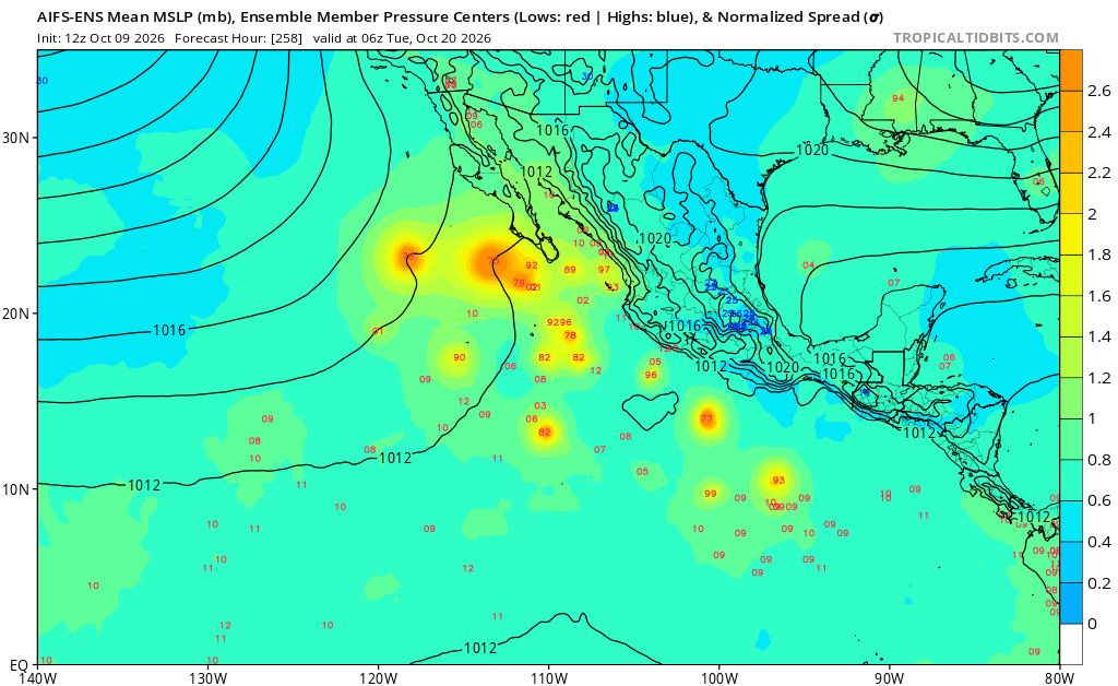
Also will add the any effects of rain over Southern California will be negated as strong surface high pressure builds into the great basin later this week leading to moderate to potentially strong offshore winds.
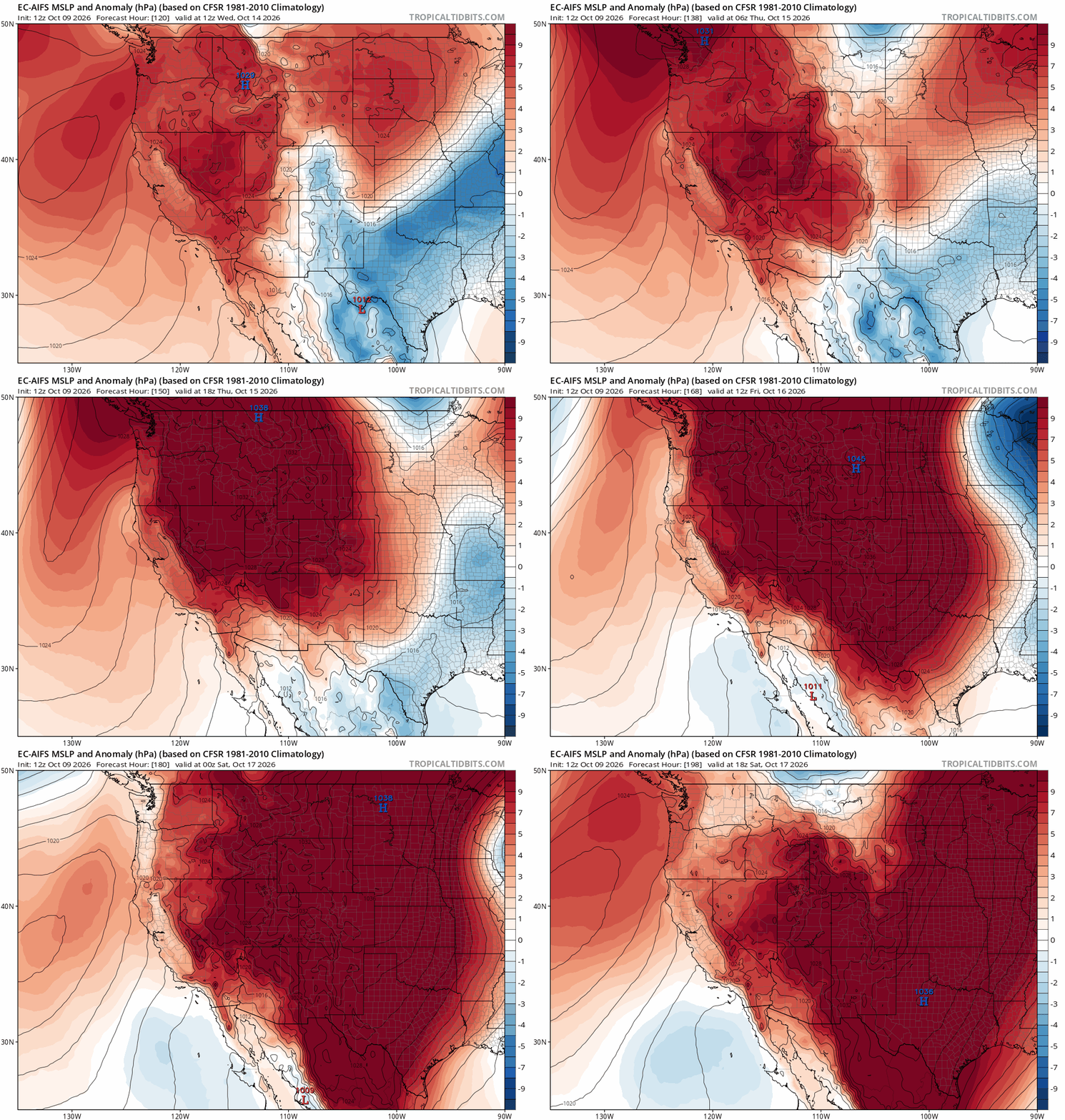
Don’t know who or what a Chad Crilley is. Showed up in my preferences when chasing the PSPS weather a week or so ago. Seems to be a guy who is doing TV station type San Diego weather on youtube. Sez he is going to do Rachel updates throughout the night and into tomorrow.
And just like that a fire on LAC/ANF Placerita/East Santa Clarita fuel stick at camp 9 is 23 but wind is 21G45
Camp 9 cams are fogged over 100% rh per the raws. Crazy weather at 4000 ft. Just above the fire
ERC for that area forecast 43rd percentile BI 38
Wind always has the last say
