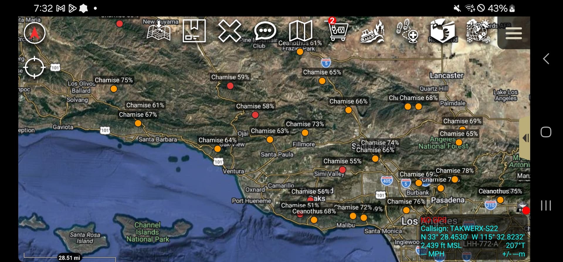
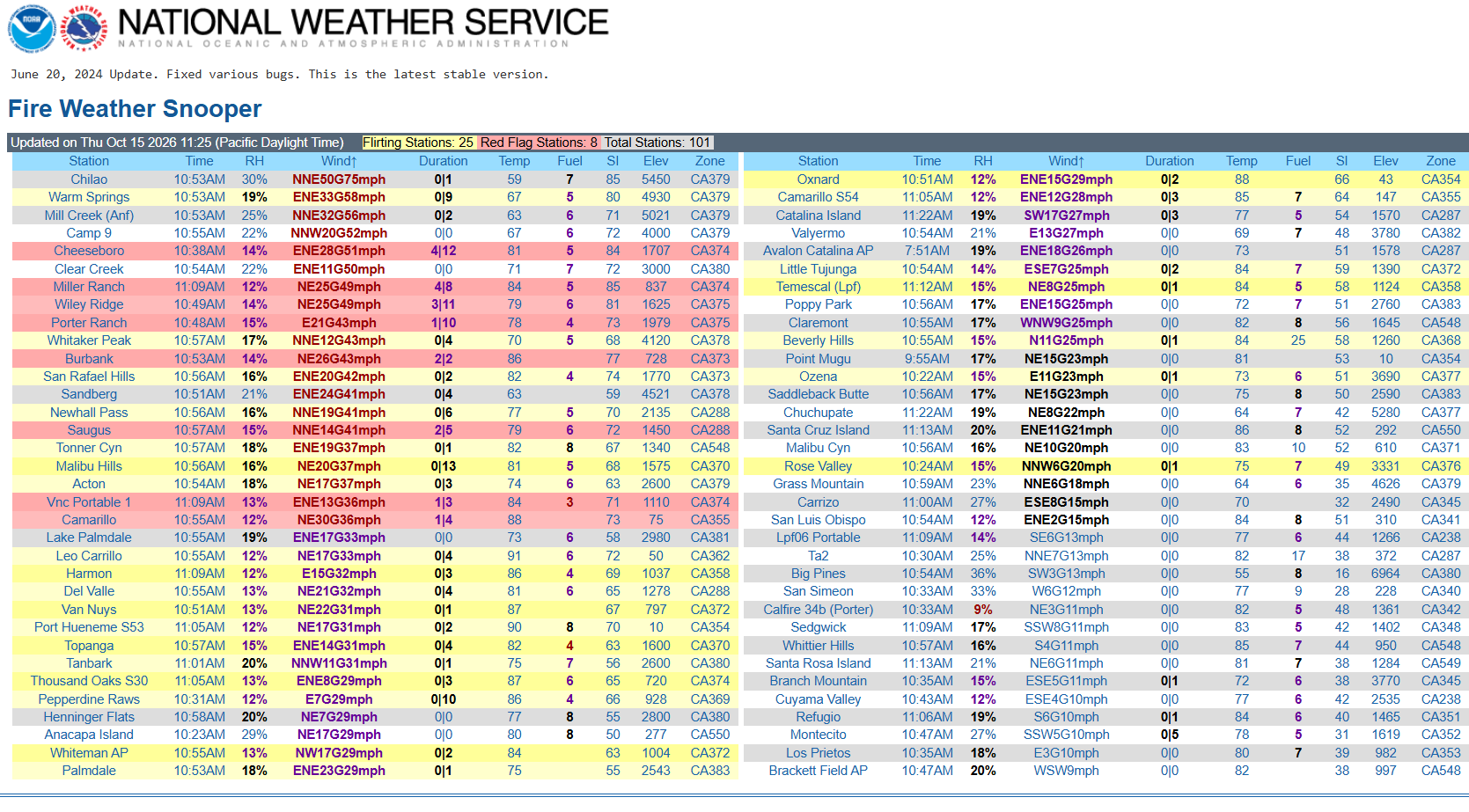
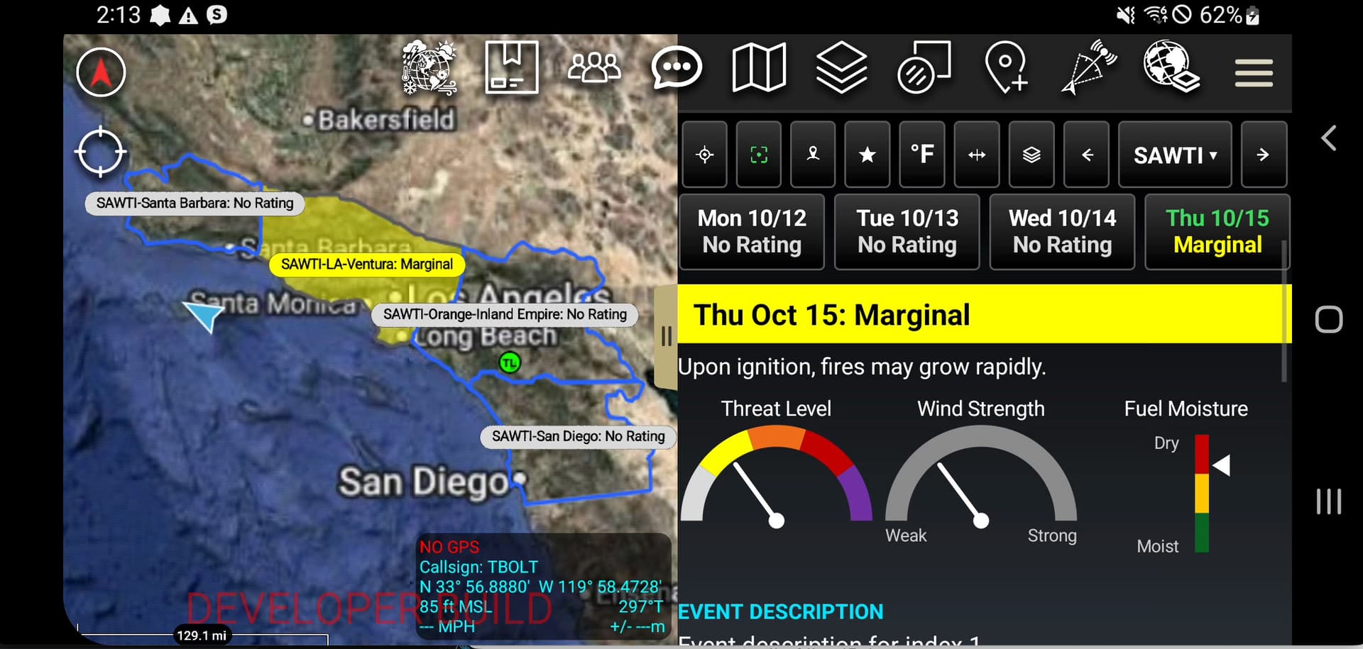
On pace for a moderate to strong Santa Ana wind event. It will be a long duration event, and very warm west of the mountains. We will likely forget that we received any rainfall from Rachel by Monday below 4000’. Ventura County and Western LA county did not receive as much rain and thus I would expect NWS to issue red flag warnings for those locations
15 Likes
FROM NWS LA
Santa Ana winds will really pick up Thursday into Friday as all the ingredients appear be in place and properly aligned. We have above normal confidence in moderate to strong Santa Ana winds during this timeframe. The latest ensemble pressure gradients indicate that the peak offshore gradient will occur Friday morning somewhere in the 5-7 mb range. Couple that with 50kt winds at 850 mb and very strong upper level subsidence, that should result in peak winds of 50-70 mph in the San Gabriel mountains and 35-55mph across the LA/Ventura valleys as well as the Ventura County coastal areas and Santa Monica mountains. This will likely be a hot and dry Santa Ana, so large and fast moving fires are a concern heading into this time frame. As a reminder, Santa Anawinds typically do not impact the LA Metro area and LA coast.
11 Likes
Pretty good weather report although his thumbnail choice is questionable
5 Likes
Inland San Diego County valleys and mountains received a lot more rain than originally expected. Received 3+ inches in Valley Center and Palomar Mountain was over 5. Coastal areas not so much and the same can be said for the counties to the north. Seems like most of the rain soaked in and only a few reports of flooding.
Lots of dead vegetation because of the protracted hot and dry weather. Rain isn’t going to bring it back and the water in the ground will take some time to rejuvenate the stressed but living vegetation. See a possibility where the ground is still wet, but plenty of dry combustibles once the Santa Ana hair dryer starts. Hoping I’m wrong, but counties to the north of San Diego are likely more at risk.
7 Likes
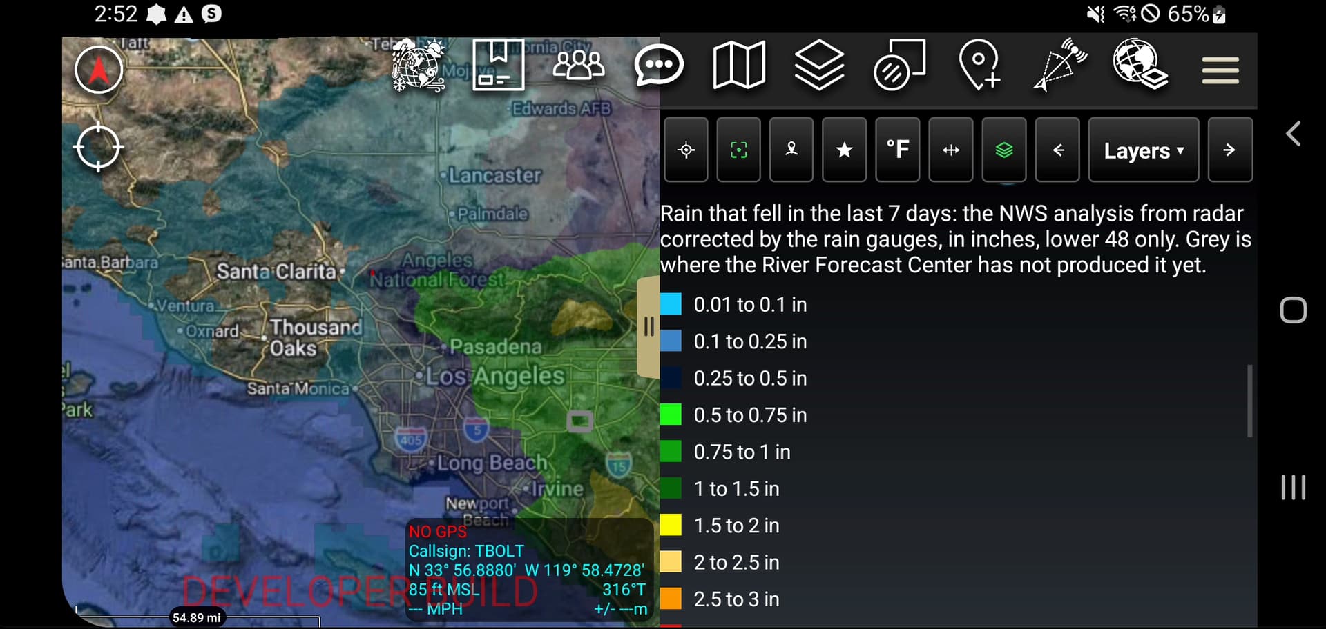
Here is last 7 days of rain totals. That red spec in eastern santa clarita is the Bike fire on sunday.
4 Likes
NWS Los Angeles, Updated October 13, 2026
…RED FLAG WARNING IN EFFECT FROM THURSDAY MORNING THROUGH
FRIDAY EVENING FOR MODERATE TO LOCALLY STRONG SANTA ANA WINDS AND
LOW RELATIVE HUMIDITY OVER THE MUCH OF LOS ANGELES AND VENTURA
COUNTIES…
…WIDESPREAD ELEVATED FIRE WEATHER CONDITIONS THROUGH SATURDAY
DUE TO DRY AND VERY WARM WITH LOCALLY GUSTY WINDS…
COASTAL FLOODING:
● Tides will lower each day through Monday, but southerly swell continues.
● Continued but less severe impacts to most vulnerable areas.
● Increasing westerly waves for the middle of next week.
WEDNESDAY
● Assessment: Elevated Fire Weather conditions in windier hills.
● Winds: NE-E 10-20 mph with gusts to 30 mph in wind-prone hills & mountains
● Humidity: Minimums 10-25% common.
● Temperature: Highs 75-85 common. Cool nights.
THURSDAY-SATURDAY
● Assessment:
○ Risks for fast-moving fires and extreme fire behavior
■ High risk over Los Angeles and Ventura Counties.
● Red Flag Warnings in effect 6am Thursday to 10pm Friday.
● Potential for targeted extensions through Saturday.
■ Moderate risk over interior Santa Barbara and SLO Counties.
● Fire Weather Watch in effect 3am to 6pm Friday.
○ Otherwise, widespread elevated fire weather conditions.
○ High risk for heat illness for all coastal areas.
■ Heat Advisory in effect from 10am Thursday through 8pm Saturday.
● Winds:
○ LA & Ventura Counties:
■ Strongest Thursday afternoon through Friday afternoon.
■ Mountains: NE-E 25-40 mph with gusts of 50-70 mph common.
■ Valleys & Coasts: NE-E 20-30 mph with gusts of 35-50 mph common.
■ Catalina Island: NE 10-20 mph with gusts of 20-30 mph.
○ Santa Barbara & SLO Counties:
■ Strongest Friday morning and afternoon.
■ Mountains: E 15-25 mph with gusts of 30-40 mph common.
■ Central Coast Hills & Interior Valleys: E 8-15 mph with gusts to 25 mph.
○ Peak LAX-DAG gradient -6 to -7 millibars. Moderate upper level support.
● Humidity: Minimums 5-15% common, except 10-20% in higher mountains.
○ Overnight recoveries: 12-25% common (poor) in wind prone areas & foothills.
○ Humidities might rise a little Friday and Saturday, but likely little effect on fuels.
● Temperatures: Highs 85-95 common, warmest at the coast. (records unlikely).
○ Lows 55-65 common, except 65-75 in windier areas and foothills.
OUTLOOK - Sunday through Wednesday:
● Improved humidities and lower temperatures.
● Tuesday-Wednesday:
○ W-NW wind gusts 20-40 mph over much of the area,
○ 30-50% chance of light rain.
ADDITIONAL INFORMATION:
● Forecast: Fire Weather Planning Forecast (FWFLOX)
● Current Conditions: Fire Weather Snooper
● Fire One Page
If you have any questions, please call us at 805-988-6626 (unlisted). Thank You
If you would like to remain on our Fire Weather Notes distribution list, please register for NWS Connect if
you have not already. Our legacy email system will be discontinued shortly with no future updates. Note
that group emails (like divisionchiefs@place.gov) CAN be in Connect. If you are a partner who is served by
multiple NWS offices, you only need to register once. Registration will default you to a primary office based
on your address/zip code.
7 Likes
Any pre-positioning discussion or action?
3 Likes
Captain Jim Acheson at Ramona FFS would say “Got 1 inch of good rain and then 10” of damn NE winds” 
Remember back in 1995 we had 2”-3” rainfall over SoCal early October, then 3-5 days 40-60 NE winds. On October 30th we had many starts from down power lines in SD County. One grass fire we IA near Warner Springs flats burned 100 acres in 1/2 hour only stopped by the over grazed land east of Lake Henshaw.
15 Likes
If any of you want those same weather views and other ops data i was showing off you can now run atak directly from your mac or windows machine. Follow this link. I dont have a video yet on how to install it but its straight forward. Get an account on tak.gov - download atak just leave it in your downloads folder. Open terminal on mac, or powershell on windows and paste one line of code it. Its all here in the instructions. Then install the cursorwerx atak plugin fom the marketplace gives you full cursor control. From there its like atak you can open up the marketplace plugin install the atmosphere plugin, feature layer and basically all the plugins i have been showing off in the TAK -information section on here. If you have ideas you want for more weather let me know but so far have wind, rain, erc, forecasts, fuels etc. The link above for atmosphere has a guide with pics of all the layers and functions.
Please look at the requirements on the page. The pre-install “should” tell you if your device has the requirements or not to run it but this is a beta project of mine. So it should tell you if you dont meet the requirements and not try and install it. Any modern computer should be able to run it. If you have issues DM me or make an issue on github. Playlist on youtube on how to use all these plugins. If you want 3D terrain make sure you check out Map Depot plugin and in ATAK settings search for Dex mode lets you control 3d from your mouse. Man now I guess I need to make a video this week on the ATAK Terminal
7 Likes
Video on Atmosphere plugin. I have added more layers since I made this video but you will get the gist of it.
3 Likes
Having the coastal trapped Kelvin wave makes our weather so dynamic because with the offshore winds sending temperatures into the 90s at the coast, usually you would expect some upwelling of water from the Santa Ana winds. With this event, it looks like it’s going to just warm the water up versus any upwelling. This sets up an even bigger juxtaposition because you have a much larger potential gradient between the warm rising air at the coast and the progressively cooling Great Basin as we get later into the year. So we will see how long this can continue…. but if we extend it into November the potential for extremely damaging winds continues to increase.
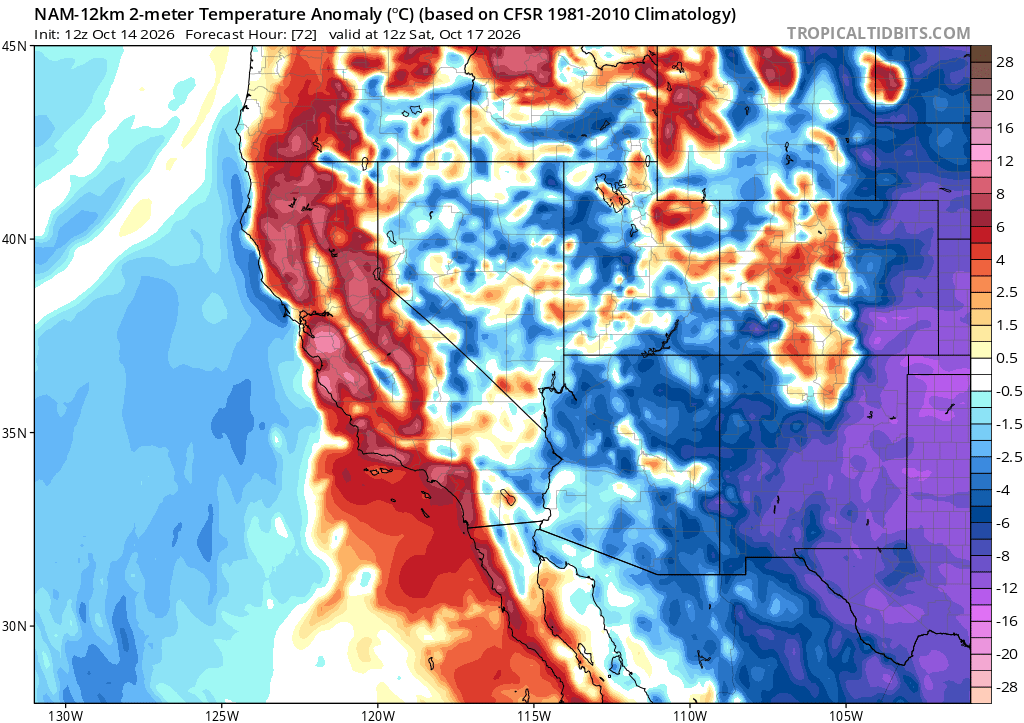
19 Likes
Red Flag Warnings issued for the Sierras as well. Somewhat of a unique situation there. Can we dig into the archives to talk about historical devastating “North or Mono” wind events in the Sierra foothills? I’m talking about the central or even southern sierras. Not in North Ops. I think Chief Hawkins and others have talked about these in the past? Could be wind testing Dome fire?
5 Likes
Jim Schmidt, retired Stanislaus NF GIS guru and early Fire GIS guy has been writing scientific articles in his retirement. Here’s one on east winds and fire danger in the Central Sierra.
9 Likes
@pyrogeography the discussion at the end just nails it.
5 Likes
3 Likes
7 Likes