Won’t be much of a warmup. More like the lower end of normal. Enjoy!
Major heat wave building into the eastern United States versus the west coast. Power grid emergency declared. We are still on track for heat impacts at the end of that time frame but the focus is the East Coast.
Super typhoon developing in the Western Pacific which corresponds with a 3x chance of west coast heatwave down stream. Forecast models and ensembles show the four corners ridge finally building in syncing up with that middle of the month.
Also cannot guarantee the location but July 29th is combust and likely more severe heat related impacts to much of the United States first week of August.
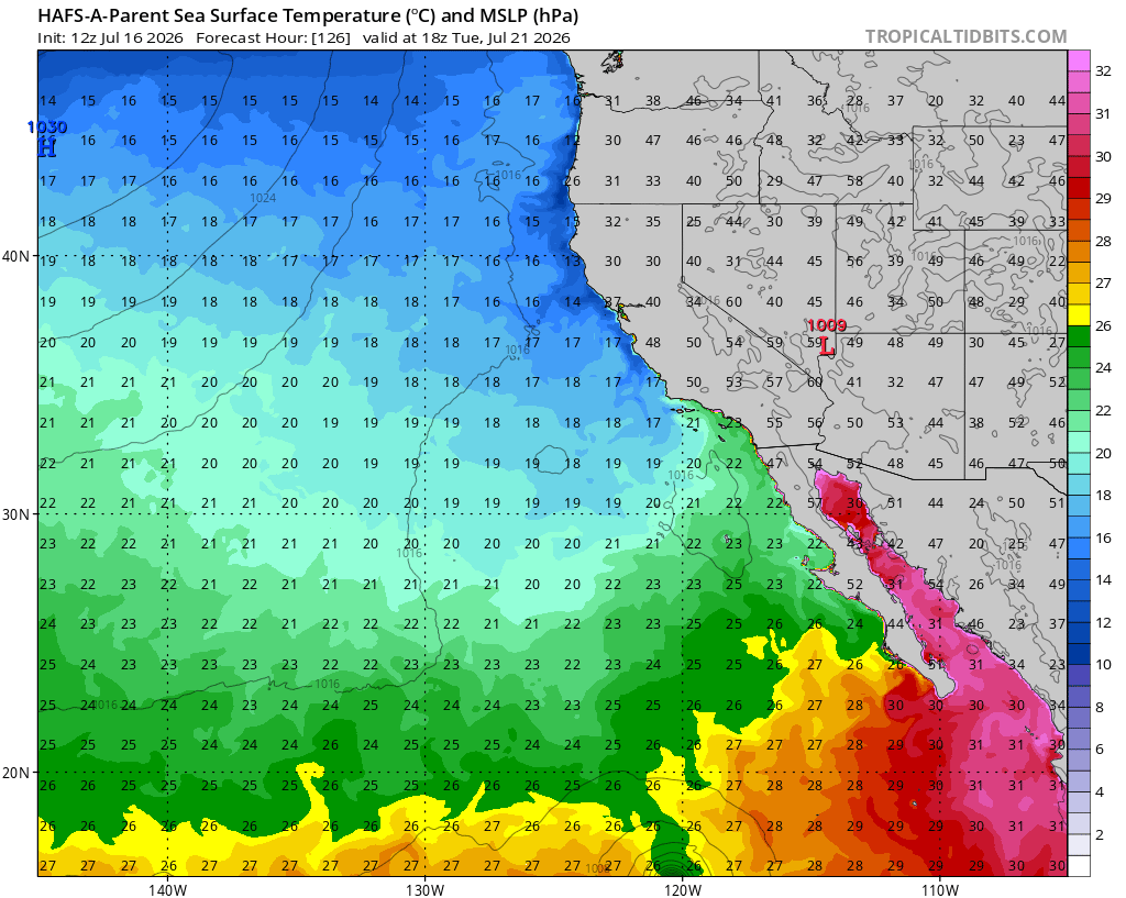
Sea surface temperatures off the southern coast of Baja are approaching category four marine heatwave. The monsoon trough is so strong this year as evident by the strong east-west orientation and deep convection. In fact, Douglas will be approaching 21N x 129W before degenerating into a remnant low. All that energy you see in other places of the world right now will end up here soon.
Michael did a really good video on what I said to watch out for middle month due to the WPAC Super Typhoon
Tonight’s GFS run is the most extreme model run I have ever seen for the west coast in regards to ridging and heat. The European model keeps this very strong ridge further to the east off of the higher terrain and 2-3 days slower… and thus a little bit weaker overall. Perhaps they will meet in the middle as far as timing and ridge placement.
What is the time frame for this potentially happening ?
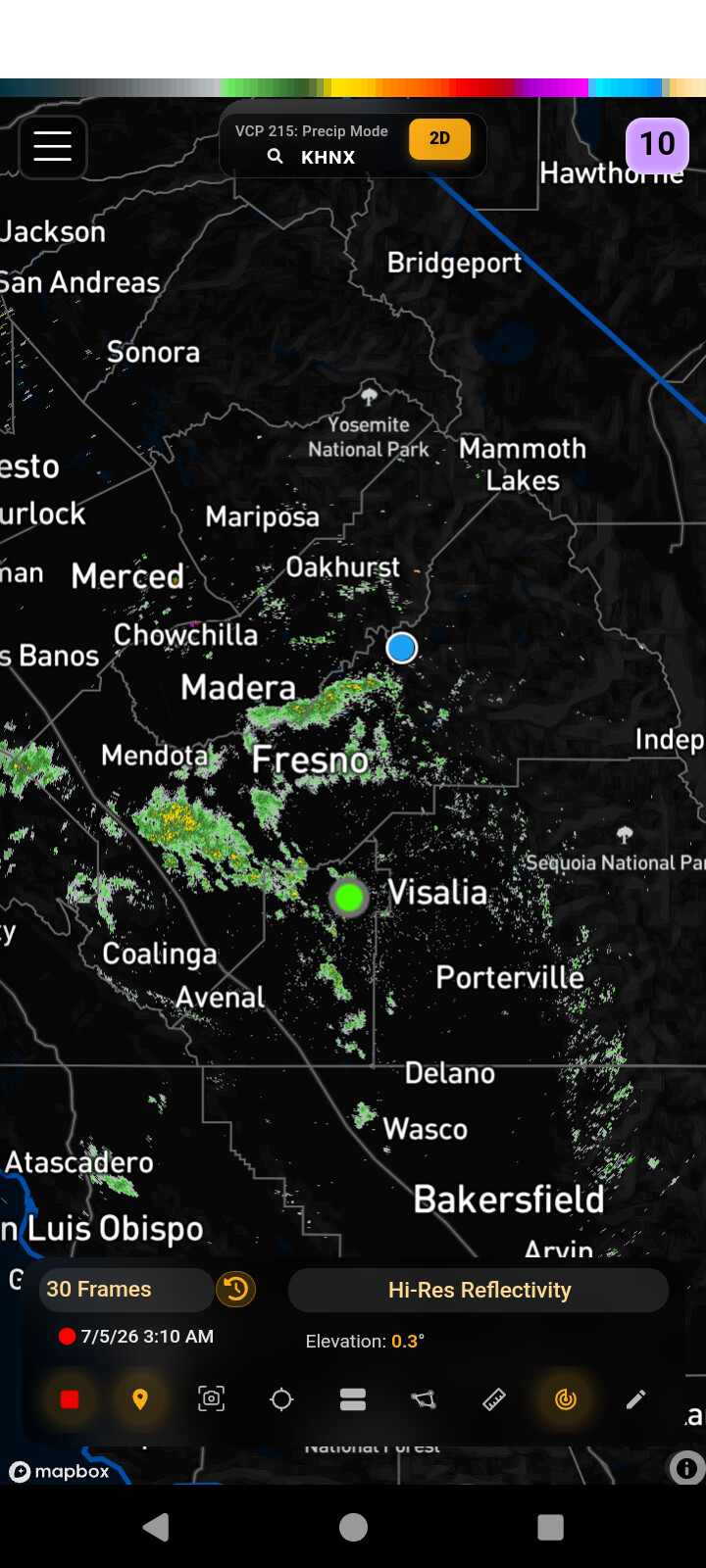
This weather has been great on my PG&E Bill so far. We need a little heat to get those watermelones ripe and sweet. Cloudy this morning here above Sonora at 06:45 temp 63, RH 66 and wind calm. Sure looks like a sprinkle or two could come down but nothing yet.
Starting right around the 14th
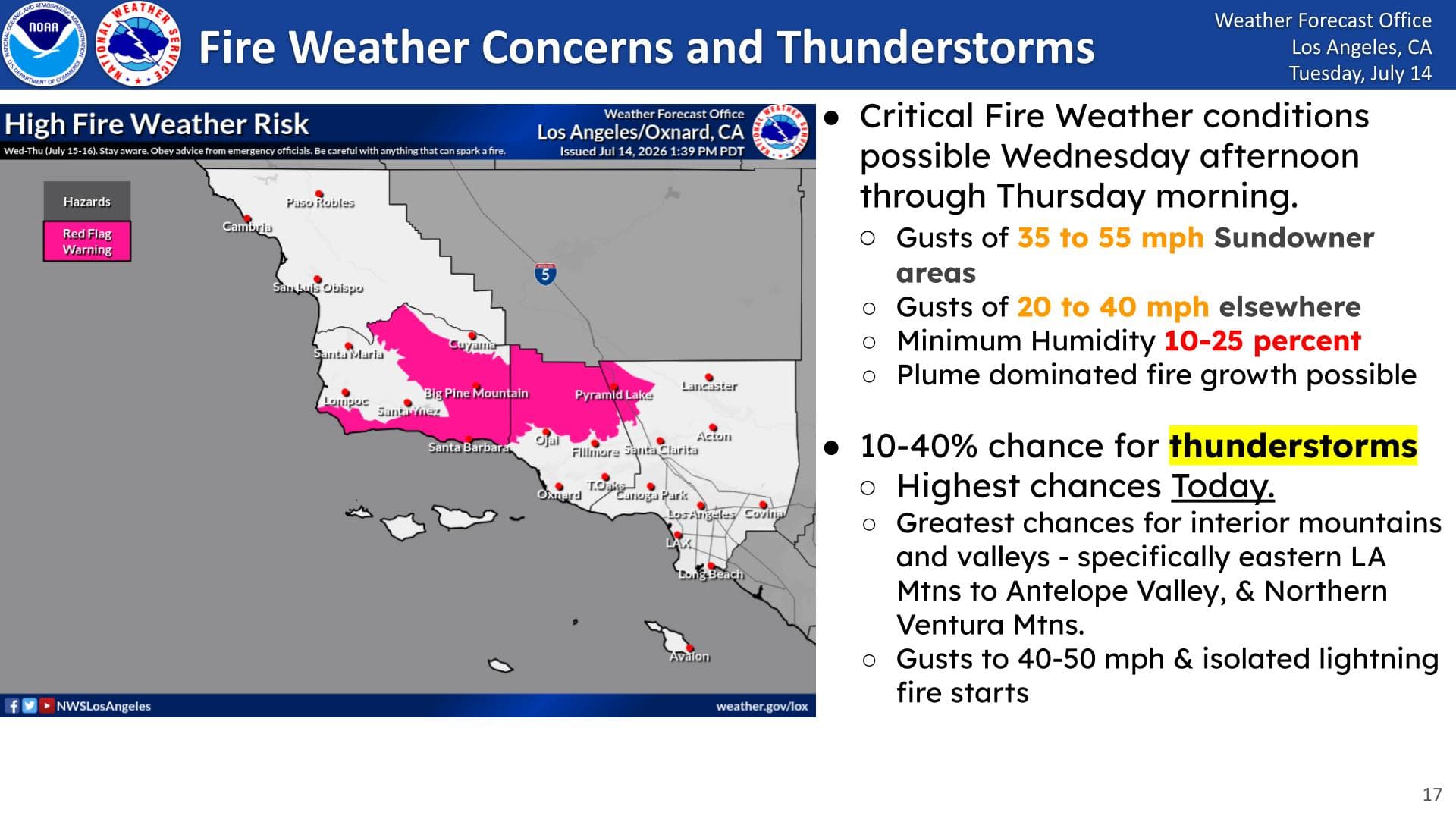
Fire Weather Watch is in effect Wed-Thurs for the Santa Barbara and Ventura Co. Mtns, along with the I-5 Corridor for strong winds, low RH, and high temperatures.
Update 7/14: Upgraded to a RFW at 128pm WWA Summary for Red Flag Warning Issued by LOX
The GEFS is suggesting that the NAO could go positive in the next week or two, when you pair this with PDO negative we could get some interesting weather coming up. Especially since the monsoon trough and ocean temperatures are off the charts. We will need to watch for an inside slider in early August if this manifests paired with active eastern Pacific hurricanes. Supports possible recurvature or downslope winds.
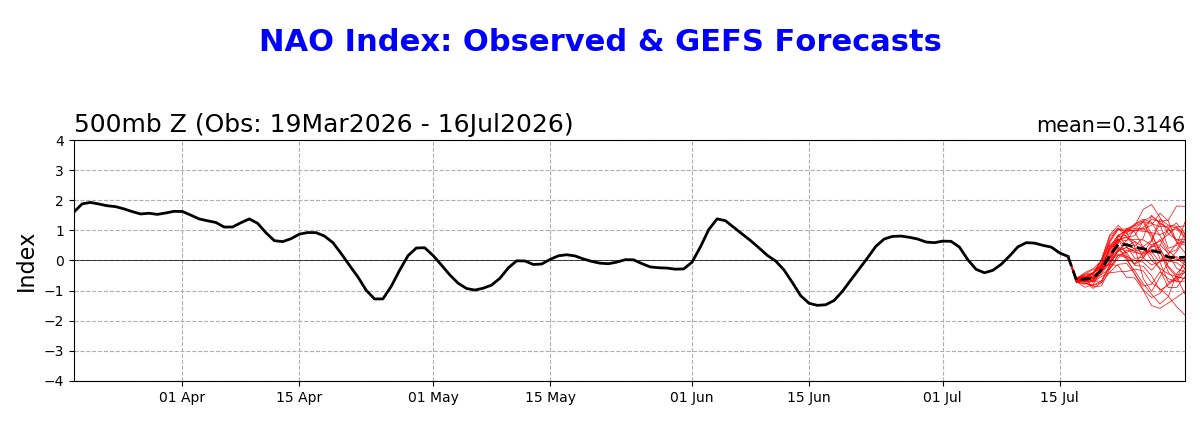
What does this mean for a S-290 level boots on the ground decision maker? I am always a fan of your weather explanations so keep them coming.
I concur with the person above I could use an explanation lol and personally I love your explanations
It basically means that there could be troughing upstream into the Pacific Northwest and Great Basin, and this could steer a tropical cyclone to the north in the break in the ridge if it happens to be there as the GFS depicts. I have been watching the monsoon trough and these hurricanes developing (one pending) push warm water all the way up Baja (on the models) and the sequence is alarmingly perfect.
You can see on the hurricane models the SST increasing significantly due to the first storm (modeled) due to ekman transport and downwelling on the right side of the storm + 90 degrees. This is only modeled out five days by the way, it does not include the impact of the second storm on SST.
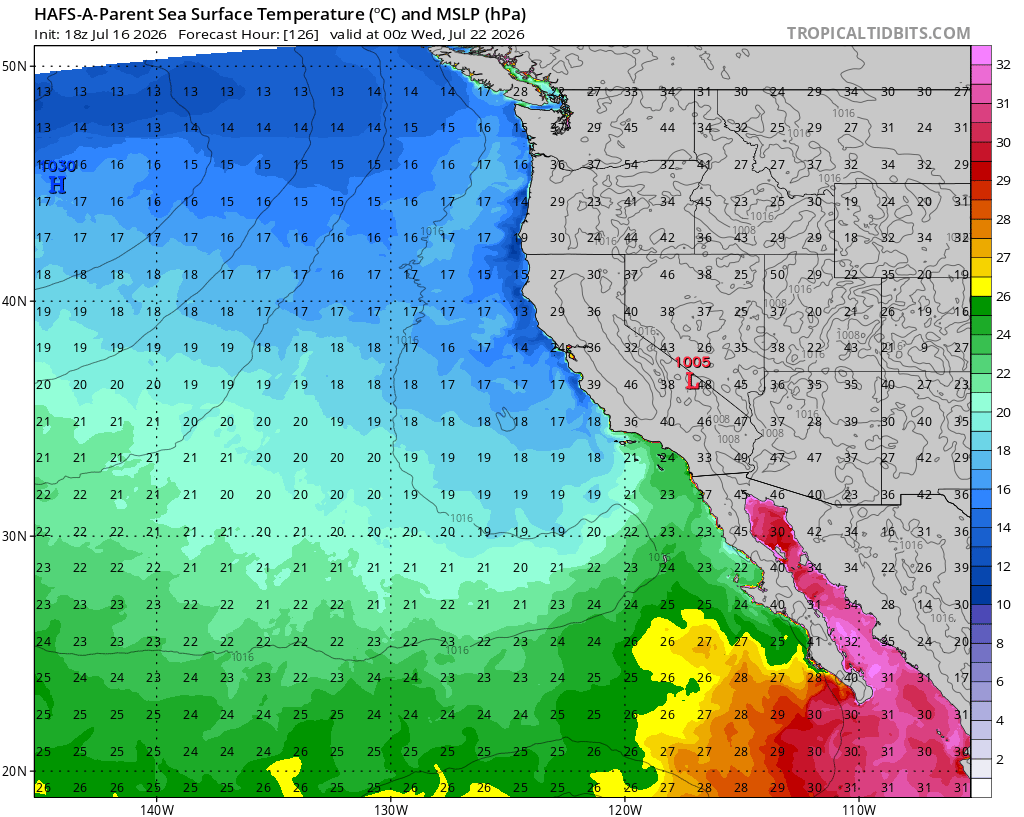
The NAO positive phase would potentially bring in a trough that can split the persistent ridging that’s been over the Great Basin and 4 corners and if that third storm that the GFS has been depicting way out in robot pirate island is there, it could make a run towards the landmass.
There is very good agreement on both the European and GFS models that there is going to be a significant heat wave starting around the 26th. The combination of strong ridging directly overhead, sea surface temperatures climbing upwards to 80° off the coast due to multiple rounds of downwelling and ekman transport from the monsoon trough to the southwest, and the possibility of downslope aided warming from an additional cyclone during this time means that we are going to be in a significant heat wave situation. Notice on this European model run a tropical cyclone undercutting the ridge and moving north off of the coast.
This looks like a very thermodynamically hot situation for much of California. Will update as we get closer.
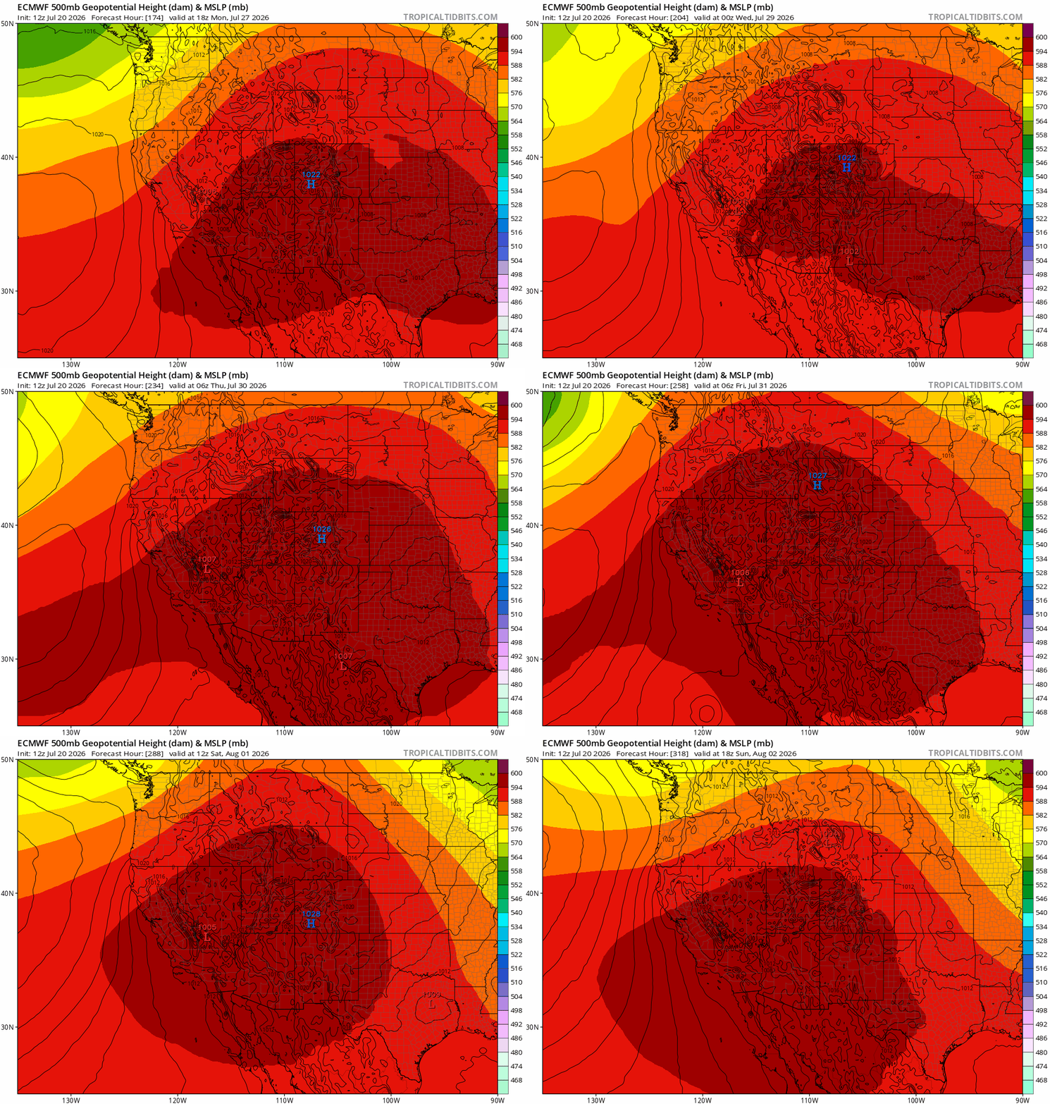
Oh My Lanta!!
Something tells me my Labradors are not gonna be happy when that giant magenta blob sit’s down on us! 
Im already worried bcuz i’m basically an elderly person now w/ a glitched out hypothalamus to boot! I’ll be over here hydrating if anyone needs me.. 