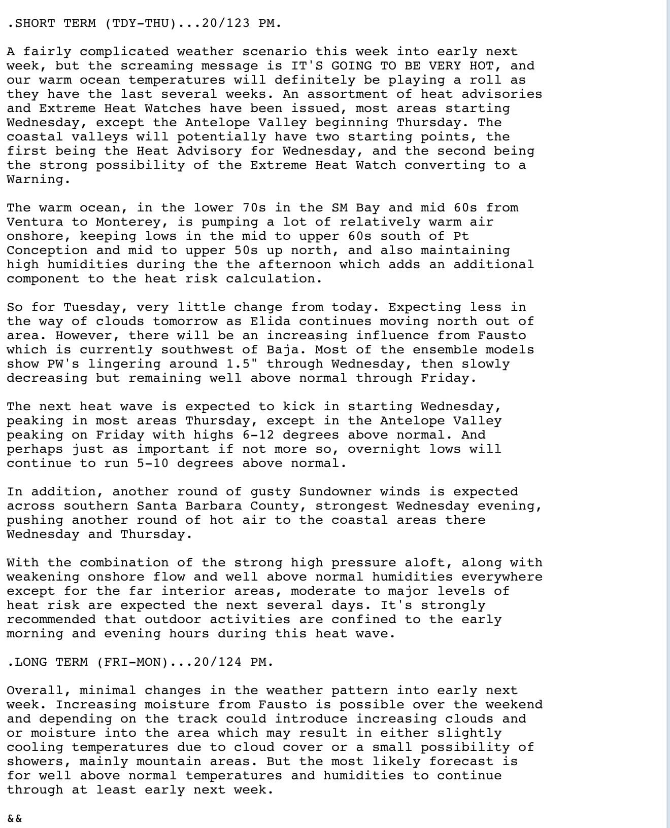
From NWS Los Angeles AFD:
9 Likes
They had lots of good fire weather info on their partner webinar today as well.
5 Likes
4 Likes
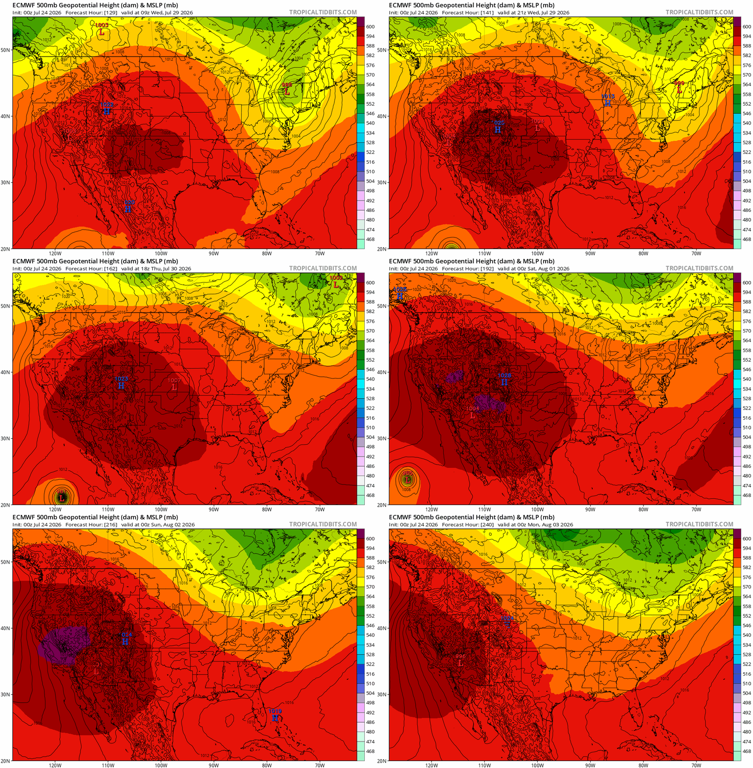
Based on the agreement on the upper air positioning and track of 98E between the ECMWF and GFS this is very likely to happen. >75% chance.
The ridge would be more directly overhead so no more of the “faux” heatwave set up, as we’ve been set up on the outer edges up the ridge forever now.
We would be wedged between the hurricane and a trough descending the eastern slope of the ridge, lots of heat potential. Historical analog: Heatwave during the Fairview Fire in 2022 comes to mind, although that was in September.
13 Likes
So in English this means 
6 Likes
It means hydrate now & prepare the elderly, pets etc for a HOT slug of Wx!
Things could get very un-nice - especially the lack of overnight cooling!

11 Likes
Yup
The overnight temps are already 5-10 degrees above normal. The heat doom loop has begun.
With the continued increase in SST of the coast (Santa Monica Bay is 75+) mother nature’s AC is broken and will remain thay way for the foreseeable future.
14 Likes
Pending Hurricane Genevievie is going to further push warm water up the coast of Baja, and we are starting to get into the modeling hours of what SST would look like due to the ekman transport and downwelling from the storm track.
After Fausto transported warm water northwest, SST are off the charts:
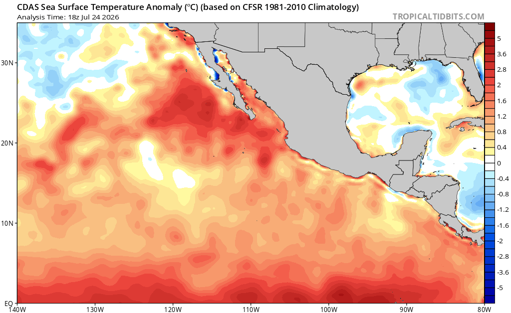
When Genevieve pushes warm water up the coast, there is a real possibility that the 26° isotherm moves as far north as 28° north. This is the required ocean temperature for a tropical cyclone to maintain hurricane intensity, and this line would only be a couple hundred miles south of San Diego. This transport of warm water is going to happen at the same time we have a 597-603 DM ridge building into the west coast. This exceptionally perfect set up for extreme marine heatwaves; would lead to a chance for a tropical cyclone to make it off the coast of Southern California or direct inland impacts, should the setup be right. Ensemble members cluster around a storm developing around August 4th and paralleling the coast, but it is much too early to have confidence in that. (The GEFS, EPS, and GEPS all show it)
17 Likes
Before the 2nd week of August.
Hillary in 2023 was at the end of August with cooler SST then we are currently seeing.
The Marine Heat Wave is in full effect.
Im still taking bets that there will be 3 Tropical Storms before October 1 that impact SoCal. With one of them being Tropical Storm strength when it makes US landfall.
14 Likes
Anvil, when you say Tropical Cyclone what level would your analysis suspect? Tropical disturbance, depression, storm or hurricane? Understanding it is a ways out and there are many variables to answer this, so no prediction is set in stone. Just looking to plan for any potential future events in the San Diego Operational area. Thanks for an additional insight you can provide.
7 Likes
There’s so much heat and energy built-up, it has to be transformed. So whether it be when the jet stream naturally changes its alignment towards the end of August, or perhaps September. I would say the chance of a hurricane in the southwest this year is way way way above average…. The monsoon would be arriving essentially in one event, since there has been little to no monsoon…. The energy gets comparmetalized into one singular event. But of course, it is hard to forecast something like that and doing so in advance would be like throwing darts at the board and just hoping you hit a bull’s-eye.
Also a late night thought; 8/12 has interesting precedent to me.
One more note: hurricane models are showing 92C potentially reach sub 900mb pressure in the Western Pacific… and if the storm gets to that level, there will likely be a monstrous heat wave for the West Coast middle to late August as the effects work through the system.!! 
24 Likes
Speaking of heat, NWS Los Angeles in their morning discussion warns that this upcoming weekend heat wave will be nearly historic:
The upper high will continue to track to the west on Friday and will peak Saturday afternoon as it settles over AZ with a central hgt of 600 dam. Hgts over Srn CA both Fri and Sat could reach 598 dam. For context since 1948 there have only been 12 days during the months of July and August where hgts have been 598 dam (10 days) or 599 dam (2 days). Hgts will fall some Sun and Mon as an impulse works its way through the north of the State.
This will translate into widespread temperatures above 100 for anywhere away from the coast, including higher overnight lows in the 70’s and even 80’s, which increases the risk of heat stress on both vegetation and humans.
7 Likes
Fire and water meet around the middle of the month, like a dam bursting…. extreme heatwave and marine heat wave likely starting around August 17th which is in line with the timing for down stream jet stream effects of Super Typhoon Dolphin.
15 Likes