Now you have me thinking more along mesh, and I could even see some “ad-hoc” mesh setups on mountain tops similar to NIFC portable repeaters. For aircraft you’d just need one mountain for an incident, for some ground coverage maybe two. Backhaul it to an area WISP, pre-established partnerships (fire cams cough cough), etc.
If we built it correctly with existing infrastructure you would rarely need adhoc set ups. Most of these can push full bandwidth at up to 60 miles and these vans are parked on the ground. Imagine these radios up on an existing repeater site! Initial attack full ISR right our the door. I will keep dreaming.
Cool screen shot of all the ATAK EUD markers on the Creek Fire. CAL-FIRE IMT-1 testing out this tech for tracking personnel and sharing data.
if i can figure out half of what this thing will do it’ll be a sucess 
New device released from Samsung. Kind of the sweet spot for on the line. Has a swappable battery.
If anyone wants to hop on the OPEN TAK Symposium its today. Sorry for the late notice , its started but havent missed much yet. I think you can still register and get right in. This is following last weeks “government” TAK Offsite.
https://register.gotowebinar.com/register/7983186002512775180
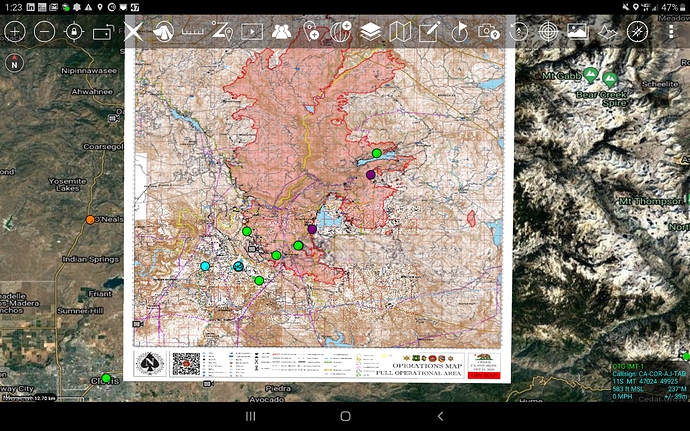
A bit of cool news. In the next full release of ATAK it will support geopdf natively. I tested today successfully. No need to convert to geotif etc. IMT’s could create a zipped folder with all the data they would want to release for an op period (maps, kmz, IAP) and in one download/import you have it all on your device.
crosspost from CA-PNF_Adams about new emerging tech using Realtime.Earth. Recovering fire behavior and resource tracking from footage from the two Alertwildfire Cameras on the CA-PNF-Adams fire using our browser-based Realtime.Earth tool. Hoping to release RTE soon to folks in here to try and give feedback.
Realtime.Earth analysis of 4 Alertwildfire cameras on CA-LNU-LightningComplex fire capturing 40 lightning strikes from 630-730a on the morning of Aug 17, and relating them to 4 independent starts observed in cameras 10-30 minutes later. crosspost from CA-LNU-Lightning
Realtime Earth needs to be our WebTAK.
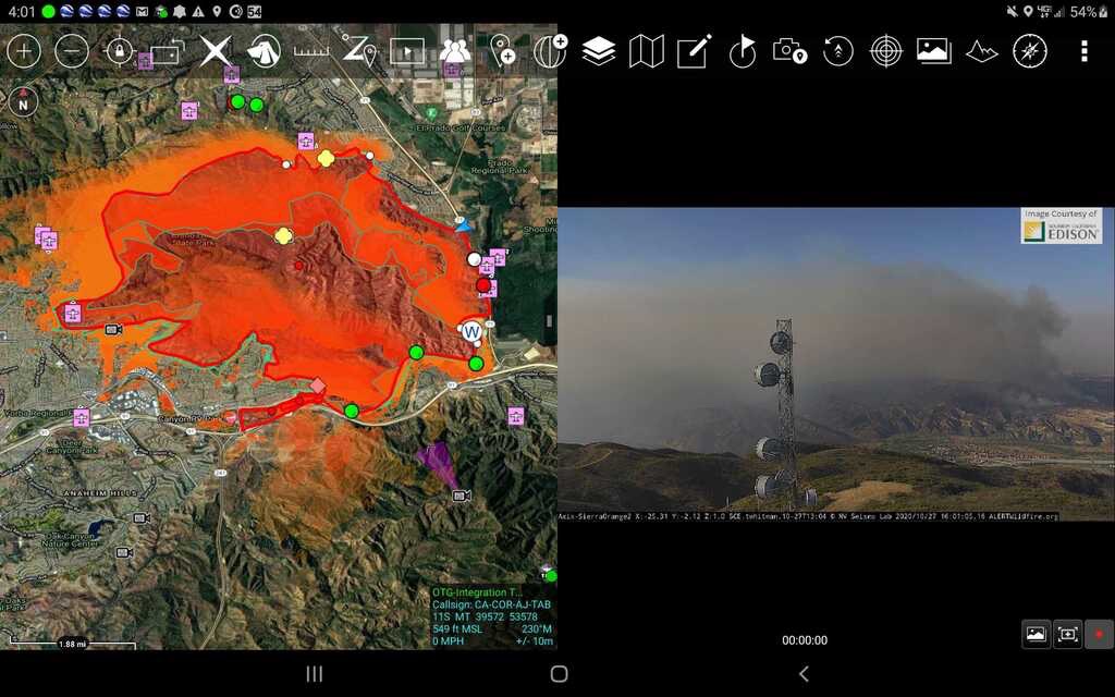
So we did some cool stuff this week with ATAK. Integrated the FIRIS (ISR Intel Proof of Concept) plane perimeter data as a streaming KML into ATAK. Then also integrated the Wifire modeling into ATAK as a streaming KML. Here is a shot from the Blue Ridge.
The International Public Safety Association is having an ATAK webinar on Novermber 12th 10am Pacific Time Zone.
https://register.gotowebinar.com/register/4068490301174270221
Here is a link to the video webinar for those that missed it.
https://drive.google.com/drive/folders/11OINlVIpYgSw0u6XiBOESOJqTUUmUwFA?usp=sharing
ATAK 4.2 is on the google play store. Biggest improvement that they did was at geopdf format. This was directly driven from the wildfire community. You can now import any incident geopdf into ATAK and even control the transparency of the map. No more need to convert to geotiff.
Just a quick request for an update, if you have one, regarding the release for IOS devices
I asked him via private message 3 weeks ago and it wasn’t sounding like it would be in the immediate future…
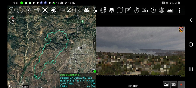
Here is a link to a website that will auto generate an atak data package with the latest alertwildfire cams. It will auto download onto your device then use the import manager in atak and import this file.
The FIRIS program this year hosted up a KML Network link for ATAK consumption. It has proven to be a valuable asset for mobile view of fire perimeters and modeling. Couple that with the AlertWildfire cam system and you have a pretty nice SA tool. DHS will be hosting a limited ATAK training course targeted for Type 3 ICs in the souther region in January. If your a CAL-Fire contract county, so cal CAL-FIRE unit or Southern Federal Forest/BLM look for the training flyer coming soon. Hoping this first small training class will turn into more down the road.
Here is a link to three of the TAK Offsite video presentations this year that are fire oriented.


