For those that want to use ATAK in the field and send data back to the incident SIT/GIS shop you can export shaped/markers via the export tool and be sure to choose KMZ as the export type as it will bring in all the icons with it. If you choose KML or shapefile it will just be the points and labels.
Here is a screen shot of an ATAK export as a KMZ similarly like you would do using Avenza and opening it up in ArcGIS Pro.
I am testing a new ATAK plugin that was funded by State of Colorado. Its specifically targeted at on the ground mapping via your tracks etc. If you have ever used ATAK you know that your tracks can’t be made into a polygon. You have to trace to make a shape. This plugin allows you to hike a small fire and create a polygon out of it or you hike section of line, have another crew hike a section etc etc and join the sections to create a closed polygon. It’s pretty cool.
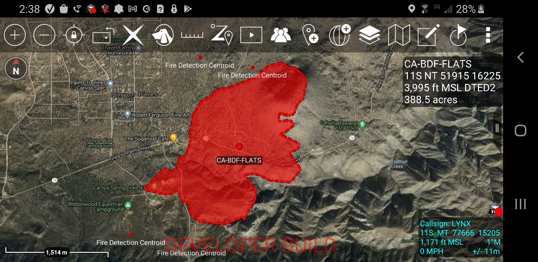
An unintended positive out of it was trying to see if it would map out an existing KML. That is something ATAK would/could not do was calculate the area of the KML. So i tried it on a FIRIS polygon and it works. No more tracing with the drawing tools. It’s not perfect and since it was not part of the original scope of the project I’m not sure we can optimize it for first release but it does work. I just used it for the flats fire and had acreage in about 10 seconds and 4 button clicks.Hoping the plugin will be released soon. Another bonus is plugins are moving to the play store! You will not need a tak.gov account to get most of the plugins.
I have a data package and its in a format called CoT Cursor on Target. When i build one its the current angle of the camera but as soon as they change it its not accurate anymore.
I have talked to the AWF cam folks and they are telling we will have some sort of live service soon.
In ATAK to adjust the field of view I just look at the camera feed and grab the x axis and then adjust the camera angle with in ATAK. Its pretty slick but man I want a live FOV for sure.
If you have android and load atak on your device download the AWF data package at maps.takserver.us. I updated about every 6 week.
Anytime you want an updated one you can go to tinyurl.com/alertfire and it will automatically build and download the latest cams. Then import that into atak and delete the old one.
So all that to say no there is not a KML but maybe something can be done to convert the CoT to KML.
What we really need is a live service and a KML network link would be great.
PRO-TIP - If you are having issues with ATAK crashing after loading a few days worth of large fire data packages be sure to delete old data packages. I typically delete the prior days package before importing the new package, This generally only affects devices with low amounts of ram and storage.
If ATAK will not load period get into the file structure. go to myfiles>internalstorage>atak>tools>datapackages and delete old packages.
You can also go to …>atak>grg and delete individual maps if you brought in that way or deleted a data package but chose not remove the contents.
Some of these incidents are approaching 200 mb worth of maps.
Its certainly a request i can out in like set a timer to delete xxx data package after a certain time frame. you would not want this globally just selected packages
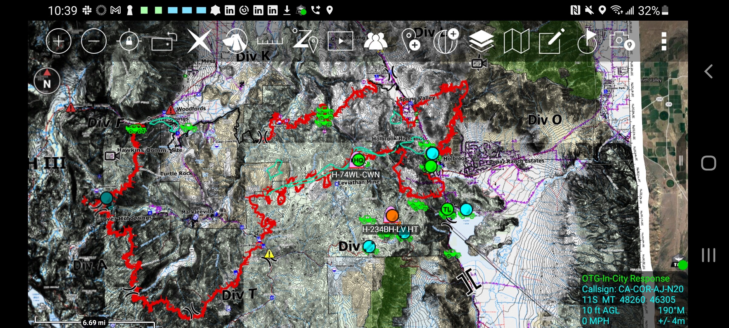
The ATAK/DART pilot project is underway on the Tamarack fire. They arw doing ATAK, some satelite trackers and local ADSB into a dedicated TAK server. Pretty pumped to see this happening. If your on the incident and have an android you should ask about participating.
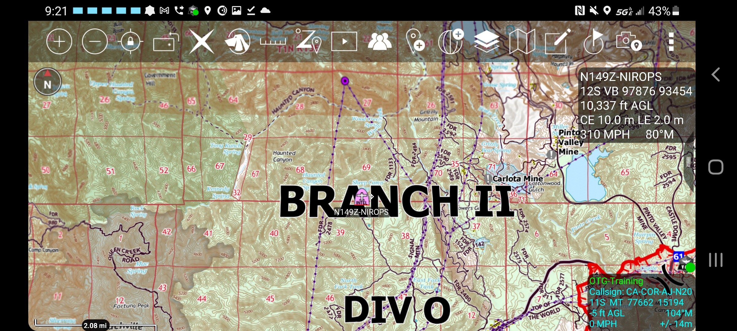
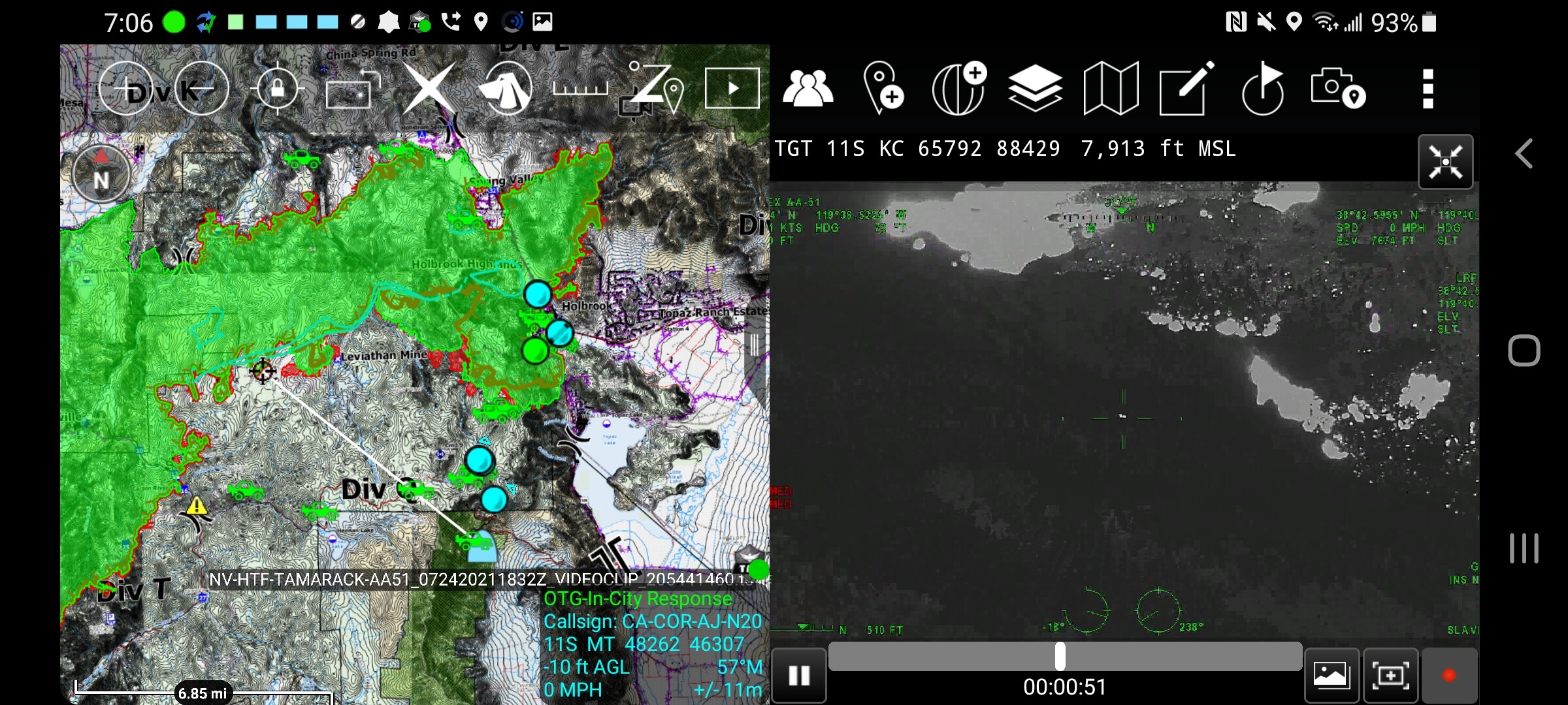
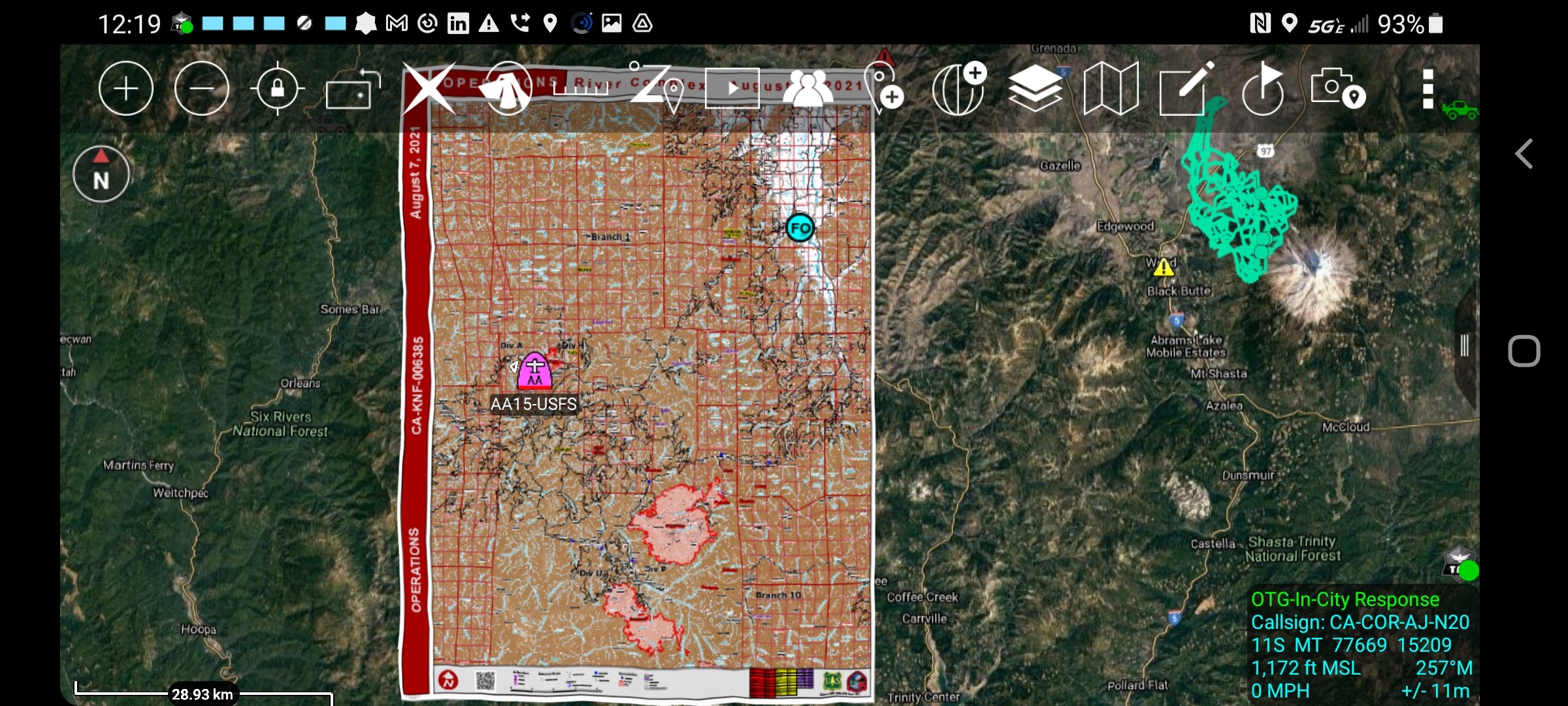
Wanted to share a screen shot of the capabilities of ATAK being ran on an incident. ATAK users showing up on the map, AVL ported in over a variety of sources, AA-51 geospatial video clips and their updated KML shared over the datasync plugin.
Hey AJ,
ATAK is looking better and better all the time! Curious what the eventual end-game is with it? Are there plans to share some of the functionalities as GIS collector at some point? Used that for FOBS work last year and seems like ATAK could do some of that if was setup that way.
Many similarities between the two. It all depends what you want to do with the data. There is an ESRI plugin for TAK that allows you to view ESRI data. ESRI is building something very TAKish called Mission.
At the end of the day you can use both just switch apps. Collect in an ESRI app and view in TAK. You can share points, lines and polys in ATAK but it doesnt feed an esri geodatabase.
Im sure it can be done. If you need to be tactical TAK is your best friend, if its more data driven us ESRI. You can certainly use both, use the app switcher on your device.
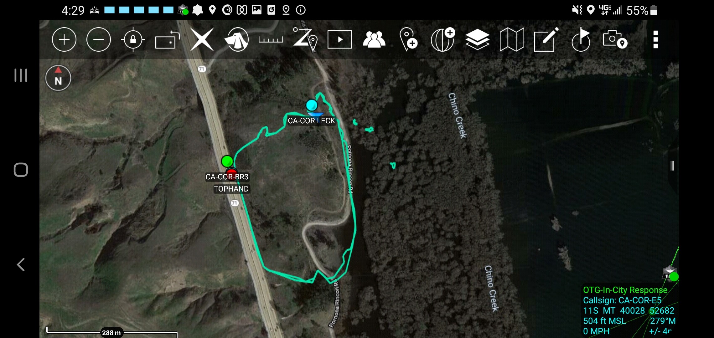
Great use of ATAK today on the CA-RRU-RINCON. The FIRIS Aircraft provided an IR stream and we were able to see it on the line. We had multiple spots in the Prado Basin and if you have ever been in there you know it’s a jungle. Using their IR data streamed into ATAK allowed us to confirm we had all the spots identified. Made us DIVS life a little easier today.
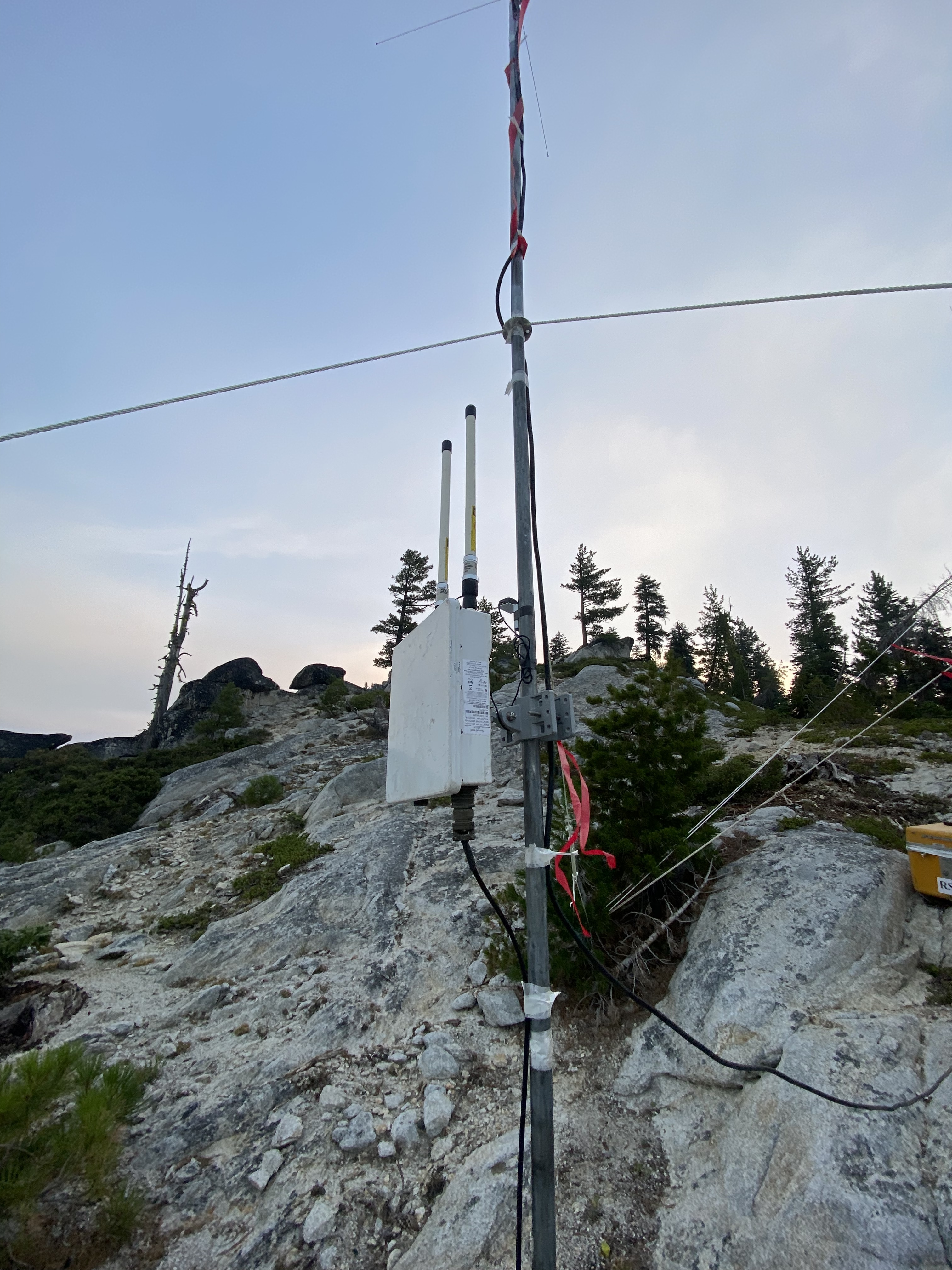
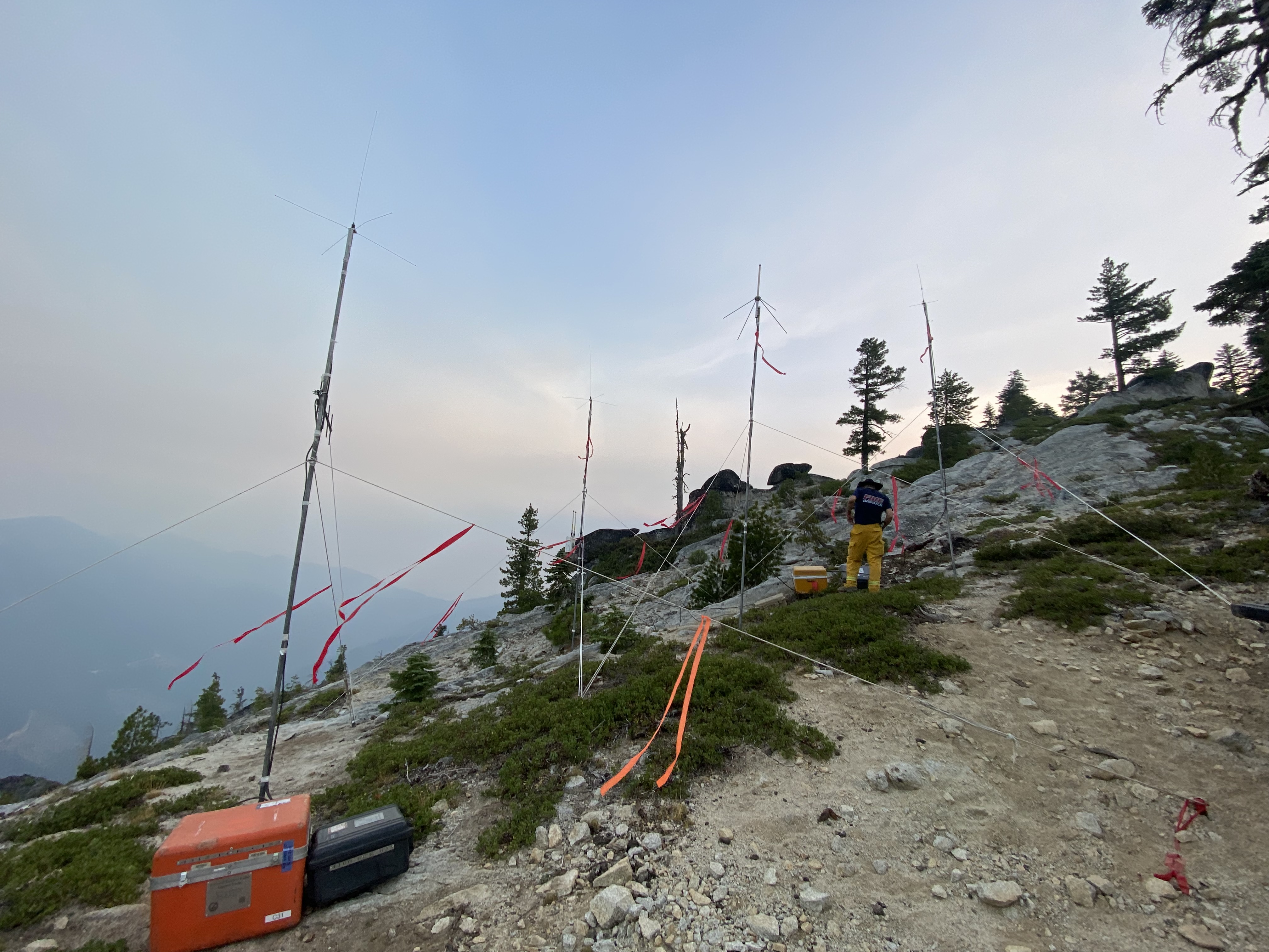
Some cool stuff being done on the River Complex and was also done in a similar fashion at the ICP on the Tamarack. @DC3075 put in an ADSB receiver on one of the River Complex portable repeater sites to increase aircraft tracking capability. This area had no coverage before except for AFF satellite coverage which is about 120 seconds between hits. ADSB coverage pumped in and out over this network is getting down to every 4 seconds.