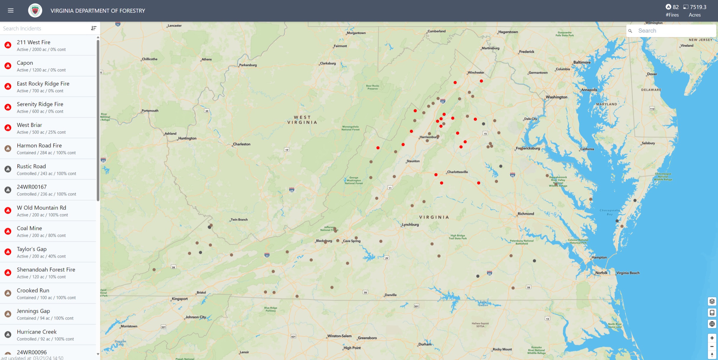
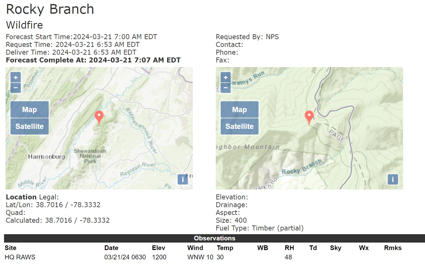
Spot Forecast for Rocky Branch…NPS
National Weather Service Baltimore MD/Washington DC
707 AM EDT Thu Mar 21 2024
Forecast is based on forecast start time of 0700 EDT on March 21.
If conditions become unrepresentative…contact the National Weather
Service.
Please contact our office if you have questions
or concerns with this forecast.
.DISCUSSION…
An elevated risk for the spread of wildfires looks
to continue across the incident location today despite decreasing
winds as high pressure builds over the region. RH values will start
in the 45 to 50 percent range this morning before quickly falling
into the 15 to 20 percent range during the peak of the afternoon.
Overall mixing will remain good from a smoke management perspective
with transport winds out of the northwest at 10 to 15 mph.
The stark contrast today will be the surface winds and temperatures.
Temperatures will be 20 degrees cooler in the mid 40s compared to
yesterday under breezy northwest flow. Sustained northwest winds
will run 12 to 14 mph with gusts up to 20 mph at times. Highest gusts
will be tied to the ridges with slightly lower values in the
valleys. Strongest winds will occur between late morning into mid-
afternoon with winds steadily falling off before sunset this evening
as high pressure asserts itself overhead.
Mostly clear skies expected tonight with light winds out of the
northwest and lows in the mid 20s. Increasing clouds and humidity
values Friday morning into Friday afternoon. Highs Friday around 50
degrees with minimum RH values around 40 to 45 percent. Light winds
will start the day before switching to the south southeast at 5 to 15 mph
with gusts up to 20 mph Friday afternoon.
The next chance for widespread wetting rain arrives Friday evening
into Saturday. Rainfall amounts of 1.00 to 1.25 inches can be
expected across the fire location.
.REST OF TODAY…
Sky/weather…Sunny (10-20 percent shading). Patchy smoke in the
morning and early afternoon.
CWR…0 percent.
Max temperature…Around 45.
Min humidity…18 percent.
Wind (20 ft)…Northwest winds 12 to 13 mph.
Mixing height…5500 ft AGL.
Transport winds…Northwest 12 to 14 mph.
Eye level winds…Northwest winds 7 to 8 mph.
.FRIDAY…
Sky/weather…Mostly sunny (30-40 percent shading). Slight chance of
rain late in the afternoon.
CWR…10 percent increasing to 20 percent late in the
afternoon.
Max temperature…Around 48.
Min humidity…41 percent.
Wind (20 ft)…Southeast winds 8 to 9 mph shifting to the
south 12 to 16 mph late in the morning.
Mixing height…2300 ft AGL.
Transport winds…Southeast 5 to 14 mph shifting to the south 14
to 18 mph late in the morning.
Eye level winds…Southeast winds around 5 mph shifting to the
south 7 to 10 mph late in the morning.
1:33PM EDT: Fire progressing into the Park. MROS. 10% containment at the heel. Dozers and crews working the flanks. Requests for brush resources and SEAT for spotting fires.
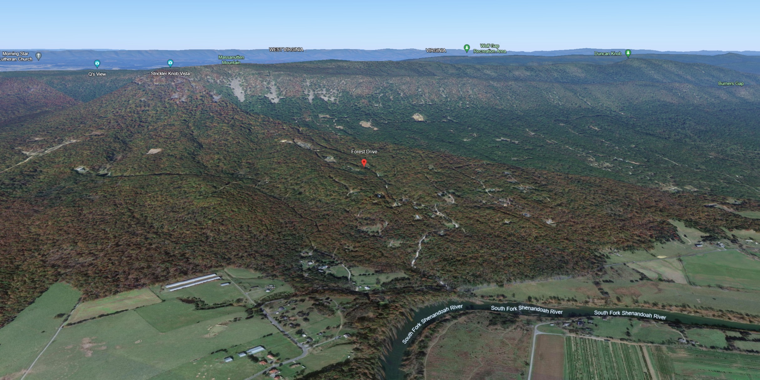
Photo of uncertain date from down at the bottom northeast of Thorton Hollow Overlook. Not the timber and oak scrub chapparal I’m used to looking at. Not all that woody. Probably pretty solid potential for rapid spread on the upslopes.
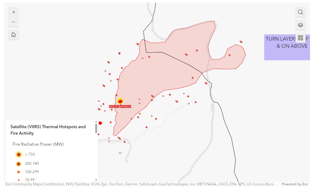
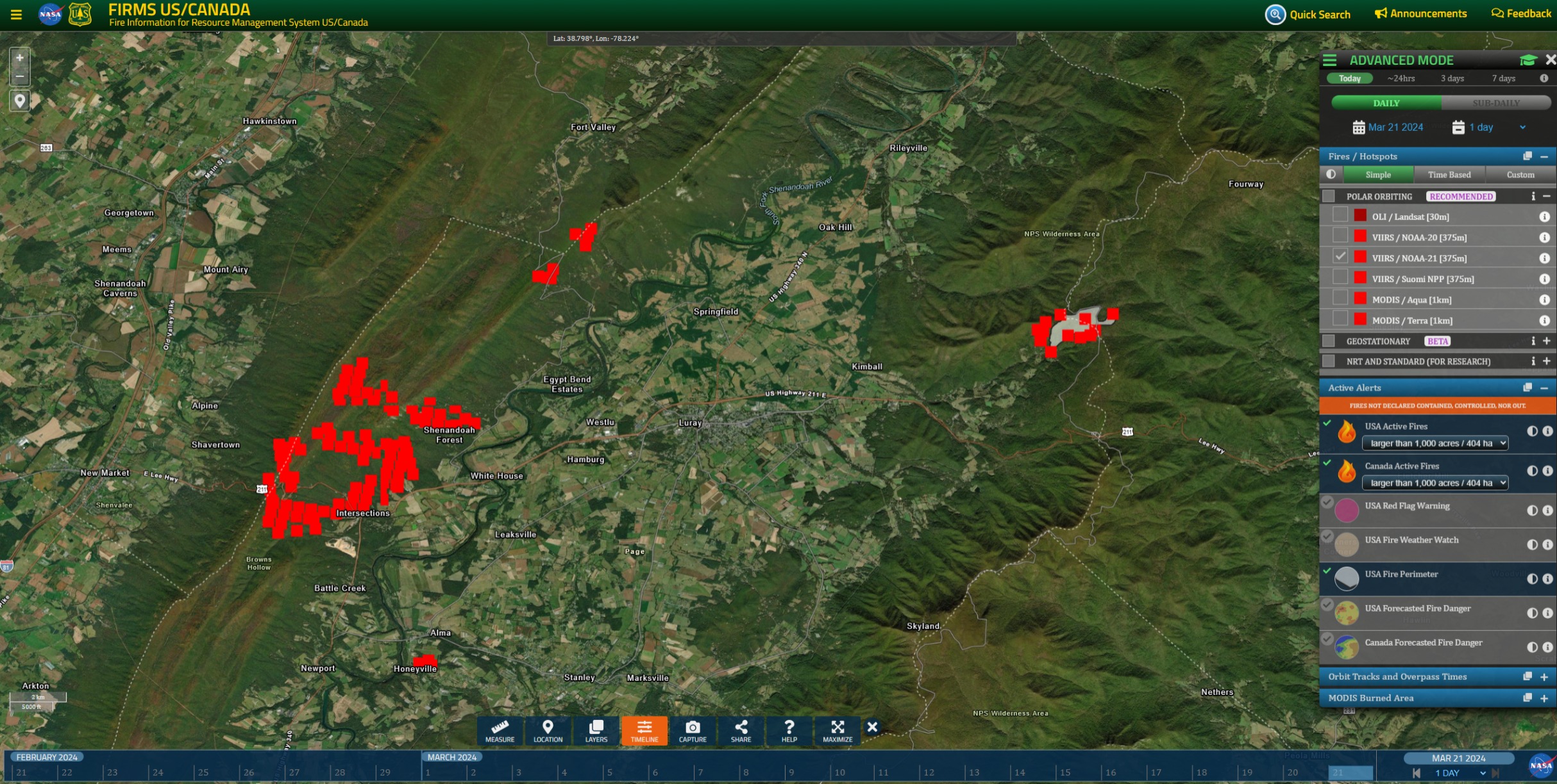
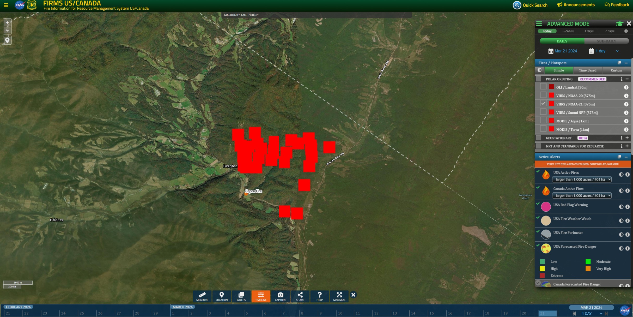
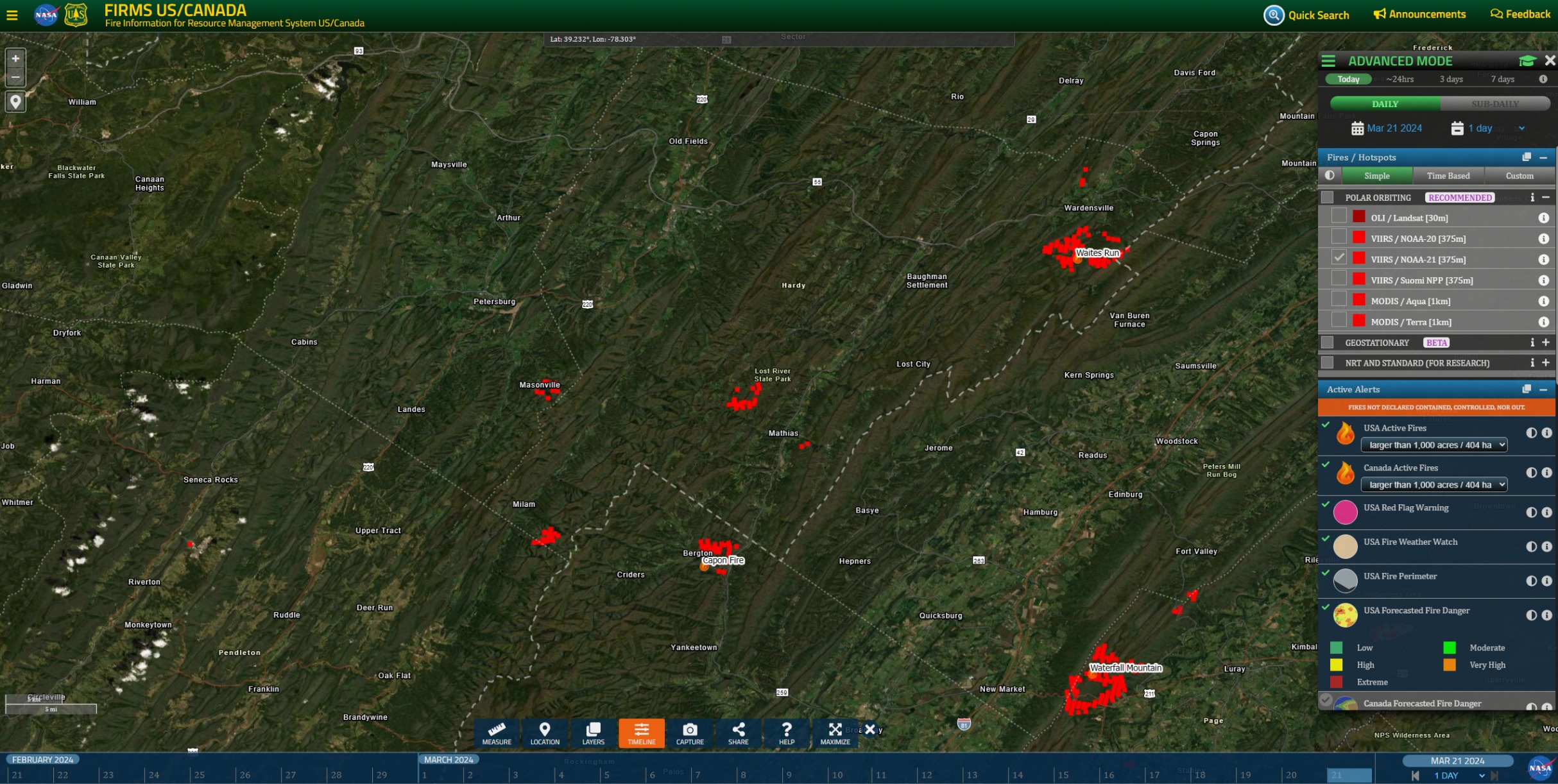
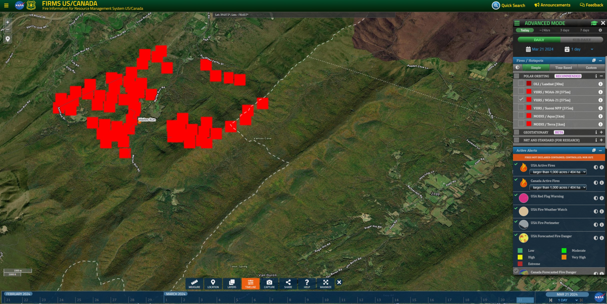
VIIRS 24H NOAA-21 (375m) heats. East Rocky Ridge perimeter on the east side of Luray. Serious looking heat in Shenandoah Forest, along the US211 and on the back of Forest Development Road 274. Not sure any resources there are on the Page County broadcast. Call me a dude, but my question would be – why is the sky not raining retardant?
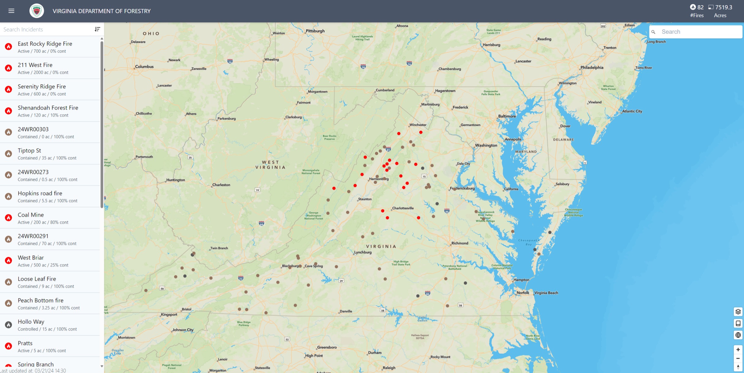
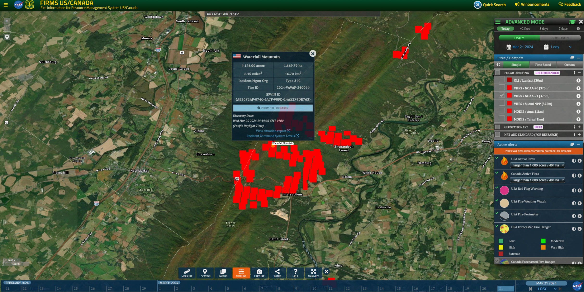
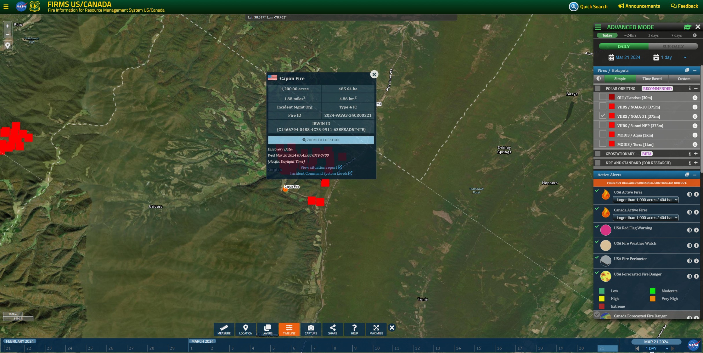
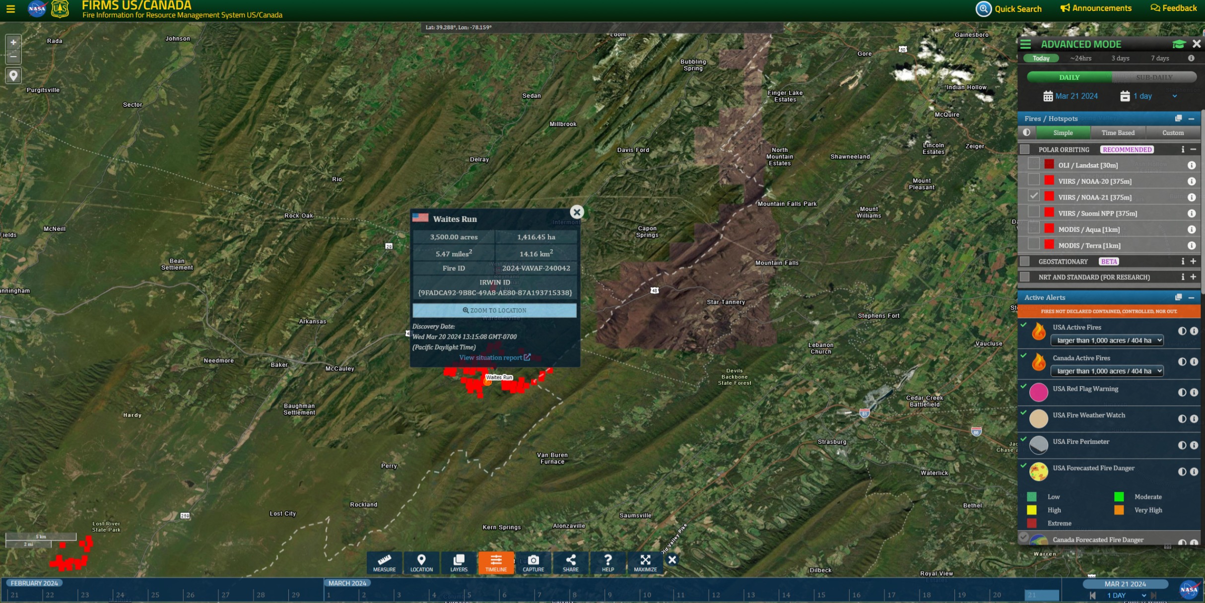
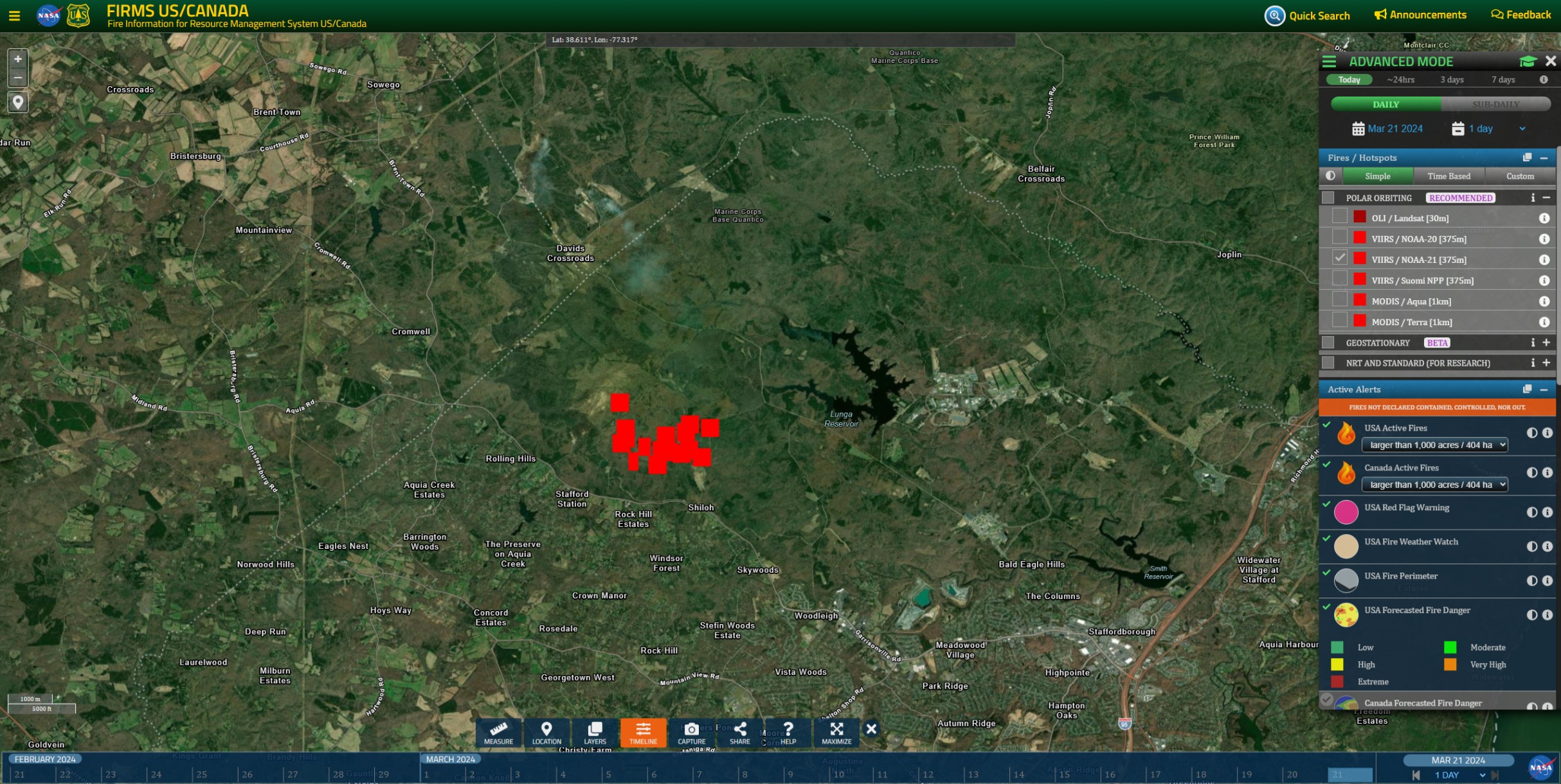
Note: FIRMS has “Waterfall Mountain” for “211 West”. VAF has “East Rocky Ridge” for “Rocky Branch”. Reflecting rapid escalation of fires today. With luck, regional fires lay down tonight with improving weather conditions. And, maybe tomorrow, they can get a VLAT, or two, on scene.
Listening to the radio traffic earlier a number of firing ops were underway and going well.
I know one thing they are good at communicating where equipment is especially WT8, everyone who wasn’t WT8 knew where it was and someone even said they were down in that holler by the road.
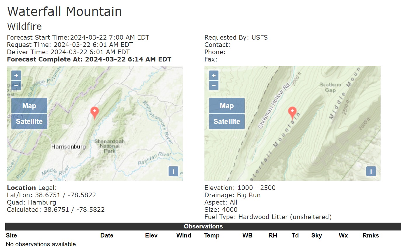
Spot Forecast for Waterfall Mountain…USFS
National Weather Service Baltimore MD/Washington DC
614 AM EDT Fri Mar 22 2024
Forecast is based on forecast start time of 0700 EDT on March 22.
If conditions become unrepresentative…contact the National Weather
Service.
Please contact our office if you have questions
or concerns with this forecast.
.DISCUSSION…
An area of low pressure will lift north from the Gulf Coast and
southern Appalachians later this afternoon and into tonight
bringing a widespread soaking rainfall to the region. One to one
half inches of rain is expected tonight into Saturday morning.
Meanwhile, a cold front will push in from the Ohio River Valley
Saturday before pushing low pressure offshore Saturday night. Drier
and breezy conditions are expected Sunday and Monday as high pressure
briefly builds over the area. Another front and area of low
pressure look to approach by the middle and latter half of next
week.
.TODAY…
Sky/weather…Mostly sunny (35-45 percent) then becoming
mostly cloudy (70-80 percent). Patchy smoke in
the morning.
CWR…0 percent increasing to 10 percent late in the
afternoon.
Max temperature…Around 55.
Min humidity…42 percent.
Wind (20 ft)…East winds around 5 mph shifting to the south 5
to 12 mph in the late morning and afternoon.
Mixing height…2200 ft AGL.
Transport winds…Northeast 3 to 8 mph shifting to the southeast
9 to 14 mph in the late morning and afternoon.
Smoke dispersal…Poor (200 knot-ft) early in the morning
increasing to fair (26400 knot-ft) in the
afternoon.
Eye level winds…East winds around 3 mph shifting to the south
up to 7 mph in the late morning and afternoon.
.TONIGHT…
Sky/weather…Cloudy (85-95 percent). Rain likely early in
the evening. Rain late in the evening.
CWR…10 percent increasing to 100 percent.
Min temperature…Around 41.
Max humidity…95 percent.
Wind (20 ft)…Southeast winds 5 to 9 mph decreasing to around
5 mph after 3 am, then becoming light after 3
am.
Mixing height…100 ft AGL.
Transport winds…South 1 to 8 mph shifting to the west around 1
mph overnight.
Smoke dispersal…Poor (100 knot-ft).
Eye level winds…Southeast winds up to 5 mph decreasing to
around 3 mph after 3 am, then becoming light
after 3 am.
Good news. NWS is forecasting a very high chance of 1" to 1.5" of wetting rains in the region overnight.
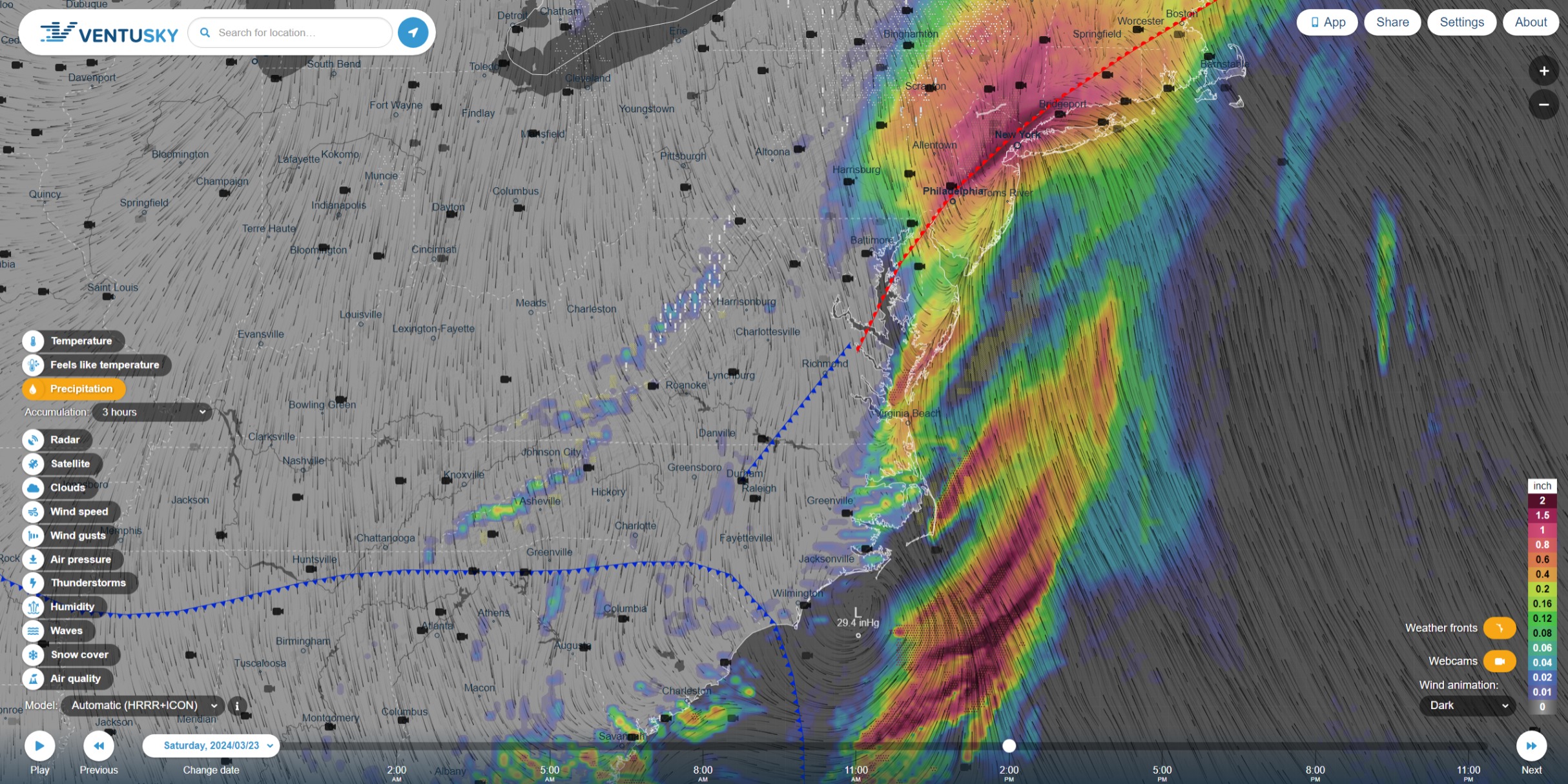
Ventusky HRRR+ICON 3H Forecast Precipitation for Saturday, Mar 22 4PM EDT
Less than great news. An inch and a half isnt going to put it all out. As the weather front passes through, its gonna bump with other fronts and produce some lightning in areas that have been under Red Flag and Fire Weather Watches for the past few days. Lighting that reaches the ground in areas with otherwise dry fuels may spark some ignitions.
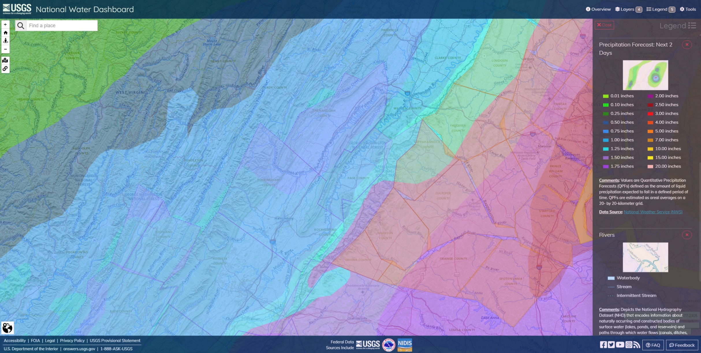
NWS projection of total accumulated precip for the next 2 days. Around an inch over these fires with low air quality and Flood Watches in place below to the southeast of the Appalachians. I’d suppose there’s a chance of some sliding, falling and rolling materials, if not full-on debris flows, in the burn and the black from recent and current fires.
1:54PM EDT: Gusty and blustery winds are driving increased spotting activity that is causing firefighters to withdraw from at least one section of line.
In my limited experience on fires in that kind of fuels, Air Tankers are of limited use. They will knockdown the surface fire but there is so much leaf litter and duff the retardant can’t penetrate so the fire just creeps underneath and crosses the line. Handline construction is also very challenging for the same reason. Found the only effective line was a road or creek bottom. The creeks are very rocky so even if they are dry, the line will hold with a litter leaf blower work.
I copy the ghostbuster. Retardant needs to cover all surfaces or fire burns under and around it. You got a lot of SoCal people thinking of ravines and draws full of thick-ass manzanita and scrub oak surrounded by grass.
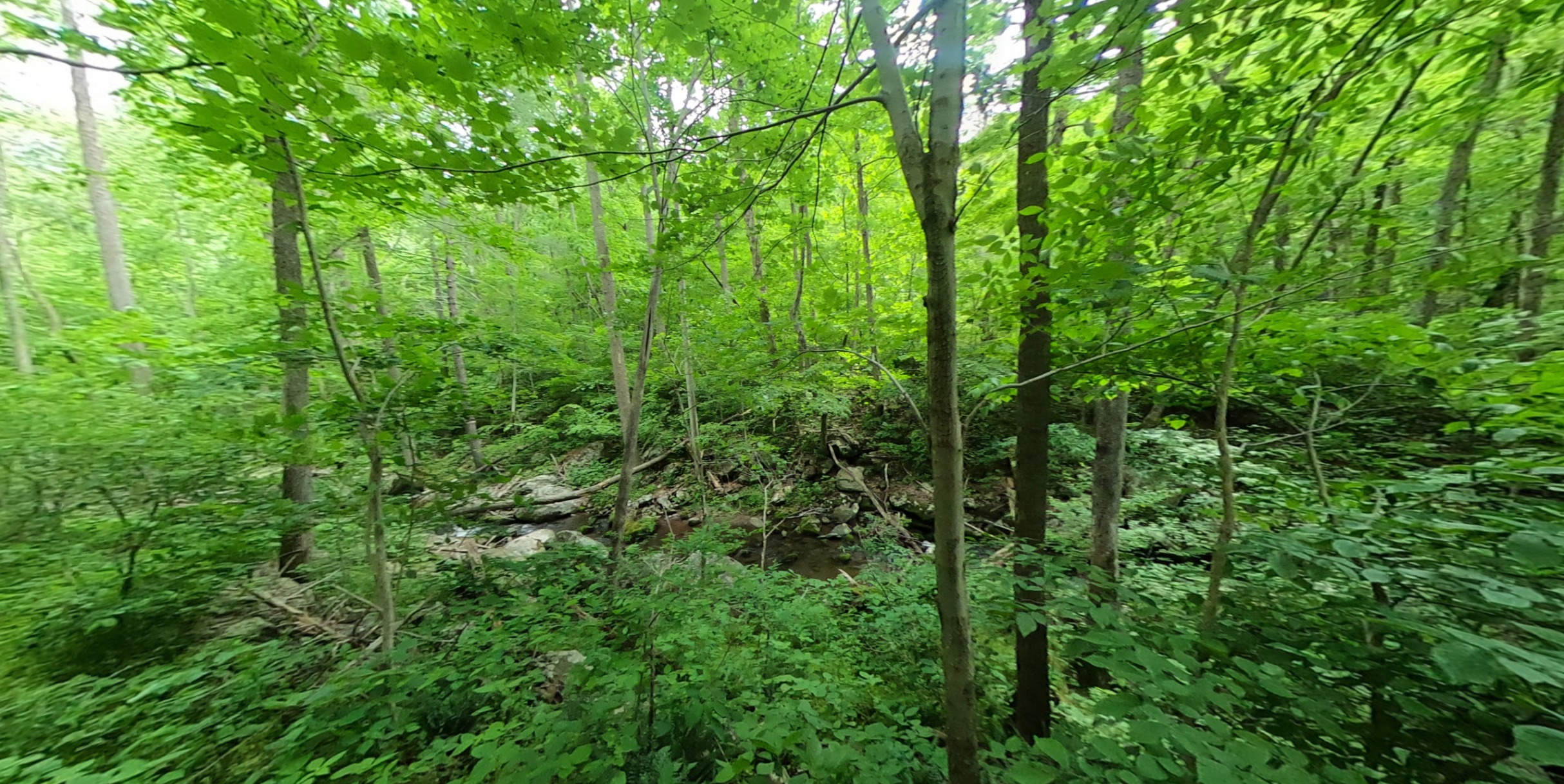
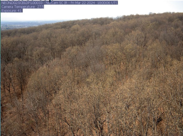
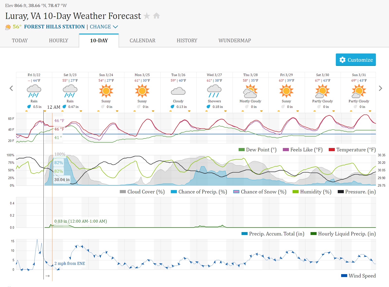
This is a very recent photo of veg cover from a science station about 20 miles northeast of Luray. Not quite as verdant and green as it looks in the other undated images. I wouldn’t take the temperature reading on the camera too serious. More like 55-60F in the fire areas.
I imagine it really sucks to lose line on a creekbed because then its coming upslope through the lighter and faster fuels with a push behind it.
No other way to say it. The Appalachians are nicer, smoother and more mature mountains than the young, craggy and rude 5 and 10 thousand foot punks we have in California. Don’t wanna leave anybody out, even the ‘junior varsity’ ranges here want to wear out hundreds of firefighters on large incidents.
Waterfall Mountain Fire has about 2 hours to sunset. Wind gusts are likely to begin slowing down but will remain 20+ mph around Shavertown and the western slopes until pretty late. They can expect light precip to start about midnight EDT. With luck, they can ink in a lot of black containment line by tomorrow afternoon.