Yep. I was just there and the rotor wings are hitting it hard. They took most of the heat out of that flare up. Structure defense set up down in Monrovia Canyon now and resources that were off the line overnight previous nights (Fed Fire on 12’s) will be on point tonight.
4 Likes
Firing Op planned for today. Waiting on details.
IR Map showing northwest perimeter at Kratka Ridge Ski area, along the Crest Hwy. Southern perimeter backing down into Sawpit canyon/MRV Canyon Park. https://ftp.nifc.gov/public/incident_specific_data/calif_s/!2020_Incidents/CA-ANF-003687_Bobcat/IR/20200912/20200912_Bobcat_IR_11x17_Topo.pdf
2 Likes
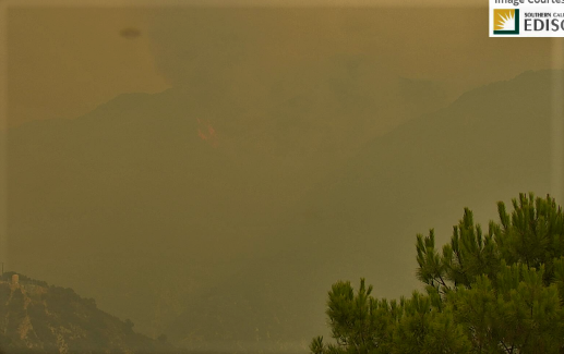
Some activity is showing. Kinda hard to see with the smoke.
http://www.alertwildfire.org/orangecoca/index.html?camera=Axis-Sunset2&v=81e002f

1 Like
Active fire front above Arcadia.
1 Like
They were supposed to do a firing operation. Hope that is what is visible.
2 Likes
VLAT has been a busy bee past Hour or so. just got back inside, so I have missed radio traffic. must have clean air somewhere on the fire. this AM they were talking to prep the 2 and 39
2 Likes
From Tabel1: hope this is their burn. Mountain in for ground is Baden Powell
http://www.alertwildfire.org/orangecoca/index.html?camera=Axis-Table1&v=7a7f1a5
1 Like
Firing op was supposed to be in Monrovia canyon to clean up front country. That header from Table is in upper reaches of Bear Creek, west of Islip, and hopefully, not Islip proper.
AA52 just put in an order: 1 VLAT, 3 LATs
2 Likes

Evening update for the Bobcat as active fire moves down into Santa Anita canyon with decent activity visible on the Alert Cam network, Arcadia Cams.

Fire crews saw heavy fire activity in the north and south ends of the Bobcat Fire today. On the south end, the fire reached Santa Anita Canyon near Chantry Flat where fire activity will remain high overnight. Priorities remain to hold containment lines and protect the foothill communities as the fire continues to progress south. On the northeast end of the fire, near the intersection of Highway 2 and Highway 39, crews used strategic firing operations to keep the fire south of Hwy 2 and west of Hwy 39. Both the eastern and western ends of the fire remain moderated by the Ranch2 and Station Fire burn scars allowing for lesser fuel loads. This fire has mainly been driven by steep terrain and dry fuels, some of which have not seen fire activity in at least 60 years. As smoke lifted, aircraft operations were able to monitor growth and make water drops. Tonight, smoke and flame will remain visible to surrounding communities as fire activity remains in the south.
2 Likes
Is the Station Fire scar really preventing high intensity fire? It hasnt recovered?
1 Like
It is a 10 year old scar. We always figured, other than Malibu, 5 to 7 years and it was ready to burn and carry fire. It has recovered to a degree and will carry a fire. It seems to be carrying fire at a good degree. A lot of the western scar was nuked and may slow this fire down to the West. It did not burn that much in the front country. Along hwy 2 and to the North may help slow it down. the South and East are concerns until an episode of NE winds hit…all bets off then. You are wiser than me.
3 Likes
Thank you. I was thinking that 10 years should be enough since a lot of the burn scar had no recorded fire history before the Station. I know the NE side moonscaped in the Acton area. This is my general concern if the fire gets hung up in that nasty country East of Highway 2… and the winds hit.
Full containment date expected on 10/12/20. That’s really pushing it since a legit wind event could occur at the end of the month beginning of October.
4 Likes
the winds could definitely be a game changer…and yes nasty fuel and terrain to the East.
2 Likes
Per local news: The city of Arcadia has ordered all residents north of Elkins Avenue and east of Santa Anita Avenue to evacuate due to “dangerous wildfire conditions.” Officials advised residents in to use Santa Anita Avenue to leave.
Looks like the inversion layer has lifted and created fire conditions ripe for rapid growth.
It has dropped into the bottom of Santa Anita Canyon above the dam and into Arcadia Wilderness Park with pretty active fire.
2 Likes
XLE 1284 A. SFS STEN, DNY STEN-T, WCV E3, TOR E79, SFS 823, DNY 63, VER 779.
On the fire as of 0700 today, deployed structure defense Arcadia/Monrovia.
1 Like
XLC 1206A just emergency demob from El Dorado after 6 days and en route to the Bobcat.
4 Likes
Front country getting ready for WUI impact with new evacs issued for Arcadia and Sierra Madre. Looking at the Alert Harvard Cam, Mt Wilson appears to be threatened. It has been evacuated, but knowing the fuels, and knowing they dodged a bullet during the Station, there is a risk to the resources there.
Fire is extending up to Mt Zion out of Santa Anita Canyon https://goo.gl/maps/Wd7jyG3ez6qXpF959
Harvard Cam link: http://www.alertwildfire.org/orangecoca/index.html?camera=Axis-Harvard2
2 Likes