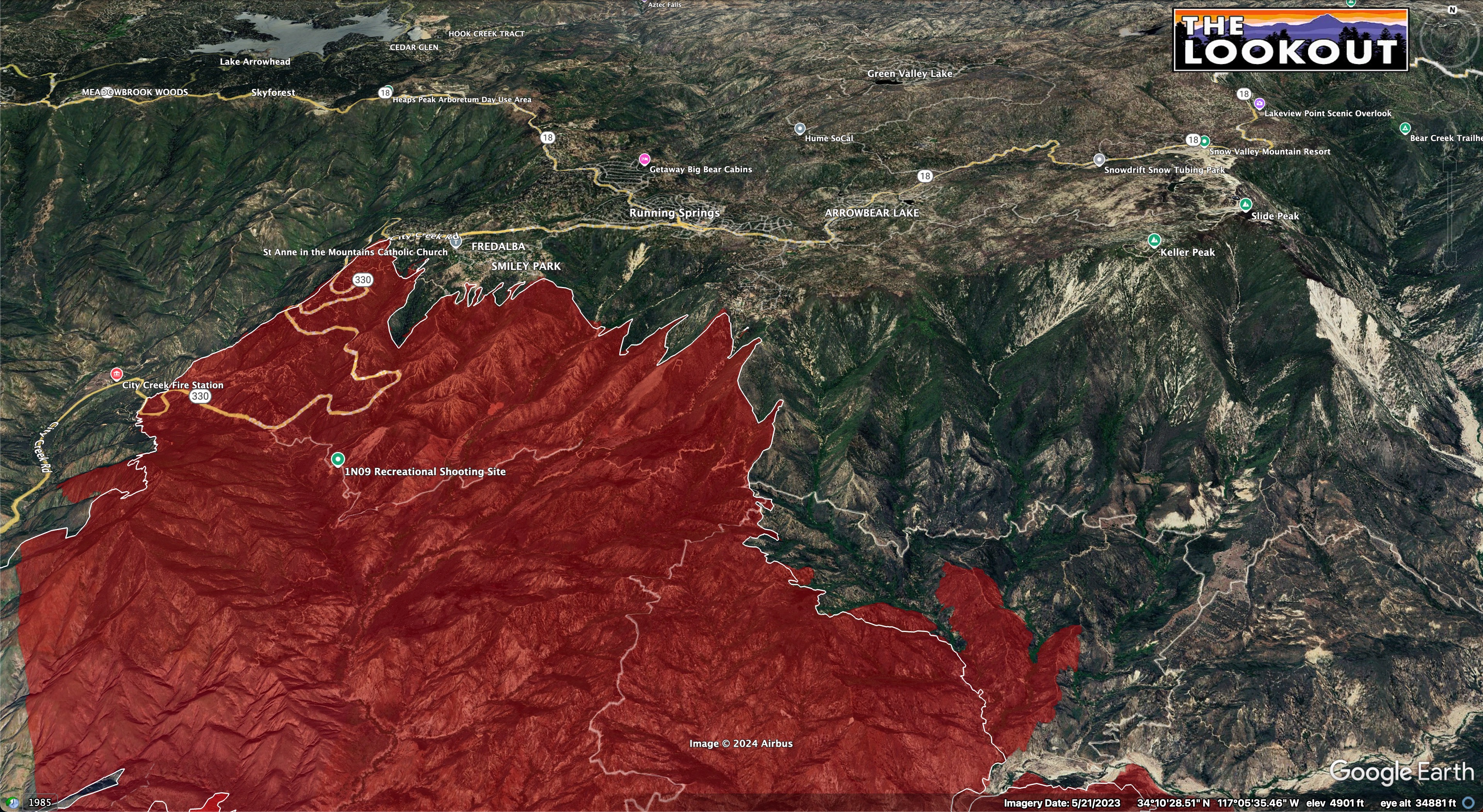
No real growth toward Running Springs in 24hrs between 9/7 2300 and 9/8 2000.
White line is 24 hr growth.
12 Likes
Interesting on this critical resource order…2 local STA were released last night.
1 Like
All federal night resources were put on standby last night and told to go back to hotel rooms…
2 Likes
Is this maybe to spread out some resources to the bridge fire?
2 Likes
When you have a rapidly evolving incident like this one you will get surge resources from local areas, these surge resources might put the local area below draw down and thus as soon as possible these local resources will be released as out of area resources arrive. This is standard practice.
29 Likes
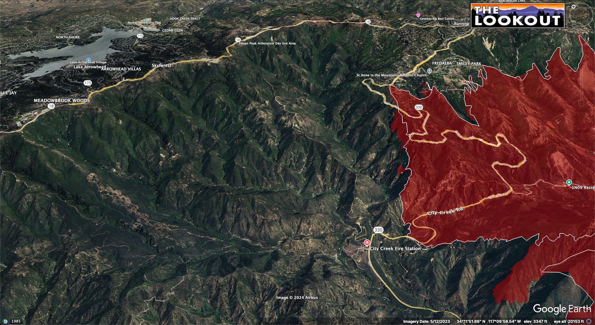
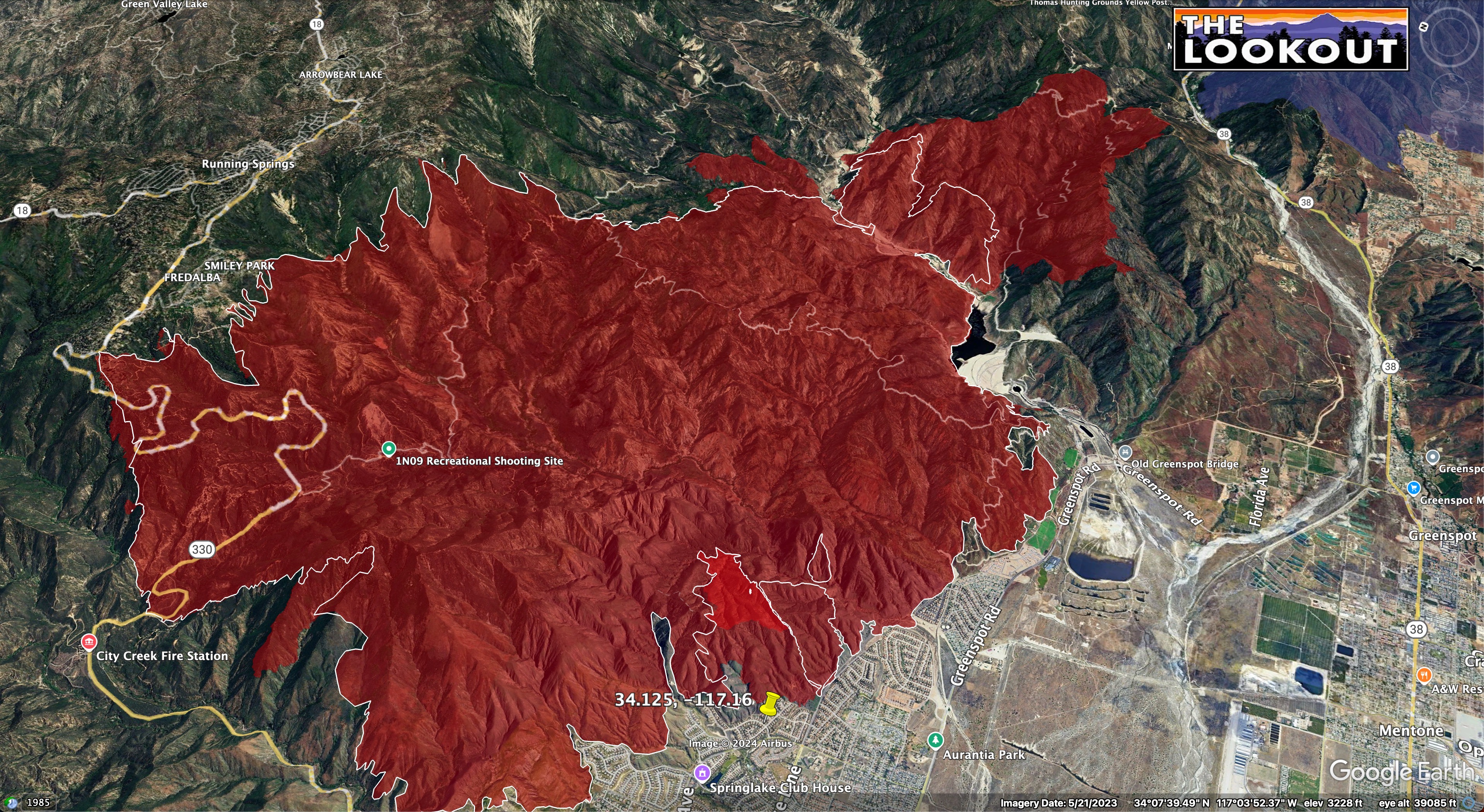
Any old-time foresters know what’s the deal with the Manzanita Flat area ( 34°09’44.8"N 117°02’40.0"W)? Appears to be some grid-like planting. Penny Pines?
(Don’t look at the perimeter too closely you dirty bastards)
5 Likes
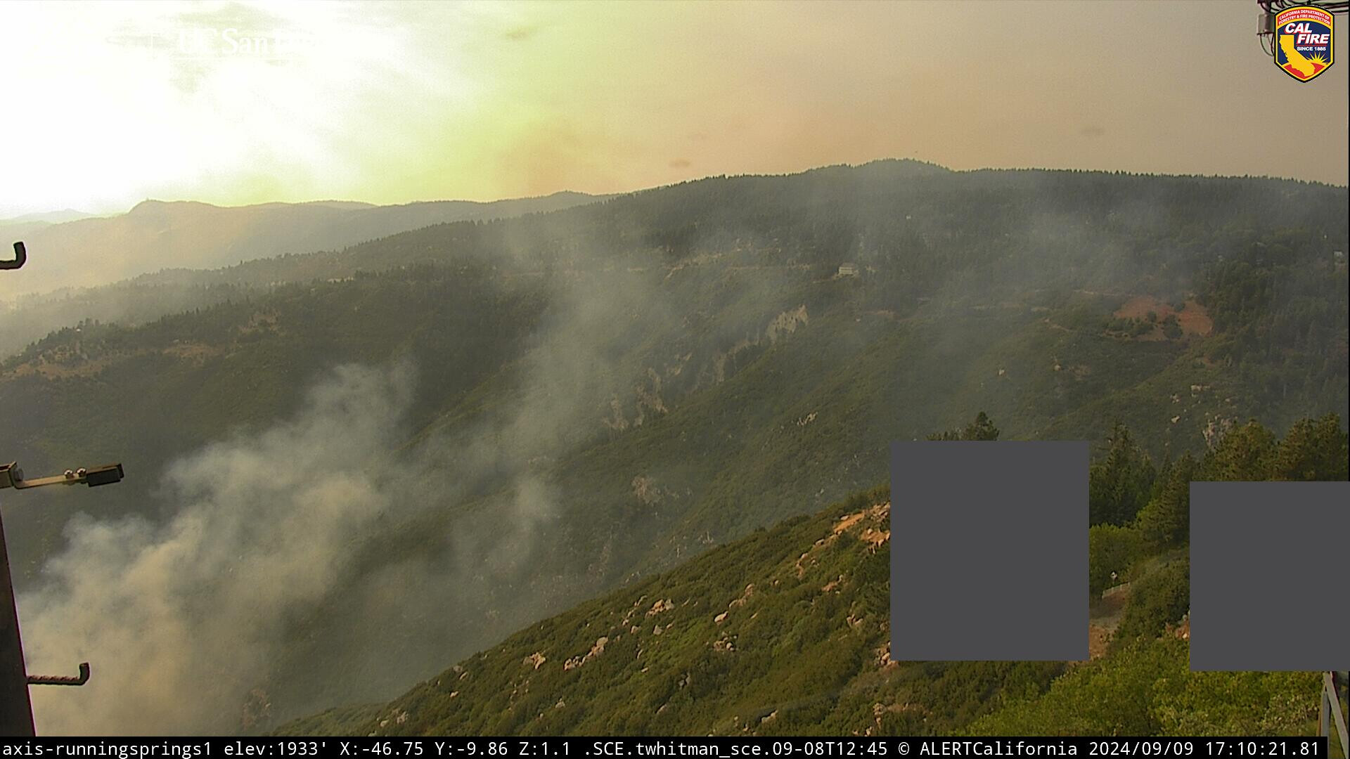
No line is what it looks like, due to weather & intense fire activity, they haven’t had air support for two days. They’ve been corralling it and prepping to protect homes, I doubt any serious line construction has been completed (3%?)
2 Likes
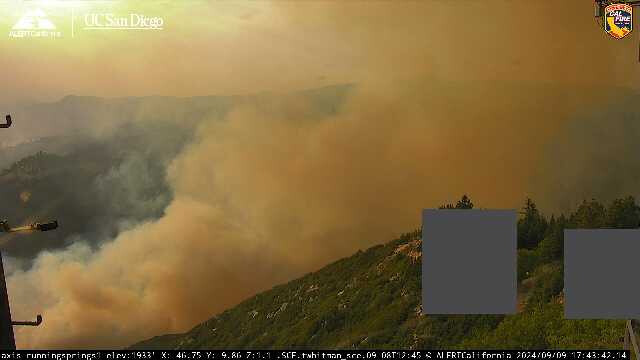
Today could be a rough day as the convergence boundary is over the ridge tops and more towards desert slopes which will probably drive the pyrocu to the east and fire upslope runs. The thunderstorms and precipitation to the east.
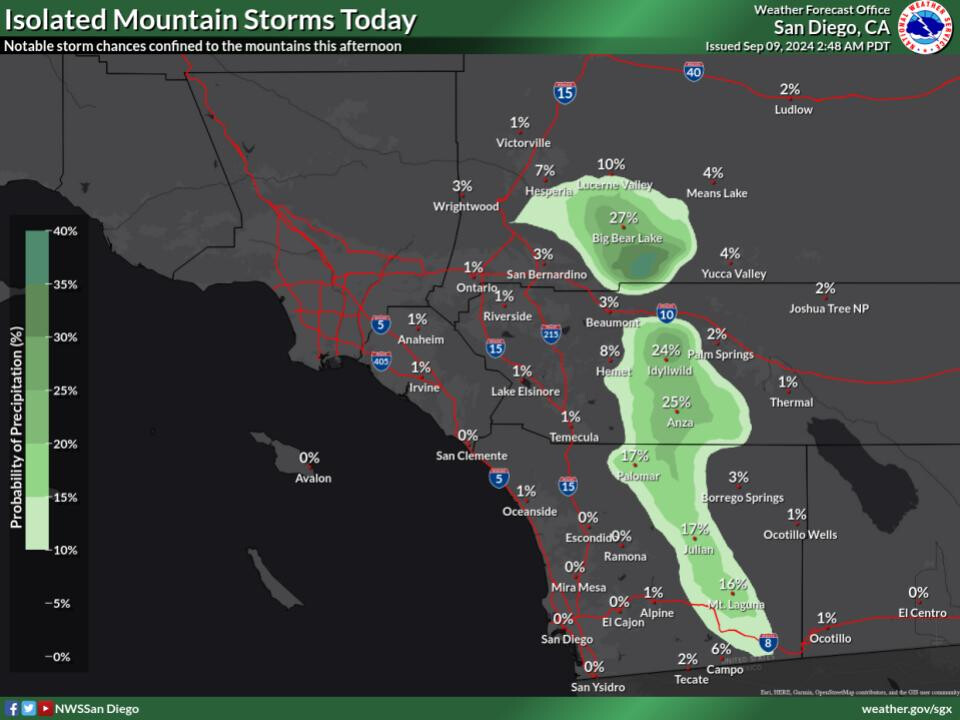
Also to add: if the fire continues to progress towards Seven Oaks it could get into alignment with the stronger onshore winds Tuesday/Wednesday and threaten Big Bear.
10 Likes
They pulled air off yesterday afternoon. Air is on it right now.
4 Likes
both yest and day before, but they did have some night ships overnight sep 7/8, hopefully today they get a chance to build a foothold
3 Likes

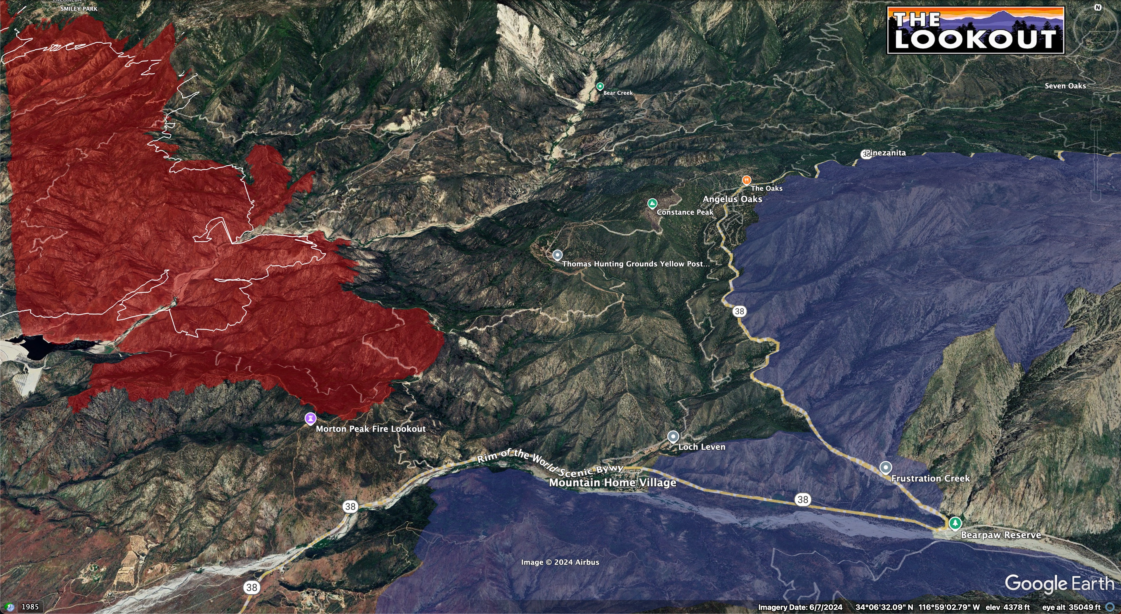
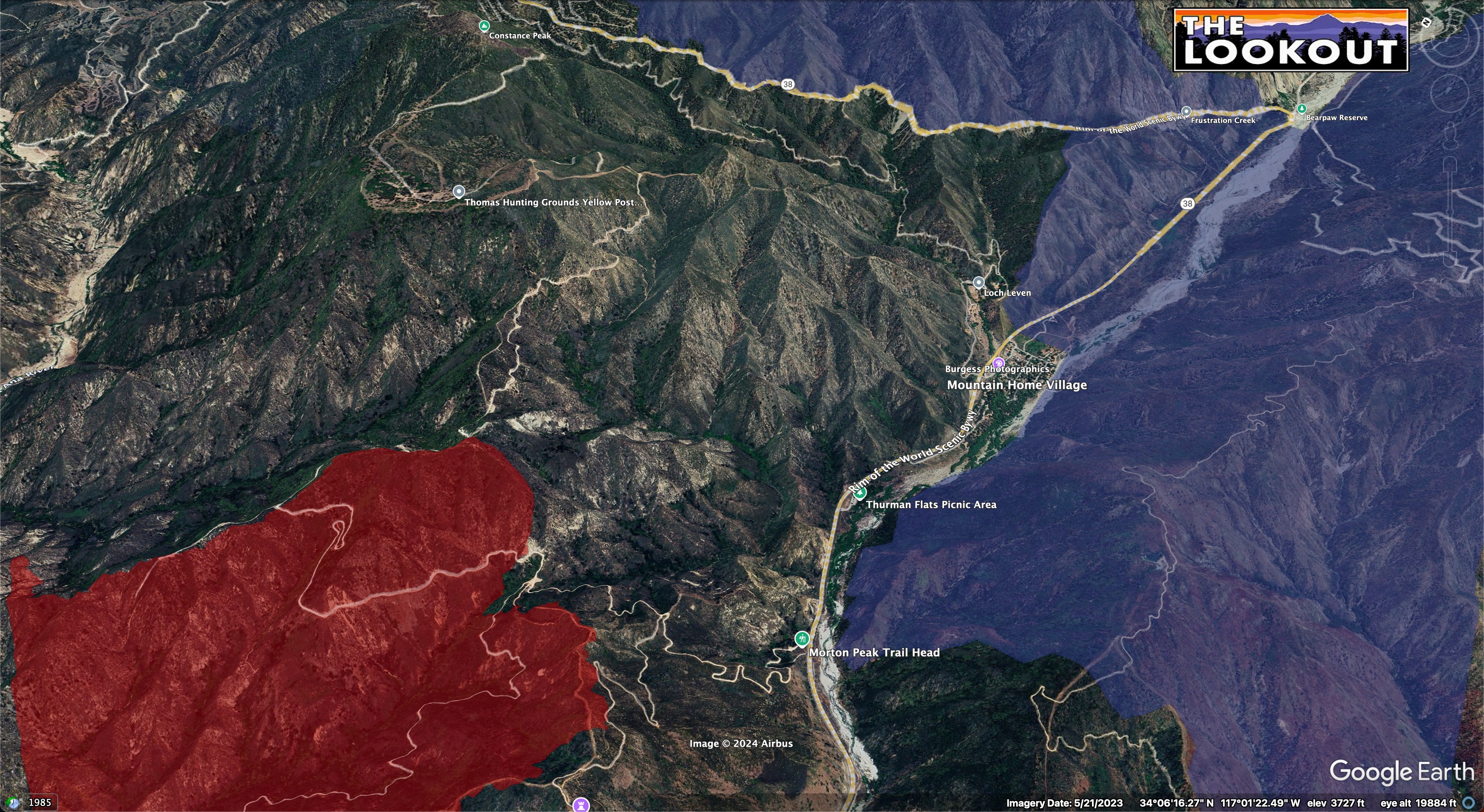
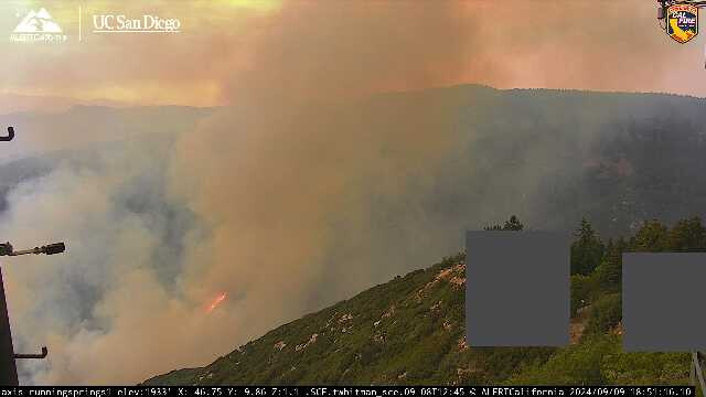
Its making its way up the Santa Ana River drainage, Id expect some more Evac warnings when it gets to the Bear Creek confluence
4 Likes
Agree. No fire history in Bear Creek since 1970. Bear Fire
4 Likes
https://scancalifornia.com/live/baldwin/
Has some fire traffic today from command
4 Likes
2 Likes
picking up some steam
5 Likes
fire has reversed slope running uphill now
8 Likes
4 Likes
Updates? Latest mapping?
1 Like
Looks like intel24 just flew it. Over the airport fire now
2 Likes