4 Likes
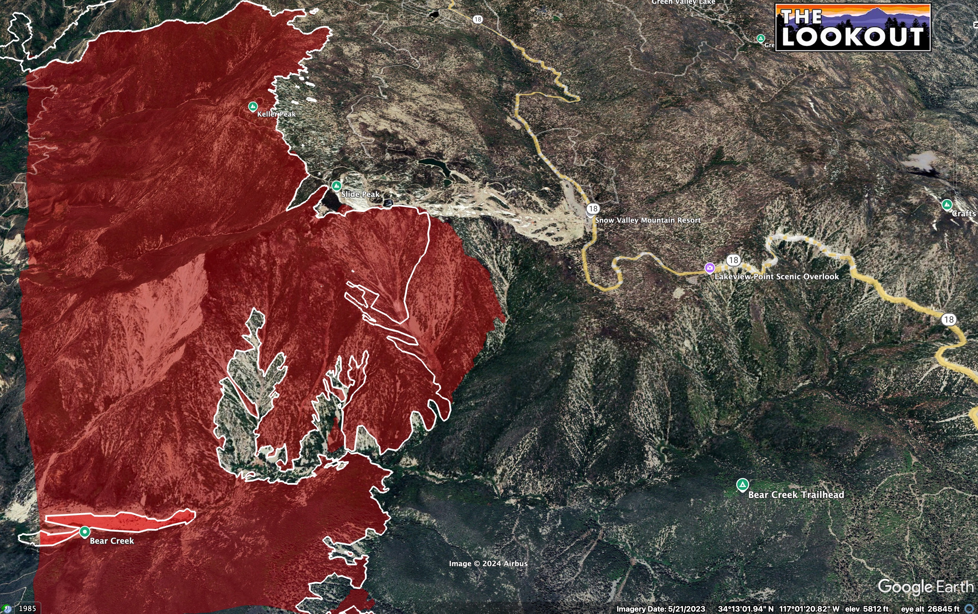
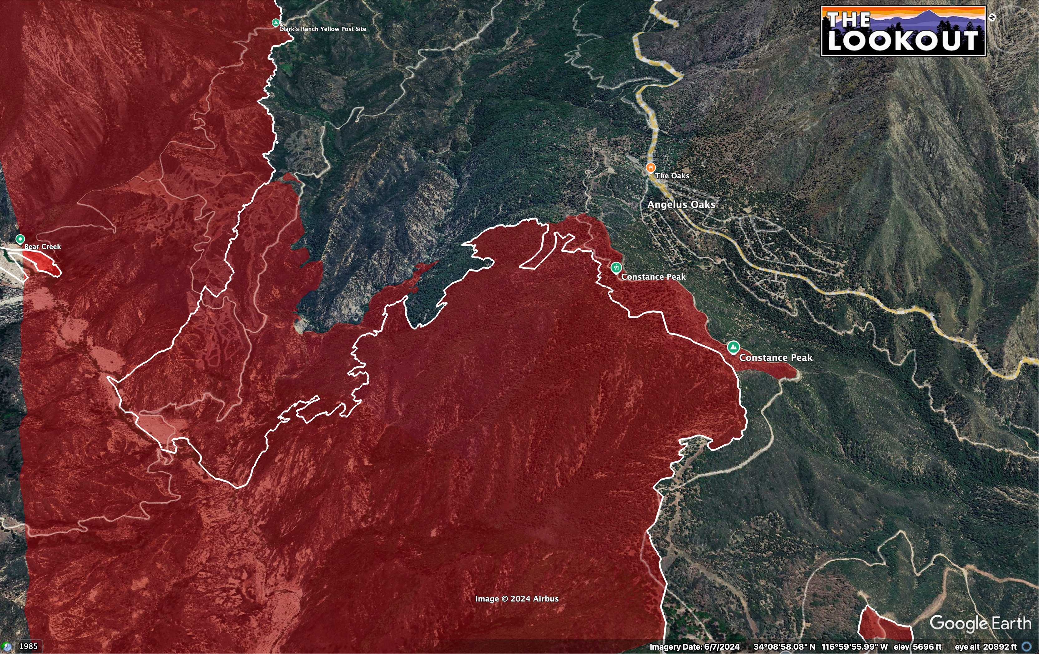
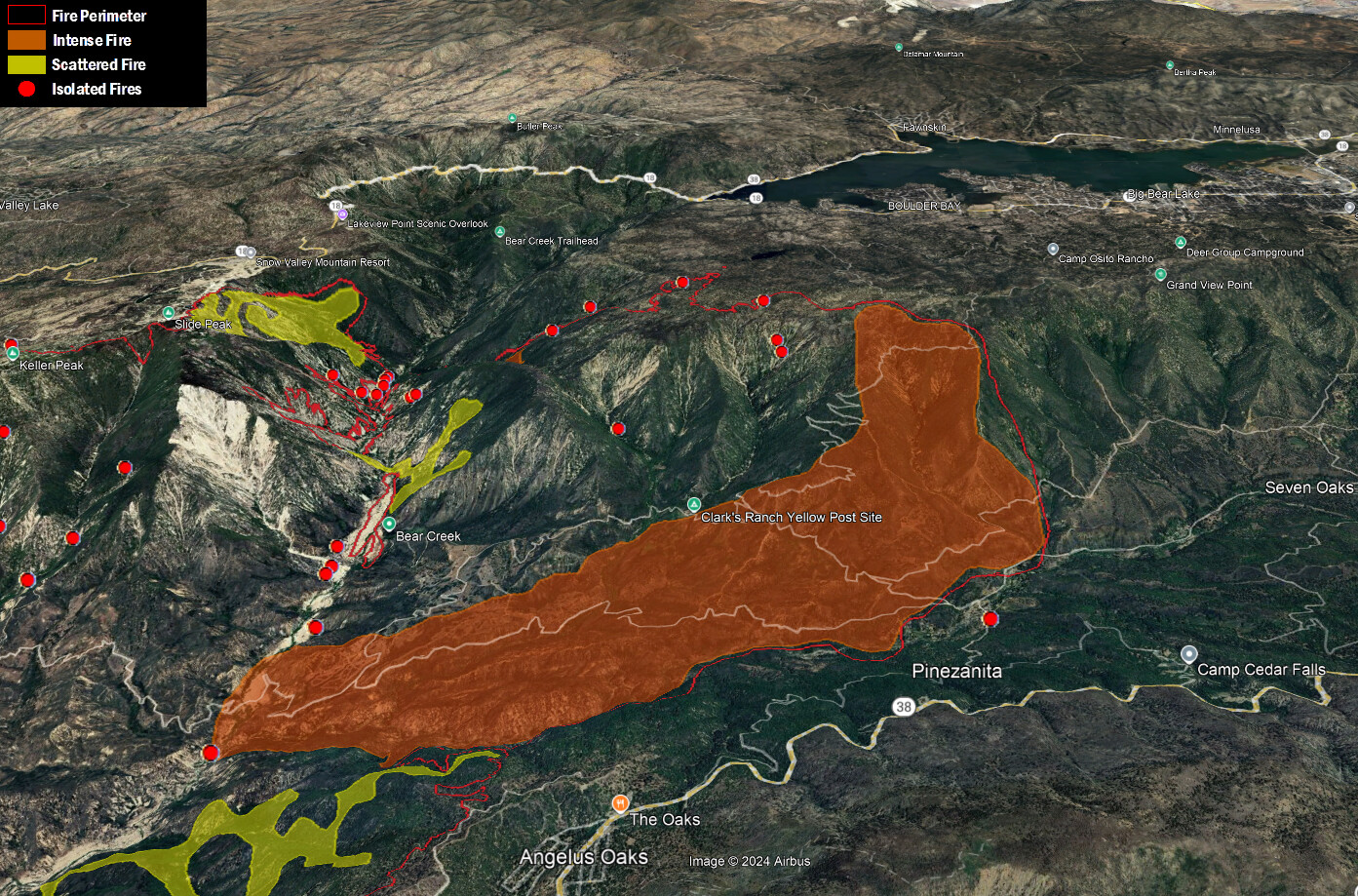
Pretty typical now for slim to none on night shifts. Saw a couple USFS engines coming down 38 into Bear City at 8pm, but don’t know if they’re coming off day shift or applying to go to night shift. Only thing we have going for us is old lost control burns, some topographic fuel features, and predominant wind patterns. If it runs from Bear Creek, it should jump 18 and shadow the Butler Fires. If it starts up the South Fork of Santa Ana, one really big burn scar from back in the 1950s with really no heavy fuel recovery, but with the exception of Radford Truck Trail, it looks like the other lines they reopened might be for nothing. There are some old control line scars up canyon towards Sugarloaf Peak, but seems like they don’t ever want to do anything in there to protect any future Wilderness designation.
3 Likes
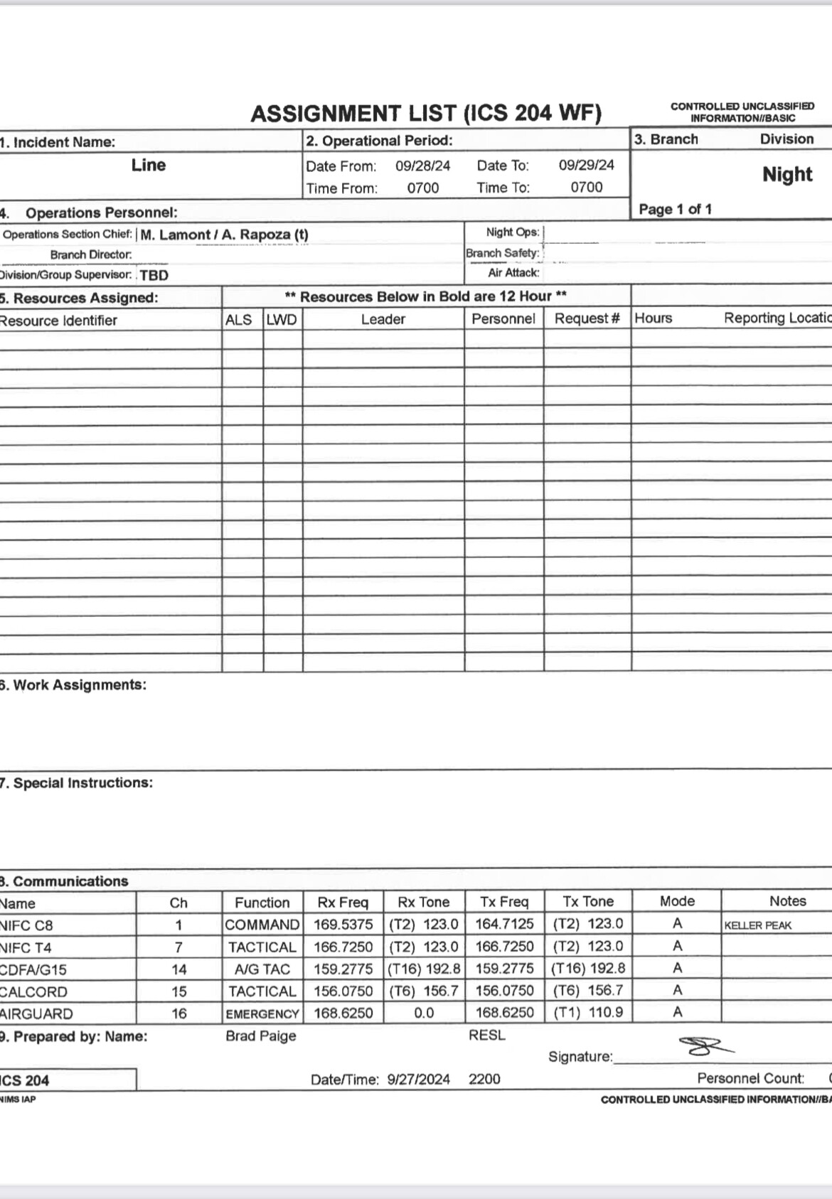
There will be equipment for night shift. That is the reason there is a Night Division in the IAP, for just the scenario that they need to staff it. There are still some 24 hour resources on the incident per the IAP, and additionally, there are multiple strike teams heading to the incident from local units currently.
9 Likes
ANF just sent a STEN to assist.
7 Likes


VNC 9325C forming up for response to Line fire. B16, ME321, E333, E342, E355, E356
6 Likes
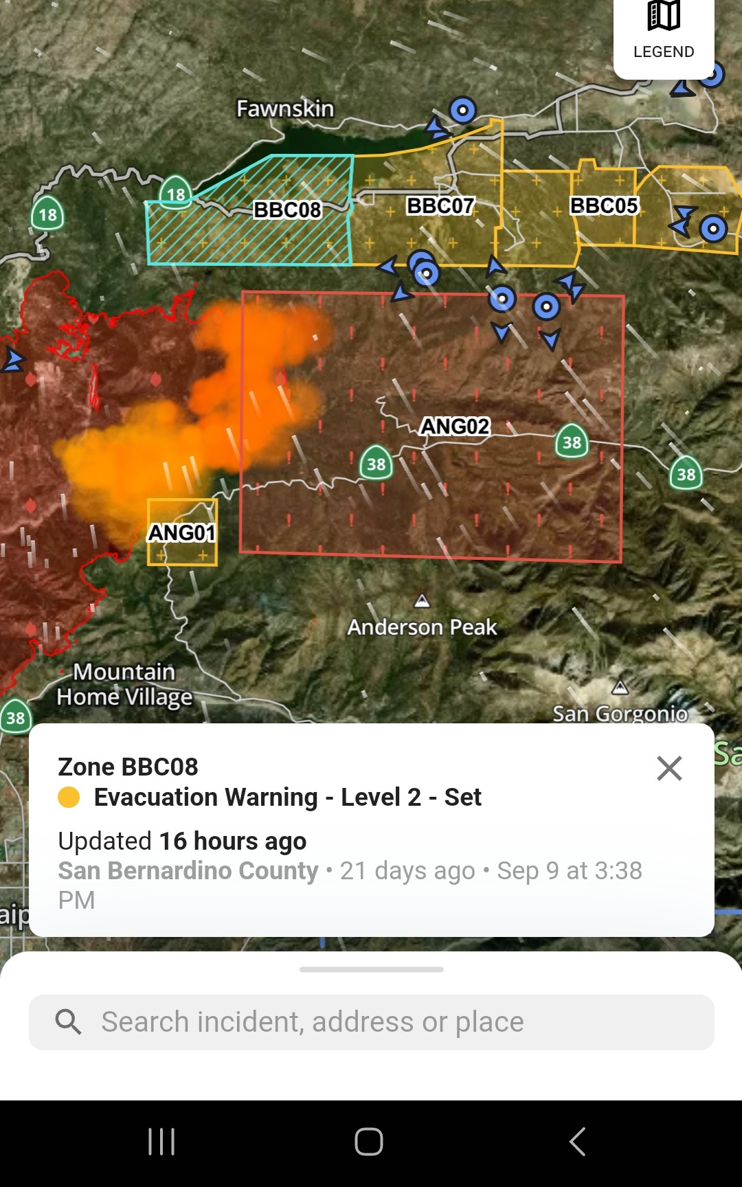
Evac warning for Big Bear
2 Likes
This is vague. Big Bear Lake, Big Bear City? Area? Source?
SB County Sheriff: x.com
Effective immediately, as of September 30, 2024:
The community of Big Bear Lake including Moonridge, Sugarloaf, and south Erwin Lake are now under an evacuation WARNING. Those who require additional time to evacuate, and those with pets and livestock should leave now.
6 Likes
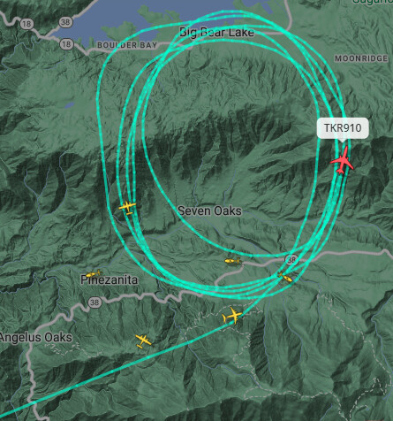
TKR 15, TKR 167 and the VLAT 910 over the fire now.
4 Likes
VLAT 911 from Santa Maria also in the mix.
3 Likes
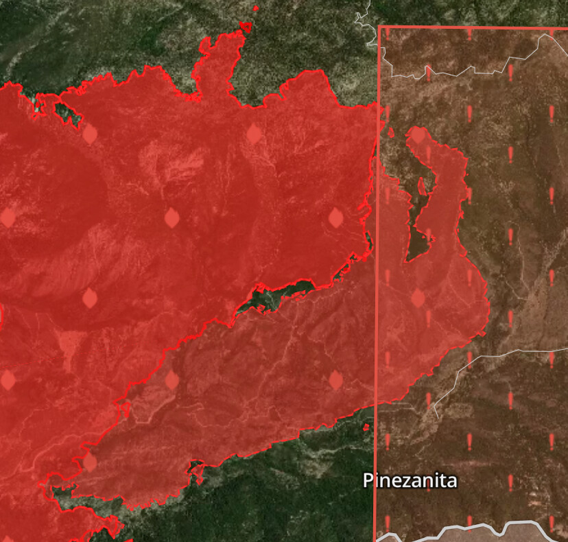
Looks like fire is extending onto the mesa near Bluff Lake.
Live Youtube feed looking down the Santa Ana river drainage: https://youtu.be/LbQQGoM7a5I
Snapshot from that live feed:
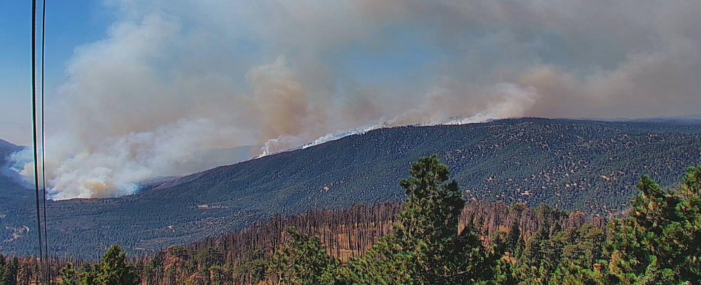
5 Likes
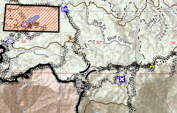
Snow Summit West camera has a good shot of it, it’s definitely on top of the bluff now. When you look on the map and see dozer line along the Mill Creek (2N10) rd, that was just a shaded fuel break as contingency line. Couple dozer blades down on the ground while leaving the canopy intact all the way east to Mid Section off Knickerbocker. It’s not going to hold against head fire. And if it was in section 11 yesterday and ran up out of there that puts in section 35 at the division break. Just a guess though
4 Likes
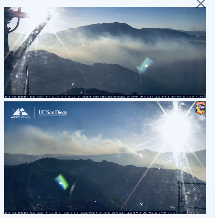
Keller Peak Camera looks like there might have been a wind shift, now out of the east. This should be good and push the fire back on its self.
3 Likes