I’ll take that minute to get folks out any day.
8 Likes
You can see the rain falling on the image I posted, and the timelapse from the camera shows the rain falling and moderation of fire activity from it in addition to the outflow wind pushing the smoke in a different direction.
8 Likes
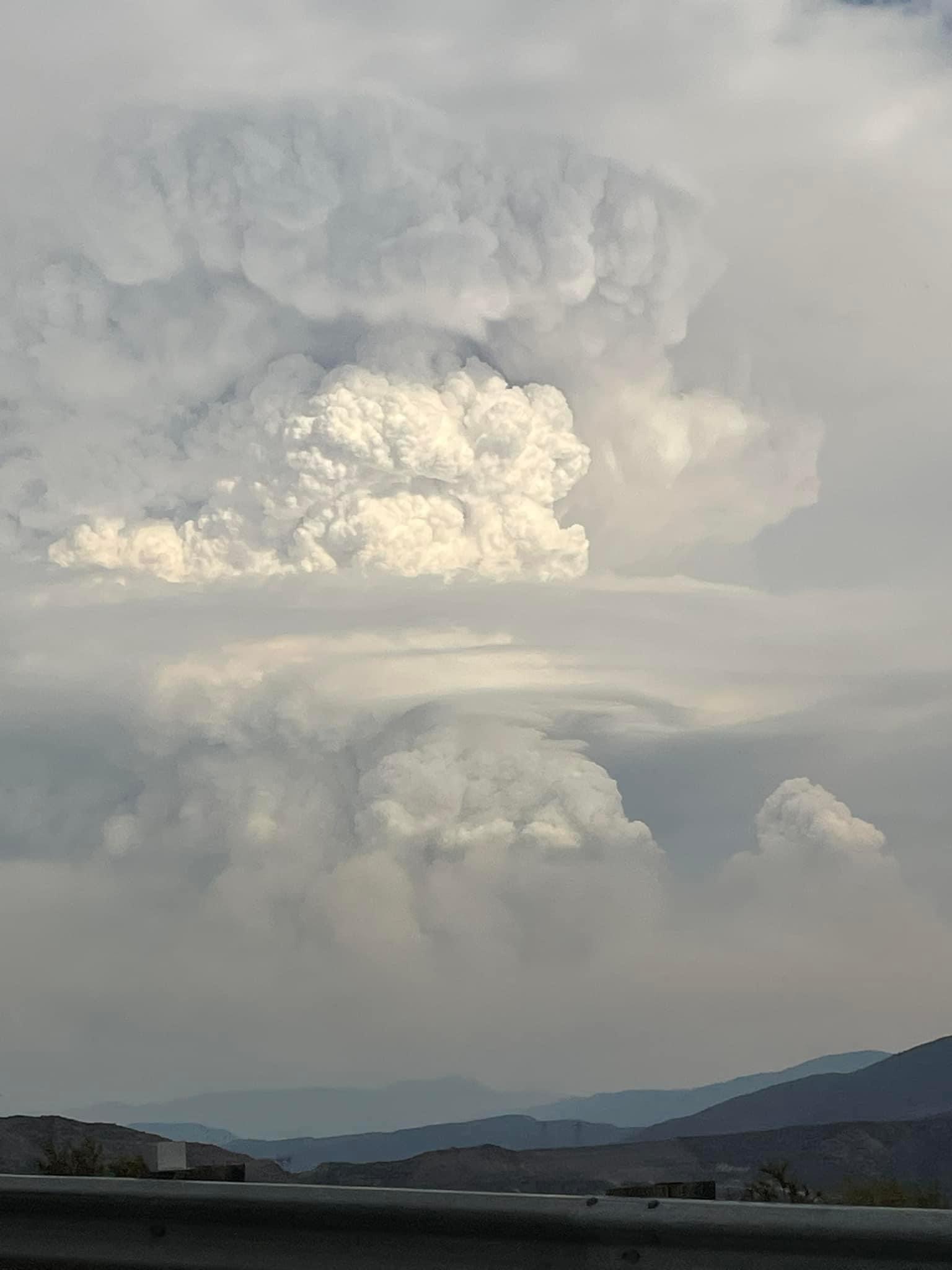
The Line Fire just paused itself mid slope because it produced too much of a pyroQ creating a wetting rain and pausing its charge into Running Springs. Amazing fire behavior for Southern California today with the influence of multiple thunderstorms.
16 Likes
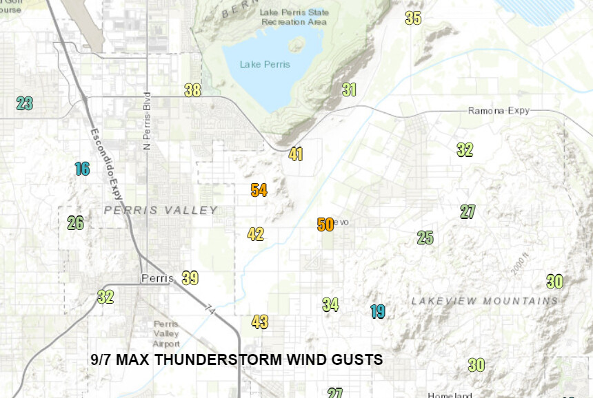
Down canyon winds should start soon. Tomorrow, there will be greater chances for widespread convection west of the mountains. The dry layer is more prevalent west of the mountains and thus gusty outflow boundaries and downburst winds could drive additional chaotic wind shifts. A thunderstorm near Perris today produced observed wind gusts of 50-60 MPH. Additionally, wetting rain is possible tomorrow as greater coverage of convection and converging outflow boundaries could produce storm complexes. The convective models show accumulating precipitation tomorrow especially across the mountains, but the totals may not factor in the low level dry layer and may be overdone
9 Likes
From NWS SDG: The area of high pressure over the Western United States has shifted
to the northeast, allowing for an influx of monsoonal moisture into
the region today and Sunday. Thunderstorms this afternoon are
expected in the mountains and locally into the mountains
foothills and deserts. Storms that develop are capable of
producing gusty winds, frequent lightning, and heavy downpours
that lead to areas of flooding. Chances of thunderstorms remain in
the forecast for Sunday afternoon, with slightly higher
probability of occurrence and more coverage compared to today.
Thunderstorms tomorrow have the potential to develop in portions
of the valleys. Precipitable water values will remain elevated
with HRRR and WRF models showing a higher chance for storms
capable of downburst winds in valley locations. HREF peak rain
rates for Sunday afternoon are mostly 0.40 to 0.60 inches per
hour, locally up to 0.75 inches per hour. Monsoonal moisture
decreases by Monday but is still sufficient for storm development,
chances of thunderstorms are in the forecast for the mountains
Monday afternoon.
5 Likes
LAC 1103A & 1109A enroute immediate need.
7 Likes
While moderates still seems to be slowly crawling away
5 Likes

Any eyes on what its doing above Highland Ave and the 330? has it gone all the way around Harrison Mountain?
2 Likes
It says cloud strikes. Plume dominate pyro cumulus clouds.i have buddies on this fire let’s just focus how we can help.
3 Likes
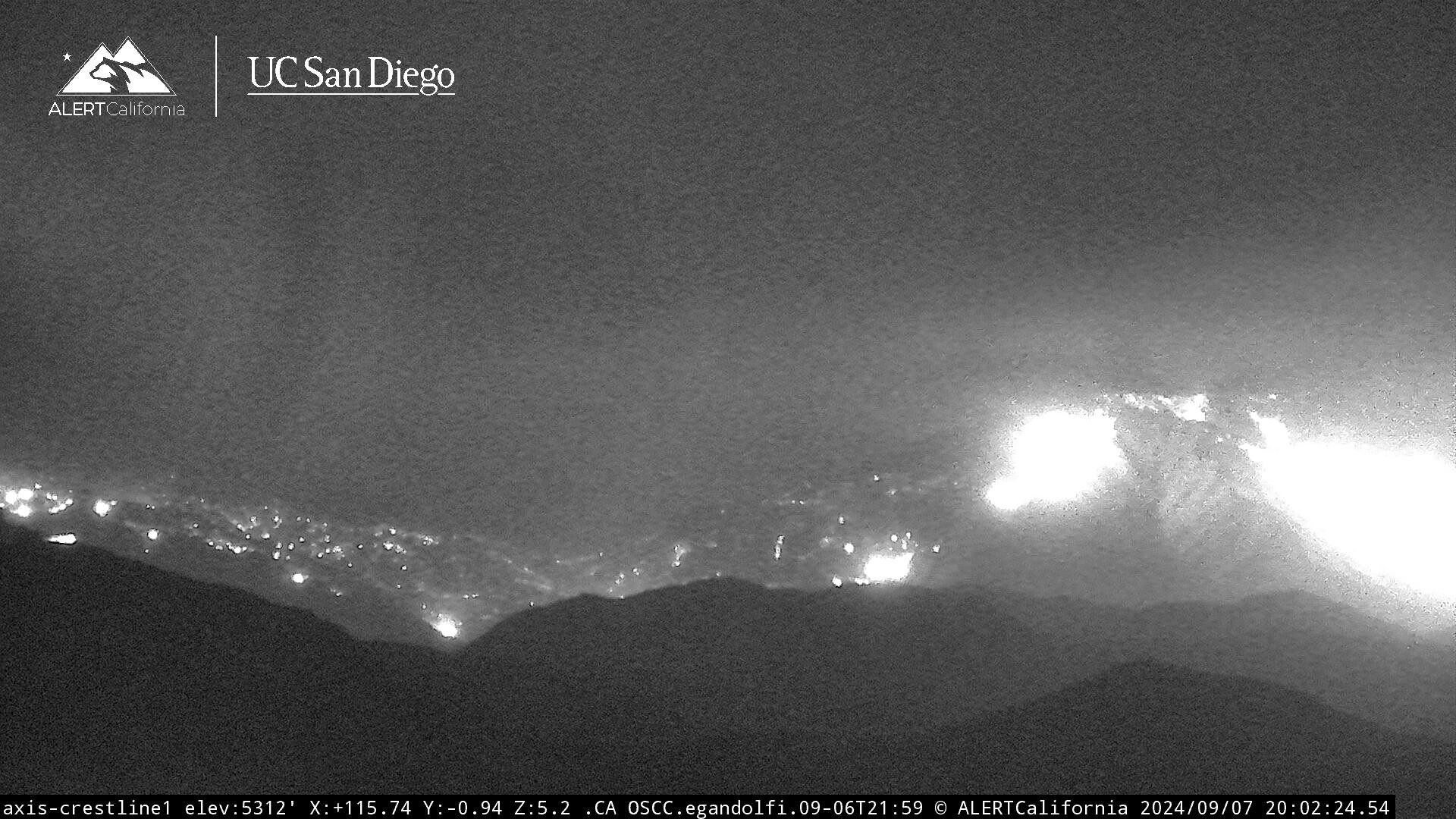
Looks like it is right now
https://ops.alertcalifornia.org/cam-console/1911
4 Likes
And if the BDF is slow to respond, the state will order and they and BDF will hash it out this winter.
2 Likes
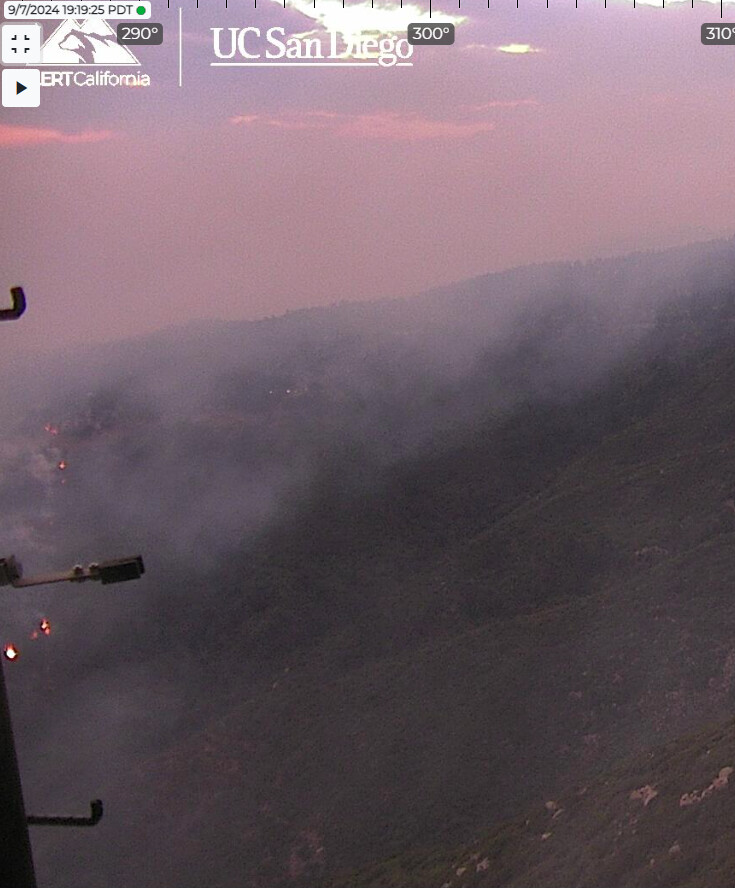
Just starting to see ash fall on these cameras in Running Springs:
3 Likes
IAP?
Whose running incident
1 Like
Cal Fire team 3 should have the incident tonight or in the morning. I haven’t seen a link yet for iap.
8 Likes
Tried to go creek like.
4 Likes
Hopefully someone saved all the video from the blow up and everything that happened after that.
Im truly glad they got everyone off the hill.
5 Likes