State ID: CA
3 letter designator: BDU
Fire name: Airport
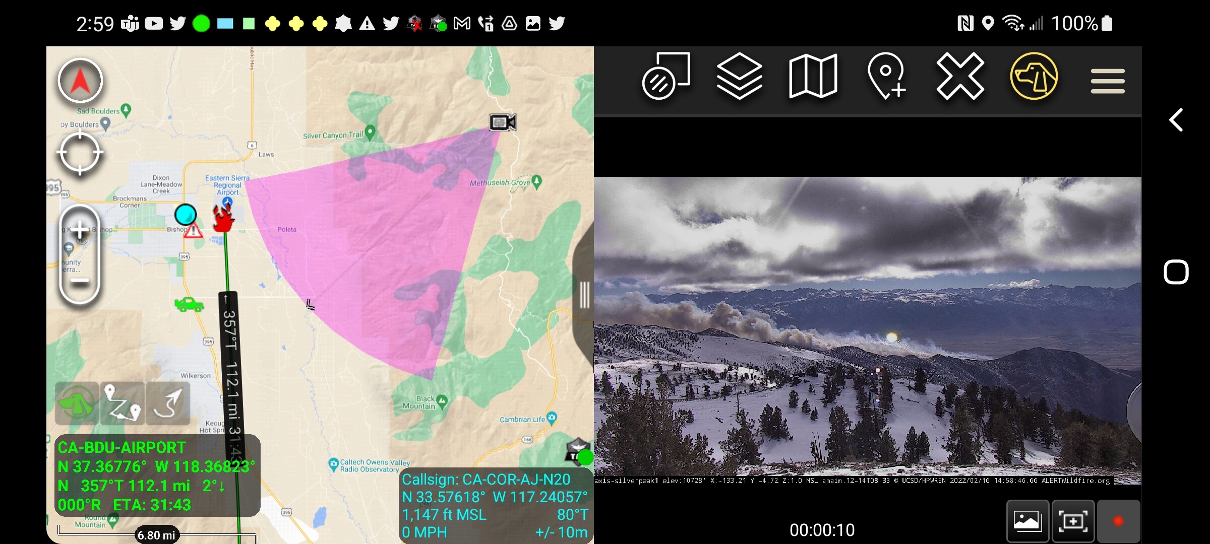
Location: Southwest of Bishop airport, Airport Rd, crossing Poleta/Line https://goo.gl/maps/6BEyEzKgjXmgKRA58
Reported acres: 25-50
Rate of spread: Critical
Report on Conditions:
Structure threat:
Resources:
Hazards:
Weather:
Radio channels:
Scanner link:
Webcam link:
Agency Website:

3 Likes
2 Likes
Scanner feed:
1 Like
Potential for 1,000 acres per BDU.
4 Likes
10 posts were merged into an existing topic: CA-BDU-Airport ??
Flightaware has an ADSB reciever right above Bishop. It’s got better local coverage.
1 Like
#AirportFire Update: 100 acres dangerous rate of spread potential for 1000 acres. Additional air and ground resources on order. Road closure Warm Springs and Collins from Hwy 395. Cause under Investigation. @InyoSheriff @Caltrans9 https://twitter.com/CALFIREBDU/status/1494070260885954563/photo/1
2 Likes
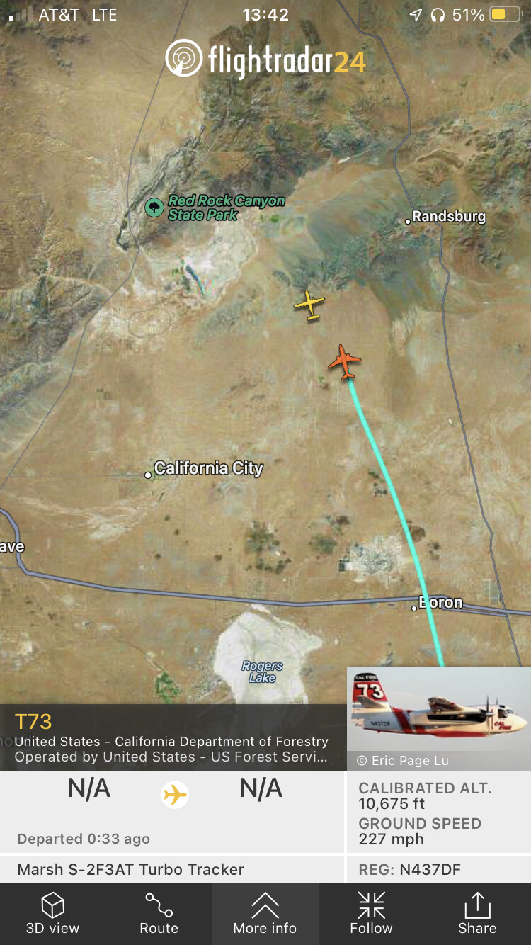
#AirportFire Air attack;
4 Cal Fire Tankers (T88, T86, T73 and T100)
1 USFS Tanker
Multiple helos responding
Temporary Flight Restriction (TFR) ordered for Bishop Airport and surrounding areas.
2 Likes
Wildfire - #AirportFire
#InyoCounty
@CALFIREBDU
Map Link: https://napsg.maps.arcgis.com/apps/webappviewer/index.html?id=6dc469279760492d802c7ba6db45ff0e&query=USA_Wildfires_v1_5644,UniqueFireIdentifier,2022-CABDU-002479
#CA #CAWILDFIRES #CALIFORNIAFIRES #FireSeason2022
#firetwitter
#FireMappers
1 Like
OCFA FIRIS Intel 12 has launched to the Airport Incident, Inyo County https://twitter.com/FIRIS/status/1494081594780442625/photo/1
1 Like
Engine and crew Strike teams coming from AEU and TCU as well
2 Likes
Current estimate is 1,330 acres. Could impact the Caltech Owens Valley Radio Observatory just north of Big Pine within a couple of hours.
Heard potential for 4000 acres as well
4 Likes
Based on CHP CAD traffic putting it at collins road and distance to Airport is 6 miles.
2 Likes
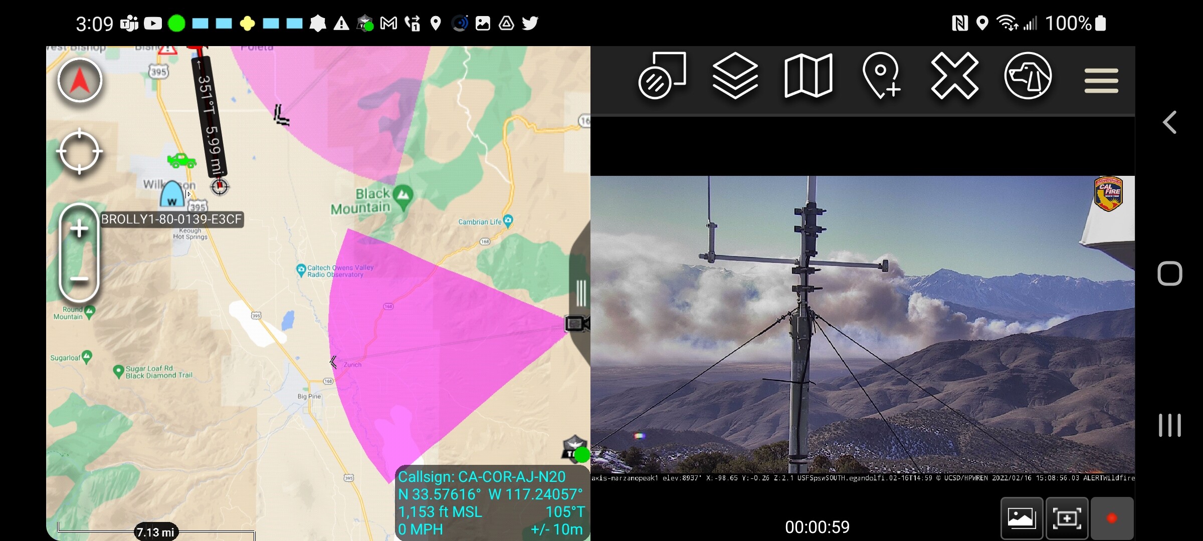
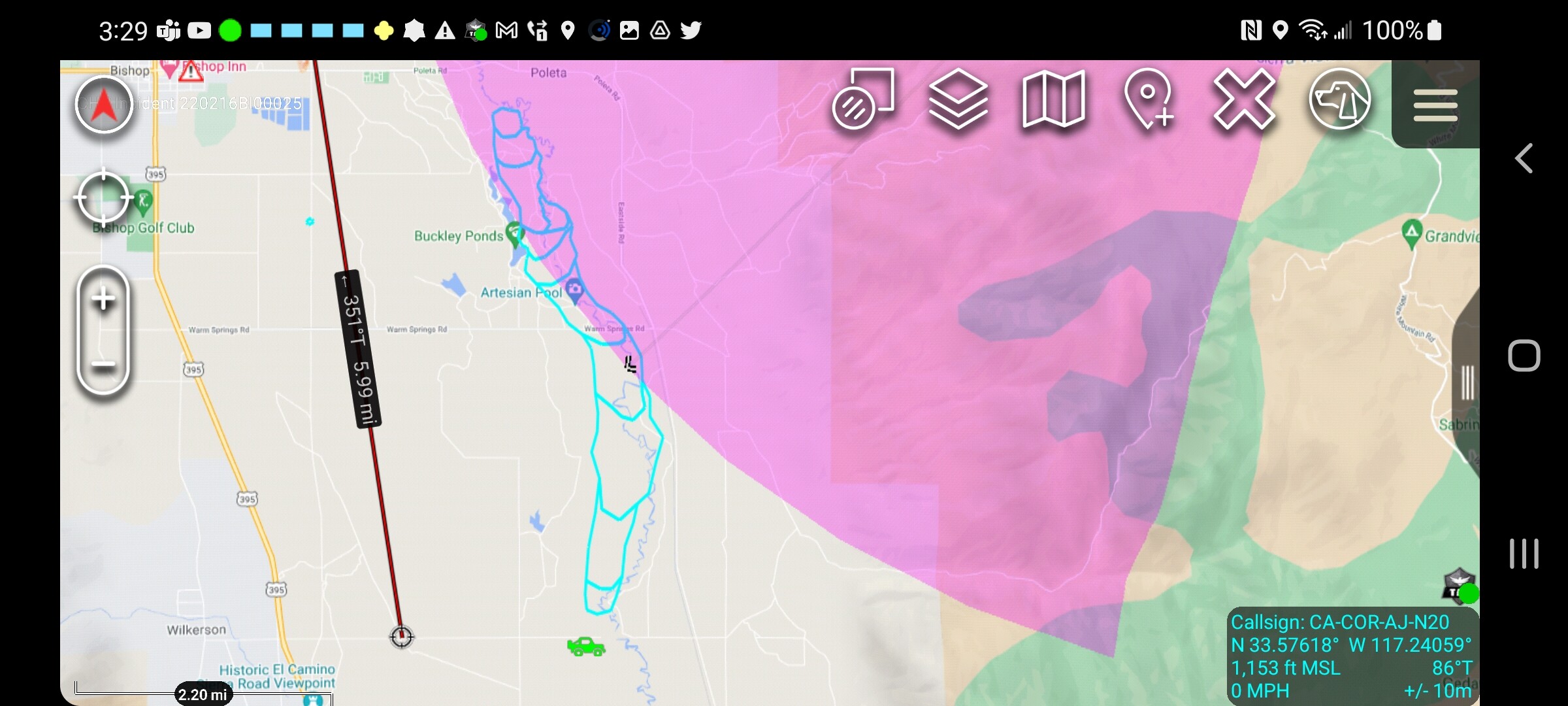
Intel 12 just mapped it at 2,151 acres.
3 Likes
Current tankers flying the fire 73, 85, 86, 88, 90, and 100.
Air Attack 430 over the fire with AA330 enroute for relief.
Tankers are loading out of Porterville.
3 Likes