CA-BTU-Dixie?

Yes, also N501TC is Courtney IR plane.

Fire is active on floor of Genesee Valley at Heart K Ranch at about 3pm. Fire likely to run Grizzly Ridge toward Quincy west of 2019 Walker Fire. Elsewhere, not much spread toward Mill Creek. New maps posted at Dixie Fire – 8/20/2021 – The Lookout

9 Likes

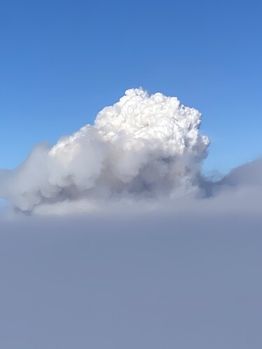
Flew right over the fire this afternoon.
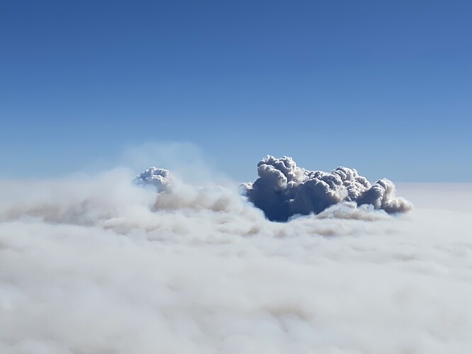
This would be QQ just north of Genesee Valley from 20k alt.

This is Lassen Sector from about 14k. This column is between Horseshoe and Summit Lakes in the park.

34 Likes

Wow, great pic’s norcalscan!

Thanks for the verification. Are both Aerocommanders?
I’m a plane geek, so it’s important. Lol

1 Like

Video about the Eagle Fire incidents:

1 Like

A post was merged into an existing topic: Emerging Technology

911 call reporting a “flare-up” near Doyle. That’s quite a ways southwest of the Janesville spot, no?
Radio traffic kinda shined it.

Reported to branch XX by Dixie east comms.

The flare up is well inside the perimeter of the sugar fire above Doyle which is well south of Janesville on 395.

1 Like

Informationally, the Dixie Fire West Zone feed I have been providing on Broadcastify will be going dark at 1500hrs today. The incident will be taking down NIFC C56 on Bald Mountain and that is the only repeater that my scanner could hear.

9 Likes

Will it still have any of the East Zone traffic?

That is the scanner feed someone has been providing from susanville, I cant speak to that ones status. Mine is in Chico and cant hear any of the east zone traffic.

2 Likes

Looks like there is a column starting to push up in Genesee Valley area per Radio Hill and Indian Ridge cams.

1 Like

in response to the genesee valley post… thats just east of taylorsville

4 Likes

Context, please.

[Edit: I thought both files were set to share with anyone that had the link but only one was set that way. I fixed the other which was the dozer lines only version.]

Any discussion about the process to get this data filtered and into CalTopo, Google Earth, etc should take place here:

Been playing with filtering data using QGIS and importing into CalTopo and Google Earth. Data is from:
https://ftp.wildfire.gov/public/incident_specific_data/calif_n/!CALFIRE/!2021_Incidents/CA-BTU-009205_Dixie/GIS/IncidentData/

Here is an example kml containing Dixie Fire completed dozer lines from 082321 data package you can import:

And this one has completed dozer lines plus roads as a line:

4 Likes

Fixed sharing on dozer lines file, now anyone with link can access, no request for sharing needed.

1 Like

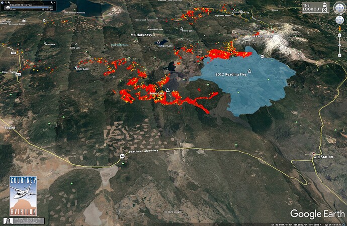
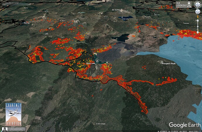
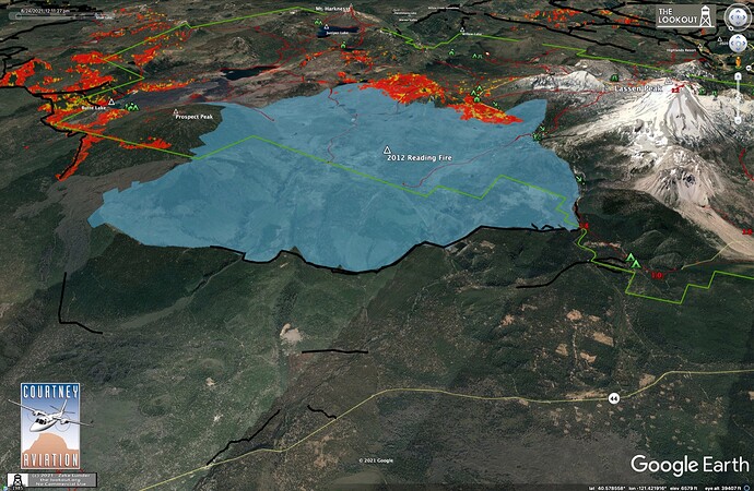
Quite a bit of new action on the far northern edge of the fire, outside of Lassen Park. A large firing operation has begun on dozer lines running to the NW on north side of Prospect Peak. It appears there is some slop of the firing over these lines and up onto the adjacent escarpment.


Main fire from south of fire just reaching 2021 Reading Fire. Dozer line around north edge of Reading Fire.

2 Likes

Lot of fixed-wing the past hour or so on Grizzly Ridge/Mount Hough - it’s really picking up in this wind. Tanker 40 just went on hold back to Redding.

2 Likes

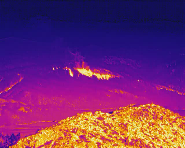
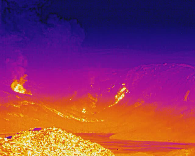
We parked the flir on Dyer towards Taylorsville for the evening. Starting to see some fire activity

2 Likes