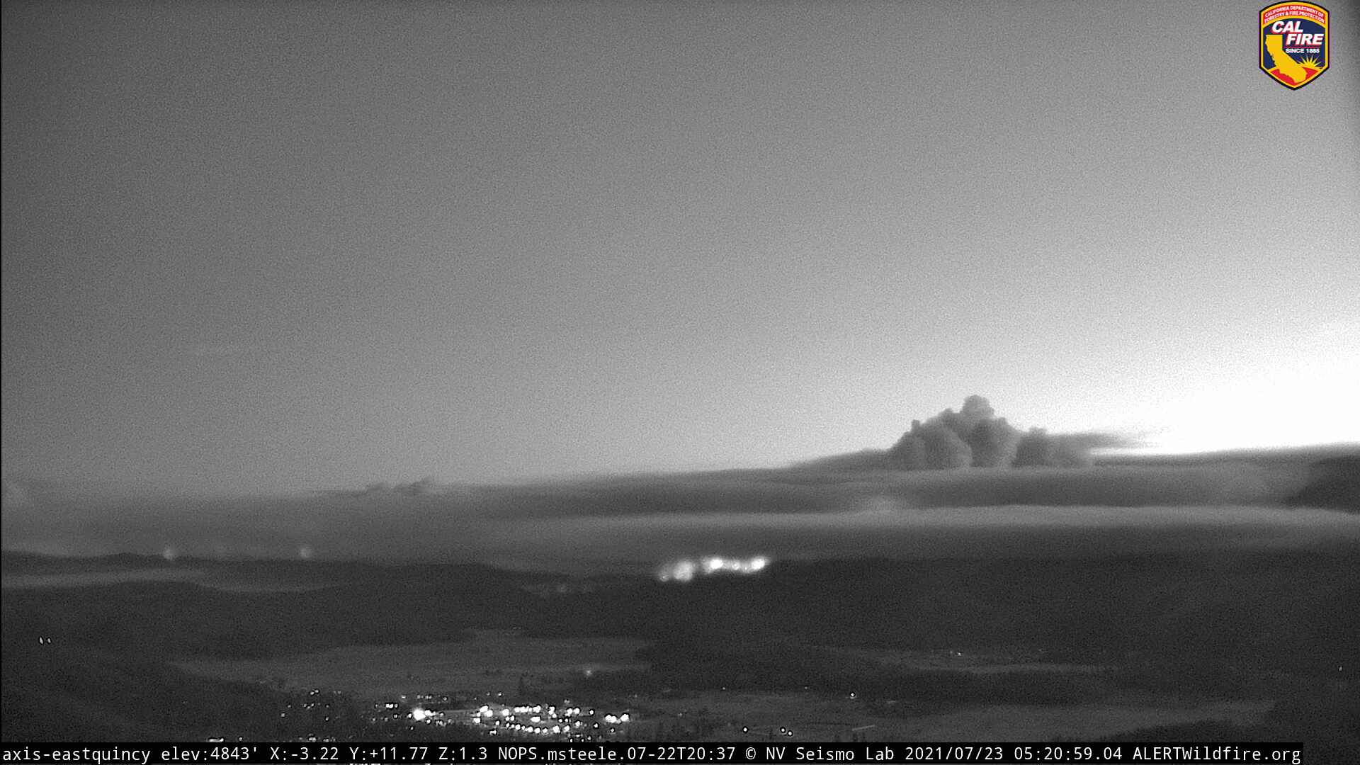
Just… WOW! This is 11:00PM!
Also for those who haven’t checked out this feed, the Alert Wildfire cams in the upper corners are streaming live (not the typical refresh) streams of whatever cam they’ve selected.
Good stuff!

Just… WOW! This is 11:00PM!
Also for those who haven’t checked out this feed, the Alert Wildfire cams in the upper corners are streaming live (not the typical refresh) streams of whatever cam they’ve selected.
Good stuff!
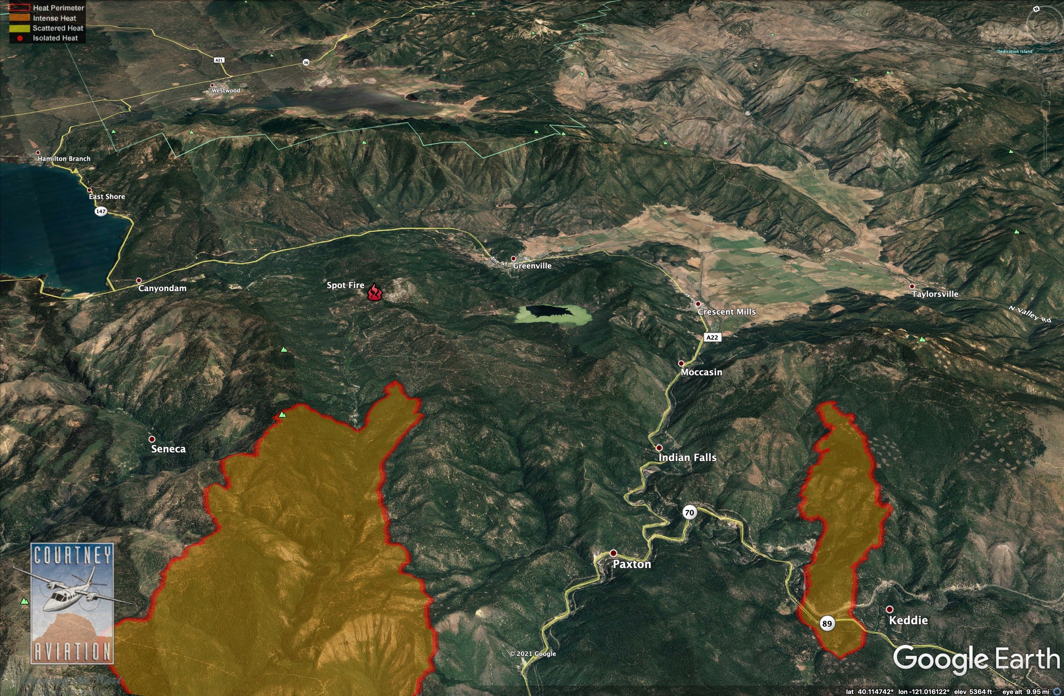
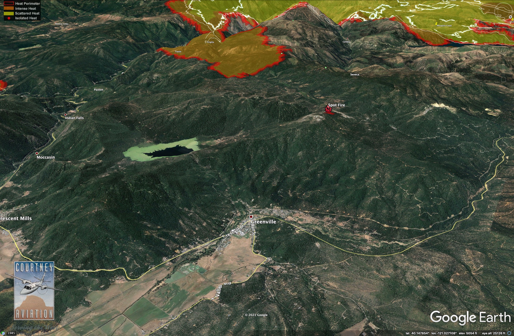
that is roughly 6 miles west of greenville
Somebody woke up grumpy 
Anybody got the YouTube channel for this mornings briefing

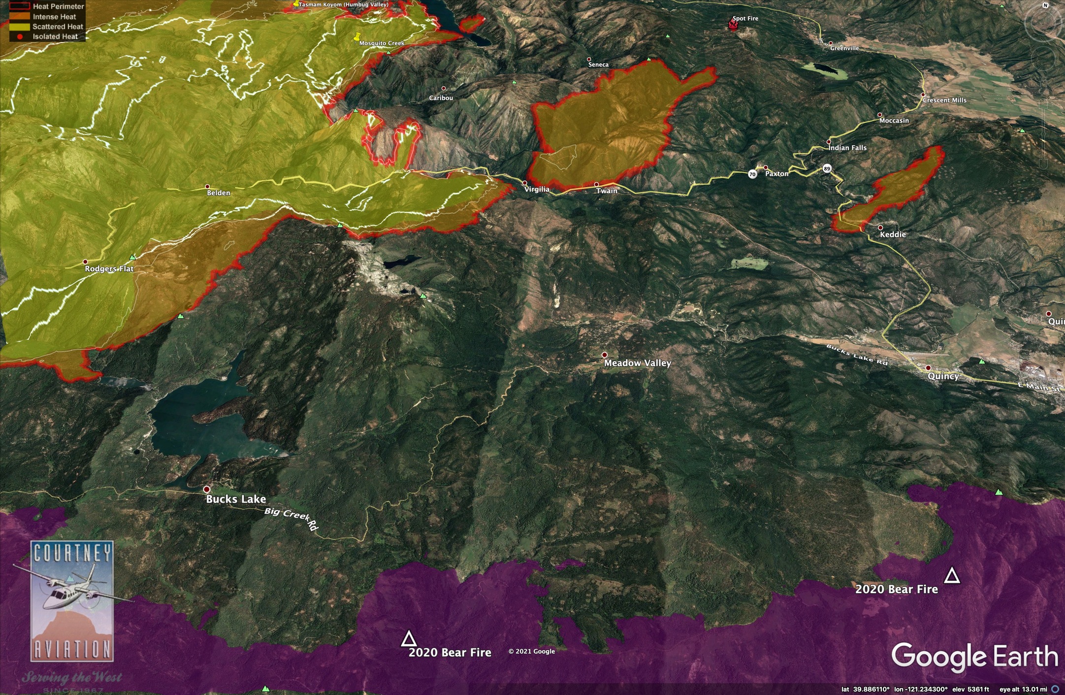
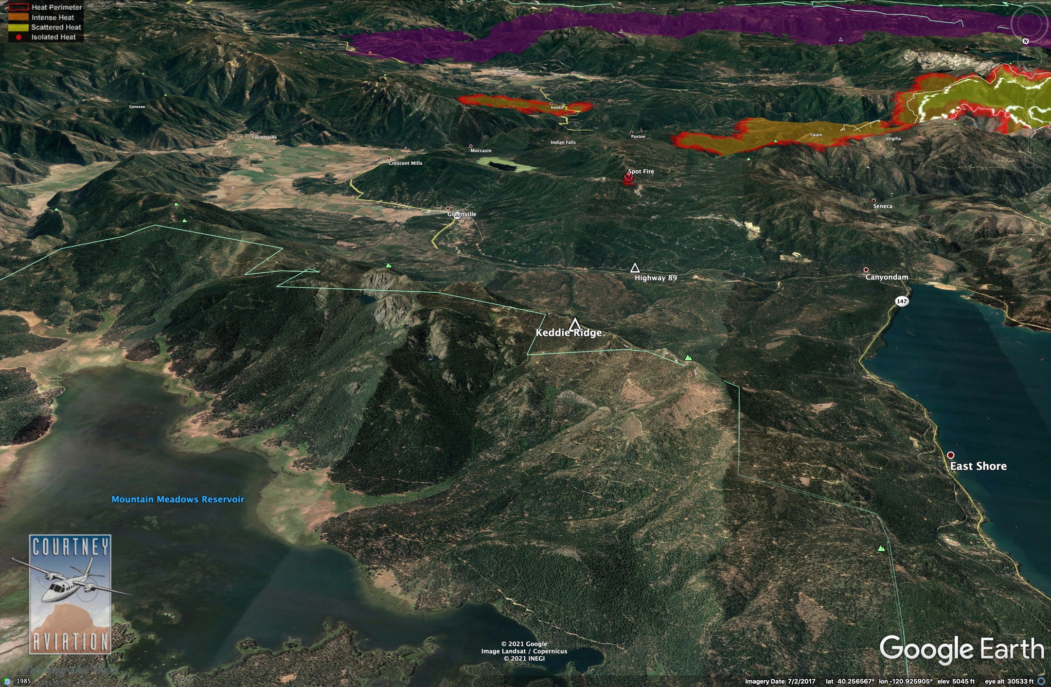
IR Maps - 7/23/21, 02:30 hrs. White lines show 24 hr spread increments.
The company I work for, Deer Creek Resources, has spent the past 2 years studying landscape-scale wildfire hazards and prioritizing fuels projects across the South Lassen Watershed Area and we just finished our final report in May. I grew up in Westwood and live in Chico, so this fire is burning a huge chunk of the land I know best {gulp}.
They had it blocked
Click “Watch on YouTube”, should work.
t’s the morning of July 23 and the greater portion of Plumas County is under some sort of evacuation order or warning.
A steady parade of cars made its way along Highway 70 as the evacuation warnings crept their way through Indian Valley and then up the Canyon to Quincy, where, as of this morning all of west Quincy is under an evacuation advisory due to the Fly Fire, which broke out late yesterday afternoon in Butterfly Valley.
Information from this morning’s briefing:
Dixie Fire West Zone: The Dixie Fire remained active overnight with active surface fire and multiple tree torching with long range spotting and rollout. The fire is going to continue to move North and Northeast with the potential for 2-3 miles of new growth. The fire is burning in a remote area with limited access, extended travel times and steep terrain which hampers control efforts. Fire will continue to rapidly expand causing a need for the critical
resources to control the fires spread.
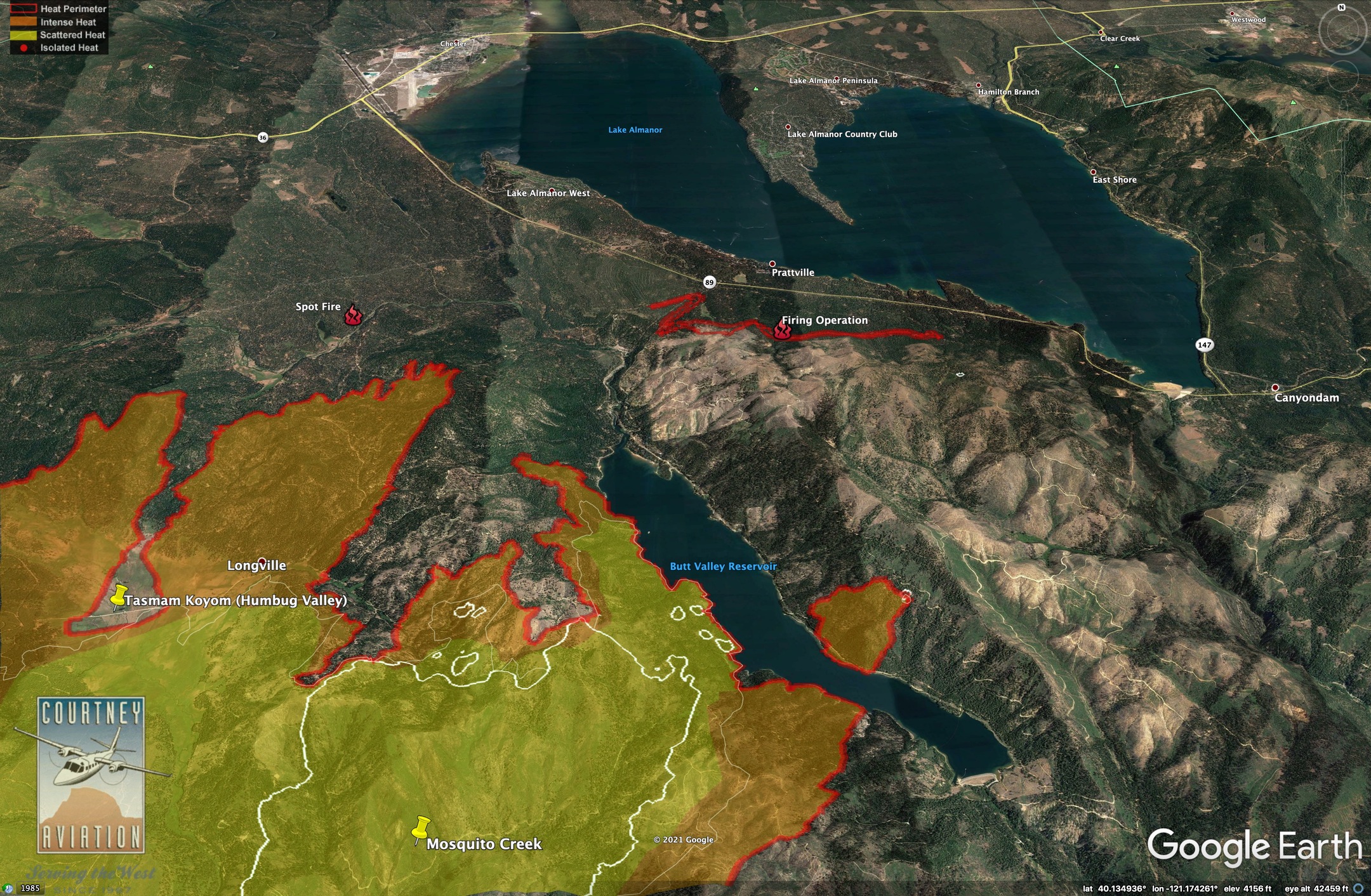
Dixie Fire East Zone: Yesterday crews made good progress along the southeast edge of the Dixie Fire toward Bucks Lake. Today, if conditions are favorable a firing operation is planned to tie the existing fireline into the west shoreline. The intent of this operation is to keep the fire north of Bucks Lake.
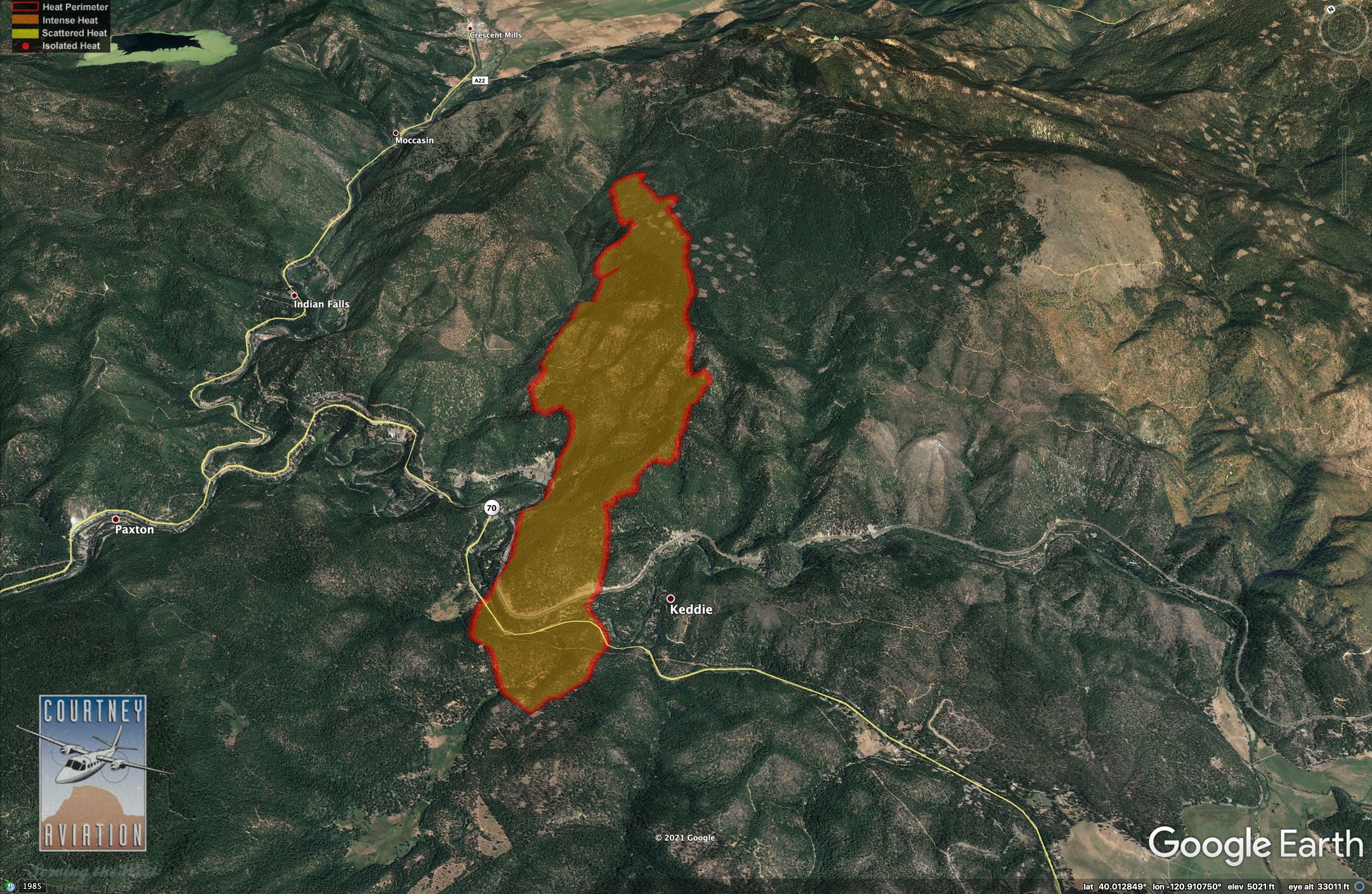
Firefighters will also address the Fly Fire, a new start just north of Keddie. The Fly Fire ignited yesterday evening in Butterfly Valley and burned quickly to the northeast across Hwy 89/70, growing to well over 1,650 acres. The cause is under investigation. The extreme fire behavior and long range spotting of both fires prompted several additional evacuation orders and warnings. The fires are expected to continue moving to the northeast today. Fire behavior is expected to remain extreme.
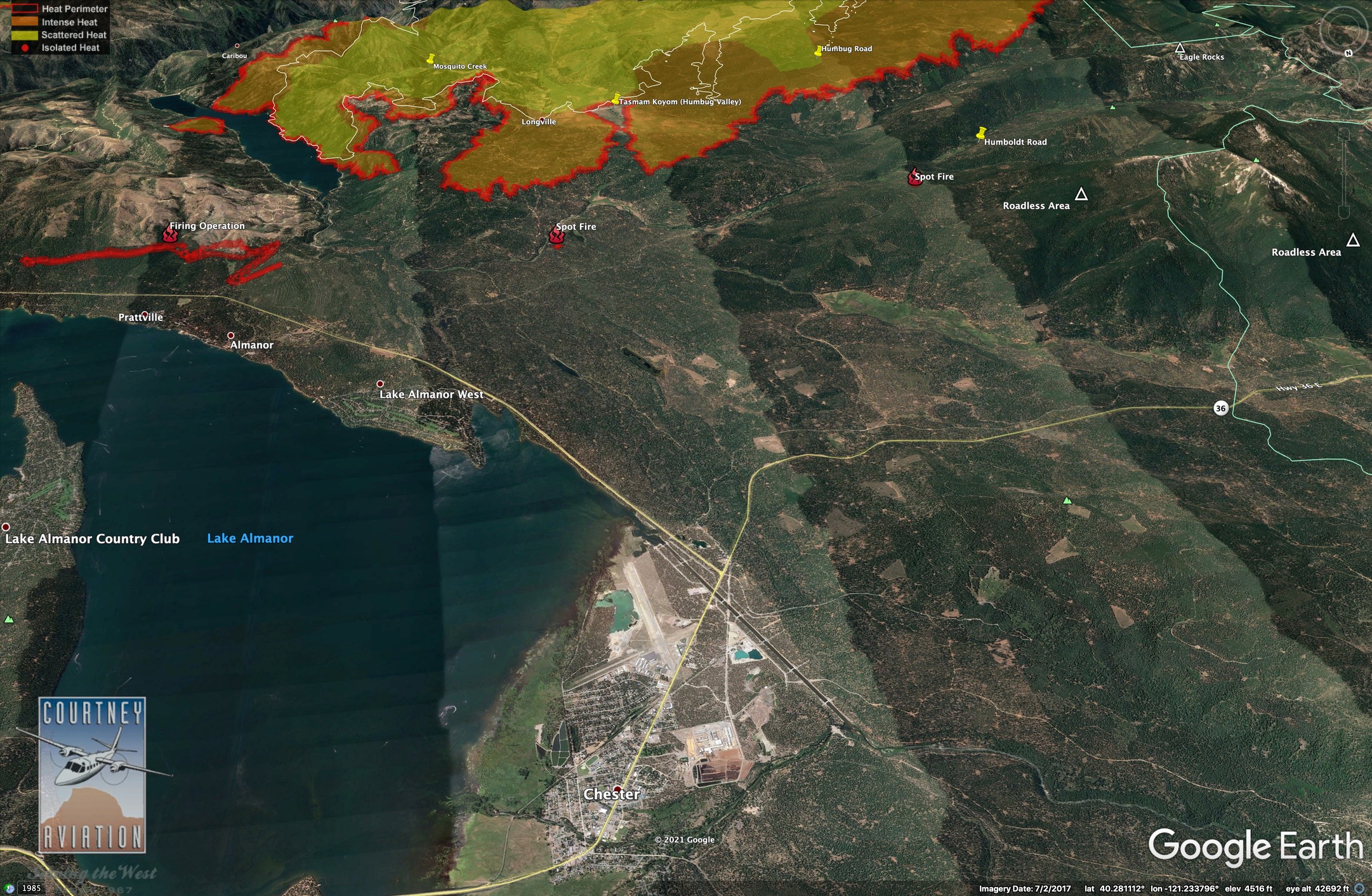
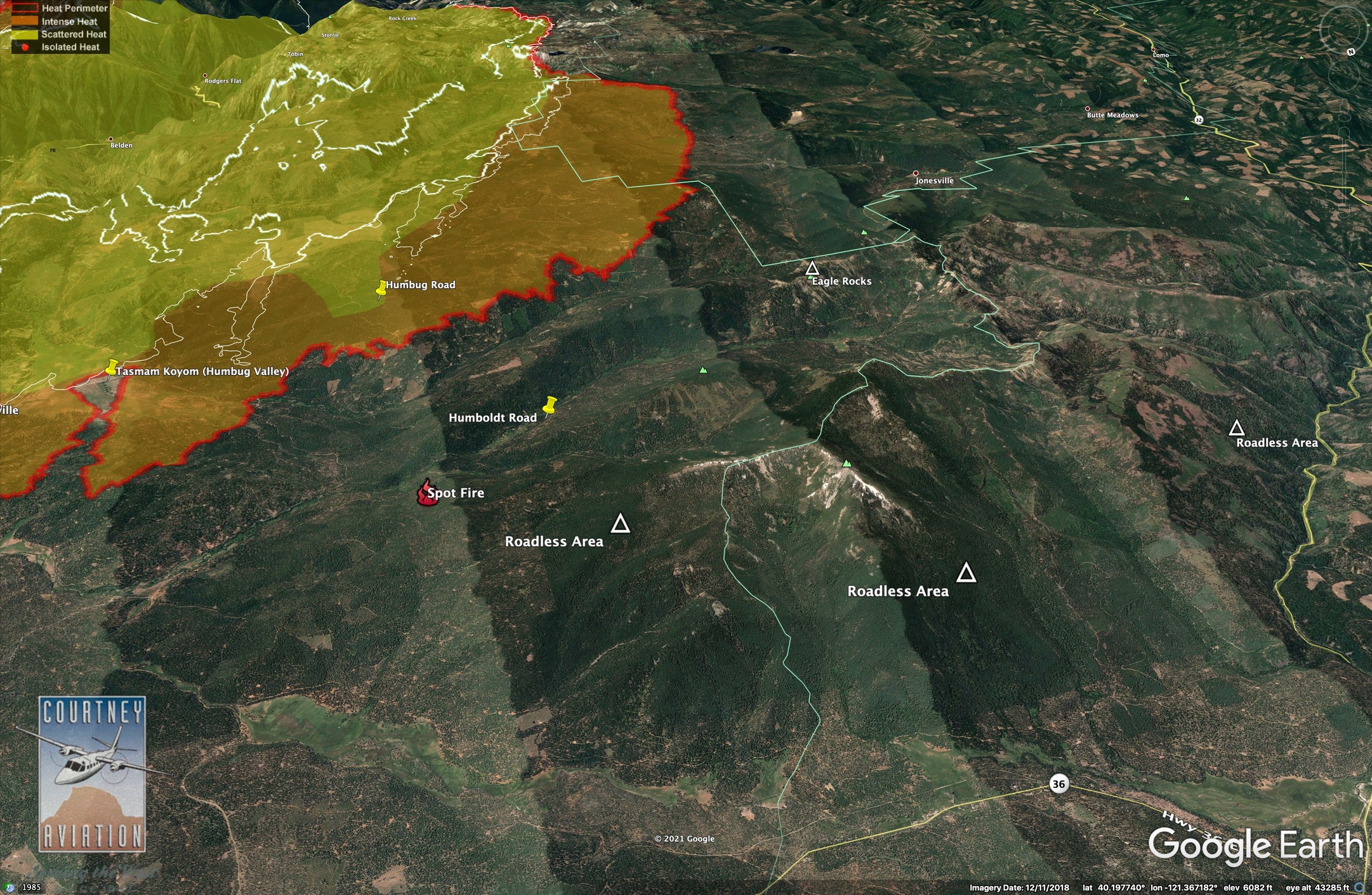
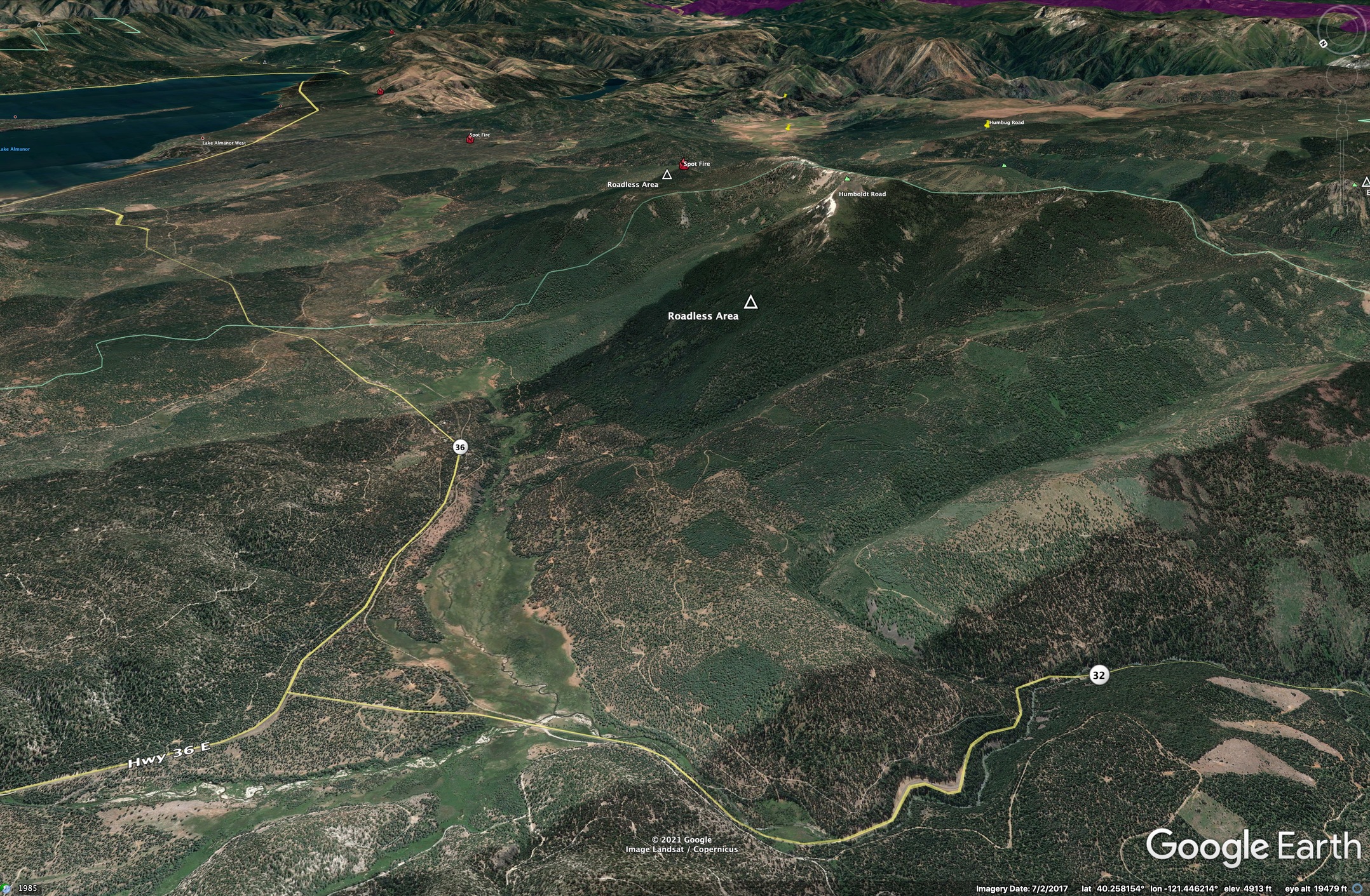
Last evening it was reported that the fire has progressed past Humbug, and crews are looking are now looking at Humboldt Road to halt the fire. The fire as reached Butt Lake, but it’s holding on the shoreline. Some spot fires were quickly accessed.
Elsewhere on the fire, the community of Twain got a spot fire yesterday. Fire behavior modeling continues to travel and have short-range spotting and now is very near where the Caribou transmission lines come down. Quincy residents were alerted last night that they should be prepared to lose power, and it could be out for some time.
We got the evac warning last evening, N side of Hwy 36, just west of the St Bernard Lodge. Hope we don’t lose the place (Hubby had heart attack in midst of our property clean-up, quadruple bypass, still in recovery phase, so have finished making fire safe) Hubby says, well, if we lose it, we’ll rebuild and this time make 2-store w/actual garage lol
Stay safe everybody … this is a scary one!
This is beautiful work…why isn’t it shared on the news or publicly? We are in West Quincy…
Pyro, I agree. Thanks for taking the time and energy to put all that great info in an easily viewed and understood format… great work, very helpful
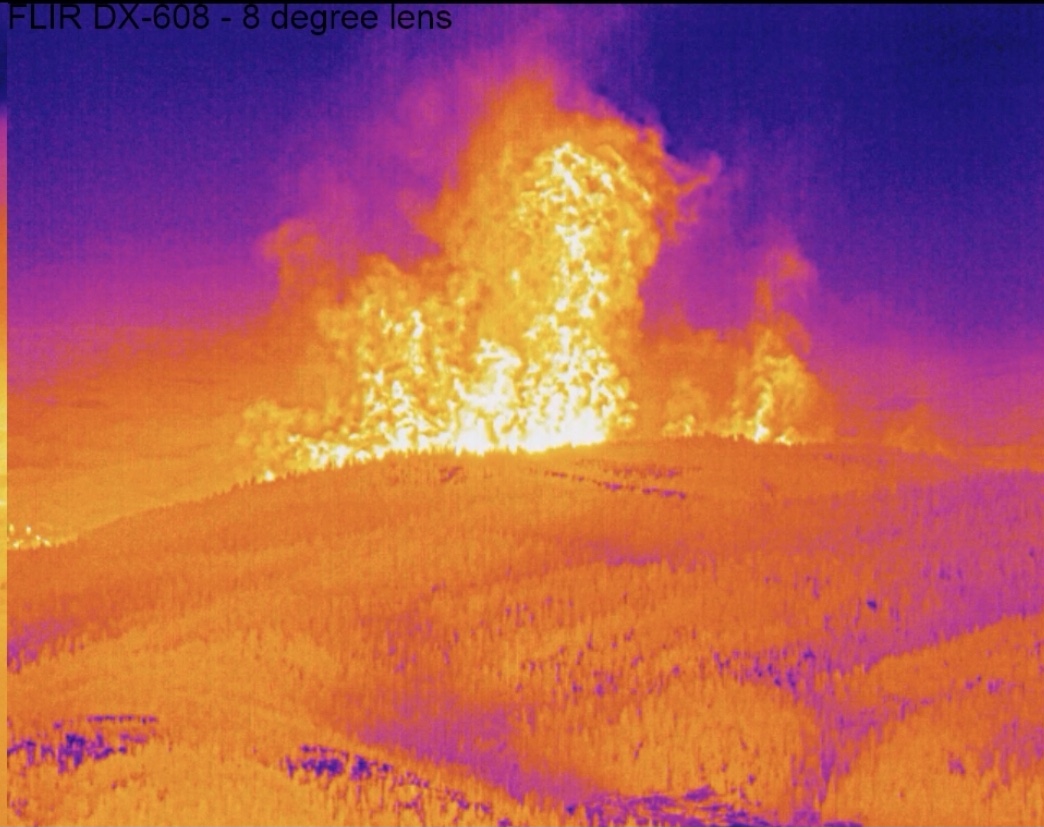
Is any of this fire burning healthy or is it nuking everything?
Everything I’ve seen from the air has been nuked
 . Copy thanks.
Our family has been coming up to Plumas and Lake Almanor for nearly 50 years, but I’m monitoring this from my house in Oakland. The aircraft monitoring sites I’m able to access don’t show any aircraft over the fire at the moment, but I don’t know whether that’s because I’m accessing only the free sites. Are there any tankers or copters on the fire today?
I’m not there and don’t know specifically, but the smoke conditions have grounded huge parts of the air show over the last number of days. The ADS-B coverage is also impacted when the aircraft are low and/or flying in steep terrain.
As of typing this, there are two Helco/Recon ships up over the fire, in the TFR. Lots of variables with aircraft, such as wind, visibility, flight times being shorter than the visible day so don’t burn your 8 hours up starting at 9am and have no aircraft available at 6pm when it’s hot and there’s still 3 hours of flyable daylight. And as others said, the entire consumer flight tracking industry runs on hobbyists with receivers that can see the aircraft and feed the data back to the servers. Places like these that are remote might not have a hobbyist who enjoys tracking planes AND has a computer/aptitude to run it 24/7 AND has decent internet out in the sticks.