
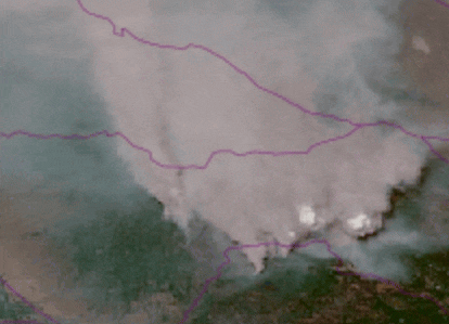
Latest 2 hour satellite loop.
4 Likes
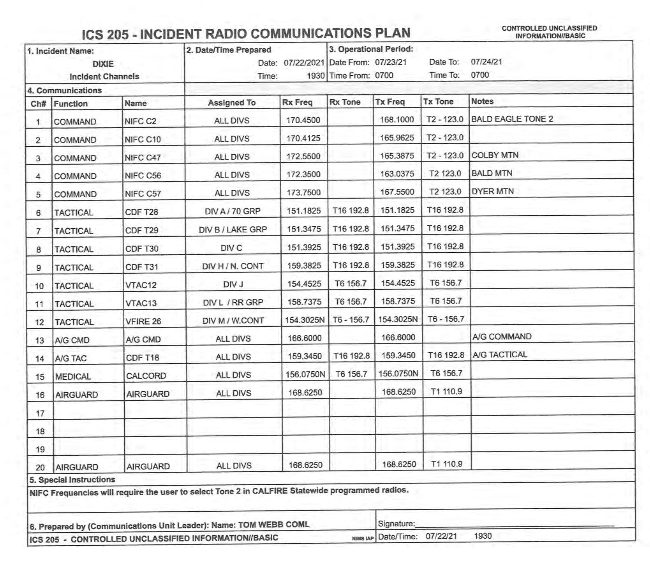
I see the command channels are duplex (use repeaters), tac are simplex (no repeater). Do you know if the repeater freqs make it to the valley for someone to scan and spin up broadcastify feed(s)?
Colby and Bald Mtn should.
23 July 16:05 haven’t heard any tankers flying from Chico and don’t see any on FlightRadar24. Whats up with that? The plume and Pyro Cloud are visible through the smoke here in the valley so I can see it’s blowing. Any comments on why no Air Ops?
Visibility most likely. The East Quincy cam pretty much tells the story on the East side.
East Quincy
3 Likes
Poor visibility most likely. If an air attack can’t see it can’t direct drops. If tankers can’t see them they can’t drop
In other words ….safety.
2 Likes
I’ve had Colby and Bald in my scancal.org live scanner ever since they stood them up, and I’m not hearing either in Red Bluff, on a legit RX setup. Not sure if my antenna is compromised (doubtful but no bandwidth to troubleshoot at the moment), or if the power level is just too low or antenna setup is favoring south and not fully omni. I’m shocked I am not getting Colby. I’ll troubleshoot a bit tonight if I get a sec.
3 Likes
What is the Dixie/Fly doing to the railroad infrastructure?
@norcalscan I have been lobbying the state to put adsb receivers on mountain tops that the state has radio equipment at and backhaul the data. I think this could come to fruition to improve overall SA and tracking of incident aircraft compared to AFF. Not that AFF is bad but the interval is long. AFF though due to satelite based isnt going anywhere as someithing is better than nothing. So in the instance of the dixie you might have a bit better coverage in some of the more remote areas.
4 Likes
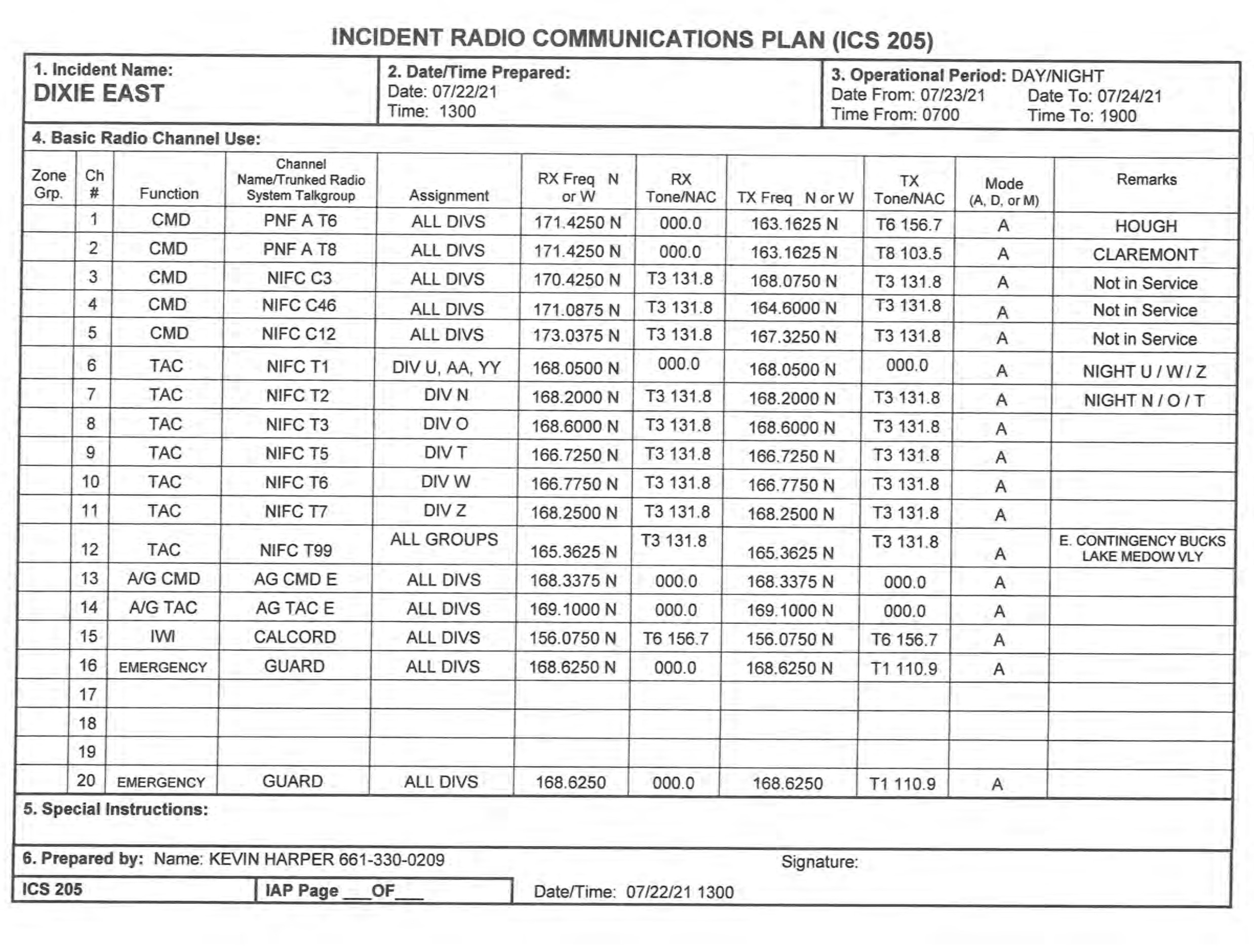
Just noticed on today’s maps all the Divisions have been renamed. As an ICS purist, this is not good. It will lead to confusion. If the system is broken, your better off cutting you losses and renaming them, but not If its just a little off or purely aesthics. A re-org could be the 1st link in a chain of events that go sideways.
8 Likes
Until we get an IR update, anything coming over the scanners about northwards movement? It all seems to be west to Butte Meadows, or S/SE towards Greenville. Might just be wishful thinking on my part, but the afternoon breeze today was out of the NE, not the usual daily SSW wind.
It might not be optimal to do, but it happens, or IMTs are asked to do it for overall safety. Especially if it has something to do with zoning the fire and the potential for duplicate naming conventions between east and west zones and the teams. Yes, the comm plans should not duplicate any tactical or command channels where folks on the ground would hear each other. But those flying 3-4-5,000 AGL can hear everything and it can quickly get confusing. I think most folks work it out in their brains since it is not too different than being assigned into a different division after being in one for several Operational Periods. Airspace deconfliction and mitigating confusion over call-signs for the ATGS(s) is critical.
3 Likes
Coming out of Sacramento on the 99, theres 3 columns on this thing visible from almost 100 miles out!
4 Likes
I am seeing a header on the north Mokuleme cam…dixie, Fly, or Tanarack?
The Tamarack
2 Likes
1 Like
This was the view from Lake Davis a few hours ago looking west. Now in smoke about 1.5 miles visibility so wind is coming from west now.
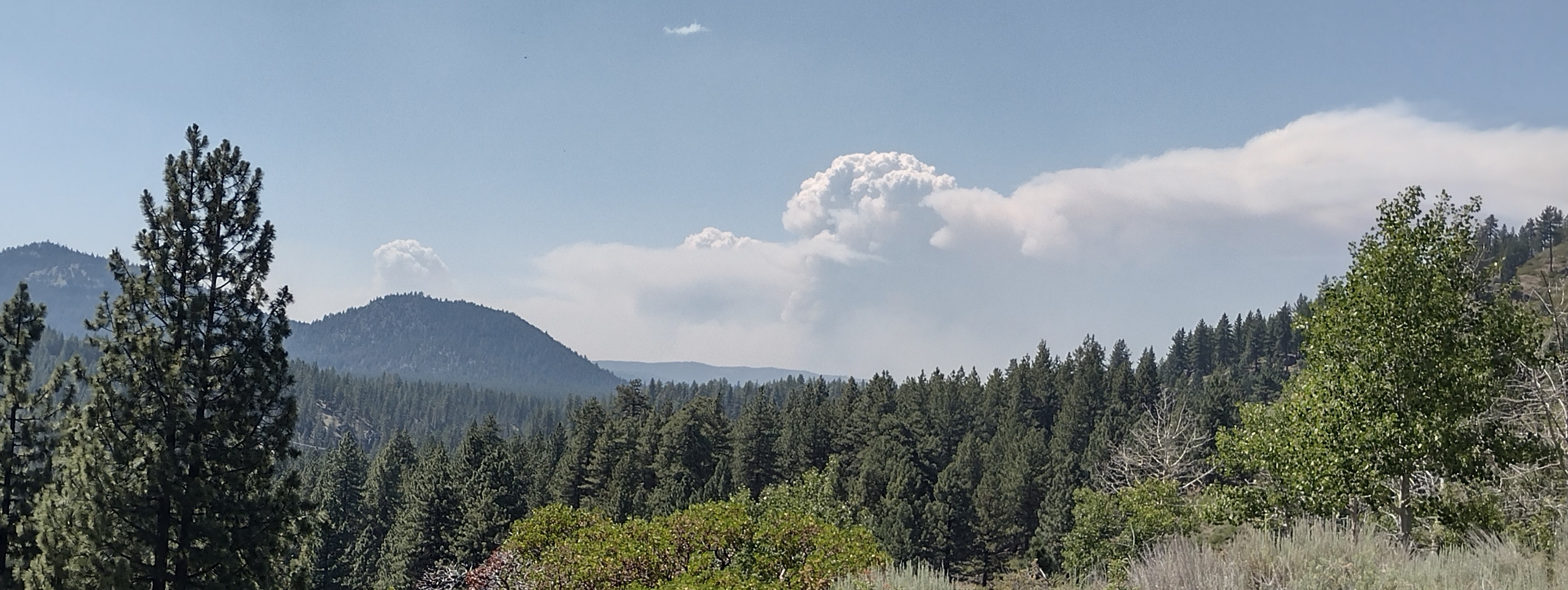
2 Likes
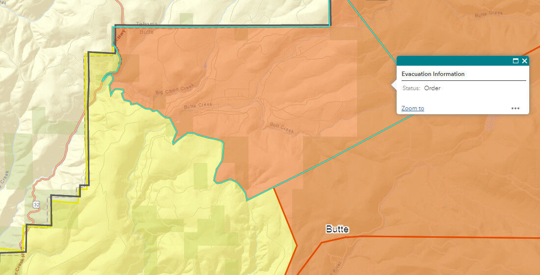
State Route 32 is closed now from Butte Meadows turnoff (Lomo) to State Rte 36.
4 Likes