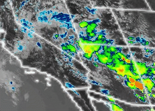
Hopefully these thunderstorms don’t succeed in making it to us:
1 Like
1 Like
That would imply 3 separate drainages are burning. Not surprising given the terrain. Seen that a couple of times.
4 Likes
Fire Crossed at Chambers creek
2:36 PM 68 [114] A20-011 FIRE JUMPED THE RIVER BURNING ON S/S OF THE RIVER CHAMBERS CREEK
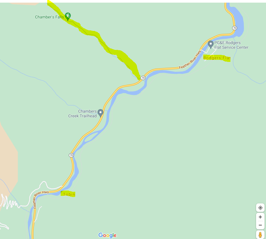
Tried to highlight Chambers Creek and Toben,Rodgers Flat
6 Likes
It clapsed tonight.
Size? And any updated threats?
18,702 acres 15 percent contained
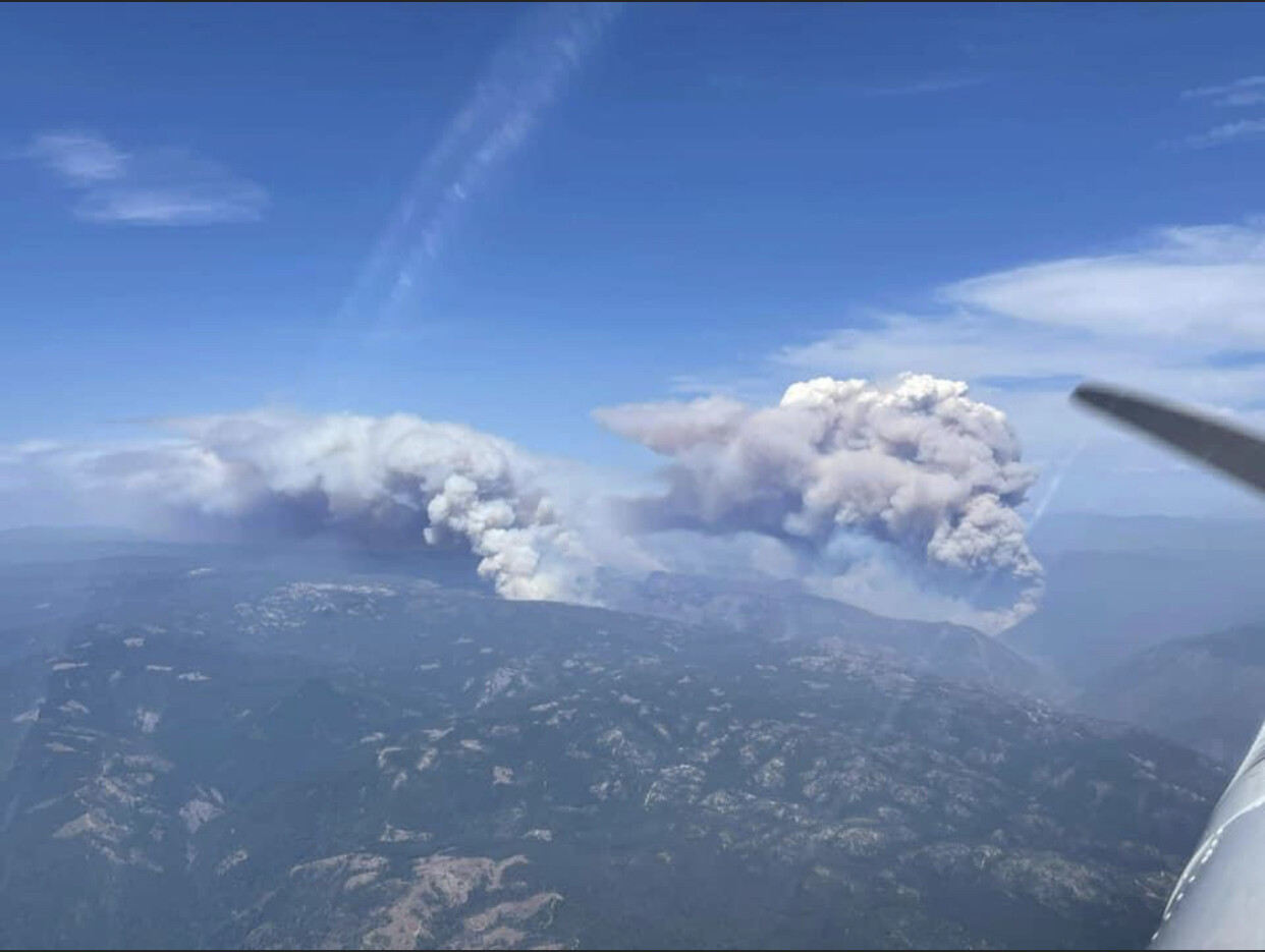
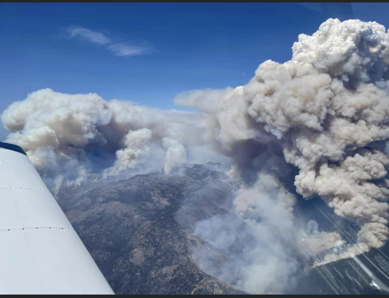
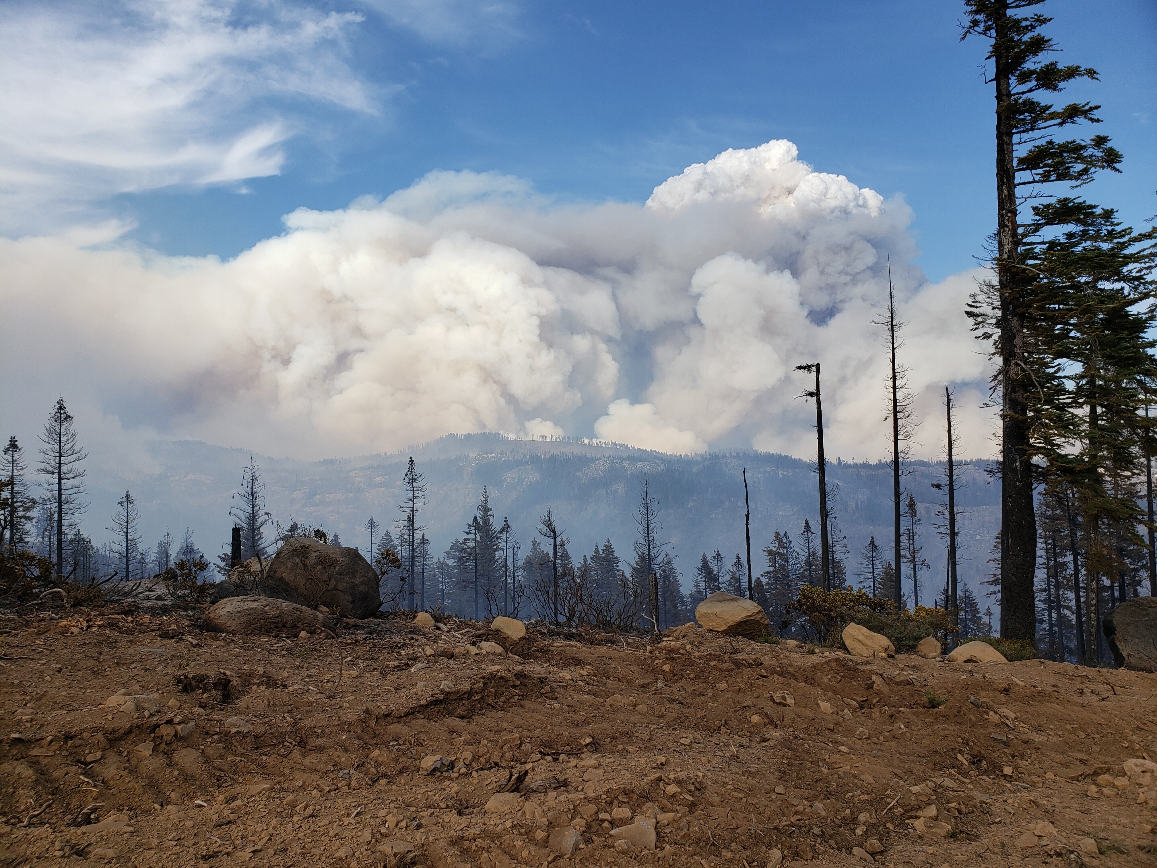
The Dixie fire had significant fire activity today and continues to burn South East towards Bucks Lake. The fire is burning in remote areas with limited access, extended travel times, and steep terrain challenges with containment. Large pyro-cumulous clouds formed over the fire and produced a large smoke column which increased fire activity. A portion of SR 70 is closed to all traffic. Firefighters continue to fight aggressively
3 Likes
Watched the evening briefing on.FB…I dont recall them saying that…could be wrong though
https://www.facebook.com/CALFIREButteCo/videos/4847399845287083/
2 Likes
FF hand crew, 2 CF strike teams cut hot line, with a hose and copter support turned the corner on it. Not complete yet, but not lost. A hell of a fight.
18 Likes
Jimw360, I don’t have a facebook account so It won’t let me watch. Are the briefings posted somewhere else that is accessible by the general public?
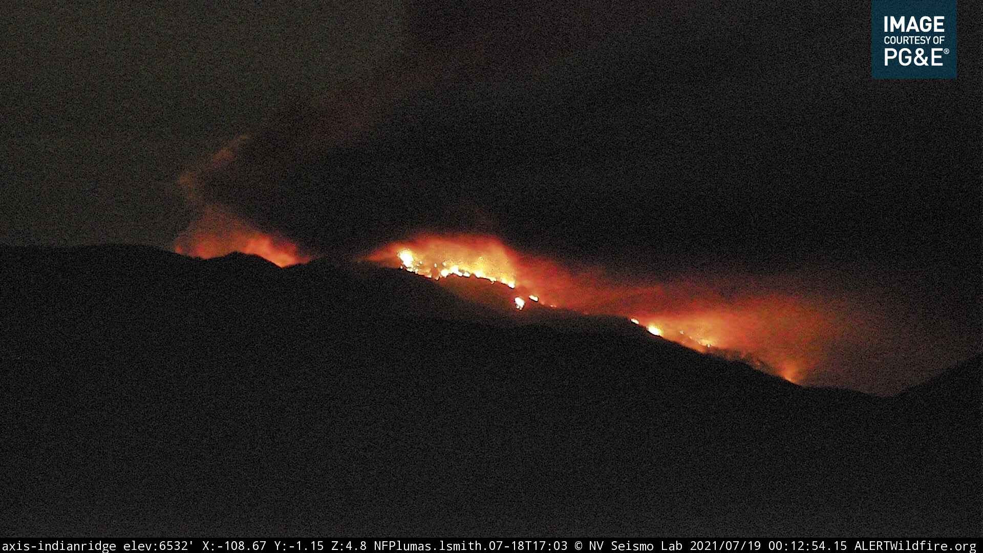
http://www.alertwildfire.org/shastamodoc/index.html?camera=Axis-IndianRidge
this is off the indian ridge camera… she is cooking tonight
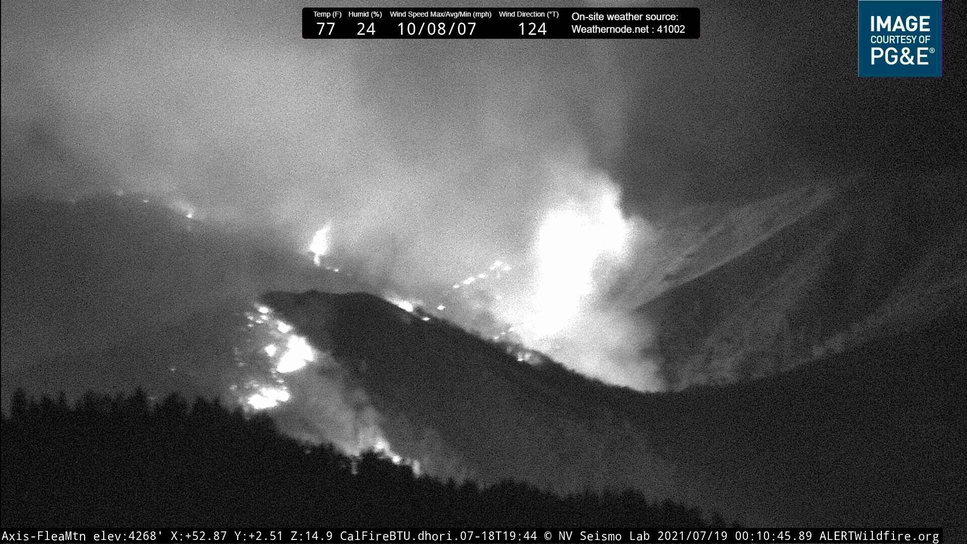
Flea Valley has given some good looks
4 Likes
I watched it on YouTube. I think it was on Cal-Fire’s channel.
1 Like
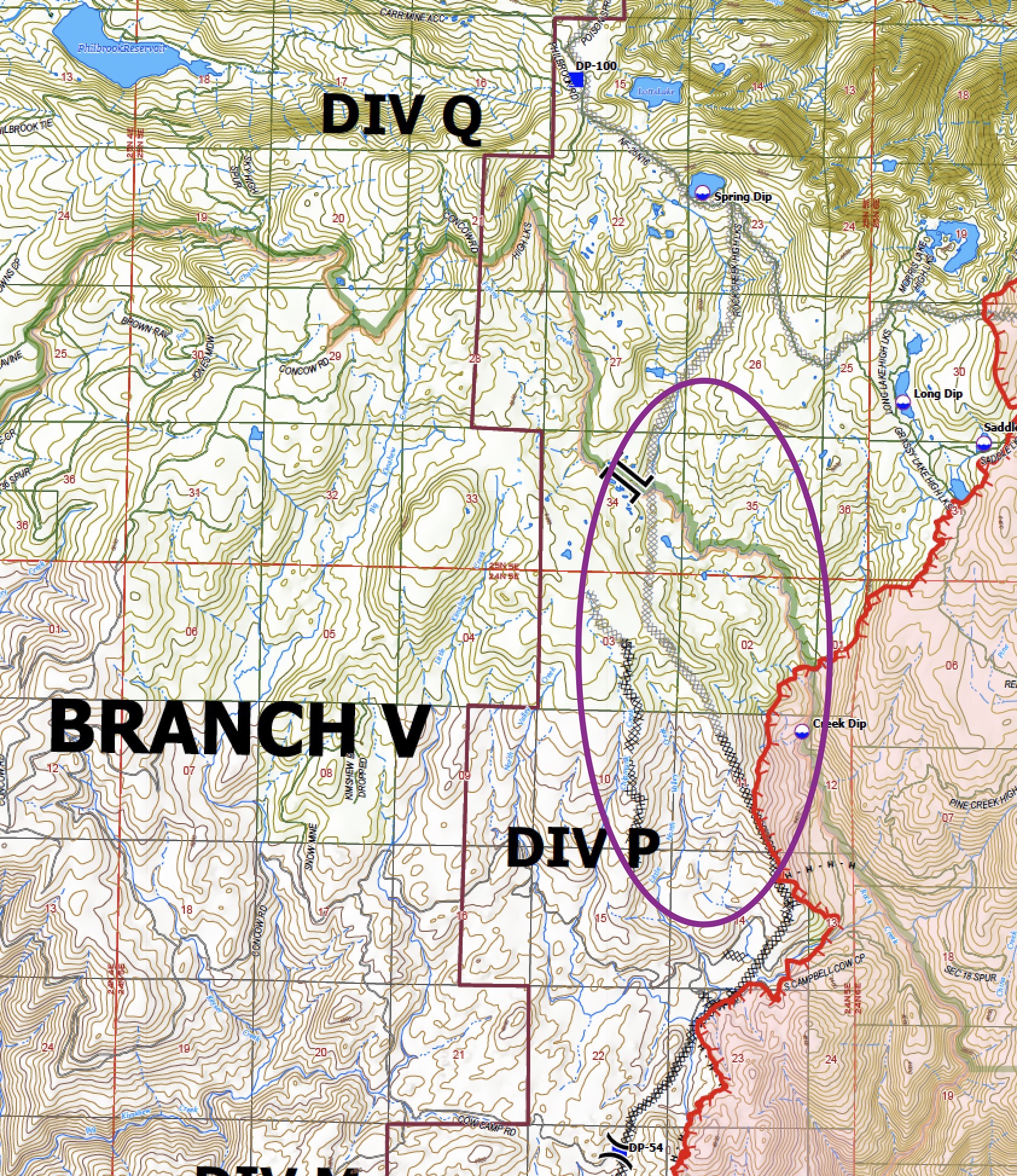
Last night’s 23:45 IR shows it pooching out over the bottom of the 2020 Bear Fire contingency dozer line in Division P. Was this a firing OP, or did it cross the line?

2 Likes
From the IR Ops map, looks like it’s boxed in with dozer lines. I’m not familiar with the Bear Fire Contingency line, but this map will probably answer your question:
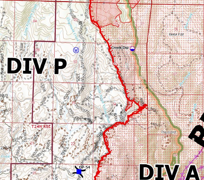
Full IR Ops map found here:
https://calfire.app.box.com/v/calfireimt1/file/835792239356
1 Like
this mornings numbers
30,074 acres burned 15 percent contained
1,918 personnel assigned
https://www.fire.ca.gov/incidents/2021/7/14/dixie-fire/
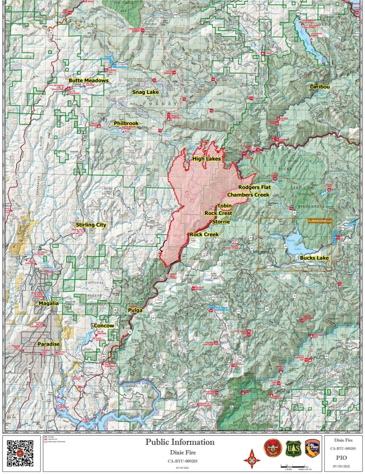
During last night’s briefing, Operations Section Chief Tony Burnell, said that the fire got very active on two sides, including the east side that caused the Plumas County evacuations. “This is where it got really active,” he said pointing to the east side of the fire. The fire jumped the Feather River and backed all the way down to Tobin. Then the fire spotted above Tobin, became established, and climbed up a steep hill. It is now burning west and north of Bucks Lake. “We want to keep it out of Bucks Lake and the Meadow Valley area,” Burnell said, but noted that it is very challenging country and difficult to get dozers in. So firefighters will be relying more on hand crews and engines.
@@ noon@@
Breeze has come up again from the South and the skies have cleared. Air coverage is up and at em. there are 6 tankers currently working the fire I can track along with as many Helo’s . Checking on the cameras the fire looks like she is laying low after a busy night
7 Likes
Does anyone know if the Oro/Quincy road has been closed? I heard it had been at Junction House but haven’t been able to confirm. Thanks.
2 Likes
70 is closed pretty much from Paradise up to 89.
2 Likes