Can we please not speculate about what “the Forest Service” shoulda done? I’m not being snarky, sincerely. 
Great post! Odering structure and planning is straight from military operations, as well. Moving and positioning resources, ordering up for multiple contingencies is a must. WHen a fire is this big and you add in the potential lightning issues, big picture planning must tyake place. It sounds like this has been the case.
I’m sure they will use quincy
Plumas County Fair starts August 11th just FYI.
We can go to direct message to not muddy up the fire side any more if needed, but quickly, VTAC33-38 are all just pairings of VTAC11-14. LE has 2 VHF channels available CALAW1 and 2, if they’re lucky their radio techs programmed them in there, and we’re lucky the officer knows how to navigate to them in their $6000 DHS-grant radio. Both VLAWs are an option as well, but even more rare they are in the radios. I’m curious what other 9 LE interop channels on VHF they have access to. I do this often throughout the state so I’m usually aware of what’s in the toolbox. Everything up here in the real Northern CA is VHF.
Yes, law comms on the whole are decades behind the amazing work and collaboration of what FireScope has built up. Too few people acknowledge or understand that so the political drive behind the scenes for something akin to “LawScope” is an uphill battle. There is a statewide push to get each band’s interop channels in every officer’s radio. That push is more of an elbow bump from CalOES unfortunately. It’s not fire’s fault law is behind. But it doesn’t negate the argument that all four VTACS were used before any attempt at finding further fire-only options. It doesn’t negate that despite the perception (reality) the rest of the state needs to catch up, Butte Sheriff has a communications system properly designed for this exact purpose and it just got taken out with zero effort.
quick edit: unlike the NIFC-approved fire radios, absolutely zero LG/State law radios have front panel programming either. We have to work with what is in their radio.
off my soapbox, back to the fire.
5 posts were merged into an existing topic: Griping About Another Agency/Where is My Order?
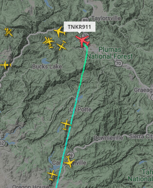
Tankers are in the air now. all the planes in the frame are tankers or AA . the DC10. The BAE 40 ,MAFFS, and the smaller turbo trackers are out there . Flying out of Sac , Redding and Chico
 ,
,
Timely post, John.
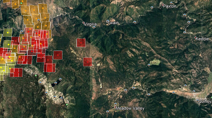
Gotta watch out posting MODIS and VIIRS hotspots way out by themselves unless you can verify with field info or webcam. They can be way off. Some of us have learned this the hard way.
Sounds like an order as made on the CHIPS fire.
Agreed. Given the wind direction and distance, they seem suspicious… but I’m curious to see if they pan out or not… I was thinking that but should have typed it out for others… edited the original post.
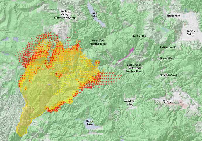
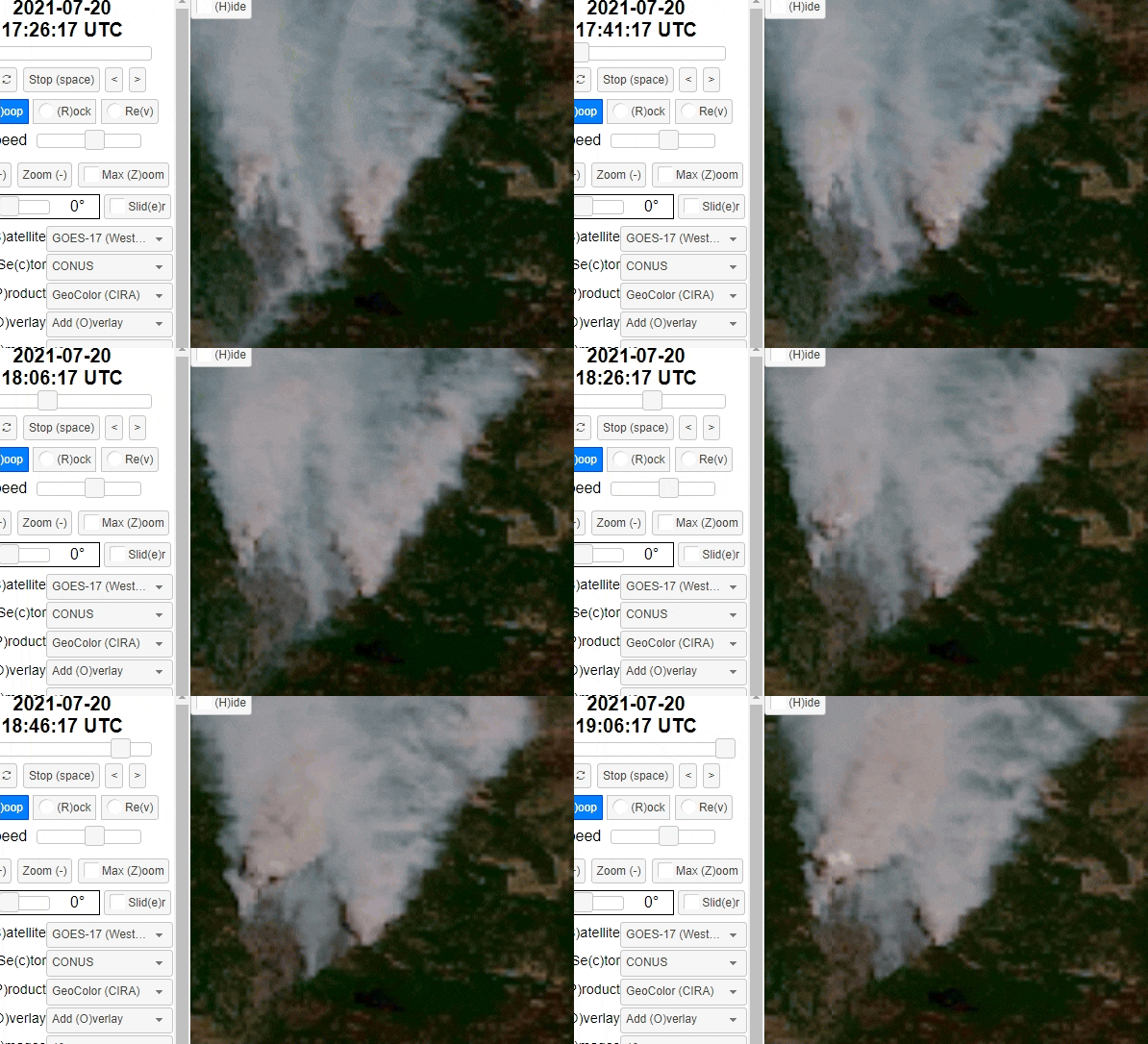
90 minute loop. Looks like some aggressive movement to the east.
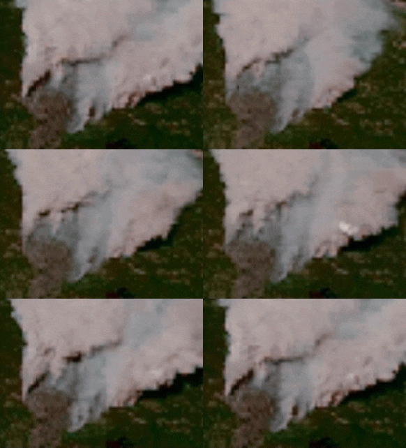
I hope a better map comes out tonight. It has definitely made a hard run. I’m in Greenville…
Nice little town, always enjoyed stopping there on the way to Bucks and Silver Lakes.
Tyvm…AJ! was the link I was looking for!
The last hour loop, Flea Mnt cam, has a nice twin column developing…
http://www.alertwildfire.org/shastamodoc/index.html?camera=Axis-FleaMtn&v=fd40729
Fire is backing aggressively downhill south of Virgilia visible on Indian Ridge camera.
Still concerned about the alignment if it crosses the River here and becomes established in Rush Creek drainage.
