Thank you for that update!
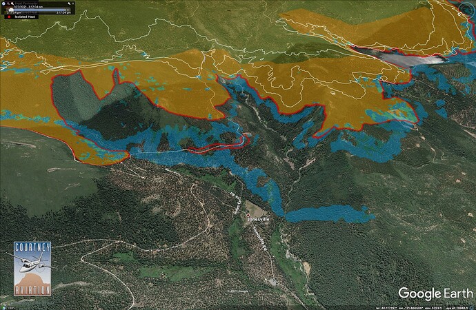
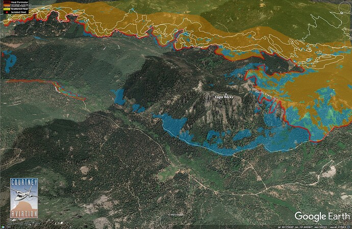
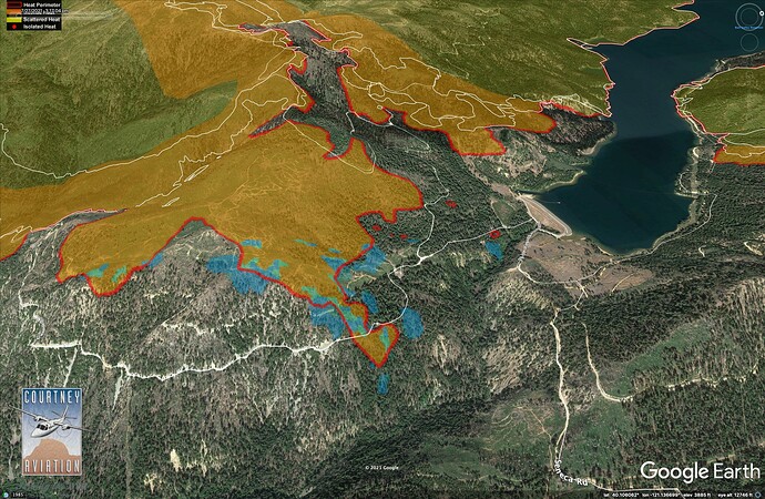
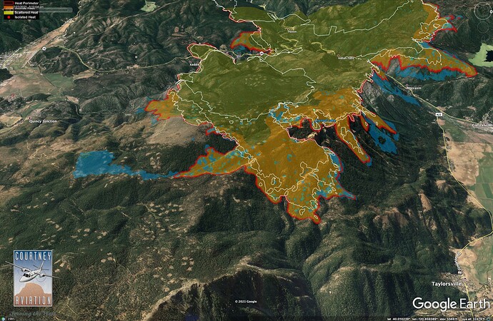
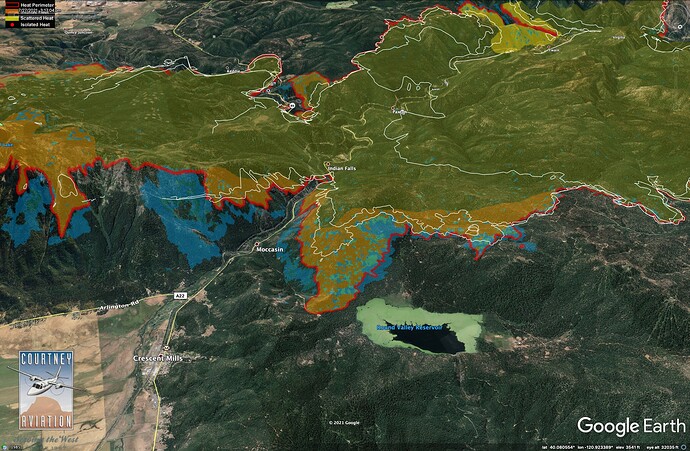
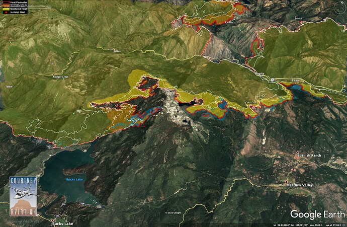
Late afternoon #DixieFire IR update - 7/27/21.
Yellow, orange, and red are from last night’s 23:30 flight.
Light blue shows new growth since then.
White lines = 24 hr growth intervals before last night.
Data: Courtney Aviation
Jonesville Area
Humboldt Road, north of Humboldt Summit.
Downstream of Butt Lake Dam
Mt. Hough and Taylorsville.
Round Valley Reservoir, south of Greenville.
Bucks Lake and Meadow Valley
Any idea what AGL these mapping planes are flying at? I remember some years ago seeing a U2 that was helping fish and game flying along Grizzly Creek doing a mapping mission couldn’t believe how low he was. But for IR on a fire in mountain terrain I wonder.
More likely these IR mapping flights occur at high altitudes 20,000 +
Makes sense. I saw somebody fly over the east side of the fire last night they were pretty high up which made me wonder, thanks.
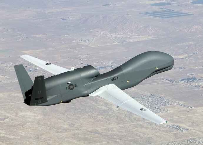
If memory serves me correctly, Beale AFB has a drone program, they fly them all over the world.
The ones I’ve payed attention to were usually around 10,000 ft or 5,000 agl almost always the same pattern, sometimes they do a checkerboard pattern.
Distance and altitude are a bit hard to judge at night but I’d guess he was around 5k higher than smith peak so that fits but after doing a north to south run along the fire he headed off SSW towards Sacramento. So unless it was the last leg probably doing something else. Thank you.
IR from last night, with some captions.
Thanks for the updates. Have a childhood friend that lives in Texas and her Aunt has a cabin in Jonesville.
Getting some pretty good cumulus build up with wind, but humidity down here on the ground is in low single digits.
The west side of the fire has quite of bit of tanker activity right now. Looks like most of the MAFFS are there, plus a few other tankers. Are they just reinforcing that west side for more burn ops?
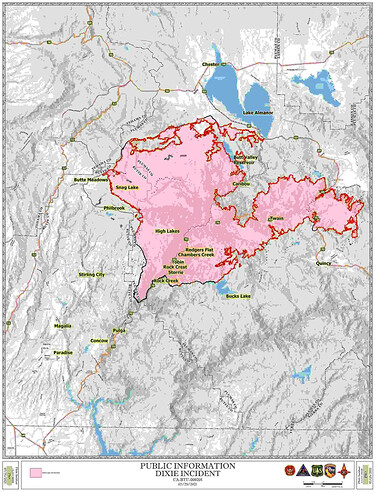
As of this morning Total acreage burned is 221,504… Containment remains at 23 percent. There are nearly 6,000 personnel assigned to the fire — 5,931. They are spread out across the roughly 82 miles of perimeter, much of it in rugged, difficult terrain.
In the west zone the fire activity was active during the evening with spotting and rollout and continues to move toward control lines, burning unburned interior islands and ridges. Fire continues to move toward control lines, burning unburned interior islands and ridges. The fire is expected to increase due to drying conditions with most expected growth to the west toward Butte Meadows
In the east zone with the smoke clearing through much of the area the fire remained persistent in some drainages and valleys. Hot and dry weather in the afternoon allowed for some firing operations along containment lines. Crews focused on strengthening containment including a line along the southern perimeter in the Bucks Lake region, the Mount Hough Road, Emigrant Road, and a northern direct line in the Long Valley and Round Valley Reservoir area.
Crews plan on strategic firing operations and air support today when and where possible. They will continue strengthening containment lines with dozers and handlines when conditions are less favorable for firing and air operations with the strategic use of firing operations and air support today when and where possible. They will continue strengthening containment lines with dozers and handlines when conditions are less favorable for firing and air operations.
Link to USFS incident update
https://inciweb.nwcg.gov/incident/7690/
Or Perhaps you prefer Cal-Fires
The good news here near lake Davis is humidity is way up 50% this morning 30% now. Of course with chance of thunderstorms later but oh well. Getting some W wind guests to 20mph though.
Just heard that Australia is sending a plane to help out with the fires on the west coast. No details maybe their 737? Something that can cross long distance anyway  .
.
It arrived a couple of days ago. Its in Boise, flying fires in Idaho and Montana. Its radio identifier is B210, and, yes, its their 737.
Npr behind the time then thank you. Interesting.
So what this map, and every other map that detects heat signatures via satellite, is it isn’t very timely, it can produce false positives on super-heated smoke columns and opposing narrow canyon walls, and most importantly, it doesn’t differentiate between good and bad fire. Lots of good fire was being put down on the north and I think trying to hook it around on this west side. I do not have the ops map up to see where their primary and contingency lines are, but on an LNF topo map there is a road off the skyway right near that heat that armchair-quarterback me would identify as a great place to make a stand and fire off of to tie in Humboldt to Skyway and give Butte Meadows a chance. Good chance it’s good fire. It was real hot up there early evening yesterday, and I’ve been off the grid for intel up there.
(and now the message I’m replying to disappeared…)

