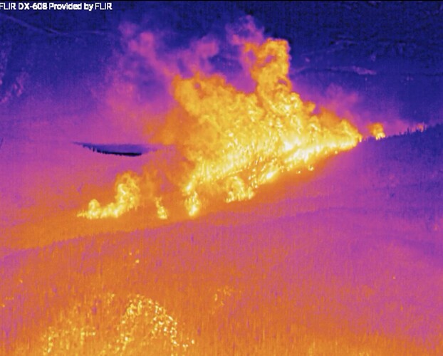
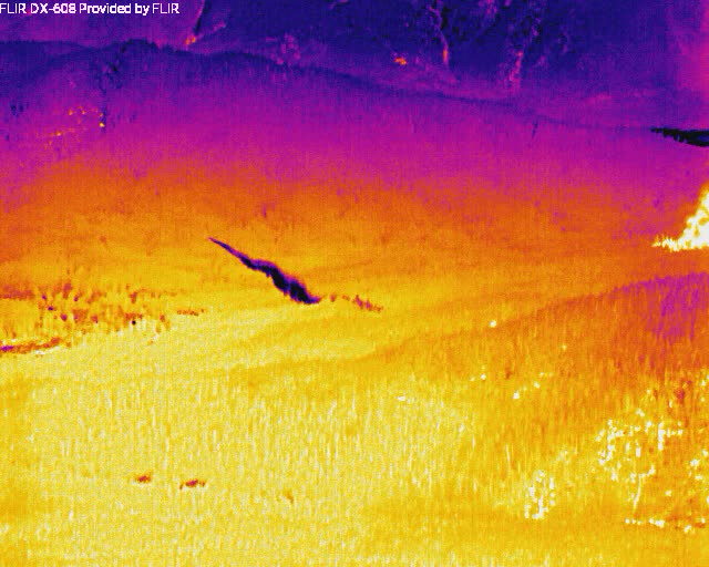
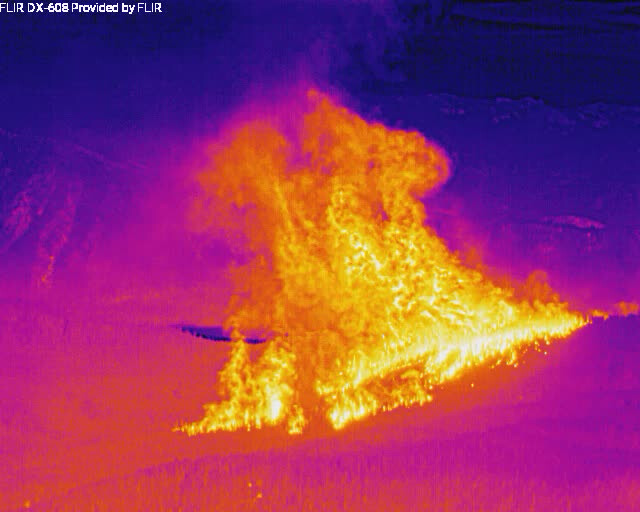
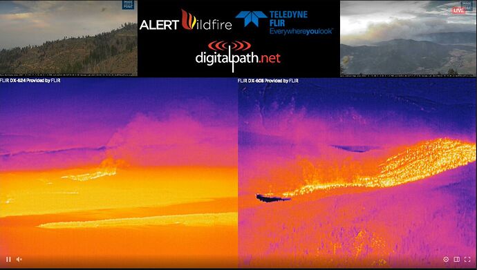
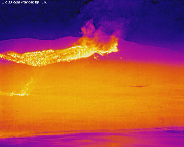
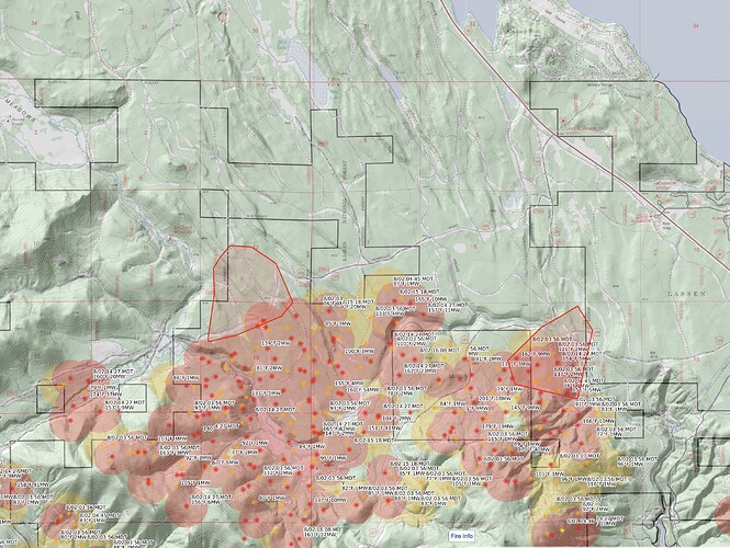
And a few minutes later - the spots are sucking back into the main fire at an amazing rate.
What am I seeing there ?
@jhiggins <— Thanks for the snips! Some crazy images!
EDIT: Anyone else seeing the rotation in the live FLIR shot?
Source with eyes on the ground, the fire is coming down the mountain toward Greenville. Spotting. Sounds like tankers working along 89 or thereabouts.
Fire is either very close or made it to Wolf Creek Rd. just north of downtown. Rapidly changing. Don’t know the full extent of the fire.
Tankers visible on camera/IR dropping really close, in a lot of smoke.
A DC10 (914) drop, on the bottom right frame, you can see the cold bloom of the retardant. They must’ve been about 500’ AGL, if not lower, which is brushing the trees:
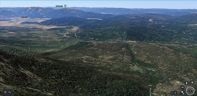
To give people a bit of geographical orientation relative to the Alertwildfire and Twitch feeds, here’s roughly what the Dyer Cam view is looking at duplicated on Google Earth. The “Y” shape on Mt. Hough is pretty distinctive, as is the Reservoir above that saddle. The fire is basically on the NW outskirts of Greenville, moving down the drainage.
They are really making an effort to get in close then. To protect structures (I assume). Can’t thank all the boots on the ground and pilots in the air enough!
Not sure what’s happening???
But a couple LAT & VLAT are really peddling to the south. Bypassed MCC
Maybe close to pumpkin time
If there isn’t already I imagine there’s going to be some sort of notice for Chester, where it’s ripping out of DIV J it’s headed right for the 36/89 intersection, they had 4 Alpha ST staged at that intersection
Yep. 131 is coming into Fresno, 914 back to Santa Maria, tanker 02 is probably going to paso. 132 not sure. But it is pumpkin time.
Seems to be calming now. See what tomorrow mid afternoon does. Thing is there are alot of chipped piles below and in the area of RV that could continue to be an issue
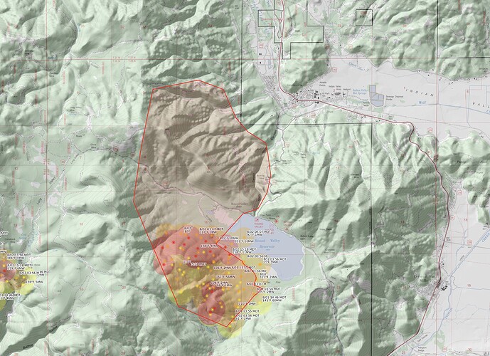
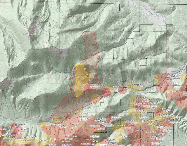
I’ve seen the emergency alerts on TV and those are really cool IR photos, but for the rest of us knuckle daggers who still use crayons, could someone sketch out today’s events on a map?
That’s only on the East zone, the blow up that is taking place in DIVS I/J/L/M on the West Zone is massive and is still cranking with a massive column visible from Chico and this isn’t even the worst of the incoming weather. Incident forecast was a Haines of 4 today, I believe it’s predicted 5 maybe 6 Wednesday
Fire above Round Valley Reservoir got up and ran north, jammed up the south facing slope and spotted all over down by Greenville, made a wicked crown run back up the north facing slope, headed west.
Fire hopped over Humboldt Road onto Ruffa Ridge, made a gnarly crown run up over the NE flank of Butt Mountain into old growth fir forest that’s never been logged or roaded, hasn’t burned in very long time.
Further east, the fire crossed Humboldt Road near the Collins 500/Soldier Meadow Road and ran about a mile north. The fire also crossed lines and made a smaller run toward Lake Almanor West.
These polygons are rough, and may be inaccurate.
Thank you…that helps both the photos and maps make more sense.
Any good scanner set up yet ? I’m hearing a lot of LE traffic on the butte scanner but not much fire, not hearing anything on the Lassen scanner and nothing on the state major incident scanner .

