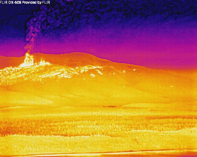
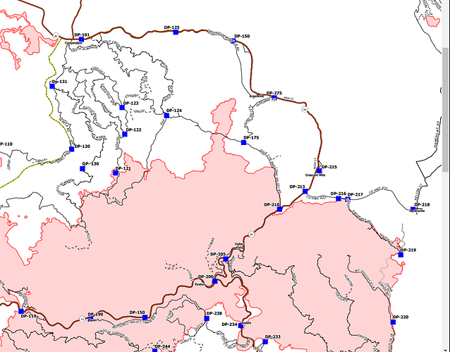
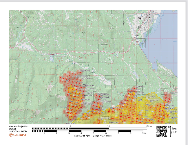
I know that low-res blurry night-vision cameras aren’t the best tools, but it really looks like something’s taking off near West Shore next to Almanor, including some spotting. And next to Greenville looks like an inferno.
You may have already seen these, but the CourtneyIntel folder here has some more recent IR maps I’m able to open and view in Google Earth. They give a good idea of where the spot fire perimeters are. This fire seems to have a lot more and different mapping techniques in use- very impressive technology!
It got a little breezy.
https://www.wrh.noaa.gov/mesowest/timeseries.php?sid=CBXC1&num=72&banner=gmap&raw=0&w=325
https://www.wrh.noaa.gov/mesowest/timeseries.php?sid=TT033&num=72&banner=gmap&raw=0&w=325
Maybe PG and E again for the Fly fire
The winds did come up yesterday and that’s likely how embers got over the lines and into receptive fuel beds…otherwise the fire would stop at the line
The fire blew out on both sides, Calfire and Fed…stuff happens
Any acreage on these spots over the line?
Jake, is the Bald Mtn cam pointed at the 36/89
Bear Mountain Lodge side? Looks like it is cranking already this morning
http://www.alertwildfire.org/shastamodoc/index.html?camera=Axis-BaldMtnButte1&v=fd40729
Wow hadn’t seen the morning timelapses yet, yes Bald is showing the fire rolling over Butt Mtn and into 36. The MODIS/VIIRS is showing heat at 330am down the northern slope of Butt Mtn getting close to the flats of the Soldier Creek meadows that separates the fire from Hwy36 right at St Bernard Lodge.
Shingletown Cam is also pointed right there, and I believe the cone shaped mtn is Morgan Summit, but I’ve never seen that profile of Morgan Summit before  . Morgan blocks the view down into that northern slope of Butt Mtn.
I live at DP 210 all good here. How big was the blowout?
I live about a qtr mi west of St Bernard, on the N. side of 36. Evac’d last evening (again lol) Watching intently to see how this goes. (Had prayed it would never get into Butt Mtn area, place is a nightmare )
There is/were very epic tree specimens up there on the west side of Round Valley Lake…
West Shore of Almanor and Canyon Dam just got re-evacuated. There’s also evac orders for areas north of Hwy. 36, west of Stover Mt., for what few people live there.
We have lost some amazing old growth in the last two years around here… depressing
nice place you have there, well fire is or will be at the train tracks by wolf creek road, some defensive firing around structures across the tracks last night if that helps
Very depressing.The impacts of this fire and other large fires in Nor Cal will be felt for generations on many , many levels.
That fire looks like it specifically wants to go after Greenville.


