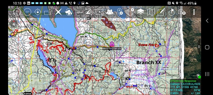
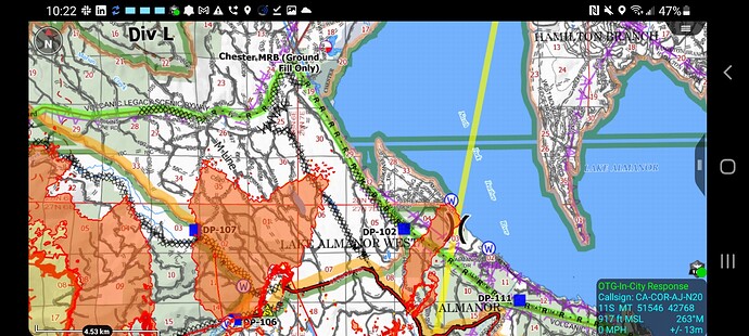
Air Attack 210 just started circling north of Butt Mountain. I hope this means they might try some drops before it’s too dark, though it’s already pretty late. The skies are as clear of widely-diffused smoke as they’ve been in weeks. I’m kind of surprised there aren’t any helos at Chester, like planned as recently as yesterday.
Total SWAG, but I suspect it’s because the weather is more clear that they AREN’T there — may be better to reposition them to an area where they can operate more reliably, given the terrible visibility issues of the last few weeks and the deteriorating conditions and current threat to Chester…
Been watching helos in and out of Quincy airport working all day.
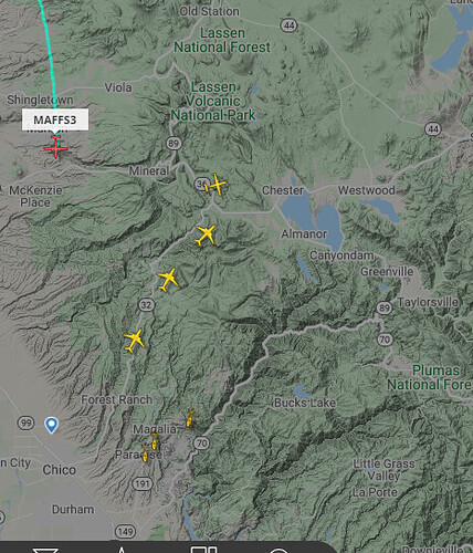
Looks like the S2s have started out of Chico; T911 is heading north out of McClellan but might be headed to Shasta.
I know too many people not evacuating from Chester or “waiting until morning” but I have a concern that there is a potential, maybe minor, that 36 to Westwood could be compromised if the fire happened to go that way. Right now that’s Chester’s only paved road out of the area… too much of a stretch to worry?
3 S2 types coming in behind a lead plane. It looks like Maybe tanker 911 and a couple of MAFF planes are working the Antelope fire
As a participant of the Camp Fire I can only say… Go… Run Forrest Run… Too many people waited far to long to leave Paradise that day… No fire ever makes town. We had been missed by dozens of fires over the year… Then our luck ran out… Take what you need and hope to come home another day… But LEAVE
Resource ordering question… About week or so ago they ordered 40 engine strike teams. I’m assuming most have since gone home. Does anyone know what is being requested now?
Seems like dejavu.
Thanks just curious
I know some of those 40 have extended to 21, or crew swapped and stayed on the incident.
Additionally there have been follow up orders after that, so more resources have arrived with different time out dates.
@pyrogeography —> Thanks Zeke, for the timely updates! You rule!
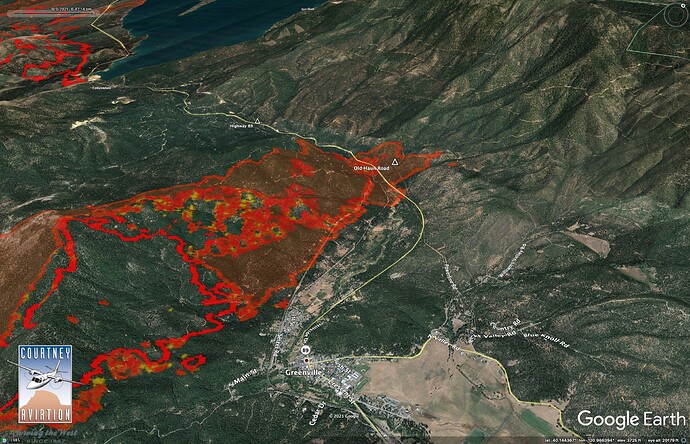
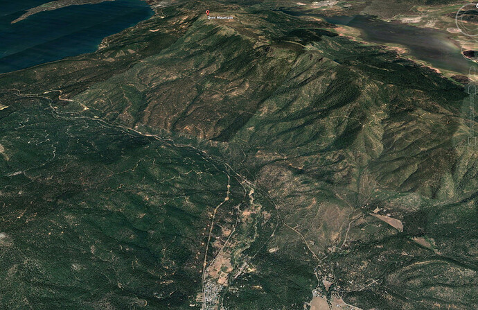
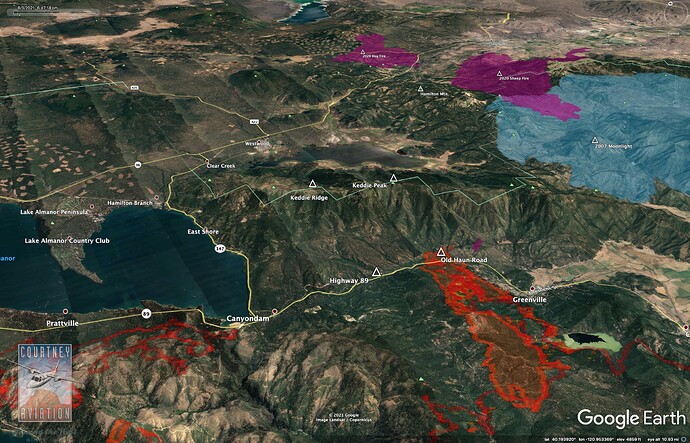
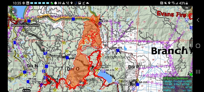
With the heat across 89 @ Old Haun Rd, sure hope that the Dyer Mtn Cams aren’t put to the test like Indian Ridge. Not looking good though given the forecast. Almost perfect alignment 
Would have never imagined when this thing kicked off as a “40 x 40 spot…” back on July 13th that Dyer would be in the crosshairs.
Damn…
Indian Ridge shows some heat in the lower left side. Part of the old burn or new start?
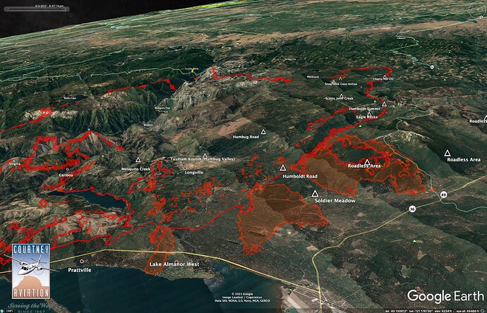
Yes. As I mentioned earlier, I am hoping we aren’t chasing this all the way to the 2020 Hog and Sheep Fires. The column from Greenville today was headed right over Hamilton Mountain and Fredonyer Pass - another area that has no recent fire history. The fire cooking up in Long Valley today was worrisome. Seems like Keddie Ridge could get hit from several angles.
Spread models I have been running seem to be keeping the fire in Wolf Creek moving NE, away from Westwood and East Shore, so that is a good thing.
Heat showing in Indian Ridge cam burned last week.
So, I’m one of those people, because I’m sheltering in place at work (the airport), alongside the Fire Department (obviously), some of the Forest Service, and the retardant loading outfit at the tanker base across the runway (less obviously, but they’re all from the Greenville area, so can’t go home anyways, and we still might set up aerial operations, another reason I’m here).
I’m not entirely worried about 36 to Susanville closing, they didn’t do that during the Moonlight Fire, and barely even did it during the Sheep Fire when it was burning right alongside the highway. And Dixie to the east in the Indian Valley area is a long way from 36. There’s also some backroads that a few locals know about that can take us north up to come out way up on 44, going around the east flank of Lassen Park and Caribou Wilderness.
If it does close off 36, I’ll probably still be hunkered down here, where I expect a serious stand to protect the USFS assets on the SW side of town.
Can someone post the link for the IR?
@pyrogeography - That new view/angle, and your insight, does give me hope for Dyer Cams.
Appreciate it…
That might be a 15 acre roll out in division Charlie
Can someone post the link for the MOTIS IR
