New start lake paradise. AA doesn’t believe it’s a spot but it is out in front of the fire.
3 Likes
Any word on a team assignment?
1 Like
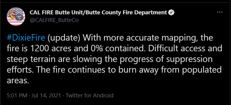
What’s the updated acreage?
CF Team 1 is on Hard Cover so they would get the call.
4 Likes
13:00 VIIRS put it at about 1,800 acres.

Most of that was in areas that burned hot in 2008. Sounds like the lighter fuels are helping them out in tanker effectiveness, esp on the left flank.
9 Likes
Anyone seen or heard any new requests for this incident? Looks like it really is taking off on the crews.
1 Like
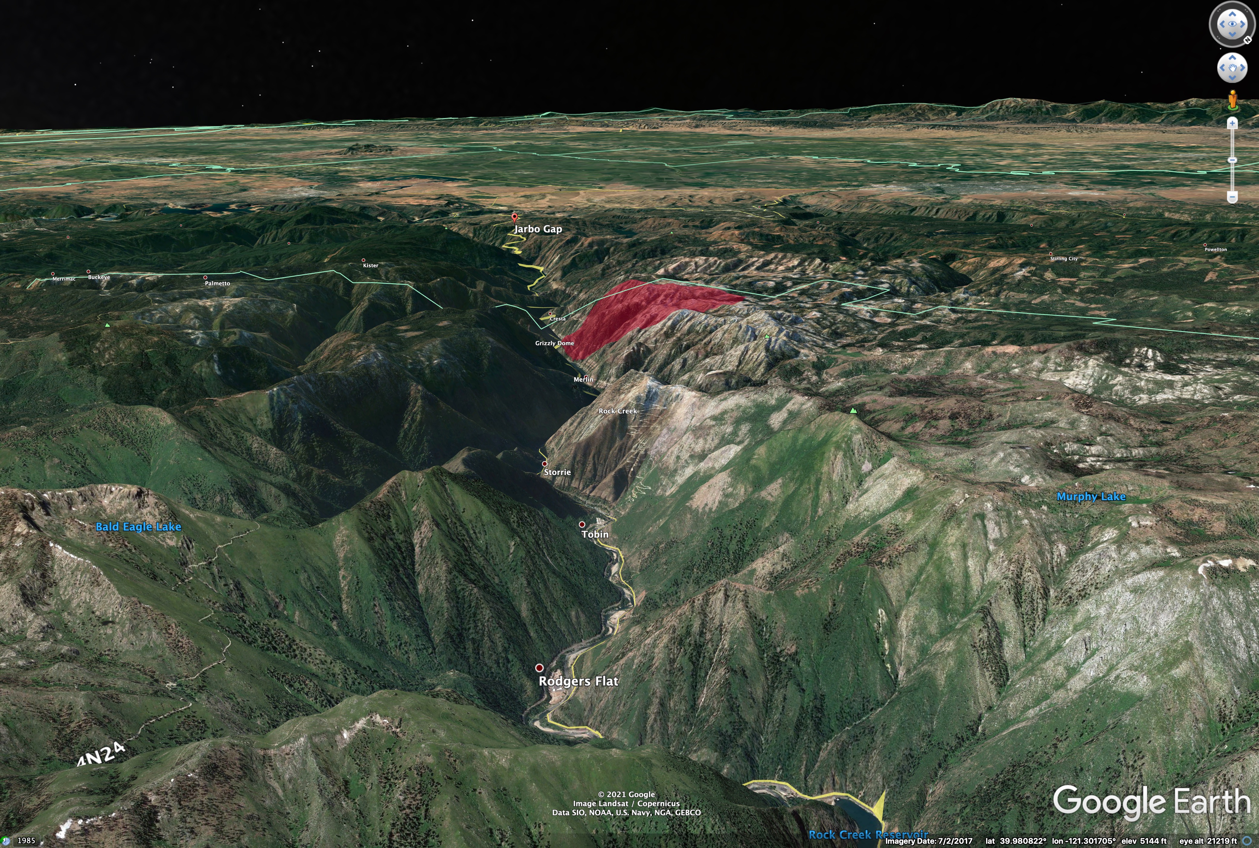
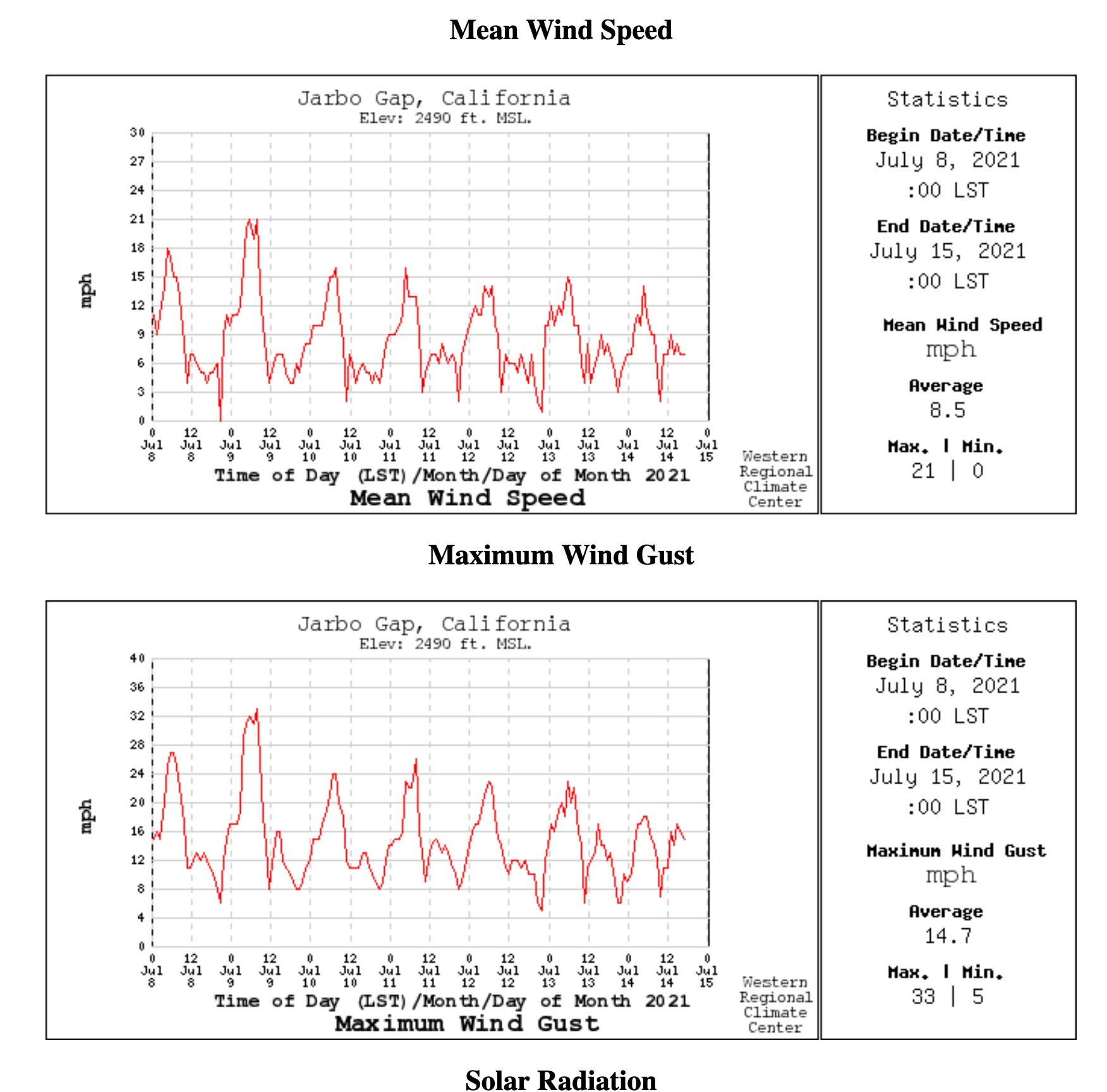
Are they expecting the big down canyon winds that are typical for jarbo?
Not too familiar with the exact area…but could also go fed if it’s more established on the Plumas NF? I think it’s burning to the northeast so maybe burning away from SRA. Not sure to be exact.
Still in the dpa of the state…
7 Likes
MDF punching out immediate need engines to T25N R5E Section 33. Assuming this would be for the Dixie.
1 Like
I believe this may be for a new fire on the Lassen NF.
3 Likes
Great Intel @pyrogeography . Looks like slack at 2300 then kickoff soon after.
2 Likes
Yes it is, they updated the order. Apologies.
1 Like
5 Likes
How long till it becomes a situation where communities are in trouble?
2 Likes
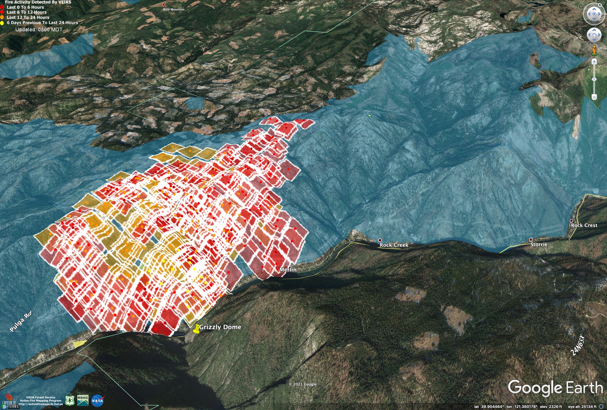
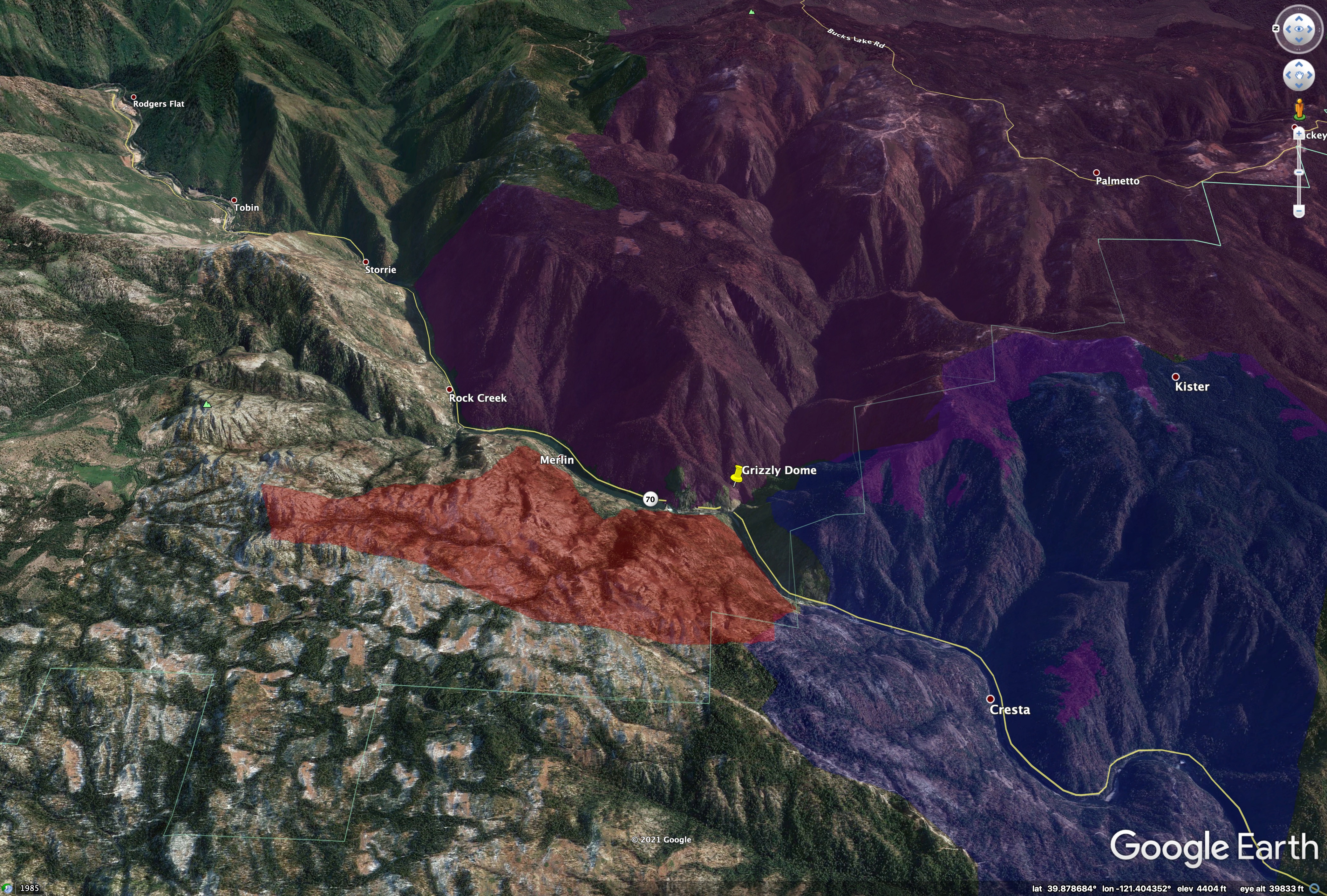
Fire stayed farther east than I thought it would yesterday. It sounded on AirTac like the open canopy and rockiness in the 2008 burn area really helped the tankers get the west flank thoroughly painted. The head was really narrow.
The big question now seems to be where to tie in the north/eastern flanks. Looks like it has the alignment to continue to run up Rock Creek, though it will be in similar fuels as long as it stays in the 2008 burn (light blue). If it gets past Rock Creek (above the Rock Creek label on this map), it gets into the 2000 Storrie Burn, which reburned during the 2008 Butte Complex.
Either way, any fire that becomes established outside 2008 burn scar is going to move in a lot different fashion than what we have seen last 36 hours.
If the fire moves far enough upstream, it will be across from areas that didn’t burn last year in the Bear/North Complex, shown in purple. The SW edge of fire is bumping 2018 Camp Fire (blue)
14 Likes
Great Intel Zeak
We got a solid Contengency line last year on the BTU-NORTH Complex. But if it gets established on the wrong side of Lynch Meadows, there are some clear cuts to tie it into, but more than a “Few” plantations with 2-4’ of red slash from the thinning. As it goes NW from Lynch Meadws it gets into the road system of “400U’s”. The “western Contengency line(over Granite Ridge)” shown on the rock creek map was never put it. Too Rocky and too far west. The line went over the high point(4800’) on the Sec 23/24 of 24N05E then turned WNW and crossed the creek up the Ridge thru Sec 13, 14 and diangle thru Sec 11. We stopped(rocked out) in Sec 11 in the area of the 410R line on the border of Sec 2/11. The are was full of 10-15’ Manzanita and hide the down timber from the 08 Butte Lightning Complex and the 00 Storie fire. It will be interesting what happens with the weather forecasted and if a true down canyon blow happens from midnight to daylight.
HEADS ON A SWIVEL & LCES
3 Likes
Not correct. The NF Feather River Canyon normally has significant down slope winds at dusk followed by down canyon winds during hot summer nights. The down canyon winds last until 9am to maybe 10am the next morning. I know well because I worked that location.
1 Like