Thank you for taking the time to write from the first hand perspective. This really helps folks understand the utter devastation this #demonfire has done.
Something about a structure fire in CHP cad about 4 am. Could this be what it was?
That makes sense with the time
Not that it provides any solace given the extreme conditions, it is interesting to see tech being added to the fight. I believe I saw this mentioned before, but not sure the video was provided. If a duplicate, my apologies: https://twitter.com/i/status/1423724481671876608
The frontal passage the other night pushed all the smoke from Dixie, RiverComplex (KNF), and other fires down to the NEU area and further… I’m in AEU and it’s been horrible. River not likely to be producing enough to be seen on camera. Probably the fire you mentioned on CHP site.
Thank you so much for the ability to check on the communities of Crescent Mills, Taylorsville and the Greenville Rancheria, firedozer.
Damage assessment information
https://www.arcgis.com/apps/webappviewer/index.html?id=91c5dc150e53415fa85a2420871aa214
Has anyone heard about the condition of the mill in Chester? I was told they had some fire on the property just curious if anyone knew the extent of it
The mill has virtually zero damage.
I w as there when the fire came through and great job by all. Small fire on top of a roof but glad the mill was safe.
Shame to see some abandoned but locally historic buildings like Cedar Chalet and the Stover ski cabin, gone, but to be fair they’ve been vulnerable to some form of destruction (wildfire, arson, vandalism, deliberate demo) for a long time. And the actively used commercial or residential property losses around Chester seem amazingly low.
Not so amazing for Canyon Dam, Greenville, Deer Creek, etc., of course. It’s going to be inpleasant driving down 89 from Chester to Quincy for a long time
Wind flow is flowing north up towards Redding from Sacramento and NE into Oregon and Nevada.
Nothing over 15mph currently:
Should start to clear out the southern Sacramento valley and points south, if it continues.
Looks like the northern and eastern flanks of the fire started to become active about 12:30 today. The northern edge looks like maybe it is pushing east across the South side of Swain Mtn, and the east flank is pushing up the SW side of Coyote Peak, just west of Moonlight Burn.
Anyone know of any outstanding resource orders for Dixie?
Increased smoke plumes across NorCal fires:
RAMMB/CIRA SLIDER: Satellite Loop Interactive Data Explorer in Real-time with GOES-16 and Himawari-8 Satellite Imagery
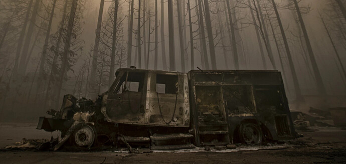
This is on the Los Angeles Times article… was it an engine? The article just called it a burned up “Truck”
There’s no doubt, a Type 3 probably. Hard to tell from what agency.
I’ve noticed the media uses the term “Fire Truck” universally for any land based fire unit with wheels. Do you have a link for the article?
I think this is the one
Injured fire fighters were not from the burned engine in the photo
