FLIR cams on Twitch: Twitch
4 Likes
here is what i am using to flight track:
https://globe.adsbexchange.com/
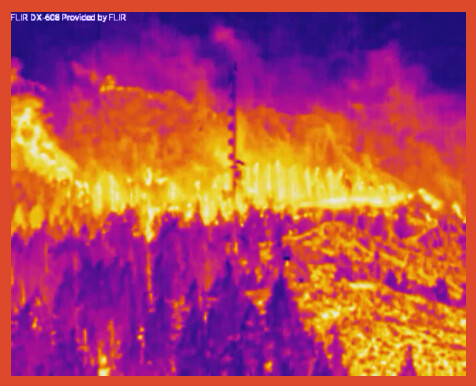
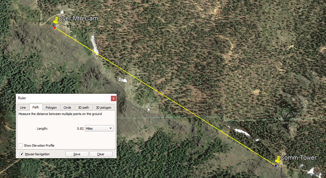
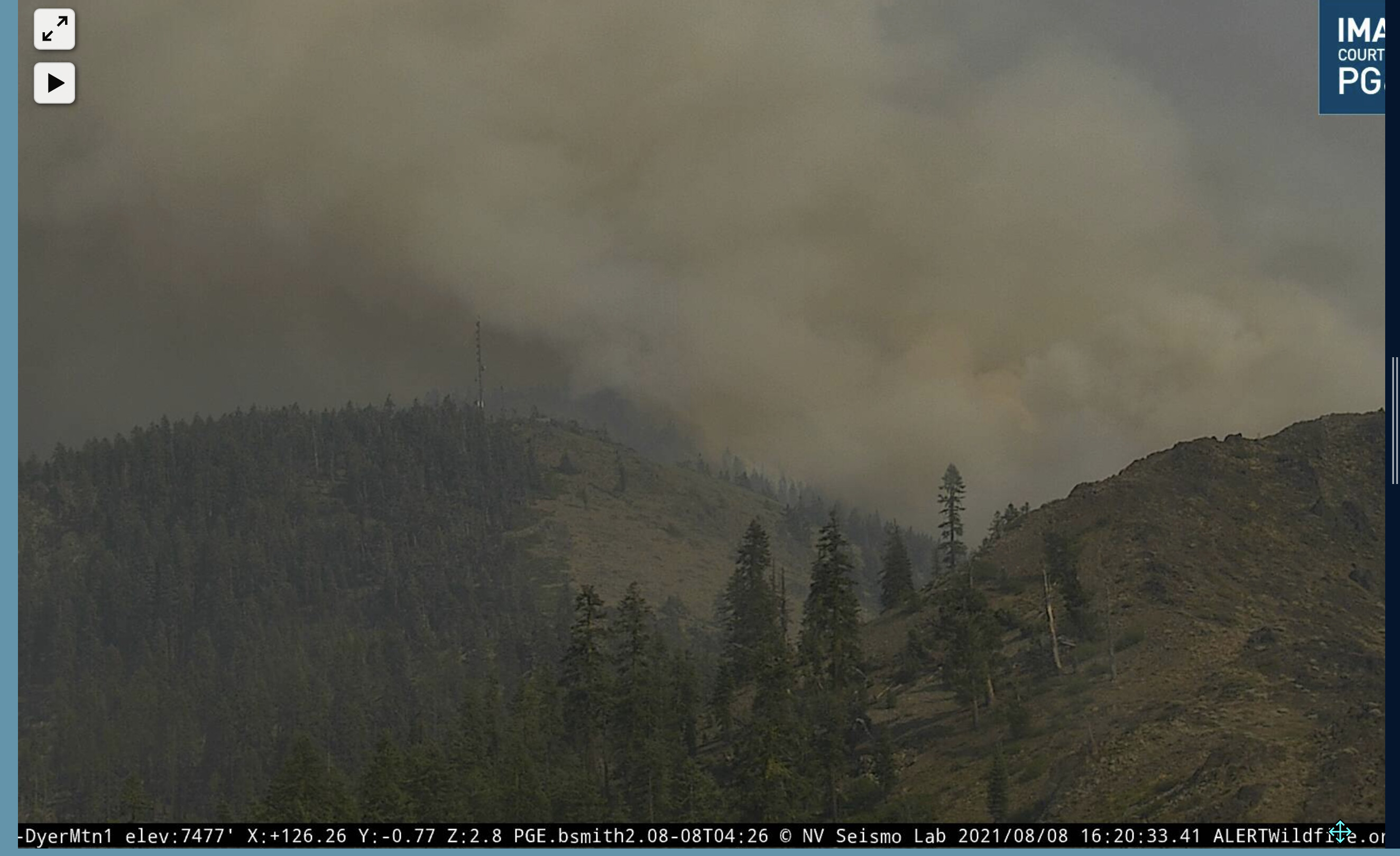
Fire is also closing the gap on Dyer Mtn this afternoon. It is engulfing the comm tower just to the east.
7 Likes
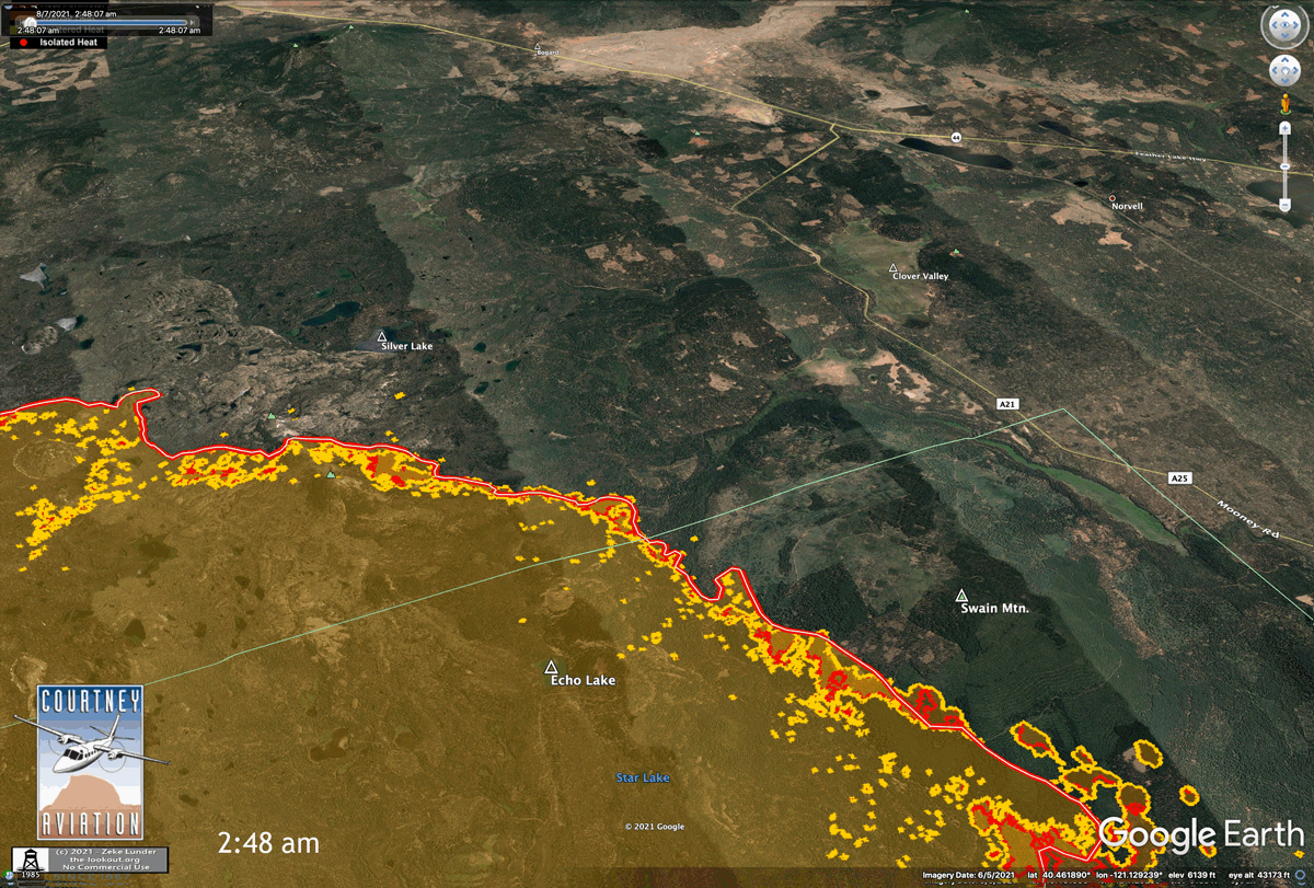
Multiple spots across A21 and crews are picking them up. The column is starting to lay over and will hamper seeing any additional spots.
5 Likes
We still have 3-4 hrs of active burning. Gotta wonder why they’re even trying to chase spots here. A-21 won’t hold under current conditions, done deal. Fire ran 2.5 miles here yesterday, spotting over 1/2 mile.
Yesterday’s spread map.
We’re in this for long haul. No use beating people up for no good reason.
15 Likes
That’s the fire below dyer mountain.
1 Like
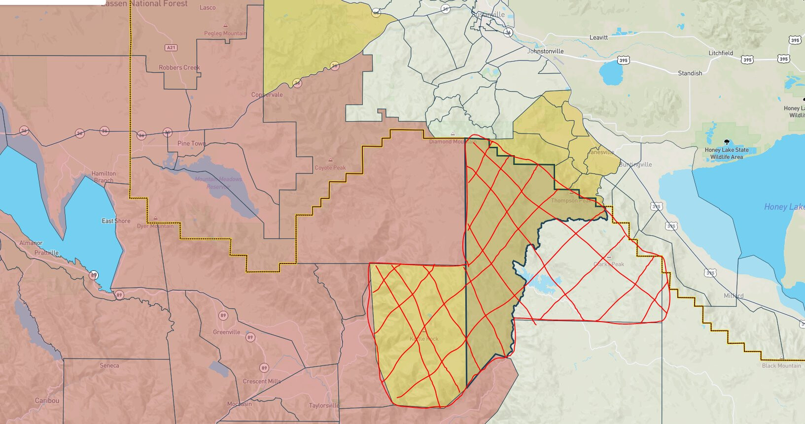
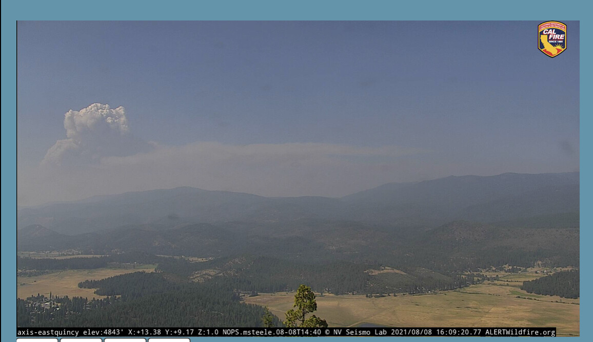
Looks like the fire is moving closer to the Dyer Mountain cameras. As previously posted East Quincy probably has the best overall view of the pyrocumulus this afternoon. Drove A21 on Thursday and while it’s a road, @pyrogeography is right that chances of it holding given current conditions are sketchy, in my view. They put in a freeway of dozer line there, but with spot fires as they are, we shall see.
4 Likes
Banch VII ordered Air Attack and 2 tankers ordered to DIVS J
6 Likes
Dyer Mt 1 cam is showing a com tower with know fire on it…moving towards it, yes. are there more than that tower in that area?
The fire is still south of the com tower but close to it. It’s only tower other than where the cameras are.
2 Likes
sometimes better for most of us to trust the cams instead of trying to read the FLIRs, I for one have not got a clue…maybe with all you smart guys teaching us old guys, we will learn. thanks
5 Likes
I hear what you are saying about not beating people up, I get it. But, sometimes we have to give it a shot. I’m not hear to get in a discussion or argument with anyone. These crews are just getting hammered and the frustration must be mounting going on four weeks now not be able to contain this Monster. Most of us have been there lets pick this spot or two up when we know down the road the the fire is going to blew over the line and it’s not going to hold. I don’t know what else they can throw at this sometimes that’s all you have is hope.
13 Likes
I know heat signatures are not all that accurate but I am guessing that the East flank is about 10 miles or so from the Hwy 395???
Base all actions on current and expected fire behavior. Fire ran 3 miles yesterday, started today 1.5 miles from A-21.
10 Likes
Yep, 10-12 miles
5 Likes
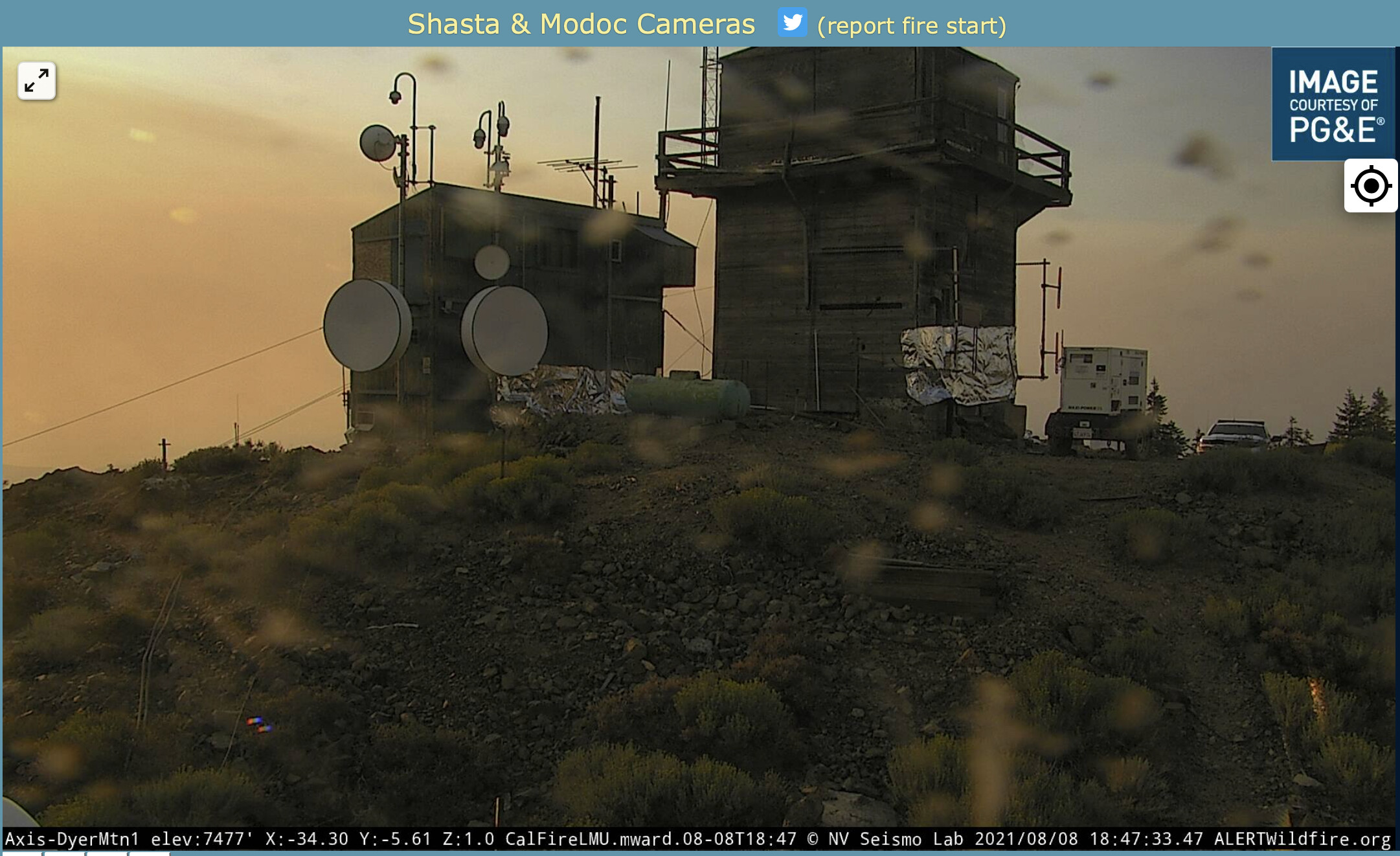
I am surprised Mt. Dyer Lookout is not wrapped and protected. Fire is very close now. Sunday night pic.
7 Likes
Fire intensity on the GOES-17 view seemed to peak about 17:30.
3 Likes
Based on the clouds along the frontal boundary it looked to me like the front passed and the wind might have started to slack-off about 17:30. The column visible in the Dyer Mtn. cam is not as bent over.
Hopefully folks will catch a break.
4 Likes