Not much but rock around it, but we will see
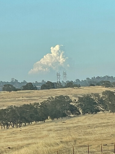
From the Sutter (not Sierra) Buttes, north of Sacramento… 95 +/- miles away. Run the time lapse to see the build-up off in the distance.
http://beta.alertwildfire.org/region/tahoe/?camera=Axis-SutterButtes
Want to apologize about my comments about not trying. I am not there, and shouldn’t be talking about things I can’t see. I really hope they’re successful, I’m discouraged about the spotting, too, and it seems like we just haven’t been able to get around enough of them to catch up.
Once you get past A-21 it’s flatish, but it’s a rocky mother for a long ways.
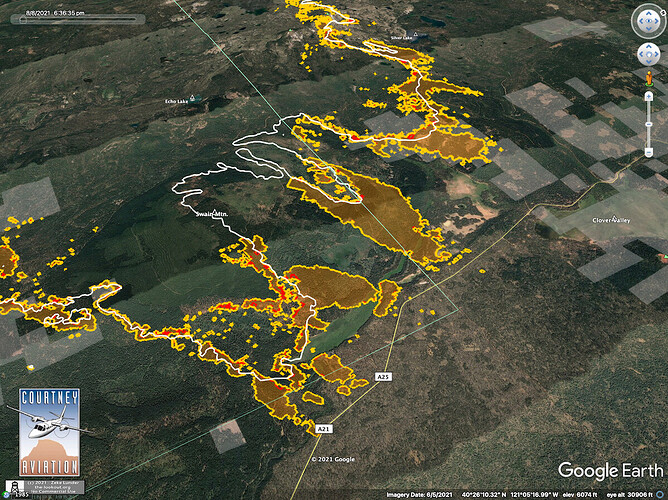
Here is IR from about 18:30.
I don’t think anyone took it like that. I know exactly what you meant. If you been doing this job long enough you get it. We have thought and felt the same way more than once.
New IR imagery and commentary, here:
https://the-lookout.org/2021/08/08/dixie-fire-8-8-2021-evening-update/
I am not sure about what you said earlier but I can tell you I am very familiar with that piece of ground around A21. Much thinning and managment has occurred there over the years. A lot. With that being said I don’t see it necessarily slowing down or stopping through there. With how dry it is and with this stupid fire I think it could still rip through there. Just my 2 cents.
I agree - it’s been treated pretty heavily around the southern swain mdw and robbers ck area. Existing condition is generally open with minimal ground cover and many larger trees. Much of the area between A21 and Swain Mtn all the way down to 36 was about to receive wide spread fuels redux and rx fire to improve meadow conditions and reduce fire hazard. Real bummer to see some projects go up like that. Zeke’s first glimpse at fire severity is not encouraging, but I am actually hopeful that east of Swain Meadow could see some pretty good fire effects if it drops out of the crown.
The last timber sale I worked on when I was on the lassen was on swan mt. It would be a speed bump with this fire at best.
Possibility of the fire skunking around in the park until we get a hard south wind event? History of that in our area. ie Eiler/Reading
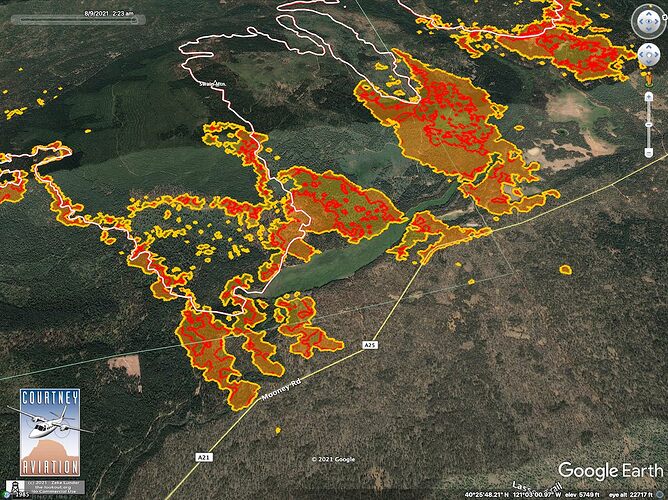
Here is 02:30 IR at A-21.
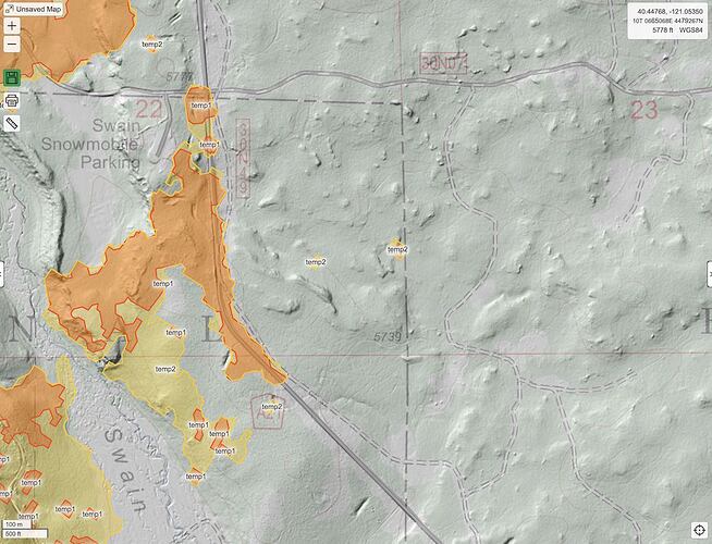
Part of my pessimism about catching spots last night was the terrain where they are. To say it is flat is deceptive. It is flattish, but there are all these funky ‘spatter cones’ where little mini volcanoes bubbled up from the rest of the big lavaflow that made that landscape. Really funky little islands everywhere. Spent some time cruising timber here in the 90s, on a huge blowdown event, and was amazed at how tricky it could be to navigate what I’d always thought of as a plateau.
Thanks, CalTopo!
I hadn’t heard of the blow down event in the 90’s but we had one in 2015 too. Damn near every road on the Eagle Lake district was affected by it.
I hit that one just after it happened, started a little after getting off i5 and almost to Susanville…one truck I saw had his trailer roof ripped off. I pulled some smaller trees off 44 to get through while loggers with chain saws were getting the bigger trees. Long trip.
(Just in interest of accuracy it was from just off i5 on 89 near shasta to near Susanville). Weird to think that it could still be causing problems so many years later.
I won’t say too much more about it here but we had a fire crew doing some pile burning on dirt 21. The winds were forecasted, I never understood why they burned that day but they did. The winds pushed the fire into an open timber sale and they had to basically evacuate cutting there way to the highway. Something like 16,000 acres of blowdown in total.
Sounds like a big firing show on A-21 today. How’s it going?
Did they pick up any spots across A21? I’m rooting for those guys to hold that!!! It would be cool to get a win somewhere!
It sounded kinda like they did but it was just kind of glossed over during the briefing. They did mention they started firing A21 last night.
It looks like Crescent Mills and Taylorsville are still safe. I’d call that a win. upbeat grin I wish there was some way for evacuees to send messages of support and thanks to firefighters out on Dixie, and their families. They sure deserve it!
Any have access to ops maps?
This is the link to Team 3’s daily products. The link does not change. Each day the new IAPS/maps/etc will be uploaded…


