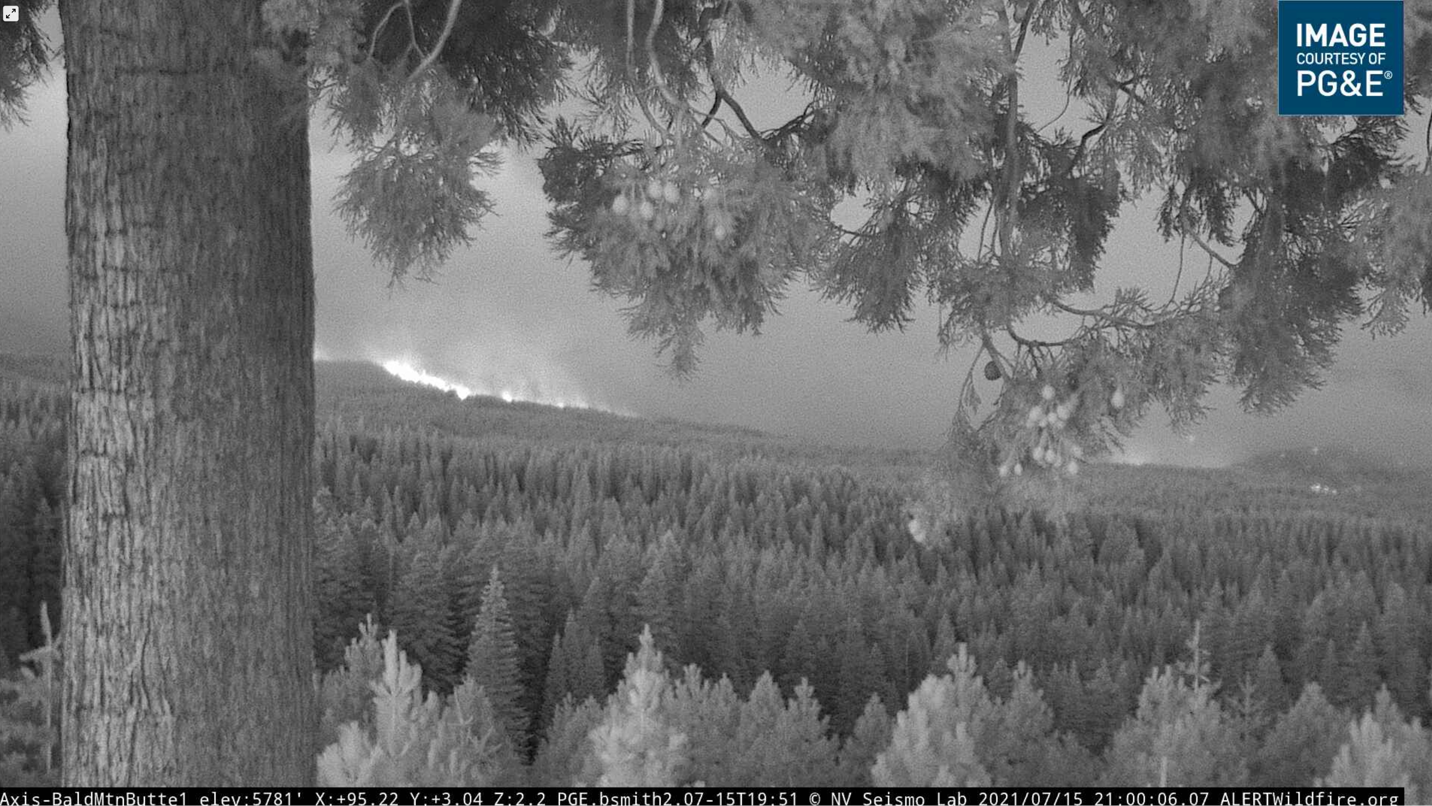
On the Bald Mtn cam, it looks like the left flank has spilled out to the west of Rock Creek drainage and is well-established in the heavy brush and timber outside of the 2008 burn.
7 Likes
So what does this mean? Did it cross contingency lines? Not super familiar
I only counted 10 questions about team activation. Maybe the standards are getting lower
16 Likes
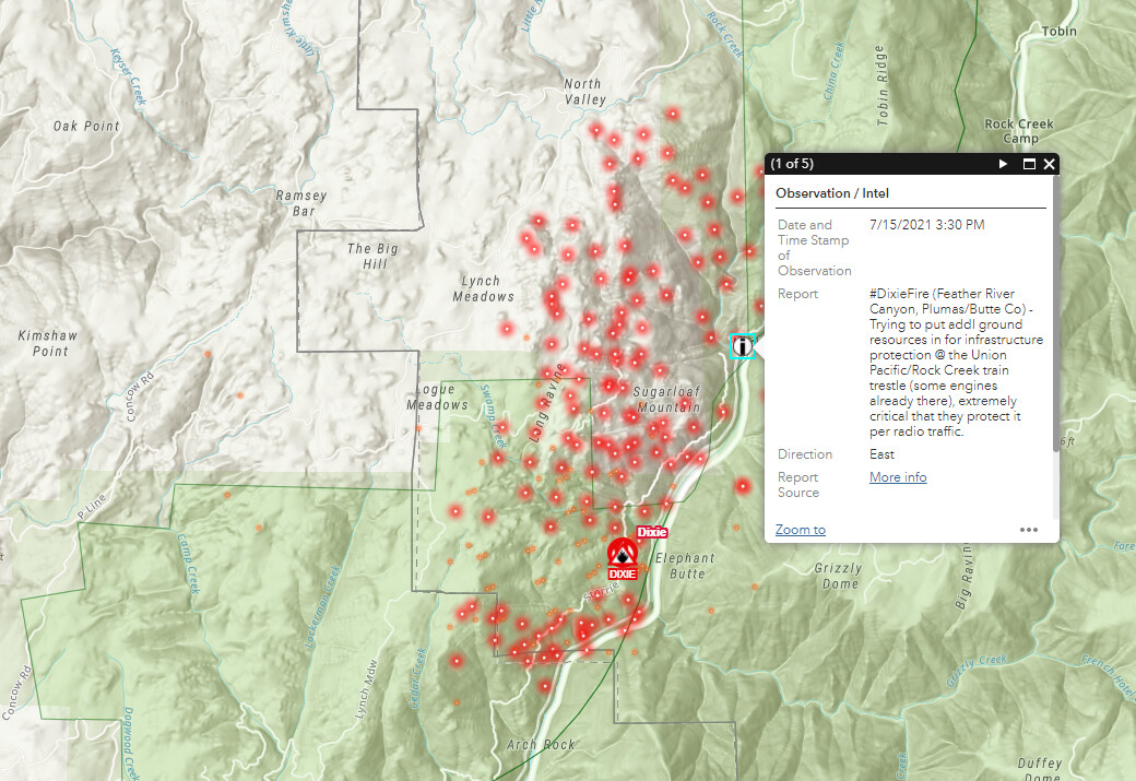
07/15/21 9:20 PM Per CF Incident page;
4,965 acres
5 Likes
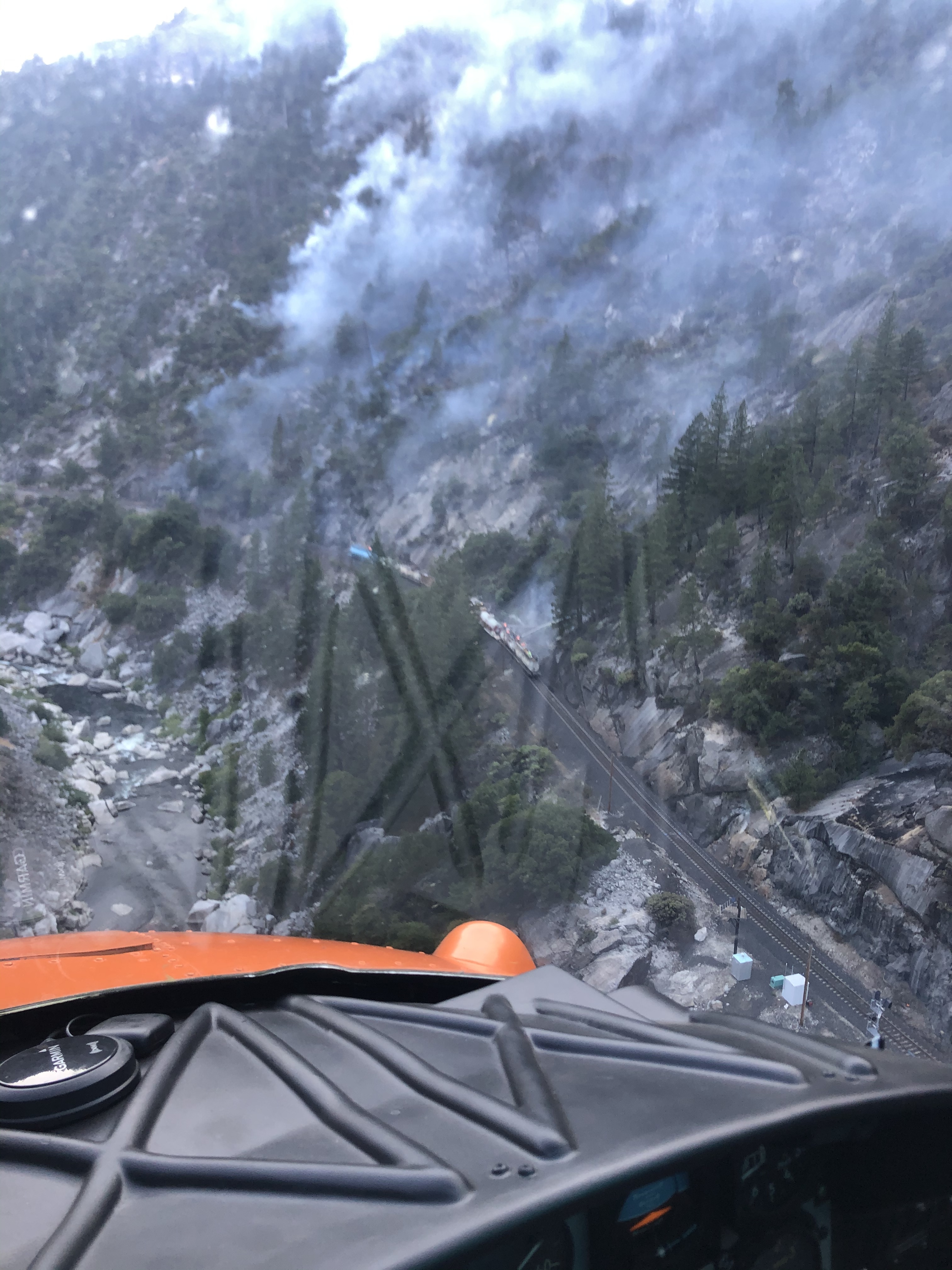
What type of aircraft are you in?
Looks like a Volkswagen.
9 Likes
Maybe my eyes are deceiving me. Look how low the feather is! 
IAP from today
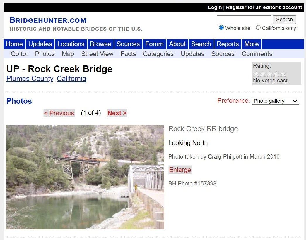
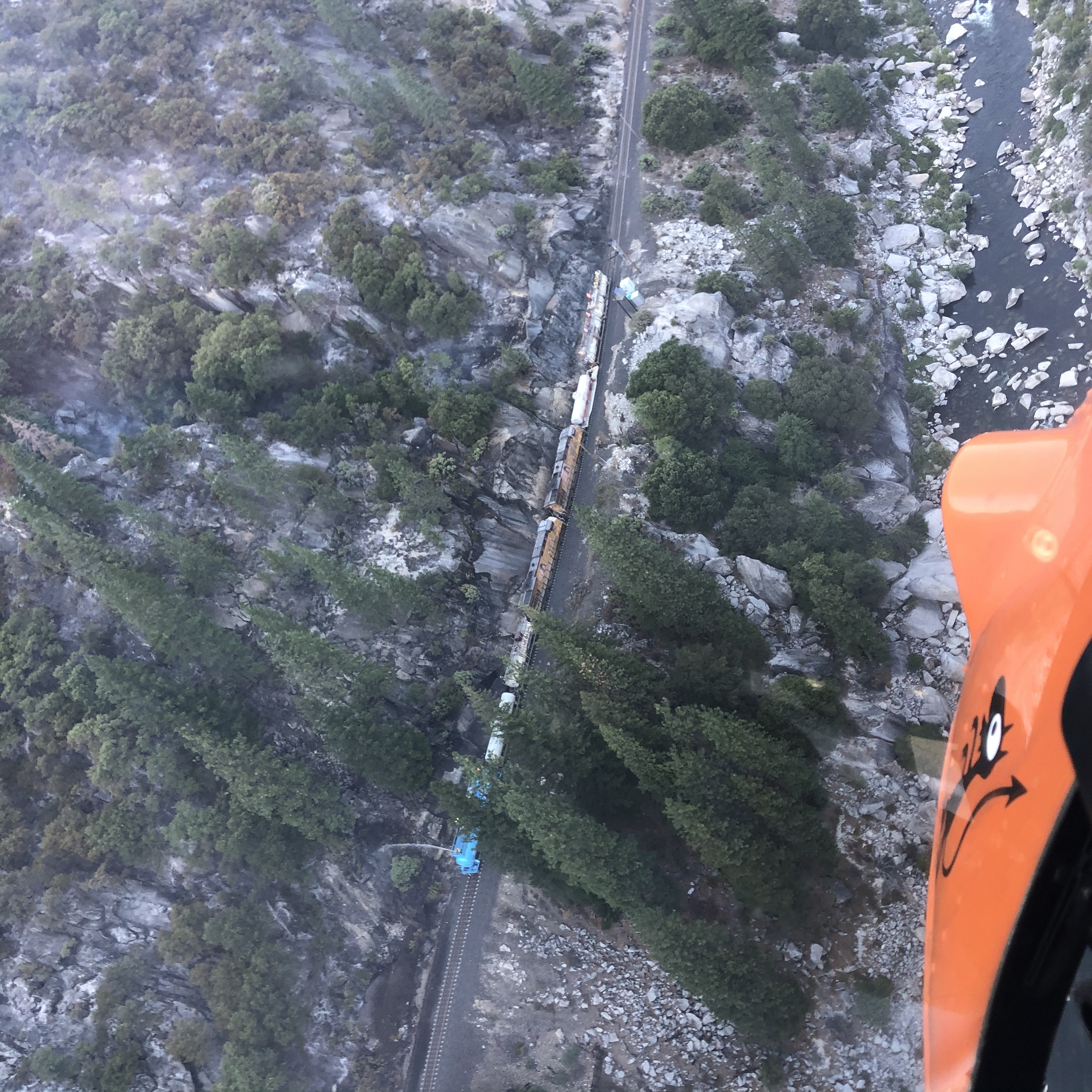
Driven past this trestle who knows how many times…
You can easily watch the glow of the fire against the night sky from the north east side of Paradise. quite the show. looks way to close at night
1 Like
Do you have it?
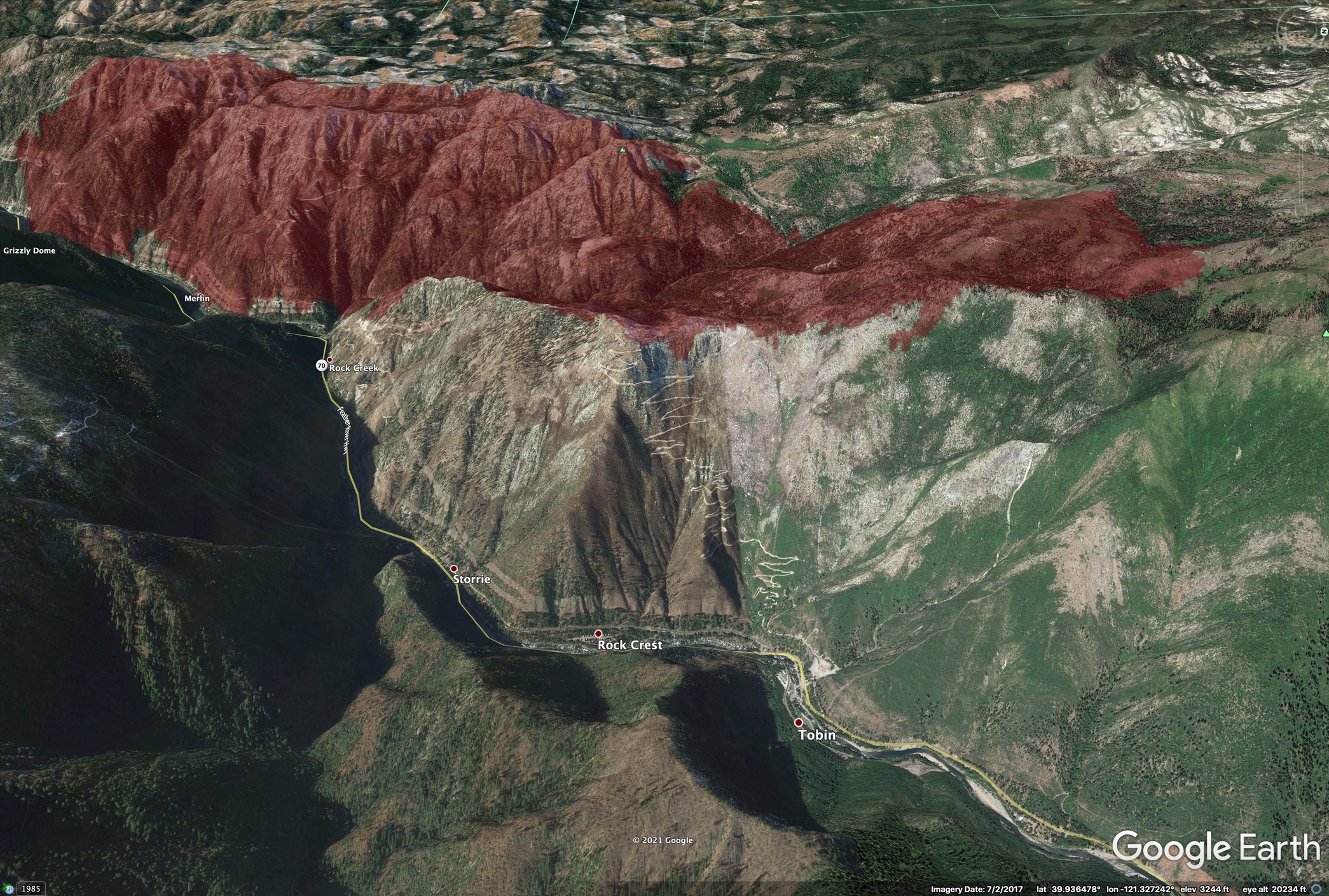
Well, if it’s out of Rock Creek there is an abundance of continuous fuels there that hasn’t burned from the 2008 lightning fires. Down canyon winds could threaten Stirling City eventually.
1 Like
UH-1H. Not a Volkswagen, just a good ‘ole American made tractor.
9 Likes
Hard to tell if it left the 2008 burn or not on the west flank. The 8pm IR showed it still within, I think I was just seeing heat bleeding over the ridge on the IR cam view. The 5am Flea Mtn shot shows a lot of heat on the NW corner.
Biggest story on the 8pm IR is that it has slopped over Tobin Ridge into the 2000 Storrie Burn, above Storrie and Tobin.

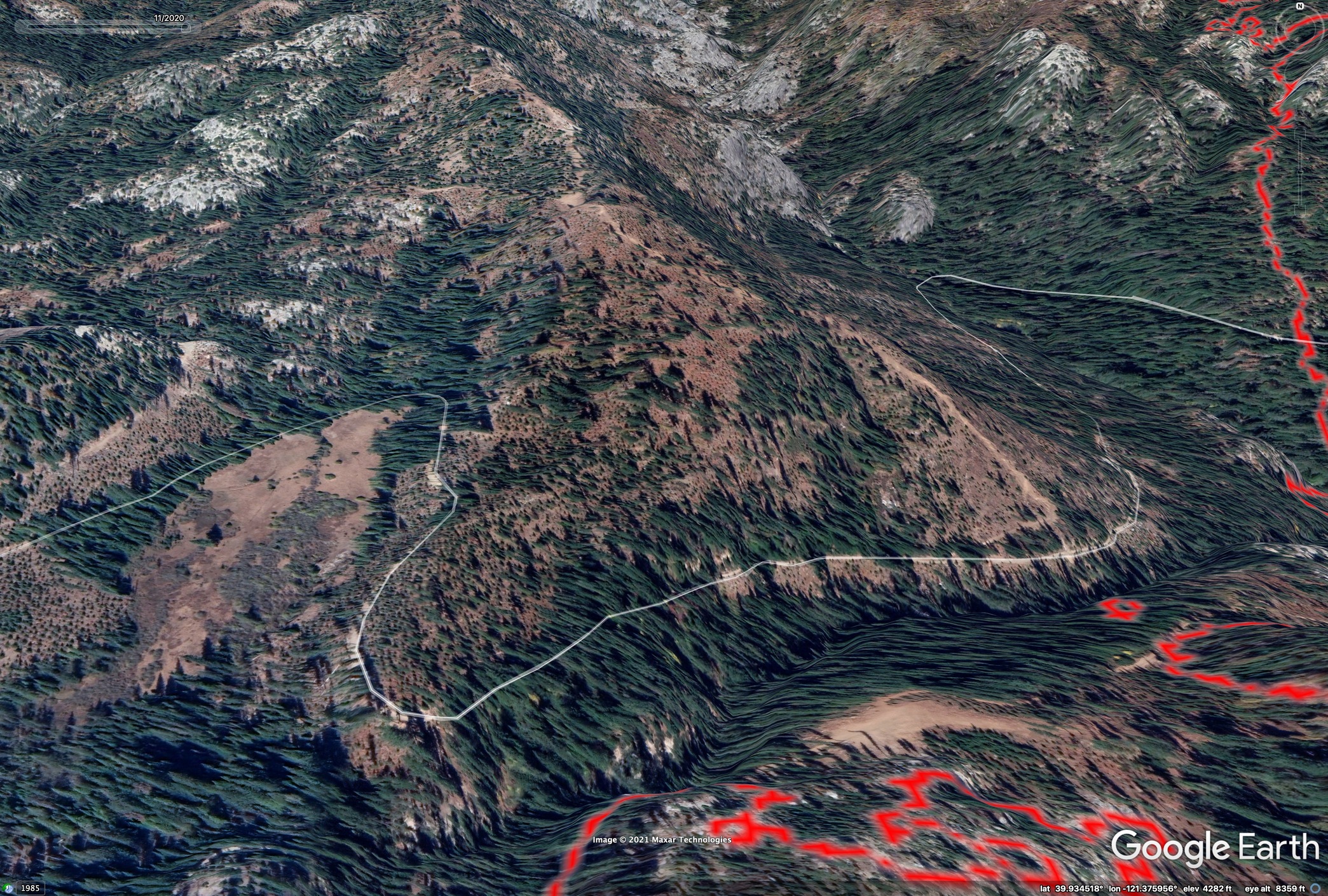
One thing that I’m curious about today: There is an existing dozer line up the ridge on the NW corner of the fire, in Sections 11 and 14, above North Valley Creek at the 470U line, but it looks the the area all around burned in 2008, was replanted, and has recently been thinned. All of the red slash from the thinning is still on the ground in the imagery (red areas). I’m curious if this will cause any problems in holding this line. It looks like the gorge of North Valley Creek is a bad setup to funnel downcanyon winds, either way.
5 Likes
Zeke, agreed on the North Valley Creek drainage.I haven’t been up that way in awhile, so I’m not aware of the plantations. However, I am aware of the winds in the area and that bears diligence. Thanks for the maps…
4 Likes
Yup
Spot on again Zeak. That line that runs thru Sec 14 & 11 stops at the Sec 2/11 break. Rocked out. Looking at the IR in Google, it’s in the Storie scar, TONS of down timber and TONS of brush & Manzanita with no real good answers. The Contengency line from last year was put in for just such a scenario
1 Like
Ehoss, it almost makes all those logistical nightmares last year worth it. 
1 Like